Hurdlow Walks

 This circular walk explores the area surrounding the hamlet of Hurdlow in the Peak District.
Start the walk from the good sized Hurdlow car park near The Royal Oak pub. From here you can pick up the Pennine Bridleway and follow it north to visit Hurdlow Town and Hurdlow Grange.
Continue west and you can enjoy a climb to High Wheeldon where you can enjoy some fine views over the surrounding hills.
The route then descends south to Crowdecote before following a country lane east past High Needham to return to the car park.
The High Peak Trail runs right past the car park so you can pick this up to continue your exercise. The shared cycling and walking trail runs along an old railway line from Cromford to Dowlow.
Postcode
SK17 9QJ - Please note: Postcode may be approximate for some rural locationsHurdlow Ordnance Survey Map  - view and print off detailed OS map
Hurdlow Open Street Map  - view and print off detailed map
Hurdlow OS Map  - Mobile GPS OS Map with Location tracking
Hurdlow Open Street Map  - Mobile GPS Map with Location tracking
Walks near Hurdlow
- High Wheeldon - This walk climbs High Wheeldon Hill in the Upper Dove Valley area of the Peak District
- Pennine Bridleway - This fabulous 120 mile long trail runs through the beautiful Derbyshire Peak District, through Lancashire and on into Yorkshire.
It is suitable for mountain bikers, horse riders and walkers taking you on a tour through some of the most beautiful parts of the country - Chrome Hill - This circular walk climbs the beautiful Chrome Hill in the Upper Dove valley area of the Peak District
- Longnor - The village of Longnor is based in a lovely part of the Staffordshire Peak District
- Axe Edge Moor - This expansive area of moorland near Buxton has some fine walking trails to try
- Monyash - A circular walk from the village of Monyash visiting Youlgreave, Bradford Dale and the popular Lathkill Dale
- Arbor Low - Visit this Neolithic henge monument and enjoy some lovely moorland scenery on this fascinating circular walk in the Peak District
- Bradford Dale - This lovely riverside walk from Youlgreave takes you along the River Bradford before climbing above the village for some great views.
Start the walk in the village and follow Hollywell Lane to the river - Lathkill Dale - Enjoy a splendid riverside walk in the beautiful Lathkill Dale in the Peak District
- High Peak Trail - This splendid, shared walking and cycle trail follows a disused railway line from Cromford to Dowlow through the beautiful Peak District.
The trail starts near Cromford railway station and climbs through the stunning High Peak area of Derbyshire giving fabulous views of the area.
The trail links with the popular Tissington Trail at High Peak Junction - Chelmorton - This circular walk explores the area around the Peak District village of Chelmorton near Buxton in the White Peak
- Hollinsclough - This Peak District village is located in a fine spot for scenic walks in the National Park.
- Cheeks Hill - This circular walk climbs to Cheeks Hill on Axe Edge Moor in the Peak District National Park.
- Crowdecote - This Derbyshire based village is a popular starting point for Peak District walks with a number of fine local hill climbs to try
Pubs/Cafes
The Royal Oak is located next to the car park at the start/finish of the walk. The charming country pub sells high quality food and has a fine interior with timber beams and cosy fires. Outside there's also an attractive garden and a campsite if you'd like to stay in the area. You can find them at postcode SK17 9QJ.
In Crowdecote there's the noteworthy Packhorse Inn. The inn dates back to the 16th century when it served as a stop off point from the packhorse trail from Newcastle Under Lyme to Hassop, near Bakewell. There's a charming old interior and a garden area with fine views of the valley.
Dog Walking
The country trails and hill climbs are a good walk for fit dogs. The Royal Oak mentioned above is also dog friendly.
Further Information and Other Local Ideas
Head east to Monyash and you can follow the Limestone Way to one of the area highlights at the wonderful Lathkill Dale.
For more walking ideas in the area see the Derbyshire Walks and the Peak District Walks pages.
Photos
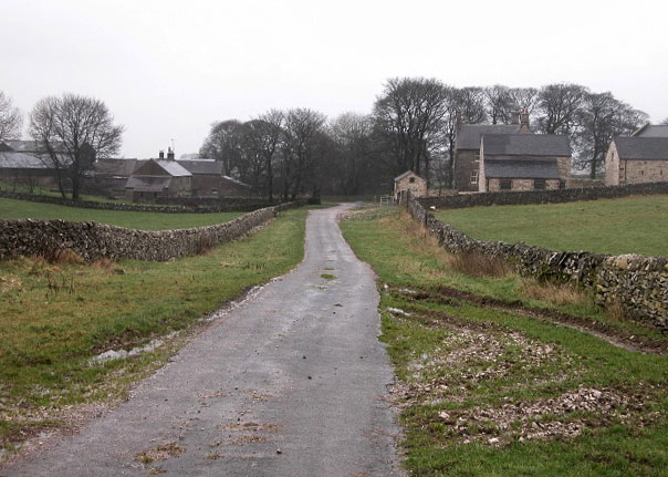
Hurdlow Town This 'town' consists of little more than 2 communities! On the left is Hurdlow Hall which is a farm and on the right is Hurdlow Grange which has been converted into holiday cottages.
Hurdlow Town and rail embankment. This would have been a spur line into the area now quarried at Hindlow.


