Ipsden Walks

 This pretty little South Oxfordshire village is located in the Chiltern Hills near the town of Wallingford.
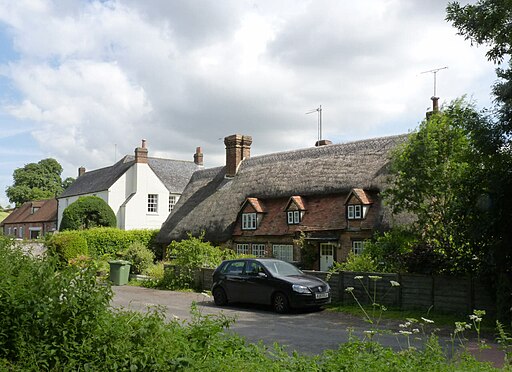
The historic village includes some attractive thatched cottages, a notable 12th century Norman church and the 17th century Ipsden House.
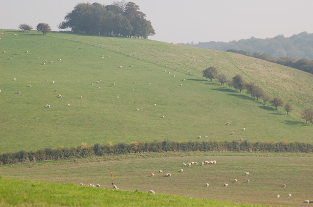
This circular walk from the village takes you east to explore Ipsden Heath. The heath has some good footpaths taking you through bluebell woodland and pasture with some fine views of the surrounding Chiltern Hills countryside. On the walk look out for wildlife including Red kites and buzzards which can often be seen soaring in the skies above.
There's also an optional extension to visit the neighbouring village of Stoke Row where there are some interesting historical features. The village includes the distinctive Maharajah's Well, a pretty cherry orchard and a noteworthy 17th century pub reputed to be the former haunt of notorious highwayman Dick Turpin.
To continue your walking from Ipsden you could pick up the long distance Swan's Way just to the west. If you were to follow the waymarked path north you could link up with The Ridgeway National Trail. Heading west would take you to Wallingford where you could enjoy a riverside walk along the Thames Path.
Please click here for more information
Ipsden Ordnance Survey Map  - view and print off detailed OS map
Ipsden Open Street Map  - view and print off detailed map
Ipsden OS Map  - Mobile GPS OS Map with Location tracking
Ipsden Open Street Map  - Mobile GPS Map with Location tracking
Walks near Ipsden
- Wallingford Circular Walk - This circular walk explores the countryside surrounding the riverside Oxfordshire town of Wallingford
- Stoke Row - This walk takes you around the pretty Oxfordshire village of Stoke Row
- Greys Court - This walk explores the area around the National Trust's Greys Court in Henley-on-Thames, Oxfordshire.
- Henley-on-Thames - The popular market town of Henley-on-Thames has a number of excellent waymarked trails to try
- Henley via Stonor Circular Walk - A circular walk from Henley visiting Stonor, Middle Assendon and the National Trust's Greys Court
- Nettlebed - This Oxfordshire village is surrounded by several large areas of woodland and some lovely Chilterns countryside
- Warburg Nature Reserve - This delightful nature reserve near Henley-on-Thames has some lovely woodland trails to try
- Oxfordshire Way - Take a trip through Oxfordshire and enjoy rivers, canals, pretty villages and beautiful countryside on this lovely trail
- Turville - This circular walk explores the countryside surrounding the Chilterns village of Turville
- Fingest - This pretty little Buckinghamshire village is located in the Chilterns near Henley on Thames
- Ibstone - This Buckinghamshire based village is located in a pleasant rural spot in the Chiltern Hills, on the border with Oxfordshire
- Rotherfield Peppard Common - This area of common land is located near the village of Rotherfield Peppard in the Chilterns area of Oxfordshire.
- Ewelme - This delightful Oxfordshire village sits in a lovely spot in the Chiltern Hills, close to the River Thames.
- Benson - This pretty South Oxfordshire village is in a great spot for riverside walks and exploring the Chilterns Hills AONB
- Woodcote - This South Oxfordshire based village is a nice place to start a woodland and countryside walk
- The Swan's Way - The Swan's Way long distance bridleroute runs from Salcey Forest in the north to Goring on Thames in the south, a distance of 65 miles (105km)
- The Ridgeway - Step back in time on this wonderful 85 mile route which follows an ancient chalk ridge route used by prehistoric man
Pubs/Cafes
On the walk you could stop off at the King William IV public house in nearby Hailey. The historic pub dates back to the 18th century and is Grade II listed. Inside there's a cosy interior with an inglenook fireplace. Outside there's a lovely large garden area to relax in on warmer days. From here you can enjoy great views over the Oxfordshire downs.
You can find the inn just to the east of the village at postcode OX10 6AD for your sat navs.


