Lymington Circular Walk
![]()
![]() The Hampshire town of Lymington is in a great location for exploring the New Forest, the south coast and the Isle of Wight.
The Hampshire town of Lymington is in a great location for exploring the New Forest, the south coast and the Isle of Wight.
This circular walk explores the countryside to the east of the town using part of the Solent Way long distance footpath. The area is home to the Pylewell Estate where you'll pass lakes, beaches, woodland and attractive countryside with fine views to the Isle of Wight.
The route runs for just under 7 miles on a series of flat paths and country lanes.
Start the walk from Lymington Town train station and head north to cross the bridge over the Lymington River. You then head east past Walhampton before turning south along Shotts Lane. This will take you down to the foreshore at Pylewell where there's a footpath running along the coast on the southern edge of the estate. There's some lovely views as you pass along the beach to Tanners Lane where you turn north. The route then turns left past Pylewell Home Farm and the pretty cricket ground on the northern edge of the estate.
The final section retraces your steps, passing Walhampton Wood before returning to the train station.
Lymington Ordnance Survey Map  - view and print off detailed OS map
Lymington Open Street Map  - view and print off detailed map
Lymington OS Map  - Mobile GPS OS Map with Location tracking
Lymington Open Street Map  - Mobile GPS Map with Location tracking
Walks near Lymington
- Solent Way - Follow the Solent Way along the beautiful south coast from Milford on Sea to Emsworth.
The route starts off at Milford on Sea and heads along the coastal marshes to Lymington with splendid views of the Isle of Wight - The Solent Way Walk Lymington - This walk in Lymington takes you from the town to Keyhaven Marshes and Hurst Castle using a section of the Solent Way
- Beaulieu River - Enjoy a waterside walk along the Beaulieu River in this easy walk in the New Forest
- Bournemouth Coast Path - This super walk takes you along the beautiful Dorset and Hampshire coastline from Swanage to Lymington
- Brockenhurst to Lymington Walk - Follow public footpaths and country lanes from the New Forest to the coast
Pubs/Cafes
The Ship Inn is a fine choice for some post walk refreshments. It's located in a great spot next to the quay, in the town centre. In the summer you can sit outside and enjoy views to all the boats in the marina. Inside there's a stylish and contemporary decor with a cosy log fire for the winter months. They do excellent food and can be found at Quay Hill with a postcode of SO41 3AY for your sat navs.
Dog Walking
The coastal and woodland trails make for a fine dog walk. Head north from the town and there's great dog walking country in the New Forest around Brockenhurst. The Ship Inn mentioned above is also dog friendly in the bar area with water bowls and biscuits available.
Further Information and Other Local Ideas
Pylewell Park has occasional open days where you can explore the beautiful pleasure grounds which include grassy paths, lakes and a wonderful selection of flowers and plants.
To continue your walking in the Lymington area try following the Solent Way west to visit the splendid Keyhaven Marshes and the fascinating Hurst Castle near the pleasant coastal village of Milford on Sea.
For more walking ideas in the area see the New Forest Walks page.
Photos
Pylewell Shore. The edge of the Pylewell estate meets the Solent mudflats here, with a border of oak trees. Some have fallen onto the beach as a result of slow erosion by the sea - the trunk of one such tree can be seen in the centre of the picture.
Pylewell House. The house dates from the 18th century, and was enlarged in the 20th century. It is English Heritage-listed. As seen from the permissive path that runs along the edge of the estate by the Solent shore. The Hampshire Treasures resource lists the following facts about the house: "Brick, partly plastered with slate roof. Cellars and basement of stone, considerably older construction. 3 storeys and attic in main block. 2 storeys and attic in wings. 11-window front. Doric pillared porch with pediment, Roman-Catholic chapel once built into house destroyed in C.19."
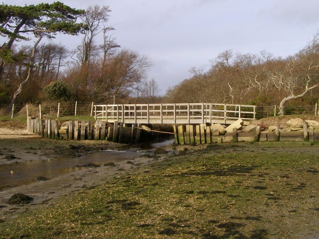
Plummers Water enters the Solent from beneath the footbridge to the left of the photo. The tide is ebbing here. Yachts sailing in the Solent near Cowes can be seen in the distance.
Lymington High Street. Looking east along the High Street in the town on a Sunday - still busy although few of the high street shops are open. In the distance is the top of the Walhampton Obelisk, presumably erected on that spot so that it was visible from the town's principal street.
Wightlink ferry approaching the Lymington terminal. The ferry Caedmon approaching the Lymington terminal (on the left). Its symmetric design is ideally suited to this shuttle service between Lymington and Yarmouth on the Isle of Wight. According to the Wightlink history website, the vessel is 61 metres long and 15 metres wide and is capable of carrying 52 cars. It was brought into service in 1973 on the Ryde-Portsmouth link and moved to Lymington in 1983.


