Papplewick Walks
![]()
![]() This pretty Nottinghamshire village is close to a major historical site and the woodland of Sherwood Forest. The village is also a conservation area with an ancient church, 18th century cottages and the Grade I listed Papplewick Hall. In medieval times the village was the southern gateway to Sherwood Forest.
This pretty Nottinghamshire village is close to a major historical site and the woodland of Sherwood Forest. The village is also a conservation area with an ancient church, 18th century cottages and the Grade I listed Papplewick Hall. In medieval times the village was the southern gateway to Sherwood Forest.
This circular walk from the village uses a section of the Robin Hood Way to visit Newstead Abbey, Normanshill Wood, Harlow Wood, Blidworth and Ravenshead.
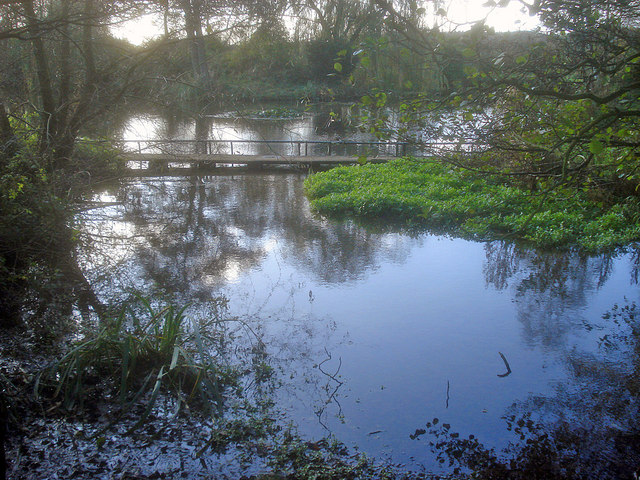
The walk starts in the village where you can pick up the Robin Hood Way and follow the waymarked footpath north to Newstead Abbey passing Papplewick Hall on the way. The former Augustinian priory is notable as the former home to Lord Byron. The house is surrounded by acres of parkland, woodland, formal gardens and lakes.
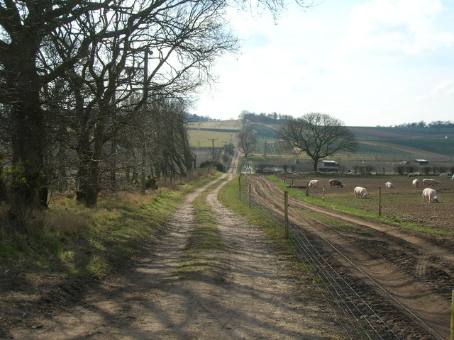
The route continues north to Normanshill Wood and Thieves Wood before turning east to pass through Harlow Wood. Here you pass along Rainworth Water and a series of ponds leading to Friar Tuck's Well.
You continue south east to Blidworth where you could take a detour from the route to visit Blidworth Woods. This route turns south west towards Ravenshead and Trumper Park. Shortly after you return to Papplewick village.
Postcode
NG15 8EN - Please note: Postcode may be approximate for some rural locationsPapplewick Ordnance Survey Map  - view and print off detailed OS map
Papplewick Open Street Map  - view and print off detailed map
Papplewick OS Map  - Mobile GPS OS Map with Location tracking
Papplewick Open Street Map  - Mobile GPS Map with Location tracking
Walks near Papplewick
- Newstead Abbey - Explore the extensive parkland surrounding this former Augustinian priory and home to Lord Byron
- Burntstump Country Park - Explore open grassland, woodland and glade in this country park in Nottingham
- Sherwood Pines Forest Park - Enjoy several waymarked cycling and walking trails in this large woodland area in Mansfield
- Vicar Water Country Park - Explore 200 acres of rare heathland, mature woodland and species rich grassland in this country park near Mansfield
- Sherwood Forest Country Park - Explore 450 acres of peaceful woodland in this famous park and Nature Reserve in Nottinghamshire
- Blidworth Woods - Explore the pine woodlands and open heath of Blidworth Woods, on this peaceful walk in Sherwood Forest.
- Bestwood Country Park - Bestwood Country Park is located on the outskirts of the city of Nottingham and consists of 650 acres of open green space
- Kings Mill Reservoir - This lake in Mansfield has a nice walking trail to follow around the perimeter of the water
- Lambley Dumbles - This walk explores the delightful Lambley Dumbles in Nottinghamshire
- Edwinstowe - This Nottinghamshire based village sits in a pleasant spot, on the edge of Sherwood Forest near Mansfield
- Rufford Abbey Country Park - Visit Rufford Country Park near Mansfield and explore 150 acres of historic parkland
- Felley Priory - This walk visits the historic Felley Priory near Underwood in Nottinghamshire.
- Moorgreen Reservoir - This short walk visits Colliers Wood Nature Reserve before following footpaths to the nearby Moorgreen Reservoir.
The walk starts in the Colliers Wood car park just to the south of the reservoir - Lowdham - This picturesque Nottinghamshire village is located in a pleasant rural spot in between Nottingham and Southwell.
Pubs/Cafes
Head to the Griffin's Head for some post walk refreshment. The pub dates back over 300 years and includes wooden ceilings, exposed beams, a well and three open fires. They serve good quality food and have a spacious outdoor area for warmer days. You can find them on Moor Road at postcode NG15 8EN.
Dog Walking
The country and woodland trails on the route are ideal for dog walking. The Griffin's Head mentioned above is also dog friendly.
Further Information and Other Local Ideas
The Papplewick Pumping Station is another major highlight of the area. The attraction is described as 'Britain’s finest Victorian Waterworks' and includes an interesting museum where you can learn all about this Scheduled Ancient Monument. It's located just to the south east of the village on Rigg Lane at postcode NG15 9AJ. Near here you can also visit Burntstump Country Park where you will find peaceful woodland walking trails, an ornamental pond and the Burntstump Inn.
For more walking ideas in the area see the Nottinghamshire Walks page.
Photos
Papplewick Hall and grounds. The hall was completed around 1787 for the Hon. Frederick Montagu, and is probably the work of William Lindley of Doncaster. The Gradfe I listed house and grounds are privately owned.
Footpath, Normanshill Wood. Part of Thieves' Wood, an ancient woodland which trees were reputedly used in the construction of Nottingham Castle.


