South Woodham Ferrers Walks

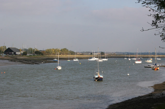
 This Essex based town has some nice waterside footpaths along the local creek and river to try. The area is particularly good for wildlife watchers with many different species to be seen around these waterways.
This walk from the town takes you along the River Crouch to the neighbouring town of Battlesbridge.
The walk starts from the train station and heads west to Woodham Fenn next to the Fenn Creek, where you can look out for a variety of wildlife. You follow the creek south to the point where it meets with the River Crouch at Marsh Farm Country Park. The park is one of the local highlights with 300 acres of grazing marsh and a wide variety of water loving birds to spot. At the park you cross the river to Hullbridge at the ford. You can then follow a river path west to take you to Battlesbridge.
Postcode
CM3 5WS - Please note: Postcode may be approximate for some rural locationsSouth Woodham Ferrers Ordnance Survey Map  - view and print off detailed OS map
South Woodham Ferrers Open Street Map  - view and print off detailed map
South Woodham Ferrers OS Map  - Mobile GPS OS Map with Location tracking
South Woodham Ferrers Open Street Map  - Mobile GPS Map with Location tracking
Walks near South Woodham Ferrers
- Marsh Farm Country Park - This country park in South Woodham Ferrers has miles of splendid waterside walking trails to enjoy
- Hanningfield Reservoir - This large body of water near Billericay has some nice woodland walking trails at its southern end
- Norsey Woods - These lovely woods near Billericay have some good waymarked footpaths to try
- Hanningfield Reservoir - This large body of water near Billericay has some nice woodland walking trails at its southern end
- St Peters Way - Travel from Chipping Ongar to the 7th century St Peter's Chapel on St Peter's Flat on this walk through Essex.
The walk first heads to Maylandsea passing Hanningfield Reservoir and Purleigh on the way - Thorndon Country Park - This large country park is located near Brentwood in Essex and contains a number of fine woodland trails, ideal for walking or cycling
- Upminster - This East London town is located in a nice spot in the London Borough of Havering
- Hornchurch Country Park - Enjoy a walk or cycle through this large country park in Havering in the Ingrebourne Valley
- Ingatestone - This pretty Essex based village has some nice country trails to try
- Billericay - This Essex based town has some nice country walking trails, a popular local wood and a nearby reservoir to enjoy.
- Hockley Woods - Follow the peaceful walking trails through this large area of mixed woodland near Rayleigh in Essex
- Saffron Trail - A walk through the Essex countryside from the coast at Southend-on-Sea to Saffron Walden
- Battlesbridge - This Essex based village has some nice local trails along the River Crouch and a well known antiques centre housed in a picturesque old mill.
- Wickford - This Essex based commuter town is located on the tidal River Crouch, within the Borough of Basildon
- Belhus Woods Country Park - Enjoy the pretty lakes and peaceful woodland trails in this country park near Ockendon and Dagenham.
Pubs/Cafes
The Curlew is located in a nice position close to the River Crouch. They serve a fine Sunday Roast and can be found on the North Bank of the river at Gandalfs Ride, CM3 5WS.
At the end of the route in Battlesbridge there's The Barge Inn. They serve good food and have a lovely garden area for warmer days. You can find them at Hawk Hill at postcode SS11 7RE. The pub is also dog friendly.
Dog Walking
The river trails make for a fine dog walk. The Curlew pub and The Barge Inn mentioned above are also dog friendly.
Further Information and Other Local Ideas
If you were to continue west from Battlesbridge you would arrive at Wickford. Here you can visit the Shotgate Thicket Nature Reserve and the pretty Wick Country Park in the interesting commuter town.
Just to the west of the town you'll find one of the highlights of the area at the expansive Hanningfield Reservoir.
The long distance Saffron Trail also passes through the area.
For more walking ideas in the area see the Essex Walks page.


