Southrop Walks
![]()
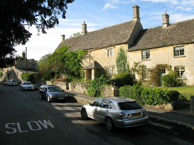
![]() This Gloucestershire village lies just to the south of Eastleach on the eastern edge of the Cotswolds.
This Gloucestershire village lies just to the south of Eastleach on the eastern edge of the Cotswolds.
The pretty village is located on the River Leach and includes a noteworthy 11th century church and a 17th century pub.
This walk from the village takes you south through the countryside to visit Lechlade where you can enjoy a riverside walk along the Thames Path National Trail.
To continue your walking in the area head north to visit neighbouring Eastleach. Here you'll find two Norman churches and an ancient stone slab clapper footbridge over the river.
Postcode
GL7 3NU - Please note: Postcode may be approximate for some rural locationsPlease click here for more information
Southrop Ordnance Survey Map  - view and print off detailed OS map
Southrop Open Street Map  - view and print off detailed map
Southrop OS Map  - Mobile GPS OS Map with Location tracking
Southrop Open Street Map  - Mobile GPS Map with Location tracking
Walks near Southrop
- Eastleach - This Gloucestershire village includes the settlements of Eastleach Turville and Eastleach Martin which sit either side of the River Leach.
- Bibury-River Coln-Arlington Row - This circular walk takes you around the delightful village of Bibury and the surrounding countryside
- Coln St Aldwyns - This pretty Cotswolds village is located in a pleasant spot on the River Coln
- Chedworth Roman Villa - This circular walk around the village of Chedworth visits the fascinating Chedworth Roman Villa and Chedworth Woods.
The walk starts in Chedworth and follows the Macmillan Way long distance trail to the National Trust owned villa - Lechlade River Circular Walk - This lovely circular walk takes you along the River Thames and through the countryside surrounding this pretty town in Gloucestershire
- Cricklade Circular Walk - Enjoy an easy stroll around the pretty Wiltshire town of Cricklade, on this circular walk in the Thames Valley
- Buscot Park - Explore the delightful grounds and gardens surrounding this fine 18th-century house near Faringdon in Oxfordshire
- Cotswold Canals - Follow a series of delightful waterways from Framilode to Lechlade on this waterside walk through Gloucestershire.
The walk starts at Framilode, next to the River Severn and follows the Stroudwater Canal and the River Frome to the market town of Stroud - Faringdon Circular Walk - This circular walk around the Oxfordshire town of Faringdon, visits Faringdon Folly and the village of Littlelworth
- Fairford - The Gloucestershire town of Fairford is ideally located for exploring the Cotswolds Hills on foot
- Carterton - This modern Oxfordshire based town is located in the western part of the county near Witney.
- Lechlade To Kelmscott - This walk takes you along a lovely section of the Thames Path from Lechlade to Kelmscott.
- Quenington - This delightful Gloucestershire village is located on the River Coln in the Cotswolds
Pubs/Cafes
The Swan dates to 1606 when it was originally known as the Bakehouse, serving bread and ale to the local farm workers. The charming ivy covered property includes low-slung ceilings, roaring fires and a spacious garden room. You can find them adjacent to the green at postcode GL7 3NU for your sat navs.


