Stanton Drew Walk
![]()
![]() This short walk visits the Stanton Drew Stone Circles in Somerset.
This short walk visits the Stanton Drew Stone Circles in Somerset.
The area is run by English Heritage and includes three ancient stone circles. It is notable as the third largest complex of prehistoric standing stones in England.
You can start the walk from the car park at the site. Then follow footpaths east to explore the circles. The largest of these is known as the Great Circle, measuring 113 metres (371 ft) in diameter. It is the second largest stone circle in Britain after the Avebury Stones. The scheduled ancient monument is throught to date from the Late Neolithic to Early Bronze Age period.
Part of the route uses the Two Rivers Way which you can use to extend your walking in the area.
Postcode
BS39 4EW - Please note: Postcode may be approximate for some rural locationsStanton Drew Ordnance Survey Map  - view and print off detailed OS map
Stanton Drew Open Street Map  - view and print off detailed map
Stanton Drew OS Map  - Mobile GPS OS Map with Location tracking
Stanton Drew Open Street Map  - Mobile GPS Map with Location tracking
Pubs/Cafes
The Druids Arms is located next to the site and offers an alternative start/finish point. They serve delicious food which you can enjoy with a country view in the lovely large garden area. You can find them at postcode BS39 4EJ for your sat navs.
Dog Walking
Due to the livestock on the fields no dogs are allowed on the site. You can pick up public footpaths around the site though. The Druids Arms mentioned above is dog friendly with biscuits provided.
Further Information and Other Local Ideas
You can extend the walk by heading a short distance to the east to visit the impressive Pensford Viaduct. The climb to the viewpoint at the Iron Age Maes Knoll also starts from Pensford village.
For more walking ideas in the area see the Mendip Hills Walks and the Somerset Walks pages.
Cycle Routes and Walking Routes Nearby
Photos
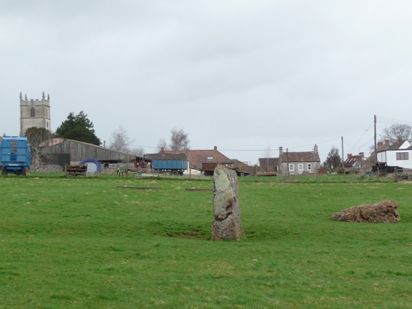
Stones at Stanton Drew. Very little is known about the stones. The megaliths, and the patterns they make in the landscape remain mysterious.
The three circles are thought to have been originally noted by the antiquarian John Aubrey in 1664, and the first plan of them was published by William Stukeley in 1776. Several others have written about them but they remain very much as first recorded over three hundred years ago.
The village pub is named for the stone circles that still attract Druids on the solstices. It is allegedly haunted by Grace, who was run over by a carriage outside.
Western edge of the great circle. To quote English Heritage: 'There are three stone circles at Stanton Drew: the great circle being one of the largest in the country... A magnetomometer [geophys] survey has produced astonishing results which demonstrate that the megalithic remains at Stanton Drew are but the ruins of a much more elaborate and important site.... There are nine concentric rings of buried pits and a very large buried enclosure ditch.... The circles are the largest and most numerous yet recorded at any site and surely indicate the investment of immense effort and enterprise in the service of prehistoric beliefs as yet dimly perceived.'


