GPS Cycle and Walking Routes

Tarrant Monkton and Chettle Walk

10 miles (16 km)

This walk explores the countryside around the attractive villages of Tarrant Monkton and Chettle in Cranborne Chase, Dorset. You'll also visit part of the ancient Dorset Cursus on Thickthorn Down.
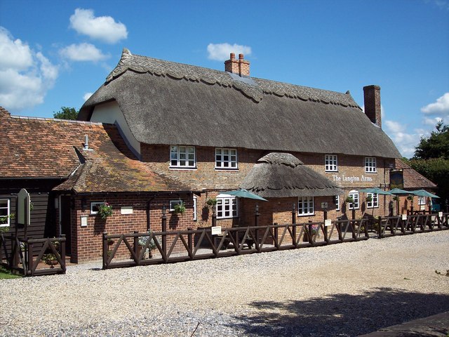
The circular walk starts off from the splendid Langton Arms pub in the village of Tarrant Monkton. The delightful village includes a number of picturesque thatched dwellings and lies just a couple of miles south west of the cursus. The pub dates back to the 17th century and is ideal for some pre or post walk refreshments. From here you can follow a mixture of bridleways and country lanes north east to Crichel Down and Thickthorn Down where you will find the south western end of the Dorset cursus.
The route then takes you north to Tarrant Hinton Down and the village of Chettle. The village includes the Chettle Longbarrow and the noteworthy Chettle House, a Grade I listed mansion dating back to the early 1700s.
You then head west and south across Launceston Down before returning to Tarrant Monkton.
To explore the rest of the Cursus please see the Dorset Cursus Walk page. This walk starts from the eastern end of the earthwork at Wyke Down and visits Gussage Hill and the village of Gussage St Michael.

Tarrant Monkton and Chettle OS Map - Mobile GPS OS Map with Location tracking

Tarrant Monkton and Chettle Open Street Map - Mobile GPS Map with Location tracking

Photos

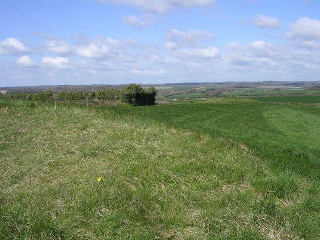
Dorset cursus southwestern terminal - geograph.org.uk - 24093

Dorset cursus southwestern terminal. The neolithic earthworks in this picture form the southwestern terminal of the enigmatic Cursus, on Thickthorn Down. The cursus is a linear ancient monument: a pair of parallel earth banks and ditches about 100m apart once stretched 10km to the northeast from this point, with the other terminal on Bokerley Down.

Tarrent Hinton Down - geograph.org.uk - 2459712

Farming activity over the centuries has destroyed much of the above-ground features of the cursus, but these earthworks in particular remain. The original purpose of the cursus is still the subject of conjecture, but it is likely that it is somehow related to the many neolithic long barrows that lie on, within and without its banks.

The Langton Arms, Tarrant Monkton - geograph.org.uk - 449470

The Langton Arms, Tarrant Monkton. This attractive 17th century thatched pub can be found next to the church in the sleepy village of Tarrant Monkton.

Chettle House - geograph.org.uk - 1289854

Chettle House. Commissioned by George Chafin MP, and designed by Thomas Archer, Chettle remained with the Chafin family until the death of the last of the line in 1818. It then passed into the hands of the Castleman family in 1846, who undertook an extensive programme of renovation and rebuilding. With the death of Edward Castleman in 1946, the house was inherited by his niece Esther Bourke, the grandmother of the present owners Peter and Fiona Bourke.

Video

GPS Files

GPX File

Tarrant Monkton and Chettle.gpx (On Desktop:Right Click>'Save As. On Ipad/Iphone:Click and hold>Share>Save to Files')