Wargrave Walks
![]()
![]() This Berkshire village is located in a nice spot next to the River Thames with some lovely surrounding Chilterns countryside. The historic settlement includes many old listed buildings, a picturesque marina, a 12th century church and a very fine riverside pub for post walk refreshment.
This Berkshire village is located in a nice spot next to the River Thames with some lovely surrounding Chilterns countryside. The historic settlement includes many old listed buildings, a picturesque marina, a 12th century church and a very fine riverside pub for post walk refreshment.
This circular walk from the village visits the woodland around Bowsey Hill before heading to Cockpole Green and Crazies Hill. There's some pleasant woodland and grassland with views of the surrounding countryside to enjoy on the way.
On Bowsey Hill there are a number of different routes to choose from with walkers, horse riders and cyclists well catered for. This includes the Chiltern Way and the Knowl Hill Bridleway Circuit.
Postcode
RG10 8HY - Please note: Postcode may be approximate for some rural locationsWargrave Ordnance Survey Map  - view and print off detailed OS map
Wargrave Open Street Map  - view and print off detailed map
Wargrave OS Map  - Mobile GPS OS Map with Location tracking
Wargrave Open Street Map  - Mobile GPS Map with Location tracking
Walks near Wargrave
- Hurley - This riverside village near Maidenhead has some nice local trails and a noteworthy ancient pub.
- Thames Path - Starting at the Source of the Thames at Thames Head in Gloucestershire, follow the iconic river through beautiful countryside and historic towns to the city of London.
- Twyford - This large Berkshire based village has some pleasant waterside walks along its Rivers and Lakes.
- Charvil Country Park - This country park is located between the villages of Charvil and Twyford in Berkshire
- Shiplake - This circular walk takes you along the River Thames around the village of Shiplake
- Maidenhead Thicket - Enjoy a short walk through the pretty Maidenhead Thicket located on the western outskirts of the town
- Maidenhead - This walk takes you from Maidenhead to Windsor along the Thames Path National Trail
- Henley-on-Thames - The popular market town of Henley-on-Thames has a number of excellent waymarked trails to try
- Reading Canal Walk - This walk takes you along the Kennet and Avon Canal from Reading to Aldermaston Wharf
- Reading Circular River Walk - This circular walk takes in a number of waterways including the River Thames, the River Kennet and the Kennet and Avon Canal
- Chiltern Way - This is the original 125 mile circuit of the Chilterns AONB taking you through Hemel Hempstead, Chalfont St Giles, Marlow, Hambleden, Turville, Fingest, Bix Bottom, Ewelme, the Ridgeway, Stokenchurch, Great Hampden, Aldbury, the Dunstable Downs Country Park, Sharpenhoe Clappers and Harpenden
- Mapledurham House - The Mapledurham estate is a wonderful place for a relaxing afternoon walk
- Warburg Nature Reserve - This delightful nature reserve near Henley-on-Thames has some lovely woodland trails to try
- Knowl Hill Bridleway - This shared cycling and walking route follows the Knowl Hill Bridleway around Wargrave and Twyford.
Pubs/Cafes
On the High Street there's the St George & Dragon. The stylish pub serves good quality dishes which you can enjoy in the courtyard or garden. It's located in a lovely spot close to the river with fine views from the pub.
Dog Walking
The woodland and country trails make for a fine dog walk. The George mentioned above is also dog friendly.
Further Information and Other Local Ideas
If you head to the opposite side of the river you can pick up the Thames Path at nearby Shiplake.
For more walking ideas in the area see the Berkshire Walks page.
Photos
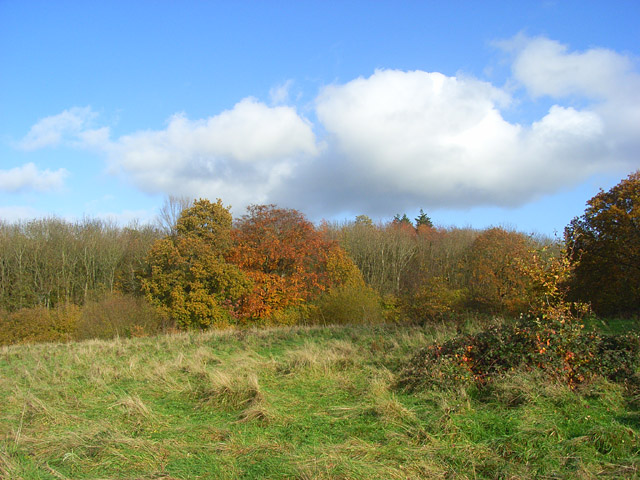
Grassland and woodland above Wargrave. A small uncultivated field stands beside Bottom Boles Wood on the shallow western slopes of Bowsey Hill.


