Langsett Reservoir Short Circular Walk with OS Map
![]()
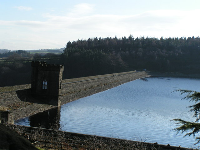
![]() This circular walk takes you around the lovely Langsett Reservoir on the edge of the Peak District National Park.
This circular walk takes you around the lovely Langsett Reservoir on the edge of the Peak District National Park.
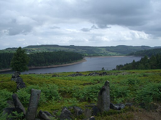
The walk starts in the village of Langsett and follows footpaths through the woodland and open moorland around the reservoir for a distance of 3.4 miles. There is some climbing involved, though you are rewarded with splendid views across the Peak District. Most of the route is on well maintained, signed paths.
Other highlights on the route include the ruined farm buildings at North America, views of the Little Don River and some delightful woodland paths. There is also a small climb to Hingcliff Common on the south western side of the water. From here there are lovely views back down to the reservoir and the village.
The Barnsley Boundary Walk runs past the reservoir so you could pick up this trail and head east to the nearby Midhope and Underbank Reservoir, or west towards Winscar Reservoir. You could also head south past Hingcliff Common, Mickleden Edge and the Midhope Moors to visit the Howden, Derwent and Ladybower Reservoirs in the High Peak. The Langsett to Ladybower Walk 10 mile route will take you across the heather clad Howden Moors to the reservoirs.
Langsett Reservoir is located close to both Stocksbridge and Sheffield.
Langsett Reservoir Ordnance Survey Map  - view and print off detailed OS map
Langsett Reservoir Open Street Map  - view and print off detailed map
*New* - Walks and Cycle Routes Near Me Map - Waymarked Routes and Mountain Bike Trails>>
Langsett Reservoir OS Map  - Mobile GPS OS Map with Location tracking
Langsett Reservoir Open Street Map  - Mobile GPS Map with Location tracking
Pubs/Cafes
After your walk head to the Waggon & Horses pub in Langsett village. The inn is well known for freshly prepared food, real ale and a real fire. With grand views from the garden overlooking Langsett reservoir and the Pennine moors. It was built in 1809 using Yorkshire stone, is a grade II listed building and set in a most scenic and attractive location. You can find the pub at postcode S36 4GY.
Near here you will also find the excellent Bank View cafe which is popular with walkers and cyclists. The cafe provides good home cooked food sourced from local producers in a relaxed atmosphere.
Just to the west of the reservoir there is another inn of some note. The Dog and Partridge is an ancient Inn with an interesting history that can be traced back to the Elizabethan period. It was originally a farmhouse and alehouse, supplying shelter and refreshment for travelers crossing the hostile moors of the Pennines. First known as Border Hill House, the Inn became known as the Dog and Partridge on receipt of its first license all the way back in 1740. The inn has an attractive interior with traditional oak beams, nostalgic photographs and roaring fires to warm yourself by. They do very good food and also have a fine selections of drinks. You can find the pub just to the east of the route at postcode S36 4HH for your sat navs.
Dog Walking
The area is a favourite for dog walkers with the Waggon & Horses pub and the Bank view cafe both dog friendly too.


