Swansea to Carmarthen

 Follow National Cycle Route 4 from Swansea to Carmathen with wonderful coastal views of the beautiful Gower Peninsula and several long traffic free sections to enjoy.
You start by the marina in Swansea and head west along the front with super views of Swansea Bay and Mumbles Bay. The ride then heads inland through the wooded Clyne Valley Country Park and on to Gowerton before joining a lovely stretch along the River Loughor which takes you to Llanelli.
From Llanelli you head west towards Burry Port along the Llanelli sea front on the off road Coastal path. The route then heads through Pembrey Country Park and Pembrey Forest on more traffic free paths before reaching the town of Kidwelly with its striking castle.
From here you join a long on road section which takes you along the River Towy to Carmarthen.
Swansea to Carmarthen Ordnance Survey Map  - view and print off detailed OS map
Swansea to Carmarthen Open Street Map  - view and print off detailed map
Swansea to Carmarthen OS Map  - Mobile GPS OS Map with Location tracking
Swansea to Carmarthen Open Street Map  - Mobile GPS Map with Location tracking
Cycle Routes and Walking Routes Nearby
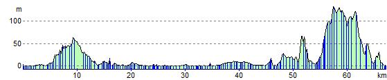
Elevation Profile