Wicken Fen Walk and Cycle
![]()
![]() Enjoy a walk or cycle through the beautiful Wicken Fen Nature Reserve in Cambridgeshire. National Cycle Route 11 runs right through Wicken Fen and there are some peaceful country lanes around the reserve. Bike hire is available from just £5.
Enjoy a walk or cycle through the beautiful Wicken Fen Nature Reserve in Cambridgeshire. National Cycle Route 11 runs right through Wicken Fen and there are some peaceful country lanes around the reserve. Bike hire is available from just £5.
The route below starts at the pretty village of Wicken before passing through the reserve and into the surrounding countryside. You follow quiet lanes to Upware, located on the River Cam, before returning to Wicken Village.
In the reserve you will find flowering meadows, reedbeds and waterways where you can see a variety of wildlife such as hen harriers, water voles and bitterns. In the Baker's Fen area you can also see konik ponies, highland cattle, lapwings and barn owls. If you're on foot you can follow the Boardwalk Trail or the longer Nature Trail while stopping off at one of the many bird hides. In the summer months you can also enjoy a 50 minute boat trip along the waterways of Wicken Fen.
A number of options are available if you would like to continue your outing. If you're on foot you could follow the Fen Rivers Way along the River Great Ouse to Ely. For cyclists National Route 11 runs along quiet roads and the River Great Ouse to Ely on the Ely to Wicken Fen Cycle Route. Or you can head east towards Newmarket via Burwell Fen.
Postcode
CB7 5XP - Please note: Postcode may be approximate for some rural locationsPlease click here for more information
Wicken Fen Ordnance Survey Map  - view and print off detailed OS map
Wicken Fen Open Street Map  - view and print off detailed map
*New* - Walks and Cycle Routes Near Me Map - Waymarked Routes and Mountain Bike Trails>>
Wicken Fen OS Map  - Mobile GPS OS Map with Location tracking
Wicken Fen Open Street Map  - Mobile GPS Map with Location tracking
Dog Walking
The reserve is a lovely place for a dog walk so you're sure to see other owners on your visit. Please keep them on leads though because of the wildlife. Dogs are also not allowed in the Sedge Fen area.
Further Information and Other Local Ideas
Head south along the Fen Rivers Way and you will soon come to the pretty village of Waterbeach. There's some nice waterside paths and a fine riverside pub and garden to visit here.
The Lodes Way starts at the reserve. This circular walk or cycle follows NCN Route 11 through the Cambridgeshire Lodes, a series of ancient man made waterways created to link a series of Fenland villages to the River Cam.
The circular Soham Walk starts from the nearby town. It visits the reserve before heading north along the river to link up with another waterside path along Soham Lode.
For more walking ideas in the area see the Cambridgeshire Walks page.
Cycle Routes and Walking Routes Nearby
Photos
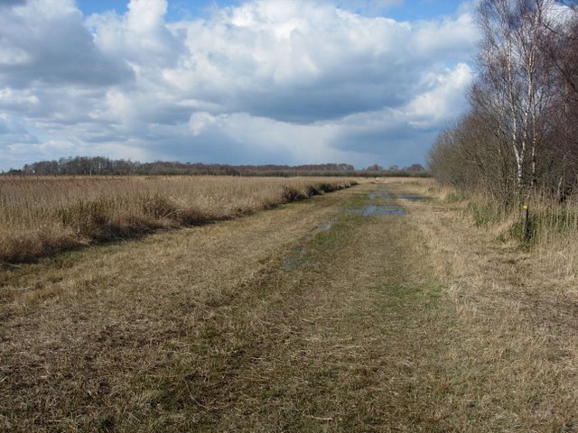
Track through the Fen. The grid of tracks separate the fen into segments with different management regimes or cutting times.
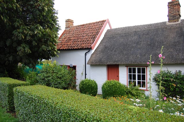
Fen Cottage. This farm labourer's cottage dating back to the 18th Century and now owned by the National Trust, was occupied into the 1970's. It is opposite the entrance to Wicken Fen.
Visitors' Centre, Wicken Fen. This building is the headquarters for Wicken Fen (National Trust) National Nature Reserve


