Buxton Walks
![]()
![]() The popular spa town of Buxton has a number of waymarked trails taking you though this beautiful area of the Peak District. There's also challenging hill climbs, riverside paths, pretty reservoirs and delightful parks to explore.
The popular spa town of Buxton has a number of waymarked trails taking you though this beautiful area of the Peak District. There's also challenging hill climbs, riverside paths, pretty reservoirs and delightful parks to explore.
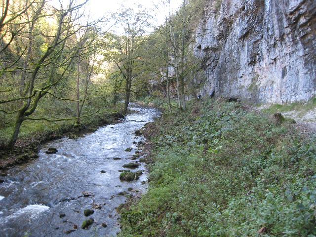
This walk from the town visits a series of beautiful valleys along the River Wye. You'll pass through Wye Dale, Chee Dale, and the popular Miller's Dale before finishing at Cressbrook Dale. It's about a 10 mile walk so 20 miles there and back. You can shorten it by going as far as Miller's Dale which is one of the highlights of the area. Here you have the option of heading north from the river and visiting Tideswell Dale and the village of Tideswell.
It's a fantastic area for walking with the rushing waters of the river, shady woodland and lots of wildlife to look out for on the way. Please note it's downhill on the way there so save some energy for the way back! You could turn it into a circular walk by heading north at Monk's Dale and returning through the countryside via Tunstead.
The walk uses some of the excellent long distance trails you can pick up near the town. This includes the Midshires Way, Pennine Bridleway and Monsal Trail.
Other Walks near and around Buxton
- Midshires Way - This route follows public bridleways and quiet country lanes through Middle England, from Bledlow, near Aylesbury in Buckinghamshire, to Stockport in Greater Manchester
- Pennine Bridleway - This fabulous 120 mile long trail runs through the beautiful Derbyshire Peak District, through Lancashire and on into Yorkshire.
It is suitable for mountain bikers, horse riders and walkers taking you on a tour through some of the most beautiful parts of the country - Monsal Trail - Follow the Monsal Trail through the Peak District National Park on this cycling and walking path.
The trail follows a disused railway line from Chee Dale near Buxton to Bakewell with the first section following the River Wye to Monsal Head via Cressbrook Dale and Miller's Dale - Limestone Way - Travel through the beautiful Peak District National Park on this walk through Derbyshire and into Staffordshire.
The walk starts at Castleton, passing through the scenic Cave Dale and past the remains of Peverill Castle - Poole's Cavern and Buxton Country Park - A walk around Buxton Country Park and a visit to Poole's Cavern - a natural limestone cave used as a lair by an outlaw in the fifteenth century
- Pavilion Gardens Buxton - Enjoy a stroll around these beautiful gardens in Buxton
- Dane Valley Way - Follow the River Dane through Derbyshire and Cheshire on this fabulous walk from Buxton to Middlewich.
Highlights on the route include the wonderful Three Shires Head where the counties of Cheshire, Derbyshire and Staffordshire meet - Three Shires Head - Explore this beautiful section of the Dane Valley and enjoy rivers, old stone bridges and waterfalls on this lovely walk in the Peak District.
Three Shires Head is a point on Axe Edge Moor where the counties of Cheshire, Derbyshire and Staffordshire meet - Chrome Hill - This circular walk climbs the beautiful Chrome Hill in the Upper Dove valley area of the Peak District
- Shining Tor and Cats Tor - Climb to the highest point in Cheshire on this wonderful walk in the Goyt Valley.
The walk starts from the Erwood Hall Car Park at the southern end of Erwood Reservoir - Errwood Reservoir and Fernilee Reservoir - Enjoy some lovely waterside walking along these two reservoirs in the Goyt Valley area of the Peak District
- High Wheeldon - This walk climbs High Wheeldon Hill in the Upper Dove Valley area of the Peak District
- Miller's Dale - This popular beauty spot on the River Wye is one of the highlights of the Peak District National Park
- Cressbrook Dale - This walk follows pubic footpaths through Cressbrook Dale Nature Reserve in the Derbyshire Dales.
The walk starts in the village of Cressbrook which sits at the southern end of the Dale - Longnor - The village of Longnor is based in a lovely part of the Staffordshire Peak District
- Combs Reservoir - This circular walk takes you around Combs Reservoir near Chapel-en-le-Frith on the edge of the Peak District National Park
- Chapel en le Frith - This small Derbyshire town is located close to some classic Peak District walks, with stunning scenery in all directions
- Castle Naze - This walk visits an elevated fort near Chapel en le Frith in the White Peak area of the Peak District.
Buxton Ordnance Survey Map  - view and print off detailed OS map
Buxton Open Street Map  - view and print off detailed map
Buxton OS Map  - Mobile GPS OS Map with Location tracking
Buxton Open Street Map  - Mobile GPS Map with Location tracking
Pubs/Cafes
The Old Sun Inn is a good choice for some post walk refreshments. The pub is a former 17th-century coaching inn with a charming interior including stone floor and oak panelling. There's also a garden area to sit out in if the weather is good. You can find the inn on the High Street with a postcode of SK17 6HA for your sat navs.
Dog Walking
The river paths through the dales are ideal for dog walking. There's also some nice parkland and woodland trails in Buxton Country Park to the south west of the town centre.
Further Information and Other Local Ideas
For more walking ideas in the area see the Derbyshire Walks and the Peak District Walks pages.
Cycle Routes and Walking Routes Nearby
Photos
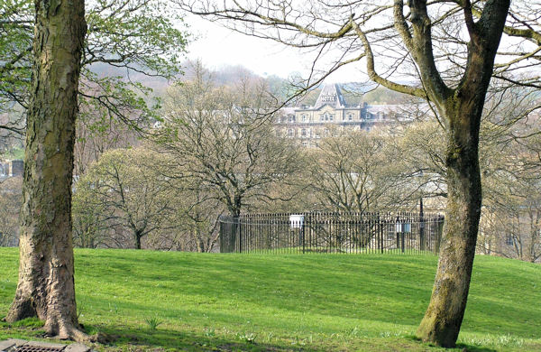
'The Slopes', Buxton. From here the green lawns of The Slopes fall away and down to Buxton's famous Crescent. The cylinder of black iron fencing encloses a weather-station, including a white equipment box and a sunny hours recorder.
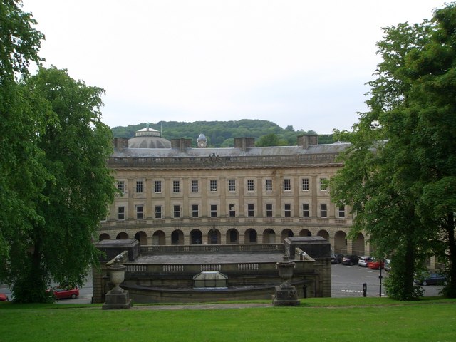
The Crescent, Buxton. Designed in the 1770s by John Carr of York, to rival Bath. It was originally two hotels and six boarding houses. Eventually the hotels took over the whole block but the building became derelict in the 1980s and is about to be transformed into one, new, spa hotel utilising the hot springs which were once sampled in the former pumphouse in the foreground. Beyond is the dome of the Royal Devonshire Hospital, originally the stable block for the hotels and now part of the University of Derby.
Bridge and Bandstand, an idyllic scene in the town's Pavilion Gardens. It's a lovely place for a stroll with the River Wye running through the park.
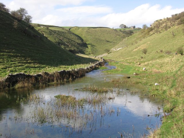
Cressbrook Dale Stream. During much of the year this part of the valley is dry. But at times, the stream which usually appears only further down the dale, flows its full length. On the day of this photograph, there were a number of camera-shy ducks swimming happily about.
