Crowborough Walks
![]()
![]() The town of Crowborough is nicely positioned for exploring the expansive Ashdown Forest and the High Weald AONB. There's also some fine waymarked trails running through the area including the Vanguard Way and the Wealdway.
The town of Crowborough is nicely positioned for exploring the expansive Ashdown Forest and the High Weald AONB. There's also some fine waymarked trails running through the area including the Vanguard Way and the Wealdway.
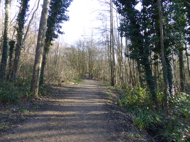
This circular walk takes you around Crowborough Common. The common is located just to the south west of the town centre and includes 220 acres of heathland and woodland. It's a nice place for a stroll with a number of trails to follow around the site. There's also picturesque streams and in the autumn months there is lots of pretty heather to see. You can pick up the footpaths just west of Whitehill and follow them south past the golf club to Sweethaws Wood and Piping Wood. Other bridleways will then take you past Redbridge Farm on the eastern side of the common.
To continue your walking around the town head to Crowborough Country Park. Here you'll find more nice footpaths taking you to wet and dry woodland, grass and heath glades, marshes, streams and ponds. It's located just to the east of Jarvis Brook and the train station.
Just to the west of the common you can pick up the Vanguard Way and use the waymarked trail to explore Ashdown Forest. Here you can explore 500 Acre Wood on the Pooh Walk and pay a visit to Pooh Sticks Bridge. The ancient Chelwood Vachery can also be visited near here.
Crowborough Ordnance Survey Map  - view and print off detailed OS map
Crowborough Open Street Map  - view and print off detailed map
*New* - Walks and Cycle Routes Near Me Map - Waymarked Routes and Mountain Bike Trails>>
Crowborough OS Map  - Mobile GPS OS Map with Location tracking
Crowborough Open Street Map  - Mobile GPS Map with Location tracking
Walks near Crowborough
- Ashdown Forest Pooh Walk - This short walk visits some of the places made famous in A.A Milne's Winnie the Pooh stories.
The walk starts from the Gills Lap car park (Postcode:TN22 3JD) located where Chuck Hatch Road and Kid's Hill meet - Hartfield Winnie the Pooh Walk - This walk takes you to some of the locations associated with A.A Milne's Winnie the Pooh books in Ashdown Forest
- Wealdway - Follow the Wealdway from the River Thames at Gravesend to Eastbourne on the Sussex coast
- Vanguard Way - This 66 mile trail runs from the outskirts of London, through Ashdown Forest, Alfriston and Cuckmere Valley to the stunning East Sussex coast.
Route highlights include the lovely Ashdown Forest, the White Horse near Alfriston and the wonderful final coastal stretch that gives views of the Seven Sisters Cliffs and Tidemills beach - Pooh Sticks Bridge - Walk to the bridge where where Winnie the Pooh invented the game of Pooh Sticks on this lovely little literary walk in Ashdown Forest.
Start the walk from the Pooh Car Park at Chuck Hatch Lane, TN7 4DN - Ashdown Forest - Explore the 'home' of Winnie-the-Pooh in this large area of woodland and heathland near Crowborough
- Heathfield - This East Sussex market town is in a good location for exploring the woods and countryside of the High Weald
- Chelwood Vachery - This circular walk visits Chelwood Vachery and Braberry Hatch Ponds in Ashdown Forest.
- Mayfield - This Sussex based village is located near Crowborough and Tunbridge Wells in the north eastern part of the county
- Rotherfield - This village is located just east of Crowborough in the Wealden District of East Sussex
Pubs/Cafes
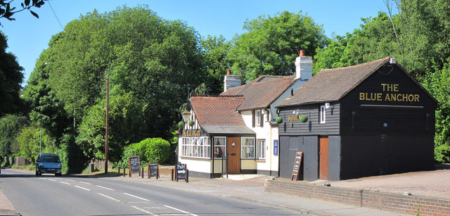
Just north of the common there's the Blue Anchor. The pub serves good quality food and has a lovely large garden area. You can find them at postcode TN6 1BB.
The Wheatsheaf is in a lovely quiet location on the outskirts of Crowborough. The 18th century pub serves delicious genuinely home-cooked food which you can enjoy in their delightful garden area with its colourful hanging baskets. Inside there's cosy log fire and a series of photos showing the pub’s history. You can find them at Mount Pleasant with postcode TN6 2NF for your sat navs.
Dog Walking
The common is a fine place for a dog walk and the two pubs mentioned above are also dog friendly.
Further Information and Other Local Ideas
Head a few miles south and you could try the Heathfield Walk. The trail takes you around Heathfield Park and the historic Old Heathfield where there's a noteworthy 14th century pub and 13th century church to see.
Just to the east is the neighbouring village of Rotherfield where there are some nice trails across the Rotherfield Millennium Green. The green includes a pond, a stream, grassland, an ancient oak, a heritage orchard and lots of wildlife. In the village you can also visit the Grade I listed 11th century church and a 17th century pub with a particularly fine garden area.
For more walking ideas in the area see the High Weald Walks page.
Photos
Crowborough Common. The thawing january snow reveals a memorial to a favourite pet, and a brace of snowmen.


