Dorridge Walks

 This West Midlands based village is located just south of Solihull.
Local walking highlights include easy waterside paths along the Grand Union Canal which runs just to the east. The Knowle Canal Walk covers this section of the canal, visiting the Grade I listed Grimshaw Hall in Knowle and the National Trust's Baddesley Clinton.
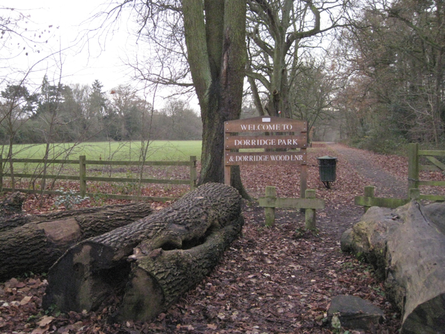
This walk starts from the train station and explores Dorridge Park on the southern side of the village. The local park includes free car parking, woodland trails, a nature reserve and a children's play area.
You then continue south on country lanes to Packwood House, an historic National Trust property. There's some beautiful gardens, splendid topiary and a nice circular trail around a large lake here.
Postcode
B93 8LJ - Please note: Postcode may be approximate for some rural locationsDorridge Ordnance Survey Map  - view and print off detailed OS map
Dorridge Open Street Map  - view and print off detailed map
Dorridge OS Map  - Mobile GPS OS Map with Location tracking
Dorridge Open Street Map  - Mobile GPS Map with Location tracking
Walks near Dorridge
- Solihull - This large town is located in the West Midlands, near Birmingham
- Knowle Canal Walk - A waterside walk along the Grand Union Canal starting from the village of Knowle near Solihull
- Baddesley Clinton - Enjoy a circular walk through the delightful grounds surrounding this moated manor house near Warwick
- Solihull Way - Starting at Earlswood Lakes head through Solihull to Castle Bromwich Hall
- Malvern and Brueton Park - This lovely park in Solihull has nice footpaths and a cycle trail to follow
- Earlswood Lakes - Enjoy a stroll along these three reservoirs and into the adjacent woodland on this lovely walk in Solihull
- Kingfisher Country Park - Enjoy walking and cycling along the River Cole in this pretty country park in South Birmingham
- Sheldon Country Park - A short walk or cycle through the pretty Sheldon Country Park in Birmingham
- Packwood House - This tudor house in Lapworth has nice footpaths to follow through the grounds and surrounding countryside
- Stratford Upon Avon Canal - Enjoy waterside cycling and walking on this 26 mile canal which runs from Stratford Upon Avon to Birmingham
- Henley in Arden Circular Walk - This circular walk explores the villages, rivers, canals and countryside surrounding the charming town of Henley in Arden in Warwickshire
- Arden Way - This circular walk takes you on a tour of the beautiful Forest of Arden in Warwickshire
- Clowes Wood - Enjoy miles of cycling and walking trails in this area of woodland near Whitstable
- Cole Valley - This easy cycling and walking route runs along the River Cole through Birmingham.
- Olton Reservoir - Olton Reservoir or Mere is located in the Solihull area.
- Sarehole Mill - This walk visits the pretty Sarehole Mill in Birmingham
- Moseley Bog - This local nature reserve in the Moseley area of Birmingham is a nice place for an easy stroll in the city
Photos
Public footpath nearing Dorridge Park. The property prices around Dorridge are the highest in the West Midlands region and also the highest in the entire English Midland
Dorridge is neither urban nor a village. However, it sits right next to the Warwickshire countryside, with green fields being a short walk from the town centre. It has a small shopping centre, a village hall, at least three churches and a number of schools. It has a substantial park bordering the countryside. There are a few small restaurants, and three pubs.


