Doveridge Walks
![]()
![]() This quiet Derbyshire based village sits close to the border with Staffordshire and the River Dove. There's some nice trails to follow through the surrounding countryside with the Peak District and the Churnet Valley also nearby.
This quiet Derbyshire based village sits close to the border with Staffordshire and the River Dove. There's some nice trails to follow through the surrounding countryside with the Peak District and the Churnet Valley also nearby.
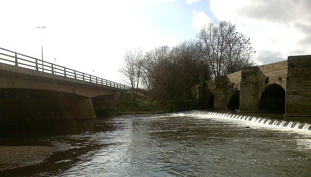
This walk from the village takes you to some of the bridges on the River Dove just to the west of the settlement. You can start the walk on the eastern side of the village at Doveridge Manor House. Then follow footpaths west through the settlement towards the church and the causeway leading to the river. Here you'll find a footbridge which you can cross to visit the two bridges and pretty weir just to the north. You could extend the walk by picking up the Staffordshire Way and following it into nearby Uttoxeter.
Postcode
DE6 5JR - Please note: Postcode may be approximate for some rural locationsDoveridge Ordnance Survey Map  - view and print off detailed OS map
Doveridge Open Street Map  - view and print off detailed map
Doveridge OS Map  - Mobile GPS OS Map with Location tracking
Doveridge Open Street Map  - Mobile GPS Map with Location tracking
Walks near Doveridge
- Uttoxeter - This Staffordshire based market town has some nice river and country trails to try.
- Blithfield Reservoir - This large reservoir in the Blithe Valley has three nice colour coded walking trails to try
- Churnet Valley - This walk takes you through Staffordshire's beautiful Churnet Valley from Froghall to Cheddleton
- Denstone - This route uses a section of the Churnet Valley Railway Path and the Staffordshire Way to create a circular walk around the Staffordshire based village
- Dimmingsdale - Explore the Dimmingsdale Valley and Furnace Forest on this lovely wooded walk
- Croxden Abbey - This walk visits the ruins of a 12th century abbey near Hollington in Staffordshire.
- Abbots Bromley - This fine Staffordshire village is a worthy place to explore
- Ellastone - This Staffordshire based village has some nice riverside trails along the River Dove and through the nearby Churnet Valley
- Sudbury Hall - This wonderful 17th century mansion in Derbyshire boasts a superb Great Staircase, fine Long Gallery, exquisite plasterwork, wood carvings, classical story-based murals and portraits by John Michael Wright, and of Charles II's mistresses.
- Oakamoor - The pretty Staffordshire village of Oakamoor makes a great base for exploring the beautiful Churnet Valley.
This circular walk makes use of the Staffordshire Moorlands Way and the Staffordshire Way to explore the wooded valleys surrounding the village - Abbots Bromley - This fine Staffordshire village is a worthy place to explore
- Rolleston on Dove - This Staffordshire village is a pleasant place to start a walk with some lovely country trails through the River Dove valley
- Tutbury - This pretty Staffordshire village sits in a lovely position next to the River Dove and the border with Derbyshire.
Pubs/Cafes
Back in the village head to the Cavendish Arms for some post walk refreshment. They serve a good Sunday lunch and have a large garden area. You can find them on Derby Road at postcode DE6 5JR.
Further Information and Other Local Ideas
Just to the east is the fascinating 17th century mansion of Sudbury Hall. There are beautiful gardens with a super waterside walking trail around the pretty lake in the grounds here.
For more walking ideas in the area see the Derbyshire Walks and the Staffordshire Walks pages.
Photos
Raised causeway leading to footbridge over River Dove The footpath and the suspension bridge, was constructed at the behest of the Brace family who were living at Doveridge Hall at the turn of the 20th Century. It opened in 1901. Raising the pathway allowed people to continue to use the path even when the Dove was in flood.


