Draycote Water
![]()
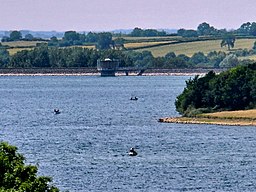
![]() Enjoy a circular waterside cycle or walk around the delightful Draycote Water Country Park near Rugby. There is a flat 5 mile path surrounding the park's reservoir which ideal for cycling and walking (a section of the path is part of National Cycle Route 41). You can also climb Hensborough Hill for fabulous views of the surrounding area. The park has a visitor centre and a restaurant.
Enjoy a circular waterside cycle or walk around the delightful Draycote Water Country Park near Rugby. There is a flat 5 mile path surrounding the park's reservoir which ideal for cycling and walking (a section of the path is part of National Cycle Route 41). You can also climb Hensborough Hill for fabulous views of the surrounding area. The park has a visitor centre and a restaurant.
The park is popular with bird watchers and includes a hide and feeding station. Look out for birds including the great northern diver during the winter months, along with kittiwake and small numbers of Mediterranean and little gulls.
To continue your walking in the area you can head east to pick up our Circular Walk Around Rugby. This will take you along the Great Central Walk Nature Reserve and the Oxford Canal.
Postcode
CV23 8AB - Please note: Postcode may be approximate for some rural locationsPlease click here for more information
Draycote Water Ordnance Survey Map  - view and print off detailed OS map
Draycote Water Open Street Map  - view and print off detailed map
Draycote Water OS Map  - Mobile GPS OS Map with Location tracking
Draycote Water Open Street Map  - Mobile GPS Map with Location tracking
Pubs/Cafes
The park includes a lovely Waterside Restaurant where you can enjoy refreshments after your exercise. There's nice views over the lake from the elevated outdoor seating area.
Dog Walking
Dogs aren't permitted around the reservoir because of the nesting birds and the cyclists. They are allowed in the adjacent country park though.
Further Information and Other Local Ideas
Head a few miles south of the park and you can pick up the Grand Union Canal and enjoy another waterside stroll along the towpath. Near here you can also find the attractive market town of Southam. You can try the circular Southam Walk which visits the River Stowe, the River Itchen and the Ufton Fields Nature Reserve. There's also the picturesque village of Harbury where there's a 16th century timber framed pub and a 13th century church to see.
A few miles to the south there's the worthy village of Napton on the Hill. Here you'll find a 12th century church and nice walks along Napton Reservoir and the Oxford Canal Walk. There's also a fine canalside pub for rest and refreshment after your exercise.
For more walking ideas in the area see the Warwickshire Walks page.


