Great Barford Walks
![]()
![]() This Bedfordshire based village has some delightful riverside walking trails. The historic settlement also includes an ancient bridge and a notable church with a 15th century tower.
This Bedfordshire based village has some delightful riverside walking trails. The historic settlement also includes an ancient bridge and a notable church with a 15th century tower.
This circular walk from the village follows the river path to the neighbouring village of Willington. It's a pretty area with locks, weirs and fine views of the surrounding countryside.
The route starts in the village and heads touh to reach the river where you'll find Barford Bridge and a weir. The 15th century arched bridge is one of the notable features of the area.
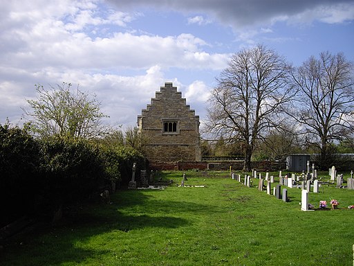
You then head south west along the river, passing Willington Lock before arriving at the noteworthy Willington Dovecote. The Tudor dovecote is maintained by the National Trust.
The route then retraces its steps before picking up the Bedford to Sandy Country Way. This shared cycling and walking path takes you along an old railway line before following a country lane to return to Barford Bridge. You then cross the bridge and return to the village.
Great Barford Ordnance Survey Map  - view and print off detailed OS map
Great Barford Open Street Map  - view and print off detailed map
Great Barford OS Map  - Mobile GPS OS Map with Location tracking
Great Barford Open Street Map  - Mobile GPS Map with Location tracking
Further Information and Other Local Ideas
Continue east along the railway line and you could visit the RSPB's Sandy Warren. There's some lovely woodland trails here with lots of wildlife to see on the way.
For more walking ideas in the area see the Bedfordshire Walks page.
Cycle Routes and Walking Routes Nearby
Photos
Tudor Dovecote, Willington. Built around 1543 as part of a range of buildings for the Manor farm in Willington.It has 1500 nest boxes and is maintained by the National Trust. Viewing is straight forward as it sits in an open site near Willington Church.


