Lakenheath Fen
![]()
![]() Follow the well laid out footpaths around this lovely nature reserve on the Norfolk/Suffolk border. The reserve consists of a large area of wetland with reedbeds, grazing marshes and riverside paths along the River Little Ouse. Lakenheath is a wonderful place for wildlife watching with reed warblers, bitterns and western marsh harriers real highlights.
Follow the well laid out footpaths around this lovely nature reserve on the Norfolk/Suffolk border. The reserve consists of a large area of wetland with reedbeds, grazing marshes and riverside paths along the River Little Ouse. Lakenheath is a wonderful place for wildlife watching with reed warblers, bitterns and western marsh harriers real highlights.
There's a car park at the site but you can also catch the train to Lakenheath station which is right next to the reserve.
The Hereward Way long distance footpath runs through the reserve so you can pick this up to extend your walk. The path heads west through New Fen, Joist Fen, Norfolk Fen before turning south to Stallode Wash.
If you head east you will come to Brandon Country Park and Thetford Forest where there are miles of fabulous woodland walking trails to try.
Postcode
IP27 9AD - Please note: Postcode may be approximate for some rural locationsLakenheath Fen Ordnance Survey Map  - view and print off detailed OS map
Lakenheath Fen Open Street Map  - view and print off detailed map
*New* - Walks and Cycle Routes Near Me Map - Waymarked Routes and Mountain Bike Trails>>
Lakenheath Fen OS Map  - Mobile GPS OS Map with Location tracking
Lakenheath Fen Open Street Map  - Mobile GPS Map with Location tracking
Explore the Area with Google Street View 
Pubs/Cafes
Just to the north is the village of Feltwell where you could visit The Wellington. The pub is situated at the heart of Feltwell, occupying a building with a diverse history, including its previous role as a village store. Some sections of the structure have origins dating back to 1730 and boast period elements like an inglenook and a distinctive green marble fireplace. The Wellington made its debut in March 2014, following a comprehensive process of refurbishment and renovation, accompanied by the adoption of its new name. The name was specifically chosen to honor the Wellington Planes that were stationed at R.A.F. Feltwell during World War II. The pub proudly showcases an extensive collection of genuine memorabilia and artwork from that era. The Wellington warmly welcomes patrons of all ages and backgrounds, making it a family-friendly establishment.
They serve good quality dishes and also have a garden and car parking area. The pub is dog friendly in the garden area.
You can find them on the High Street at postcode IP26 4AF. In the village you could also visit the two, ancient Grade I listed churches.
Dog Walking
Dogs are not allowed on the reserve itself but they are allowed on the public footpath that runs adjacent to the reserve. Please keep them on leads in this area as there are cows grazing here.
Further Information and Other Local Ideas
If you head east into Thetford Forest you can pick up the delightful Little Ouse Path and follow the river trail into Thetford. In the forest there's also the splendid Lynford Arboretum. It's a lovely place for a walk with woodland trails, pretty lakes and an impressive 19th century Sequoia Avenue to see.
For more walking ideas in the area see the Norfolk Walks and Suffolk Walks pages.
Cycle Routes and Walking Routes Nearby
Photos
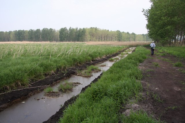
Ditch on Lakenheath Fen When the RSPB took over this area it was arable farmland, with ditches for draining it. This ditch, with the lumps of earth in the middle has been profiled with wildlife as a priority as the area has been returned to wet fenland so drainage is not a priority.
Lakenheath Fen RSPB The foreground used to be a carrot field. The RSPB bought the land in 1995 and reverted it to fenland, recently opening the reserve to the public. There is a growing move to recreate fenland habitat, partly for the sake of recreating natural habitat but also because the habitat created may in the long term replace similar habitat along the Norfolk and Suffolk coasts, which is pressurised by coastal erosion (the pressure is likely to increase with global warming through higher sea levels and increased storminess). The trees in the background are a poplar plantation, initially planted to produce wood for matches. They are no longer economic but they and others nearby support most (or maybe all) of the country's Golden Oriole population. Interesting decision coming up for the RSPB as these plantations reach full maturity.
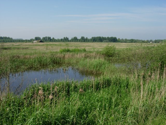
RSPB Lakenheath Fen Towards the western end of this large habitat recreation project, restoring fenland habitat to the fens. This part was added on after the first land acquisition and links the reserve to Botany Bay, which has never been fully drained. This should help significantly in the recolonisation of the area by insects and plants.


