Norfolk Walks

Use the filter to show walks of a certain type such as woods, reservoirs, hills, long distance, country parks, canals and rivers.
In the spring walkers flock to the beautiful bluebell woods in the Norfolk area. Click the 'Woodland' button below to see these.
Use the links to view full route information including elevation profiles, interactive maps and GPS downloads.
You can also view an overview map of all the routes in the using the Norfolk Walk Map>>
*New* - Walks and Cycle Routes Near Me Map - Waymarked Routes and Mountain Bike Trails>>
| Filter: |
| Route Name | Photo | Distance | Description |
| Acle and the River Bure | 5 miles (8 km) | This circular walk explores the Bure Valley around the pretty Norfolk market town of Acle. It's a beautiful area with lots of water loving wildlife to look out for. Starting on the eastern edge of the town you follow the Weavers' Way south to Damgate Marshes before turning east along the Tunstall Dyke. You soon come to the River Bure where you pick up the riverside footpaths towards Stokesby. Here you turn west and follow the river back to Acle. If you would like to extend your walk you could follow the river east from Acle to Great Yarmouth. It's about a 10 mile walk to the coast with the river dotted with lots of pretty drainage mills. At Great Yarmouth you can enjoy more waterside paths along the beautiful Breydon Water. Also nearby is a circular walk around Fleggburgh and Filby Broad. If you head north along the Bure you will soon come to Acle Bridge where there is a nice waterside pub. Keep going and you will soon come to Hickling Broad where there is a huge variety of wildlife to look out for. View Full Details>> | |
| Angles Way | 77.1 miles (124 km) | This splendid walk through the Norfolk Broads was voted the best waterside walk in Britain by waterscape.com in 2003. The walk is often completed in the following stages: 1. Great Yarmouth to Fritton Lake Country Park - on this section you will follow the River Yare, Breydon Water and the River Waveney passing Burgh Castle as you go. The section finishes at the delightful Fritton Lake Country World 2. Fritton Lake to Oulton Broad - you continue along the Waveney towards Lowestoft and the pretty Oulton Broad. On the way you will pass the splendid Somerleyton. The delightful model village includes thatched red-brick estate cottages and the splendid Somerleyton Hall with its beautiful gardens and expansive estate. 3. Oulton Broad to Beccles - an exclusivley waterside section along the Waveney (video below). You'll pass Oulton Broad and Carlton Marshes Nature Reserve with lots of interesting wildlife to look out for. 4. Beccles to Bungay - a countryside section via Shipmeadow 5. Bungay to Harleston- through the countryside via Homersfield with views of the River Waveney 6. Harleston to Diss - continuing along the Waveney via Hoxne and the Billingford Windmill. View Full Details>> | |
| Bacton Woods | 3.4 miles (5.5 km) | Bacton Woods, near North Walsham, has several delightful walking and cycle paths running through the forest. This short circular route starts at Bacton car park and follows various paths through the wood, which has 30 species of tree, including Scots and Corsian Pine, Western Hemlock, Douglas Fir and Larch. The woods are also popular with mtb (mountain bikes) as there is an excellent single track ride to be found here. View Full Details>> | |
| Barton Broad Boardwalk | 0.6 miles (1 km) | This walk takes you to the lovely Barton Broad Boardwalk where you can follow the accessible path through swampy woodland and enjoy wonderful views across Barton Broad. View Full Details>> | |
| Bawsey Pits | 1.9 miles (3 km) | This country park near King's Lynn has nice trails to follow around around birch covered hills and a Scandinavian style lake. It's a delightful spot with the lakes surrounded by attractive woodland and small cliffs. There's also little beaches and picnic areas. You can park at the car park at the north eastern end of the lake, off Gayton Road. From here you can pick up the trails to take you around the site. N.B Please do not swim in the waters of the lake. It may look tempting but several people have got into difficulty. To continue your walk you can head north and visit Roydon Common. The pretty nature reserve includes a large area of heathland and woodland with Dartmoor Ponies to look out for. View Full Details>> | |
| Beccles and Geldeston Circular Walk | 7.5 miles (12 km) | A pleasant circular walk using the Angles Way and other footpaths to explore the area around Beccles and Geldeston in Norfolk. View Full Details>> | |
| Beetley and Hoe Rough | 3.5 miles (5.7 km) | This circular walk explores the Hoe Rough and Beetley Meadows Nature Reserve near the village of Beetley in the Breckland district of Norfolk. View Full Details>> | |
| Binham Priory | 1.4 miles (2.2 km) | This walk visits the fascinating ancient ruins of Binham Priory in Norfolk. View Full Details>> | |
| Blakeney Point Nature Reserve | 5.2 miles (8.3 km) | This beautiful National Nature Reserve on the Norfolk coast is a four-mile-long sand and shingle spit with sand dunes, salt marshes, tidal mudflats and farmland. View Full Details>> | |
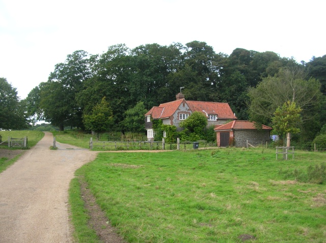
| Blickling Hall | 3.1 miles (5 km) | The Blickling Hall estate in Aylsham has five thousand acres of parkland, farmland and woodland to explore on foot or by bike. View Full Details>> | |
| Boudicca Way | 36 miles (58 km) | Follow the Boudicca Way from Norwich to Diss on this walk through the beautiful, unspoilt South Norfolk landscape. The route runs for about 36 miles with some fascinating historical sites to see on the way.
The walk also passes through a series of pretty villages including Shotesham, Saxlingham Nethergate and Pulham Market. There are also views of the rivers Yare and Tas to enjoy and a visit to the Venta Icenorum Roman town at Caistor St Edmund. View Full Details>> | |
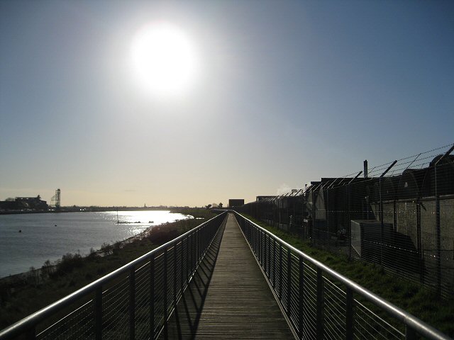
| Breydon Water | 14 miles (22.5 km) | Visit the UK's largest protected wetland on this wonderful waterside walk in Great Yarmouth. The expansive estuary is also a nature reserve with a huge number of wading birds to look out for. Keep your eyes peeled for golden plovers, wigeons, lapwings and tens of thousands of Bewick's swans. There is also a bird observation hide at the east end of the water. You can explore the area from Great Yarmouth by following the Weavers' Way west towards Berney Marshes. There's some beautiful Norfolk Broads scenery with mills, marshland and views of the River Yare and River Waveney. If you follow the Angles Way along the southern side of the water you can visit the fine Roman Fort at Burgh Castle. View Full Details>> | |
| Brierley Forest Park | 2.5 miles (4 km) | This circular walk takes you around the pretty Brierley Forest Park near Mansfield. At the park you will find Wildflower meadows, a sculpture trail and a visitor centre. Look out for foxes, owls, deer, meadow pipits and lapwings as you make your way through the park. View Full Details>> | |
| Broadland Country Park | 1.7 miles (2.8 km) | This country park is located near Horsford and Felthorpe in the Norwich area of Norfolk. View Full Details>> | |
| Bure Valley Path | 8.7 miles (14 km) | This walk and cycle track runs along Bure Valley Railway, and the River Bure from Aylsham to Wroxham. The route passes Brampton, Buxton and Coltishall with each having a station if you wish to rest your legs and take a trip on the railway. The Bure Valley Railway is Norfolk's longest fifteen inch gauge line. It opened on 10th July 1990, and the long distance footpath running parallel with it was opened a year later in 1991. It's a nice flat path which runs for about 9 miles. As such it makes for a leisurely stroll or an easy cycle ride. View Full Details>> | |
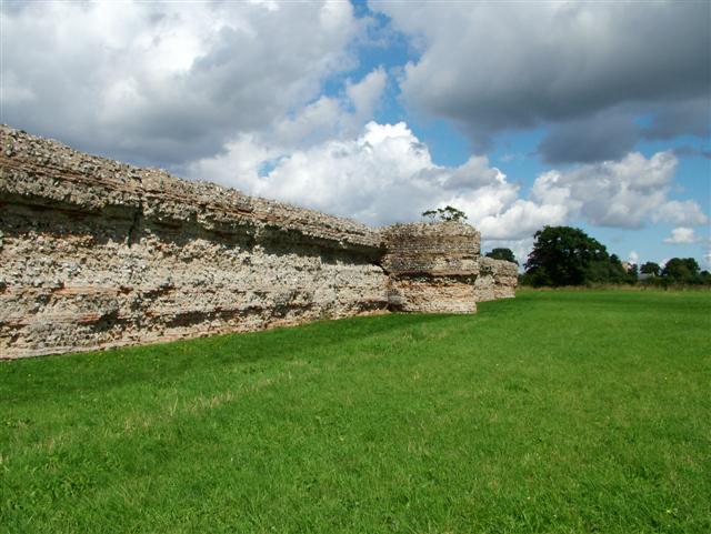
| Burgh Castle | 1.2 miles (2 km) | Explore the Roman Fort and enjoy a stroll along the River Waveney on this short walk in Norfolk. The fort dates from the 3rd century and still has some of its thick walls in tact. The area around the fort is also very beautiful with nice views across the Norfolk Broads to Breydon Water and the River Yare. View Full Details>> | |
| Castle Acre | 7.5 miles (12 km) | This lovely circular walk takes you around the grounds of Castle Acre Priory, before heading along the River Nar to the nearby Castle Acre Common. You can then explore the wider countryside surrounding the village on various footpaths and bridleways. The walk starts at the castle in the centre of this pretty Norfolk village. The remains of the motte-and-bailey castle are well worth exploring before you head off towards the priory. It dates from the 11th century and is in the care of English Heritage. From the castle you head west through the village to the priory. The fascinating and atmospheric ruins date back to the late 11th century. There are substantial remains of many of the buildings round the cloister, a beautiful west end church gable and a herb garden. After exploring the priory you continue west along the Nar Valley Way to West Acre where you can stop for refreshments at the Stag pub. You can then follow other trails through the countryside to Bartholomew's Hills before returning to the village along the Peddars Way and Norfolk Coast Path. If you would like to extend your walk then you can continue along the River Nar to Narford Lake and Narborough, a few miles west of West Acre. Following the Peddars Way and Norfolk Coast Path south will take you towards Swaffham where you'll find some fine Georgian buildings and an interesting medieval church. View Full Details>> | |
| Cley Marshes Nature Reserve | 5 miles (8 km) | This walk takes you around the stunning Cley Marshes on the Norfolk coast at Cley next the Sea. You start at the windmill at Cley next the Sea and head through the reserve to the coast, before following a walking trail and country lanes through the countryside and returning to the windmill. Cley Marshes contains 430 acres of reed beds, freshwater marsh, pools and wet meadows. An abundance of rare birdlife can be seen at the site, including pied avocets on the islands, western marsh harriers, Eurasian bitterns and bearded reedlings. There are five bird hides and an excellent visitor centre with a cafe, shop, viewing areas (including viewing from a camera on the reserve) and an exhibition area. Plantlife at the reserve includes biting stonecrop, sea campion, yellow horned poppy, sea thrift, bird's foot trefoil and sea beet. Wilidlife includes Water Voles, hares and otters. If you would like to continue your walk the Peddars Way and Norfolk Coast Path runs through the reserve so you could follow this trail west to Morston Quay and catch a boat to Blakeney Point Nature Reserve where can you go seal watching! View Full Details>> | |
| Cockthorpe Circular Walk | 9 miles (14.5 km) | A circular walk from Morston, visiting the neighbouring villages of Stiffkey and Cockthorpe. View Full Details>> | |
| Cromer to Overstrand | 1.9 miles (3 km) | Follow the cliff top path from Cromer to Overstrand on this walk along the Norfolk coast. The cliffs rise to a height of over 250ft giving great views across both settlements and along the coast. It's a short walk at just over 2 miles, but there is some moderate climbing, so a reasonable level of fitness is required. The walk starts on the sea front in Cromer next to the pier. The Grade II listed pier is the home of the Cromer Lifeboat Station and the Pavilion Theatre. You pass along the sea front before climbing away from the town towards Cromer Lighthouse. The present lighthouse was built half of a mile from the cliff edge (although it is now much closer) and came into operation in 1833. It is constructed of masonry and the tower is octagonal in shape and is 59 feet (18 m) tall. The path continues along the Royal Cromer Golf Club, before descending to the village of Overstrand. Here you can enjoy refreshments at the cliff top cafe before the return leg. View Full Details>> | |
| Cromer to Sheringham | 9.3 miles (15 km) | Enjoy nice beaches and great coastal views from Beeston Cliffs on this circular walk along the Norfolk coast. After visiting Sheringham the route returns via the Norfolk Coast Path and Beacon Hill, Norfolk's highest point. The walk starts next to the pier in Cromer and heads west along the English Coast Path to Muckle Hill. You continue along the beach to West Runton before coming to Sheringham. Here you can enjoy refreshments before retracing your steps for about half a mile. Then you can pick up a section of the Norfolk Coast Path which climbs south away from the coast. This will take you to the 103 metres (338 ft) high Beacon Hill which is run by the National Trust. There's some nice woodland trails here with great views of the sea. After exploring Beacon Hill the walk descends back into Cromer. View Full Details>> | |
| Dereham | 2.2 miles (3.5 km) | This historic Norfolk market town sits in the heart of the county. The town includes many interesting features including a Norman church, a Grade II listed windmill and the Mid Norfolk Railway which begins in the settlement and travels along the line to Wymondham Abbey. View Full Details>> | |
| Dersingham Bog | 3.7 miles (6 km) | This circular walk explores the Dersingham Bog Site of Special Scientific Interest in North Norfolk. The nature reserve is part of the wider Sandringham Royal Estate and includes attractive heathland with interesting flora and fauna to see. View Full Details>> | |
| Diss | 4.1 miles (6.6 km) | The attractive market town of Diss has some nice options for walkers with the pretty mere and the River Waveney in the vicinity. This circular walk uses a section of the Angles Way long distance trail to take you to the Roydon Fen and the Wortham Ling Nature Reserves. It's about a 4 mile route, taking place on easy flat footpaths and country lanes. The walk starts in the town centre next to the mere. From here you can pick up the Angles Way and follow it west to Roydon Fen. The footpaths take you through the reserve where you can see typical fen plants such as marsh helleborine, marsh fragrant orchid and sawsedge. The path continues to Wortham Ling where there are more nice trails to follow. The reserve includes acid grassland and dry heath on a sandy soil. Look out for wildlife including rabbits and butterflies in this area. After exploring the reserve the route follows country lanes back into Diss. View Full Details>> | |
| Downham Market | 10.9 miles (17.5 km) | Enjoy a lovely riverside walk along the River Great Ouse in this attractive Norfolk town. The interesting town has a nice market square, a mediaeval parish church and a Victorian clock tower, constructed in 1878. Several rivers and long distance footpaths runs through the area surrounding the town so there are lots of nice waterside walking options. The walk starts from the train station and heads to the river where you pick up the Fen Rivers Way long distance footpath. The waymarked trail heads north along the Great Ouse towards Stowbridge and Watlington. At Wiggenhall St Mary Magdalen you can cross the river on the Magdalen Bridge. Footpaths then return you to Downham Market on the western side of the river. To extend your walking in the area you could continue north along the river into King's Lynn. Just to the east of Wiggenhall St Mary Magdalen you can pick up the Nar Valley Way and enjoy a walk along the River Nar. Following the river south will take you towards Brandon Creek and Littleport. If you follow the river to the Denver Sluice and then turn south west along the New Bedford River you could visit the wonderful Welney WWT. Here you will find more riverside trails, boardwalks and a tremendous variety of birdlife to look out for. In the reserve you can also pick up the Hereward Way long distance trail. The Ouse Valley Way also runs through the town and will take you along the river through Bedfordshire, Buckinghamshire, Northamptonshire and Norfolk. One nice option is to follow the river south from Downham Market to Ely and visit the magnificent cathedral. View Full Details>> | |
| Edith Cavell Pilgrimage | 7.5 miles (12 km) | This walk follows the Edith Cavell Pilgrimage route from Nurse Cavell’s home village of Swardeston to Norwich Cathedral. View Full Details>> | |
| Elizabeth Way | 17.1 miles (27.5 km) | The Elizabeth Way is a dedicated long distance trail that bridges the gap between the coastal village of Heacham and the historic maritime town of King's Lynn. View Full Details>> | |
| Felbrigg Hall Park | 5.3 miles (8.5 km) | Explore Fellbrigg's 520 acres of rolling landscape park, woods and waymarked trails on this circular walk in Cromer, Norfolk. There's also the historic St Margaret's church to visit, just to the east of the hall. The church dates back to the 15th century and includes a noteworthy 14th century font.
The hall is located very close to the Peddars Way and Norfolk Coast Path and Weavers' Way long distance trails. You can pick up these footpaths to extend your walking through the countryside surrounding the hall. View Full Details>> | |
| Fen Rivers Way | 49.7 miles (80 km) | This is a teriffic riverside walking route running from Cambridge to King's Lynn in Norfolk. The path runs alongside the River Cam and the River Great Ouse and passes a series of delightful riverside towns and villages including Ely, Littleport and Downham Market. Highlights on the walk include Wicken Fen near Waterbeach in Cambridgeshire, the cathedral at Ely and the 18th century sluice at Denver. View Full Details>> | |
| Fleggburgh and Filby Broad | 1.9 miles (3 km) | This short circular walk in the Norfolk village of Fleggburgh visits Filby Broad in the Trinity Broads. View Full Details>> | |
| Foxley Wood | 2.1 miles (3.4 km) | Visit the largest ancient woodland in Norfolk on this peaceful walk near Dereham. View Full Details>> | |
| Fritton Lake Country Park | 5.9 miles (9.5 km) | This super country park is situated just a few miles from Lowestoft and Great Yarmouth. There are lovely cycling and walking paths around the large lake which is 2.5 miles long. The lake is surrounded by peaceful woods where there are nice shady trails to try. You can follow footpaths along the Angles Way public footpath on the western side of the lake. Please stick to this section as the central and eastern parts are private property. The Angles Way long distance path runs past the site so you could pick this up and head north to visit the impressive Roman Fort at Burgh Castle. If you follow the trail south you can visit Somerleyton. The delightful model village includes thatched red-brick estate cottages and the splendid Somerleyton Hall. View Full Details>> | |
| Great Yarmouth | 5.9 miles (9.5 km) | This Norfolk seaside town is the gateway from the Norfolk Broads to the North Sea. There's lovely coastal walks and long distance trails which you can pick up from the town and follow into the Norfolk Broads. This walk follows the Angles Way along Breydon Water to the Roman Fort at Burgh Castle. The walk starts on the seafront next to the Britannia Pier. The town's attracttions include the Pleasure Beach, the Sea Life Centre, the Hippodrome Circus and the Time and Tide Museum, as well as the UK's only surviving Victorian seaside cast iron and glass Winter Garden. From the front you can pick up the waymarked Angles Way footpath and follow it west through the town to Haven Bridge, where you cross the River Yare. You then pass through Cobholm Island before following the path along Breydon Water. The expansive estuary is also a nature reserve with a huge number of wading birds to look out for. Keep your eyes peeled for golden plovers, wigeons, lapwings and tens of thousands of Bewick's swans. After a few miles you will come to the noteworthy Burgh Castle which is another highlight of the area. The interesting Roman fort dates from the 3rd century and still has some of its thick walls in tact. The site sits next to the River Waveney so you can enjoy more waterside trails here. View Full Details>> | |
| Great Yarmouth to Caister On Sea Circular Walk | 7.3 miles (11.7 km) | This Great Yarmouth to Caister-On-Sea Circular Walk offers a diverse 6-mile trek that showcases the contrasting landscapes of the Norfolk Broads and the North Sea coastline. View Full Details>> | |
| Hellesdon Circular Walk | 5.3 miles (8.5 km) | A circular walk from the Norwich village of Hellesdon. The route uses a section of the Marriot's Way and other public paths to explore the area to the north west of Hellesdon. View Full Details>> | |
| Hereward Way | 110 miles (177 km) | Starting in Oakham, in Rutland, follow the Herward Way through Stamford, Peterborough, Ely, and the Breckland forests to Thetford, in Norfolk.
Highlights on the walk include
| |
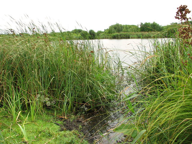
| Hickling Broad | 14.9 miles (24 km) | Visit the Norfolk Broads village of Hickling and enjoy a walk around the beautiful Hickling Broad. It's the largest of the Broads and a fantastic area for wildlife. Look out for common crane, bittern, marsh harrier bearded tit and Cetti's warbler as you make your way around the lake. Also of interest are Chinese water deer, red deer and otters. The walk starts at the car park and visitor centre off Stubbs Road on the north eastern side of the broad. From here you can pick up footpaths heading west to Hickling Heath. The walk then uses a section of the Weavers' Way long distance trail to take you around the broad to the River Thurne. Here you can enjoy riverside footpaths to Potter Heigham Bridge and boatyard where refreshments are available at the waterside Potters tearooms. The route then returns to the car park on the same paths. It's easy to extend your walk by heading about a mile to the east and visiting the National Trust run Horsey Windpump and Horsey Mere. Here you'll find waymarked circular walks taking you to the interesting old drainage windmill and around the pretty mere. Just to the south you can visit Fleggburgh and Filby Broad where there's a nice little circular walk from the village to the broad and Burgh Common. If you follow the Weaver's Way and the River Bure south you will come to the market town of Acle which is well worth a visit. View Full Details>> | |
| Holkham National Nature Reserve | 16.2 miles (26 km) | Explore 9,600 acres of grazing marsh, woodland, salt marsh, sand dunes and foreshore in England's largest Nature Reserve.
The walk begins at the delightful village of Burnham Overy Staithe, following Overy Creek to the beach at Holkham Bay. You continue east to Wells-Next-The-Sea, passing the pretty harbour on the way before reaching Stiffkey Salt Marsh where you will find a vast open expanse of salt marshes with large numbers of birdlife including waders and wintering wildfowl. You continue to Morston where you can catch a boat to Blakeney Point Nature Reserve with its colonies of seals. The final stretch takes you through Blakeney to Cley-Next-The-Sea and the Cley Marshes Nature Reserve. This 430 acre reserve contains reed beds, freshwater marsh, pools and wet meadows. Holkham Nature Reserve really is a special place with its wonderful mixture of habitats. You will pass through a maze of creeks and saltings, dunes and sandspits, woodland, green pastures and grazing marshes. There is also a huge variety of wildlife to see with pink-footed geese, white-fronted geese, brent geese, wigeon and waders regular visitors to the reserve. To continue your wildlife watching in North Norfolk you could head to the splendid Pensthorpe Natural Park near Fakenham. It has several lakes and woodland trails with various wildfowl and red squirrels to look out for. View Full Details>> | |
| Holkham Park | 7.5 miles (12 km) | Enjoy a super cycle or walk in this 3000 acre deer park near Wells-Next-The-Sea on the Norfolk coast. National Cycle Network Route 1 passes straight through the centre of the park taking you past the large lake, the Obelisk, the beautiful 18th century mansion and back through peaceful woodland. There are also a number of waymarked walking trails including a lakeside trail and a nature trail with 28 information boards explaining interesting facts about the flora and fauna in the Park. This includes a large herd of Fallow Deer, a smaller herd of Red Deer, Barn Owls and the evergreen oaks imported from Italy. View Full Details>> | |
| Holt Country Park | 5.6 miles (9 km) | Explore nearly 100 acres of peaceful woodland in this country park in Norfolk. The park is situated around the River Glaven and contains several delightful trails through the woods including Scots Pine, Oak and Silver Birch. The park includes a Visitors Centre, a waymarked arts trail and a cycle route. The area is great for wildlife so keep your eyes peeled for grazing ponies, various woodland birds and butterflies fluttering around the park's wildflowers. View Full Details>> | |
| Horsey Windpump and Horsey Mere | 3.1 miles (5 km) | A fine circular walk visiting an early 20th century drainage windmill on the Norfolk Broads with lovely waterside footpaths along Horsey Mere and other waterways. It's a beautiful area with reedbeds, marshes and the option of extending the walk to the nearby Horsey Beach where you can look out for grey seals and explore the dunes. Horsey Dunes, together with the adjoining Winterton Dunes, also contain the largest colonies of dark green fritillary and grayling butterflies in Norfolk. The National Trust owns the mill so you can enjoy a climb to the top and enjoy fabulous views over the mere and surrounding broads. The area is also great for wildlife watching with Bitterns and Marsh Harrier to look out for in the air. Highlights on the walk include Horsey's thatched church with a Saxon round tower and fascinating interior. You will also pass the 18th century Brograve Mill. The mill is now a derelict Grade II listed building and the earliest surviving tower mill in the Broads. There's lots of good options for extending your walk. You could head just a mile to the west and visit Hickling Broad where you can pick up the Weavers' Way long distance trail. The trail runs around the broad before picking up delightful riverside paths along the River Thurne. View Full Details>> | |
| Hunstanton to Thornham Walk | 5.8 miles (9.4 km) | Hunstanton has some beautiful coastal walking to enjoy with the Peddars Way and Norfolk Coast Path National Trail passing through the town. The seaside town faces west across The Wash, making it one of the few places on the east coast where the sun can be seen setting over the sea. This walk takes you along the waymarked trail to the nearby village of Thornham. It's about a 6 mile walk on flat trails with lovely beaches, sand dunes and nature reserves to enjoy. The walk starts in the lovely cliff top gardens in Hunstanton where there's a very pretty Sensory Garden. The route heads north along the cliffs to St Edmund Point where you will find the remains of St Edmund's Chapel and Old Hunstanton Lighthouse. The present lighthouse was built in 1840 although there has been a Lighthouse on the site since 1665. The trail continues towards the village of Holme-next-the-Sea. The position of the village on the North Sea coast makes it a prime site for migratory birds in autumn. There are two nature reserves on this section including the Holme Dunes National Nature Reserve. The reserve's sand dunes, salt marsh, pasture and pools are important for breeding birds like pied avocet, and wintering ducks, geese and waders. There are a range of coastal habitats including, freshwater pools, grazing marsh and saltmarsh. After passing through the lovely coastal reserve the route turns inland to take you to Thornham. View Full Details>> | |
| Icknield Way Path | 110 miles (177 km) | The Icknield Way Path starts at Ivinghoe Beacon in Buckinghamshire and heads to Knettishall Heath in Suffolk along prehistoric pathways. There's fantastic views as you climb through the hills of the Chilterns AONB. There's also a series of lovely nature reserves and country parks to enjoy on the way. Highlights on the walk include the Cam Valley views from Royston Heath, the lovely Dunstable Downs Country Park and the splendid Whipsnade Tree Cathedral. View Full Details>> | |
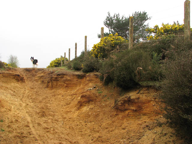
| Kelling Heath | 3 miles (4.8 km) | This large area of heathland near Sheringham includes miles of footpaths taking you to heather, western gorse, bracken, and mixed woodland. The walk starts from Kelling Heath Park railway station on the North Norfolk Railway (NNR). You can catch the heritage steam railway from Sheringham or Holt. From the station you can pick up footpaths taking you through Hundred Acre Wood and around the popular Kelling Heath holiday park. Then head north across the railway line to a large area of heathland. You'll pass Telegraph Hill and Holgate Hill before following a path along the railway line back to the station. The heath is good for wildlife spotting. Look out for heathland birds including nightjar, whitethroat and tree pipit. The dry conditions on the heath are also favourable to reptiles such as common lizard and adder. View Full Details>> | |
| Ketts Country Walk | 16.8 miles (27 km) | Follow Kett's Country Walk from Cringleford to Wymondham on this splendid walk through Norfolk. In 1549 Robert Kett led a movement which threatened the property owning classes. His journey from Wymondham to Norwich ended with the death of thousands of rebels in a pitched battle with 10,000 troops. View Full Details>> | |
| King's Lynn and The Walks | 3.7 miles (6 km) | This nice circular walk takes you around 'The Walks' urban park before a riverside stroll along the Great Ouse. The Norfolk market town is a great place for a walk with wonderful architecture, a fascinating history and lovely riverside paths. The walk starts in the park next to the train station in the centre of town. The lovely 42 acre park has nice surfaced footpaths, a 15th century chapel, beautiful landscaping, a children’s play area, toilets and a cafe. After strolling through the park the route heads through the streets to the quay on the river. You then head towards South Lynn before crossing the bridge and following the paths along the western side of the river through West Lynn. Here you can catch the ferry which runs about every 20 mins from 7am to 6pm (excluding Sundays). You can then retrace your steps back to the park. On your way through the town look out for the fine Custom House tourist information centre which was originally built in 1683. The St Nicholas's Chapel, built between 1145 and 1420, and the Burkitt Court Almshouses are other notable architectural highlights. If you would like to extend your walking then there are several long distance trails running through the area. For example the Peter Scott Walk starts in King's Lynn. It will take you along the coastline of the Wash to Sir Peter Scott's lighthouse near Sutton Bridge. The Nar Valley Way also starts in the town and will take you along the River Nar to Gressenhall. A few miles to the north east of the town you can visit Roydon Common. Here you'll find nice trails taking you around a large area of heathland and woodland with Dartmoor Ponies to look out for. Just to the south of the common you can visit Bawsey Country Park. View Full Details>> | |
| Lakenheath Fen | 2.2 miles (3.5 km) | Follow the well laid out footpaths around this lovely nature reserve on the Norfolk/Suffolk border. The reserve consists of a large area of wetland with reedbeds, grazing marshes and riverside paths along the River Little Ouse. Lakenheath is a wonderful place for wildlife watching with reed warblers, bitterns and western marsh harriers real highlights.
There's a car park at the site but you can also catch the train to Lakenheath station which is right next to the reserve. The Hereward Way long distance footpath runs through the reserve so you can pick this up to extend your walk. The path heads west through New Fen, Joist Fen, Norfolk Fen before turning south to Stallode Wash. If you head east you will come to Brandon Country Park and Thetford Forest where there are miles of fabulous woodland walking trails to try. View Full Details>> | |
| Litcham | 5 miles (8 km) | This waymarked trail follows the East Lexham Circular Walk through the countryside surrounding the villages of Litcham and East Lexham in Norfolk. View Full Details>> | |
| Little Ouse Path | 9.9 miles (16 km) | Follow the Little Ouse River on this delightful, gentle walk through Thetford Forest. The route runs for about 10 miles along a fairly flat riverside path surrounded by peaceful woodland. The walk starts in Thetford mainly following the river towpath through Santon Downham to Brandon. At Brandon you'll find the super Brandon Country Park. Here you will find beautiful lakeside lawns, a delightful walled garden and an excellent visitor centre. View Full Details>> | |
| Lynford Arboretum | 1.2 miles (2 km) | Enjoy a short, peaceful stroll around this delightful Arboretum in the Thetford Forest area. There are three waymarked walking trails taking you to the arboretum's points of interest on well surfaced paths. This includes the Sequoia Avenue with its double rowed avenue of Sequoias planted in the 1800s to honour the Duke of Wellington. Other trees include Norway Spruce, Chinese Fir, Serbian Spruce and an ancient oak planted in 1671. There are also pretty man made lakes with ducks and geese in the southern area. The woodland is great for birdwatching too - look out for Nuthatch, Chaffinch and Pheasants. View Full Details>> | |
| Marriot's Way | 22.4 miles (36 km) | This wonderful cycle and walking path runs from Aylsham to Norwich along the trackbeds of two former railway lines. The route passes Cawston, Reepham, Lenwade, the wildlife rich Taverham Mill and Drayton, taking you through the Wensum Valley with regular views of the River Wensum to enjoy. Along the way look out for a series of rail sculptures and lots of interesting flora and fauna. Wildlife includes butterflies, jays, magpies, green woodpeckers and wrens. Cycle hire is available at Reepham station where there's also a nice cafe for refreshments. View Full Details>> | |
| Mousehold Heath | 1.6 miles (2.5 km) | This area of heathland and woodland in Norwich, has miles of nice footpaths to try. It's located just to the north east of the city centre and train station. You can park at the car park on Gurney Road to start your walk. From here you can pick up trails heading along the heath on both sides of the road. The common is elevated above the city so there are fine views towards the Norwich skyline. You can clearly see landmarks such as the cathedral, the city hall and the castle from here. To extend the walk you could climb to St James Hill at the south eastern corner of the heath, for more nice views. The heath is also a nature reserve so you can look out for a variety of flora and fauna on your walk. Keep your eyes peeled for frogs around the Vinegar Pond and muntjac and roe deer, red fox and rabbits on the heath and in the woods. There's lots of pretty wildflowers to see in the summer including Trailing St John's-wort and Bell Heather. View Full Details>> | |
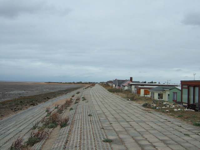
| Mundesley | 2.3 miles (3.7 km) | This lovely seaside village has some nice coastal trails to follow in both directions. It is part of the Norfolk Coast AONB where there's some wonderful coastal scenery. This walk follows the England Coast Path south east to the nearby village of Bacton. The route runs for just over 2 miles on a flat path running along the beaches. As such it's suitable for all abilities. View Full Details>> | |
| Nar Valley Way | 33.6 miles (54 km) | Follow the River Nar from King's Lynn to Gressenhall on this delightful waterside walk through Norfolk. The walk passes Shouldham, West Acre and Litcham following footpaths and country lanes close to or beside the River Nar. Walk highlights include Pentney Abbey, Pentney Lakes, West Acre Priory and Castle Acre castle and priory. The fascinating and atmospheric ruins date back to the late 11th century and are a major highlight on the walk. View Full Details>> | |
| North Walsham and Dilham Canal | 1.4 miles (2.2 km) | Enjoy a short waterside stroll along the North Walsham and Dilham Canal on this easy Norfolk walk. The disused canal has a lovely footpath running from North Pigney's Wood nature reserve along the canal. Start the walk from the Pigney's Wood car park just off Hall Lane. It's located just to the north east of North Walsham town centre. From here you can pick up some nice woodland trails taking you through the woods to the canal. Follow the canalside footpath down to Bacton Road before returning on the same path. The nature reserve includes some nice features including wetland areas, carpets of bluebells in spring and a 450-year-old ancient oak tree. It's also great for wildlife with goldcrest, nuthatch, Cetti’s Warbler, dragonflies, butterflies, otter, water vole and badger to look out for. View Full Details>> | |
| Norwich Riverside Walk | 3.1 miles (5 km) | This circular walk around the city centre of Norwich follows the lovely riverside path along the River Wensum. The walk starts near the forum in the centre of Norwich where parking is available. You could also start at the train station as the river is just a short distance away. There is a path on both sides of the river for most of the way with the option of taking a short detour to visit the impressive cathedral. There's lots to see along the river with a series of bridges and historical buildings such as the New Mills Pumping House and the medieval watergate of Pulls Ferry. You'll also pass Cow Tower, a 14th century artillery tower with a fascinating history. If you'd like to extend your walk you could continue along the river and visit the delightful Whitlingham Country Park where you will find the Whitlingham Broads. There's also Mousehold Heath just to the north east of the city centre. View Full Details>> | |
| Ouse Valley Way | 142.3 miles (229 km) | Follow the River Great Ouse from the source at Brackley, Northamptonshire, to the mouth at The Wash at King's Lynn. You begin at Brackley and head to Buckingham, Milton Keynes, Olney, Bedford, St Neots, Huntingdon, St Ives, Ely, Downham Market before finishing at King's Lynn. View Full Details>> | |
| Oxburgh Hall | 1.9 miles (3 km) | This walk visits the Norfolk village of Oxborough and the 15th century moated country house of Oxburgh Hall. View Full Details>> | |
| Paston Way | 18 miles (29 km) | Follow the Paston Way and the Norfolk Coast from Cromer to North Walsham on this splendid walk. You start at the seaside town of Cromer and head to Overstrand along the cliff top path. After a short inland stretch the route rejoins the coast at Mundesley, passing along the sea front towards Bacton. The final stretch takes you inland towards the finish point at North Walsham. Highlights on the route include the wonderful coastal scenery and pretty seaside towns. Much of the route is also suitable for cyclists. View Full Details>> | |
| Pensthorpe | 1.2 miles (2 km) | This 700 acre natural park in Fakenham has miles of nice walking trails to try. There's lots to see with a number of pretty lakes and ponds with waterside trails to enjoy. There's also large areas of woodland, beautiful gardens, water features, wildflower meadows, views of the River Wensum and lots of wildlife to look out for. Keep your eyes peeled for Grey-Crowned Cranes, Red Squirrels, Cormorant and Lapwing. To continue your wildlife watching in North Norfolk you could head to the wonderful Holkham National Nature Reserve. View Full Details>> | |
| Peter Scott Walk | 9.9 miles (16 km) | Travel along the Wash on this lovely, easy walk through Norfolk. The path starts by the River Nene near to Naturalist and painter Sir Peter Scott's lighthouse north of Sutton Bridge. You then follow the coastline of the Wash to the Lynn Channel on the River Great Ouse. The river then leads you to the finish point at King's Lynn Ferry. Wildlife is abundant on this walk with numerous species of bird to look out for including oystercatchers, curlew, redshanks and marsh harriers. View Full Details>> | |
| Roydon Common | 0.9 miles (1.5 km) | This lovely large area of heathland has some nice walking trails to try. The best time to visit is in late summer when the beautiful purple heather is out. The common is also a nature reserve so look out for a variety of wildlife as you make your way along the paths. Highlights include over 30 species of butterfly and Dartmoor Ponies which can be seen grazing on the common. There's also some nice woodland trails with birds such as nightjars and woodlarks to keep an eye out for. The reserve is located a few miles north east of King's Lynn where you can pick up a number of different walks. Just to the south of the reserve you can visit Bawsey Pits Country Park where there are nice trails around birch covered hills and a Scandinavian style lake. View Full Details>> | |
| Sandringham Country Park | 6.2 miles (10 km) | This huge country park surrounds the Queen's splendid country retreat in Norfolk. There are two waymarked Nature Trails, one 1.5 miles long (2.4km) and the other 2.5 miles long (4km). There are also numerous woodland walking paths to explore while National Cycle Network route 1 runs right through the park, so you can bring your bike. View Full Details>> | |
| Sheringham Park | 5 miles (8 km) | Enjoy a long cycle or walk through this large National Trust owned park and estate in Norfolk. The parkland surrounds the 19th century Sheringham Hall and includes miles of peaceful woodland trails, beautiful landscaped gardens full of rhododendrons and azaleas and fabulous views of the Norfolk coast. There is also an abundance of wildlife with 3 species of deer and a wide variety of birds and butterflies. There are 4 lovely way-marked trails in the park. They are colour coded with orange, blue, red and white waymarkers. Cycling is permitted in the park but please do not cycle on the orange trail and keep to reasonable speeds. View Full Details>> | |
| Snettisham | 9 miles (14.5 km) | This circular walk takes you around the Snettisham Coastal Park Nature Reserve on the Norfolk coast. View Full Details>> | |
| St Edmund Way | 78.9 miles (127 km) | A walk through Essex, Suffolk and Norfolk from Manningtree to Brandon. View Full Details>> | |
| Tas Valley Way | 24.9 miles (40 km) | This 25 mile river walk runs from Cringleford, near Norwich, to Attleborough, visiting a series of pretty villages with historic churches along the way. View Full Details>> | |
| Taverham Mill | 1.2 miles (2 km) | This walk visits the Taverham Mill Nature Reserve in the village of Taverham, Norfolk. View Full Details>> | |
| Thornham | 10.6 miles (17 km) | The pretty Norfolk Village of Thornham has some lovely trails to try along the beautiful north coast of the county. This walk follows a section of the Peddars Way and Norfolk Coast Path to the nearby village of Brancaster and the Titchwell Marsh Nature Reserve. The walk starts in the village centre where you can pick up the waymarked trail. It heads south east from the town, following country lanes and bridleways to Branchester. You can follow trails north to the lovely beach where there are some dunes and fine sea views. Other nice, surfaced footpaths take you around the reserve where there's lots of little lagoons with a variety of birds to see. Other features include reed beds, saltmarshes, a sandy beach and a small woodland area near the car park. Notable visitors include pied avocets on the islands, and western marsh harriers, Eurasian bitterns and bearded reedlings in the reeds. View Full Details>> | |
| Walsingham Way | 37.6 miles (60.5 km) | This walk takes you from the historic abbey in Great Walsingham to the city of Norwich. View Full Details>> | |
| Weavers' Way | 59 miles (95 km) | Follow the Weavers' Way through the beautiful Norfolk Broads from Cromer to Great Yarmouth via North Walsham. The route meanders through the countryside passing Aylsham, North Walsham, Hickling and Acle before finishing at the popular coastal resort of Great Yarmouth. Highlights on the walk include:
| |
| Wells to Holkham Walk | 5 miles (8 km) | This walk takes you to the Holkham Nature Reserve and Holkham Park from Wells-next-the-Sea on the North Norfolk coast. It's about a 4.5 mile walk from the town to the park, using a series of flat footpaths. The walk starts at the harbour in Wells, close to the train station. From here you can pick up the Peddars Way and Norfolk Coast Path and follow it north along Beach Road. The trail runs alongside the Wells Harbour Railway, which runs for 1,200 yards (1,100 m) between Wells Harbour and Pinewoods. You soon reach the Lifeboat station and the Coastguard station next to the beach and the boating lake. Turn west here to take you through a lovely woodland area in Holkham Meals. The trails also lead down to the lovely beach where there's dunes, sea lavender and lagoons to see. The route then turns south along the pretty Lady Ann's Drive which leads you into Holkham Park. Nice trails run through the park to the hall and the lake, where the walk finishes. The magnificent 3000 acre park includes a large lake, the Obelisk, a beautiful 18th century mansion and attractive woodland. There are also a number of waymarked walking trails including a lakeside trail and a nature trail with information boards. Flora and fauns in the park includes a large herd of Fallow Deer, a smaller herd of Red Deer, Barn Owls and the evergreen oaks imported from Italy. View Full Details>> | |
| Welney WWT | 9 miles (14.5 km) | Enjoy waterside footpaths along the New Bedford River on this easy circular walk at the Welney Wetland Centre. View Full Details>> | |
| Wendling Way | 3.2 miles (5.2 km) | The Wendling Way is a waymarked walk forming part of Norfolk's Platinum Jubilee Trails. The trail runs for just over 3 miles from Dereham to Gressenhall, passing through some attractive countryside on the way. View Full Details>> | |
| Wherryman's Way | 35.4 miles (57 km) | This walk follows the River Yare between Norwich and Great Yarmouth through the Norfolk Broads. View Full Details>> | |
| Whitlingham Country Park | 2.2 miles (3.5 km) | Enjoy a peaceful cycle or walk around the lovely Whitlingham Country Park on the outskirts of Norwich. The park is situated on the River Yare and has a number of lakes, so is perfect for a relaxing waterside ride or walk.
The park also contains the Whitlingham Outdoor Education Centre where you can try a number of activities including windsurfing, sailing, archery, kayaking. If you'd like to continue your walking in the area then you try the lovely Norwich Riverside Walk along the River Wensum. There's also Mousehold Heath just to the north east of the city centre. View Full Details>> | |
| Wolferton | 1.7 miles (2.7 km) | This historic North Norfolk village includes a noteworthy old Royal rail station and a 13th century church. For walkers there's some nice trails in the adjacent woodland and bogland with the Royal residence of Sandringham House also nearby. View Full Details>> | |
| Wolterton Hall | 5 miles (8 km) | This walk explores the grounds of the 18th century Wolterton Park estate in Norfolk. View Full Details>> | |
| Wroxham | 3.1 miles (5 km) | This delightful Norfolk town has some nice walking trails to follow along the River Bure in the town centre. There's also lovely nature trails to try at Hoveton Broad, just to the south east of the town. View Full Details>> | |
| Wymondham Tiffey Valley Walk | 5.9 miles (9.5 km) | This walk follows footpaths along the River Tiffey in the Norfolk town of Wymondham. View Full Details>> | |
| Yare Valley | 6 miles (9.7 km) | Follow the River Yare from Bowthorpe to Marston Marsh on this deilghtful riverside walk near Norwich. View Full Details>> |