Suffolk Walks

Use the filter to show walks of a certain type such as woods, reservoirs, hills, long distance, country parks, canals and rivers.
In the spring walkers flock to the beautiful bluebell woods in the Suffolk area. Click the 'Woodland' button below to see these.
Use the links to view full route information including elevation profiles, interactive maps and GPS downloads.
You can also view an overview map of all the routes in the using the Suffolk Walk Map>>
*New* - Walks and Cycle Routes Near Me Map - Waymarked Routes and Mountain Bike Trails>>
| Filter: |
| Route Name | Photo | Distance | Description |
| Aldeburgh | 5.9 miles (9.5 km) | The coastal Suffolk town of Aldeburgh is a lovely place for walkers. This circular route takes you along the River Alde, through Aldeburgh Marshes and along Aldeburgh Bay. On the way there's a great deal of attractive, varied scenery to enjoy. The town has strong associations with Benjamin Britten, the leading British composer of the 20th century. On the coastal section of the walk you will pass the Scallop sculpture dedicated to him. The piece is made up of two interlocking scallop shells, with the following inscription: 'I hear those voices that will not be drowned', which are taken from Britten's opera Peter Grimes. Listening to this piece of music as you stroll along the beach would be the perfect accompaniment to the walk. The trail starts from the Fort Green car park on the sea front. Head south along the coast towards Slaughden before turning west to pick up the footpath along the River Alde. Just after West Row Point the path leaves the river to cross Aldeburgh Marshes. The marshes are great place for wildlife watching. Look out for Kingfishers, Snipe and Reed buntings as you make your way through this peaceful area. The route continues north through the North Warren RSPB reserve. The reserve is made up of grassland, lowland heath, reed bed, shingle, dune and woodland. It contains a variety of rare shingle flora and birds such as Eurasian bittern, European nightjar, nightingale and western marsh harrier. When you reach the Suffolk Coast path turn right and then head along the shingle beach back to the car park. This final section passes a model yacht pond, the lifeboat station and a pair of 19th-century look-out towers. View Full Details>> | |
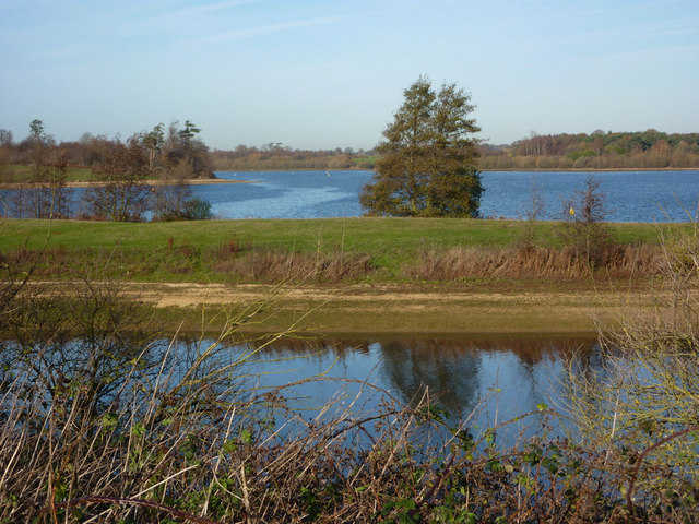
| Alton Water | 6.8 miles (11 km) | Follow a mixture of well surfaced and unsurfaced cycling and walking trails around this large reservoir in Stutton, Ipswich. The reservoir is surrounded by lovely countryside and includes a butterfly garden, woodland, a wildflower meadow, ponds and a bird hide. It's a great place for wildlife watching. Look out for golden eye, wigeon, pochard, teal and shoveller. There is also a visitor centre at the start of the route where you can hire bikes. View Full Details>> | |
| Angles Way | 77.1 miles (124 km) | This splendid walk through the Norfolk Broads was voted the best waterside walk in Britain by waterscape.com in 2003. The walk is often completed in the following stages: 1. Great Yarmouth to Fritton Lake Country Park - on this section you will follow the River Yare, Breydon Water and the River Waveney passing Burgh Castle as you go. The section finishes at the delightful Fritton Lake Country World 2. Fritton Lake to Oulton Broad - you continue along the Waveney towards Lowestoft and the pretty Oulton Broad. On the way you will pass the splendid Somerleyton. The delightful model village includes thatched red-brick estate cottages and the splendid Somerleyton Hall with its beautiful gardens and expansive estate. 3. Oulton Broad to Beccles - an exclusivley waterside section along the Waveney (video below). You'll pass Oulton Broad and Carlton Marshes Nature Reserve with lots of interesting wildlife to look out for. 4. Beccles to Bungay - a countryside section via Shipmeadow 5. Bungay to Harleston- through the countryside via Homersfield with views of the River Waveney 6. Harleston to Diss - continuing along the Waveney via Hoxne and the Billingford Windmill. View Full Details>> | |
| Beccles | 9 miles (14.5 km) | The Suffolk town of Beccles has some lovely riverside walks through the Broads National Park. View Full Details>> | |
| Bigod Way | 9.9 miles (16 km) | Explore the countryside around Bungay, in Suffolk, on this 10 mile circular walk in the Waveney Valley. The route offers a variety of wildlife, rare plants, and many sites of historical interest surrounding the town. It also visits Outney Common and includes fine views of the River Waveney. View Full Details>> | |
| Bradfield Woods | 0.9 miles (1.5 km) | This National Nature Reserve near Bury St Edmunds is one of the best places in Suffolk for wildlife. There's nice walking trails taking you through the woods to a lovely lake with a bird hide. Birds in the woods include garden warbler, blackcap and willow warbler. Other wildlife to look out for includes a variety of butterflies and deer in the adjacent fields. There's also lots of interesting flora with over 370 plant species. Woodland flowers include bluebells, oxlip, herb paris and ramson (wild garlic). There's three trails to try in the reserve. These will take you around the reserve and into the adjacent Monkspark Woods. To continue your walking in the are you can head west towards Stanningfield and pick up the long distance St Edmund Way. Following it north will take you into Bury St Edmunds where you can visit the delightful Abbey Gardens. View Full Details>> | |
| Brandon Country Park | 6.8 miles (11 km) | A lovely cycle or walk around Brandon Country Park and the surrounding Thetford Forest in Suffolk. There are three waymarked, woodland walks while the Poacher Trail cycle route also starts out at Brandon Country Park. This is an intermediate ride waymarked with blue posts. The park has beautiful lakeside lawns, a delightful walled garden and an excellent visitor centre. You will then head into Thetford Forest along peaceful woodland trails before returning to Brandon Country Park. The park is located near to the small town of Brandon on the River Ouse. If you have time you could continue your walk along the nearby Little Ouse Path for a delightful waterside walk. View Full Details>> | |
| Bungay Riverside Walk | 2.5 miles (4 km) | This circular walk takes you along the River Waveney in the Suffolk town of Bungay. There's a nice riverside path with the option of continuing your walking on the surrounding Outney Common. The trail runs for about 3 miles following the river around the common on flat paths. Along the way there's lovely views over the river to the surrounding Suffolk countryside. You can also pay a visit to Bungay Castle, a ruined Norman structure which is Grade I listed. View Full Details>> | |
| Bury St Edmunds | 6.8 miles (11 km) | This walk visits some of the highlights of this lovely Suffolk town using sections of the St Edmund Way and Bury to Clare Walk. You'll visit the delightful Abbey Gardens, the River Linnet, Hardwick Heath and Nowton Park. The walk starts off in the centre of town with a stroll around the Abbey Gardens next to the cathedral. The gardens have a nice circular walk taking you to a rose garden, sensory garden, ancient monument ruins, an aviary, and a section of the River Lark. You can then follow a section of the waymarked St Edmund Way, south through the town to Hardwick Heath, crossing the River Linnet on the way. The 55 acre open space of Hardwick Heath is popular with dog walkers and includes majestic trees such as 200-year-old Cedars of Lebanon. After leaving the heath you continue south into the countryside before picking up a section of the Bury St Edmunds to Clare Walk and heading east to Nowton Park. Here you will find good paths taking you around 200 acres of Suffolk countryside landscaped in a beautiful Victorian style. After exploring the park the walk follows Hencote Lane back to the St Edmund Way before returning to the town centre. This route heads south from the town but you could also head north along the Lark Valley Path. This delightful riverside trail takes you along the River Lark to the nearby West Stow Country Park and the Lackford Lakes Nature Reserve. It's a lovely walk with woodland, lakes and lots of wildlife to look out for on the way. Other good options for walkers include the nearby Clare Castle Country Park and Ickworth Park. The delightful nature reserves at Bradfield Woods and Cavenham Heath are also well worth a visit. View Full Details>> | |
| Bury to Clare Walk | 19.3 miles (31 km) | Follow the Bury to Clare Walk from Bury St Edmunds to Clare on this walk through Suffolk. The path starts at Nowton Park in Bury St Edmunds and heads south passing Somerton, Hawkedon and Stansfield before finishing at Clare Castle Country Park where there are the ruins of the historic Clare Castle. View Full Details>> | |
| Cavenham Heath | 1.6 miles (2.5 km) | Enjoy a short stroll around this pretty nature reserve near Bury St Edmunds. The site includes heathland, riverside meadows, woodland, wet woodland scrub and small areas of fen. There's lots of wildlife to look out for including a good population of Britain's only poisonous snake, the adder. You can park at Temple Bridge to start your walk which follows part of the Icknield Way Path. Near to the reserve you can also pick up the Lark Valley Path and enjoy a riverside stroll along the River Lark. You could follow it west into the attractive market town of Mildenhall. Also nearby is King's Forest and the popular West Stow Country Park. View Full Details>> | |
| Clare Castle Country Park | 1.9 miles (3 km) | This pretty country park is situated on the River Stour in the Suffolk town of Clare. In the park you will find the remains of the 13th Century stone castle keep and the old Clare railway station. There is a riverside walk where you can see a variety of wildlife and a railway walk with details of the park's history. View Full Details>> | |
| Dedham Vale | 9.6 miles (15.5 km) | Explore John Constable country and visit the site of his famous Hay Wain painting on this circular walk in the Dedham Vale AONB. The route makes use of the Stour Valley Path, the St Edmund Way and the Essex Way to create a round walk starting and finishing from the village of Dedham. You'll enjoy riverside paths, countryside views and gentle ascents as you make your way through this picturesque area. The walk starts in the Essex village of Dedham which has strong links with John Constable and his family. Constable attended the Grammar School and would walk to school each morning along the Stour from his family's home in East Bergholt. From the village you head north to Dedham Bridge and Dedham Mill which was owned by Constable's father. Here you can pick up the riverside path to Flatford Mill and Willy Lott's Cottage, scene of The Hay Wain. The Grade I listed cottage dates from the 16th century and is now owned by the National Trust. Right next to it you will find Flatford Mill which is also Grade I listed. The watermill dates from the 18th century and includes a 17th-century miller's cottage. You can enjoy refreshments at the National Trust's lovely riverside cafe. After leaving the delightful riverside scene, the route then heads away from the river towards the town of Manningtree. You then head past Lawford where you can visit the Grade I listed St Mary's Church. Fabric in the nave of the church dates from around 1200. From Lawford you follow the Essex Way west towards Dedham Heath, passing attractive countryside and woodland on the way. Around Dedham Heath you turn north and return to Dedham village and the finish point. To extend your walking in the area you could visit the nearby Alton Water where there are nice cycling and walking trails around the large reservoir. View Full Details>> | |
| Dunwich Forest | 5 miles (8 km) | This large forest is located in the Suffolk Coasts and Heaths Area of Outstanding Natural Beauty in the village of Dunwich. There are miles of peaceful woodland walking trails and lovely conservation areas of marshland and wetland adjacent to the woodland. This 5 mile circular walk starts at Dunwich village car park and takes you into the forest on the Suffolk Coast Path. You then follow a series of well defined trails through the coniferous and broadleaved woodland before returning to the village. At the northern end of the forest you will find the delightful Westwood Marshes and Walberswick Nature Reserve where there are excellent birdwatching opportunities. Also look out for the Dunwich ponies in the woodland area. If you follow the Suffolk Coast Path south you will soon come to the wonderful Minsmere Nature Reserve. This coastal nature reserve is considered one of the best sites in the country for birdwatching. Just to the south you'll find the lovely National Trust owned Dunwich Heath. There's miles of footpaths through beautiful purple heathland and coastal views along the pretty Dunwich beach. Also nearby is the pretty town of Southwold where you can try our circular walk around the town and along the River Blyth to Walberswick. The forest is also part of the Suffolk Coast National Nature Reserve. It includes waymarked trails taking you to heathland, reed beds, grassland, woodlands, shingle, lagoons, mudflats and the salt marshes of the Blyth estuary. View Full Details>> | |
| East Suffolk Line Walks | 70.8 miles (114 km) | Follow the 'East Suffolk Line' railway from Ipswich to Lowestoft on this splendid walk through the Suffolk countryside. You'll pass through Woodbridge, Melton, Saxmundham, Halesworth and Beccles. There are also several riverside sections along the Rivers Alde, Deben, Fynn and the final one along the River Waveney from Beccles to Lowesoft. View Full Details>> | |
| Elveden | 1.9 miles (3 km) | This walk explores the Elveden Estate in the West Suffolk village of Elveden. View Full Details>> | |
| Felixstowe | 14.3 miles (23 km) | Flanked by two rivers and with a lovely coastline, the Suffolk town of Felixstowe is a fine place for a walk. It's an attractive place with a Victorian promenade, an old pier and some pleasant seafront gardens to explore.
This circular walk explores the coast and countryside surrounding the town using a section of the Suffolk Coast Path. The route runs for about 14 miles along a flat, waymarked path. There's much to enjoy with seaside stretches, riverside footpaths and countryside trails on the way. You'll also pass marshland and nature reserves where there are some excellent bird watching opportunities. The walk starts from the pier on the seafront and heads north east along the town and beach to Felixstowe Ferry. Here you can catch the little ferry over the river to Bawdsey and follow the Suffolk Coast Path east towards Orford Ness. You head around Felixstowe Marshes next to the River Deben before turning west along the King's Fleet waterway. You continue west to the village of Trimley St Martin before coming to Loompit Lake and the Trimley Marshes Nature Reserve. The site is one of the premiere wildlife watching spots in England with a huge variety of water loving birds to look out for. The path runs through the reserve and along the River Orwell before climbing to a viewpoint at Fagbury Cliff. The final section takes you through the town before returning to the seafront where the walk finishes. View Full Details>> | |
| Flatford Mill | 1.6 miles (2.5 km) | Visit the site of Constable's most famous painting and enjoy a short stroll along the River Stour on this easy walk in the Dedham Vale AONB. There's wonderful old buildings, lovely river views and a nice National Trust tea room where you can enjoy refreshments after your walk. Start your walk from the Flatford Mill car park and head past the mill to Willy Lott's Cottage, scene of The Hay Wain. The pretty Grade I listed cottage dates from the 16th century. The watermill is also Grade I listed and dates from the 18th century. It includes a 17th-century miller's cottage. After passing the buildings, footpaths take you past a pretty lake to the River Stour. You can then pick up the Stour Valley Path to take you back to the car park. You can virtually explore part of the site using the google street view link below! To extend your walking in the area you could try our Dedham Vale circular walk which takes you on a wider tour of the countryside and woodland of the AONB. The Stour Valley Path also runs past the mill so you could pick this up and continue along the riverside path towards the lovely Alton Water. The waymarked path can be followed to the mill from the nearby village of Dedham. View Full Details>> | |
| Framlingham Castle | 0.9 miles (1.5 km) | This walk visits the 12th century Framlingham Castle and follows the public footpaths surrounding the attractive Suffolk based market town.
You can park at the castle car park to start your walk. The paths then take you around the pretty mere which is a Suffolk Wildlife Trust nature reserve and bird sanctuary. From here there are splendid views back over the water to the castle. The paths then take you around Framlingham College before heading back towards the castle. Here you can walk the full length of the parapet walls and climb some of the 13 towers for views across the mere. There's also the option of following footpaths through the countryside north east to Brabling Green. View Full Details>> | |
| Fritton Lake Country Park | 5.9 miles (9.5 km) | This super country park is situated just a few miles from Lowestoft and Great Yarmouth. There are lovely cycling and walking paths around the large lake which is 2.5 miles long. The lake is surrounded by peaceful woods where there are nice shady trails to try. You can follow footpaths along the Angles Way public footpath on the western side of the lake. Please stick to this section as the central and eastern parts are private property. The Angles Way long distance path runs past the site so you could pick this up and head north to visit the impressive Roman Fort at Burgh Castle. If you follow the trail south you can visit Somerleyton. The delightful model village includes thatched red-brick estate cottages and the splendid Somerleyton Hall. View Full Details>> | |
| Fynn Valley Walk | 9.3 miles (15 km) | This footpath runs along the River Fynn from Witnesham to Woodbridge. You will pass the pretty villages of Tuddenham St Martin, Playford, Little Bealings and Martlesham where you join the lovely final section along the Martlesham Creek and the River Deben to Woodbridge, finishing at the train station. View Full Details>> | |
| Gipping Valley River Path | 16.8 miles (27 km) | Follow the River Gipping from Stowmarket to Ipswich on this pleasant riverside walk. The path passes Needham Market, Claydon and Sproughton before finishing in Ipswich. There is a variety of water loving wildlife to look out for on this walk as well as interesting old water mills and locks. Also on the path are Needham Lake and Suffolk Water Park near Claydon. The latter is a particularly nice place to stop for refreshments or to try your hand at fishing. View Full Details>> | |
| Hadleigh Railway Walk | 2.1 miles (3.3 km) | This walk takes you along the trackbed of the old Hadleigh Railway line from Hadleigh to Raydon Wood railway station in Suffolk. It's a 2 mile stroll on flat paths which are also suitable for cyclists. The walk starts from the now closed Hadleigh railway station, in the centre of the ancient market town. The station was the terminus of the Hadleigh Railway, a short branch line from Bentley Junction, which opened in 1847. The station building still stands and is in use as a private residence. The route heads south east along the old line, passing Raydon Great Wood before finishing at the old Raydon Wood railway station. There's a car park at this end of the route so you could also start from here if you prefer. View Full Details>> | |
| Haverhill | 3.4 miles (5.5 km) | This Suffolk based town has some nice local trails along the Stour Brook and the River Stour which run through the area. View Full Details>> | |
| Hereward Way | 110 miles (177 km) | Starting in Oakham, in Rutland, follow the Herward Way through Stamford, Peterborough, Ely, and the Breckland forests to Thetford, in Norfolk.
Highlights on the walk include
| |
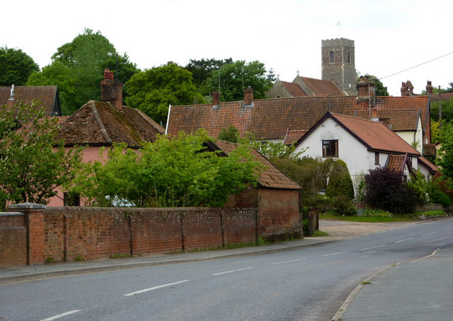
| Hoxne Heritage Walk | 2.4 miles (3.8 km) | This waymarked circular walk explores the area around the historic Mid Suffolk village of Hoxne. View Full Details>> | |
| Icknield Way Path | 110 miles (177 km) | The Icknield Way Path starts at Ivinghoe Beacon in Buckinghamshire and heads to Knettishall Heath in Suffolk along prehistoric pathways. There's fantastic views as you climb through the hills of the Chilterns AONB. There's also a series of lovely nature reserves and country parks to enjoy on the way. Highlights on the walk include the Cam Valley views from Royston Heath, the lovely Dunstable Downs Country Park and the splendid Whipsnade Tree Cathedral. View Full Details>> | |
| Ickworth Park | 5 miles (8 km) | A circular walk around the parks and gardens at Ickworth in Bury St Edmunds. There are 1,800 acres of parkland to explore with lakes, woodland and arable fields to enjoy. The walk also takes you through the beautiful Italianate garden which is the oldest of its kind in England. Here you'll also find the 18th century Italian Rotunda, built by the 4th Earl of Bristol to house his collection of Italian art and sculpture. The route below is devised for walkers but much of the park is also great for cycling, with bike hire available from the Ickworth hotel. Please click here for more information. Also of interest is the Newmarket to Bury St Edmunds cycle route which runs along National Cycle Route 51 and passes close to Ickworth Park. View Full Details>> | |
| Ipswich | 8.1 miles (13 km) | A circular walk around Ipswich with lovely river views and visits to a series of attractive parks. On the way you'll pass the River Orwell, River Gipping, Ipswich Docks, Holywells Park, Landseer Park and Orwell Country Park. The route uses a section of the Suffolk Coast Path so you can follow the waymarkers on the way. Start the walk in the town centre from Stoke Bridge, where the River Gipping becomes the River Orwell. Follow the path east round the attractive docks and marina. It's an interesting area with hundreds of yachts, an old Custom House, wharves, converted warehouses, new apartments and waterside pubs. After passing round the docks you soon come to Holywell Park. There's nice footpaths in the park with gardens, ponds, fields, woodland and lots of wildlife to look out for. There's also a visitor centre and cafe where you can stop for refreshments. The route continues south through Landseer Park where there is more nice scenery in the wide open fields. Shortly after you come to Orwell Country Park. The 200 acre park has some nice woodland trails and great views towards the river. After exploring the park you cross the river on the Orwell Bridge. Follow the riverside path on the western side of the river to Bourne Bridge where there is another pretty marina. You then follow roads back to the docks before returning to Stoke Bridge. View Full Details>> | |
| Kentwell Hall Long Melford | 3.1 miles (5 km) | This circular walk explores the beautiful grounds of this 16th century stately home in Long Melford, Suffolk. There is much to explore including the lovely Walled Garden with Herb Garden, Potager and fruit trees. There are also moats with two original bridges, a Wildlife Pond, a Ha-Ha and woodland with Ancient Yews & Cedars. You can also stroll up the three quarter mile long avenue of ancient lime trees with the hall at the far end making a wonderful backdrop. The site includes a rare breed farm with Tamworth pigs, Bagot Goats and Poitou Donkeys. You can also tour the house with its grand rooms and furniture. View Full Details>> | |
| Kersey | 5 miles (8 km) | This Suffolk based village is regarded as one of the most picturesque villages in East Anglia. A stroll around the village is a real delight and it is also surrounded by some attractive countryside. View Full Details>> | |
| Kessingland to Southwold Walk | 10.2 miles (16.4 km) | This walk follows a popular section of the Suffolk Coast Path from Kessingland to Southwold. It's about a 10 mile walk on fairly flat, waymarked footpaths and country lanes. You'll pass through a section of the Benacre National Nature Reserve which consists of open water lagoons, marshland, reed beds, woodland and heathland. There's great wildlife spotting opportunities with marsh harrier, bearded reedling, water rail, and bittern to look out for on the way. Starting on the sea front the walk heads south along Kessingland Beach before turning inland toward Benacre which is designated as a National Nature Reserve. You then turn south, following country lanes toward Wrentham and then heading east to Covehithe. Here you will find the partly ruined St Andrew's Church which is Grade I listed. The route continues past Covehithe Broad and the Pottersbridge Marshes before coming to Reydon. Here you turn toward the coast where you pass along Sole Bay and finish at Southwold on the front. View Full Details>> | |
| King's Forest | 9.3 miles (15 km) | This large area of woodland near has miles of cycling and walking trails to enjoy. You can park at West Stow Country Park and pick up the Icknield Way Path which runs through the woods along the Westtow Road track. The woods are great for wildlife with Fallow, Red, Roe and Muntjac deer to look out for. You may also see foxes and badgers. Birdwatchers may see Owl, Warblers, Finches, Goldcrests, Great Spotted and Green Woodpecker, Treecreeper, Nuthatch and Buzzards. To extend your walking in the are you can further explore West Stow Country Park. It's right next to the woods and includes waterside trails through the Lackford Lakes Nature Reserve and along the River Lark. Also nearby is the pretty Cavenham Heath Nature Reserve. The reserve has nice trails through heathland with more wildlife to look out for. The long distance Lark Valley Path also runs through the area so you could pick this up and enjoy a riverside walk through Suffolk. View Full Details>> | |
| Knettishall Heath Country Park | 3.7 miles (6 km) | This delightful open space near Thetford is the start point for three of Britain's best long distance walks:- the Icknield Way Path, the Peddars Way and Norfolk Coast Path, and the Angles Way. View Full Details>> | |
| Lakenheath Fen | 2.2 miles (3.5 km) | Follow the well laid out footpaths around this lovely nature reserve on the Norfolk/Suffolk border. The reserve consists of a large area of wetland with reedbeds, grazing marshes and riverside paths along the River Little Ouse. Lakenheath is a wonderful place for wildlife watching with reed warblers, bitterns and western marsh harriers real highlights.
There's a car park at the site but you can also catch the train to Lakenheath station which is right next to the reserve. The Hereward Way long distance footpath runs through the reserve so you can pick this up to extend your walk. The path heads west through New Fen, Joist Fen, Norfolk Fen before turning south to Stallode Wash. If you head east you will come to Brandon Country Park and Thetford Forest where there are miles of fabulous woodland walking trails to try. View Full Details>> | |
| Lark Valley Path | 13 miles (21 km) | Travel through the River Lark Valley on this interesting and varied walk from Mildenhall to Bury St Edmunds via West Stow Country Park. View Full Details>> | |
| Lavenham | 5.6 miles (9 km) | This pretty Suffolk village has lots of good options for walkers wishing to explore the area. The picturesque village includes a 15th-century church, the 13th-century Lavenham Priory and several half-timbered medieval cottages. This walk uses a section of the St Edmund Way long distance trail to take you through the village and then into the countryside along a disused railway line. You can use the trail to create a shorter circular walk by turning left at Park Road and continuing back into the village if you wish. View Full Details>> | |
| Lavenham Circular Walk | 5 miles (8 km) | This circular walk explores the lovely countryside surrounding the Suffolk village of Lavenham. The route runs for about 5 miles, exploring the countryside to the east of Lavenham before visiting the nearby village of Brent Eleigh. It's a fairly flat route with a couple of short climbs, so suitable for most abilities. Start the walk from the car park at the southern end of the village and follow the footpath north east. You'll pass some of the wonderful half-timbered medieval cottages that the village is famous for. The route then picks up the Clay Lane track to head east past Clay Hill to Spragg's Wood. You then turn south along Hall Lane, leading you into Brent Eleigh. The village has a noteworthy church which dates from the 13th-century and includes a number of 14th century paintings. It's also a good place to stop for refreshments at what is roughly the half way point of the walk. The Cock Inn does a good selection of meals and has a nice outdoor seating area as well. The route leaves the village, heading south east along Cock Lane. A public footpath then leads west to Bear's Lane Farm where you pick up a country lane to take you back into Lavenham. View Full Details>> | |
| Laxfield | 2.4 miles (3.8 km) | This walk visits the splendidly preserved medieval village of Laxfield in Suffolk. View Full Details>> | |
| Leiston | 1.7 miles (2.8 km) | This East Suffolk based town is located near the coast and the towns of Aldeburgh and Saxmundham. View Full Details>> | |
| Little Ouse Path | 9.9 miles (16 km) | Follow the Little Ouse River on this delightful, gentle walk through Thetford Forest. The route runs for about 10 miles along a fairly flat riverside path surrounded by peaceful woodland. The walk starts in Thetford mainly following the river towpath through Santon Downham to Brandon. At Brandon you'll find the super Brandon Country Park. Here you will find beautiful lakeside lawns, a delightful walled garden and an excellent visitor centre. View Full Details>> | |
| Lowestoft | 10.3 miles (16.6 km) | This Suffolk based town has some lovely coastal walking and lovely trails to try around the nearby Oulton Broad and Carlton Marshes. This walk takes you along the beaches and dunes to the nearby village of Kessingland before continuing to Southwold. The walk starts at the south pier in Lowestoft and heads towards Kirkley and Pakefield along South Beach. On the way you'll pass the Claremont Pier which was constructed in 1902/03. There's also the Pakefield Lighthouse which was dates from the 19th century. The next section runs along Pakefield Cliffs before coming into Kessingland where there is a lovely beach and plenty of good options for refreshments. The route then continues south to Southwold, passing Covehithe on the way. View Full Details>> | |
| Melford Hall | 2.5 miles (4 km) | Enjoy a walk around the beautiful grounds of Melford Hall in Suffolk. The hall has been the family home of the Hyde Parker family since the 1780s. View Full Details>> | |
| Mid Suffolk Footpath | 19.9 miles (32 km) | This footpath runs from Hoxne to Stowmarket through the Suffolk countryside. The route passes Eye, Thorndon and Mendlesham before finishing just outside Stowmarket. Highlights on the path are the town of Eye with its ruined castle, and waterside sections along the Rivers Dove and Gipping. This route links with the Gipping Valley River Path which takes you along the river to Needham Market and the pretty Needham Lake. View Full Details>> | |
| Mildenhall | 5 miles (8 km) | This is a lovely circular walk along the River Lark from the Suffolk market town of Mildenhall. There's a nice waterside footpath running to the village of West Row, with herons to look out for on the way. The walk takes place near Mildenhall airfield, the headquarters of the 3rd United States Air Force in Europe. Look out for the planes taking of and landing as you make your way through the area. The annual air shows, held in May, are the biggest of their kind in the world and always attract huge crowds. You can start the walk from the car park near to the river in town. Then follow the riverside footpath west, passing Wamil Hall to Jude's Ferry Bridge. Here you cross the river and head through the little village of West Row. The Mildenhall Treasure, a major hoard of highly decorated Roman silver tableware from the fourth-century AD, was discovered in West Row. The hoard was discovered by farmer Gordon Butcher while ploughing in January 1942 and acquired by the British Museum in London. The walk returns to Mildenhall, following bridleways along the northern side of the river. You can extend your walk by following the river in the other direction along the Lark Valley Path. The trail starts in Mildenhall and heads east along the river to Cavenham Heath Nature Reserve. You can also pick up the Icknield Way Path near the town. View Full Details>> | |
| Minsmere Nature Reserve | 3.7 miles (6 km) | Enjoy a peaceful walk around this lovely coastal nature reserve near Leiston. Easy walking trails take you through woodland, reed bed, lowland heath, wet grassland and shingle vegetation. The reserve attracts a wide variety of birdlife and is considered one of the best sites in the country for birdwatching. Look out for Avocet, Bittern and Marsh Harriers. Other wildlife in the reserve includes Exmoor Ponies and Konik horses. You may even catch a glimpse of an otter if you are lucky! The Suffolk Coast Path runs past the site so you could pick this up and continue your walk along the coast. If you head north along the path you will soon come to Dunwich Forest and then Westwood Marshes and Walberswick Nature Reserve where there are more excellent birdwatching opportunities. Just to the north you'll find the lovely National Trust owned Dunwich Heath. There's miles of footpaths through beautiful purple heathland and coastal views along the pretty Dunwich beach. Also nearby is the Suffolk Coast National Nature Reserve at Walberswick. View Full Details>> | |
| Nacton Shores | 3.7 miles (6 km) | Enjoy a lovely waterside stroll along Nacton Shores on this easy walk in Suffolk. You can park at the car park on Shore Lane, near Orwell School to start your walk. From here you can pick up footpaths along the River Orwell with its nice beach and views across the river. You can follow the path all the way to the Levington Lagoon Nature Reserve at the eastern end of the shore. View Full Details>> | |
| Needham Lake | 1.6 miles (2.5 km) | Enjoy an easy stroll around Needham Lake on this short walk in Needham Market. After following the trail around the main lake you can pick up the Gipping Valley River Path and follow the riverside path south to Bosmere and Alderson Lake. It's a very pretty area with wetland areas, meadows and a small woodland. In the summer months you can see lots of wildflowers including pyramidal and bee orchids. You should also see lots of water loving birdlife on the lake. You can park at the car park off Coddenham Road and pick up the nice surfaced trails from here. Needham Market train station is also very close by so you can access the site from there quite easily. View Full Details>> | |
| Newmarket | 5 miles (8 km) | This walk uses sections of the Stour Valley Path and Icknield Way Path long distance trails to take you past the famous racecourse and into the countryside surrounding the Suffolk town of Newmarket. The walk begins in the centre of town, near the tourist information centre and the former palace of Charles II. You then pick up the waymarked Stour Valley Path and follow it south west along the racecourse. Look out for thoroughbred horses galloping on the exercise track. The route turns south east along the Devil's Dyke, with nice countryside views and a short woodland section. The Devil's Dyke is the largest of several earthworks in south Cambridgeshire which were designed to control movement along the ancient Roman roads. It is over 7 miles (11 km) long and is the largest of a series of ancient Cambridgeshire dykes. The route then finishes at the village of Stetchworth. View Full Details>> | |
| Nowton Park | 1.9 miles (3 km) | Explore 200 acres of beautiful Suffolk countryside landscaped in a beautiful Victorian style in this country park in Bury St Edmunds. There are well maintained footpaths taking you around the park with good facilities including a visitor centre and cafe. The park is located just over a mile to the south of Bury St Edmunds town centre so can be easily reached on foot. The Bury to Clare Walk runs just past the park so there is scope for continuing your walk if you have time. View Full Details>> | |
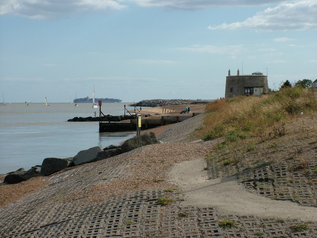
| Orford Ness | 3.7 miles (6 km) | Follow the walking trails around this beautiful nature reserve on the Suffolk Coast. The reserve is located on a remote shingle spit by the River Ore. It can be accessed by catching the National Trust ferry from Orford Quay (this is show on the google street view link below). You can then pick up the walking trails which take you to the WWI airfield, King's Marsh, Orford Ness lighthouse and Orford beach. There's three colour coded, waymarked trails to try with reserve features including shingle, salt-marsh, mud-flats and brackish lagoons. These areas are a haven for wildlife. Highlights include Orford's brown hares and the wonderful Chinese water deer who swam the river to reach the reserve. Also look out for a wide variety of birds such as avocet and common tern. Marsh harrier's have a nest in King's Marsh and Barn Owls can also been seen nesting in the disused military buildings on the site. View Full Details>> | |
| Orwell Country Park | 4 miles (6.5 km) | Enjoy fabulous views of the River Orwell in this delightful country park in Ipswich. There are woodland walks and riverside footpaths to enjoy in over 200 acres of parkland. There's good facilities with a good sized car park where you can directly pick up the trails. View Full Details>> | |
| Oulton Broad and Carlton Marshes | 5 miles (8 km) | This is a lovely waterside walk visiting Oulton Broad, the River Waveney and the pretty Carlton Marshes Nature Reserve near Lowestoft. The walk uses part of the long distance Angles Way and a series of other footpaths to explore the area. As well as the lovely Suffolk Broads scenery there's a huge variety of interesting wildlife. Look out for birds of prey including marsh harrier, barn owl and hobby. There's also lots of interesting plants including marsh orchid, marsh marigold and ragged-robin. You can start your walk from the Oulton Broad car park or from Oulton Broad South railway station. From here you can pick up the Angles Way footpath which will take you into the reserve. Trails then take you along the waterways including various dykes and the River Waveney. There's also nice views across the large expanse of water and marsh that is Oulton Broad. Look out for a variety of watersports taking place on the water. The broad is a popular tourist spot with lots of restaurants, cafes, pubs, bars and shops. View Full Details>> | |
| Pin Mill | 1.7 miles (2.8 km) | Enjoy woodland trails and riverside paths on this delightful walk in Suffolk. There's wonderful views over the River Orwell where you can see lots of little boats at the charming hamlet of Pin Mill. The area is also great for flora and fauna with pretty heather and yellow gorse to see as you make your way through the area. The walk starts from the Pin Mill car park, just to the north of the village of Chelmondiston. From here you can pick up the Stour and Orwell Walk to take you along the River Orwell. View Full Details>> | |
| Ramsholt | 8.7 miles (14 km) | This walk visits the lovely riverside village of Ramsholt in Suffolk. View Full Details>> | |
| Rendlesham Forest | 5 miles (8 km) | Rendlesham Forest is probably most famous for reported UFO sightings in 1980 but it is also a great place for cycling and walking. Cyclists can enjoy two easy, family cycle routes on flat well defined paths and quiet country lanes. For walkers there are also two way-marked trails of differing lengths. Both are an easy stroll suitable for all abilties. There is also a UFO trail which takes you to some of the areas connected to the UFO sighting in December 1980. The circular route below starts at the car park/visitor centre and takes you through forest on trails and quiet roads. The route is suitable for cyclists and walkers but the latter could take the woodland paths adjacent to the section along the road. The forest also has a bike park with two challenging one-way rides. This is located near the car park. On the eastern side of the forest there's the Staverton Thicks Walk. This will take you through and extraordinary collection of gnarled, ancient oak trees, many of which are centuries old, some estimated to be over 400 years old. Rendlesham is located just a few miles east of Woodbridge. If you would like to continue your walking in the area then you could pick up the Suffolk Coast Path. It runs along the Butley River through Boyton Marshes to the River Ore and the coast. Also nearby is the wonderful Orford Ness Nature Reserve. The national trust owned reserve is located on a remote shingle spit by the River Ore and can be accessed by catching the National Trust ferry from Orford Quay. Also nearby is Tunstall Forest where you can try the excellent 10 mile red graded single-track mountain bike trail. View Full Details>> | |
| River Deben | 11.2 miles (18 km) | Enjoy a waterside walk along the River Deben from Woodbridge to Felixstowe Ferry. There's a nice footpath running for about 12 miles from the town to the Deben estuary on the North Sea. The walk starts on the quay in the Suffolk town of Woodbridge, close to the train station. You then follow a section of the Fynn Valley Walk towards the village of Martlesham. The next section follows public footpaths to Waldringfield where you will find a 14th century church and a pretty beach by the river. It's also a good spot to stop for refreshments at the quayside pub. You continue along the river to Hemley and then through Falkenham marshes before finishing at Felixstowe Ferry. Here you can catch the little ferry over the river to Bawdsey and follow the Suffolk Coast Path east towards Orford Ness. If you follow the path south it will take you into Felixstowe and then on to the splendid Trimley Marshes Nature Reserve, located close to the seaside town of Felixstowe. NB. As of August 2019 there are breaches of the sea wall in two places: 1. South of Martlesham Creek before Cross Farm 2. At Early Creek, south of Waldringfield This means it may nor be possible to walk the full length of this walk along the river. You will need to take a detour by following country lanes to the west of the river, south of Martlesham Creek. View Full Details>> | |
| Saint Botolphs Way | 8.7 miles (14 km) | This circular walk explores the countryside around the villages of Rickinghall and Botesdale in Mid Suffolk. View Full Details>> | |
| Sandlings Walk | 54.7 miles (88 km) | A walk through the Suffolk Coast and Heaths Area of Outstanding Natural Beauty from Southwold to Ipswich via Woodbridge. View Full Details>> | |
| Shotley Peninsula | 13 miles (21 km) | Starting from Shotley, this circular walk takes you along the banks of the Stour, with good views of Harwich. Cutting back across rolling farmland to Chelmondiston, you then follow the Orwell downstream, opposite Levington, before cutting back up to Shotley. A nice combination of countryside and riverside walking, with opportunities for pub stops on the way, the most notable being at Pin Mill. Here you will find the 17th century Butt and Oyster pub with great views over the little boats in the River Orwell. The walk makes use of the Suffolk Coast Path for part of the way. You could extend your walk by following the long distance path north west from Chelmondiston to the nearby Woolverstone Park. View Full Details>> | |
| Somerleyton | 5.6 miles (9 km) | Explore the area surrounding the delightful village of Somerleyton in the Waveney area of Suffolk. The circular walk makes use of the Angles Way and other public footpaths to take you on a tour of the village and the Somerleyton Estate surrounding Somerleyton Hall. The village is accessible from Somerleyton rail station. You can catch the train from Lowestoft and Norwich directly. The area has a fascinating history. Sir Samuel Morton Peto lived at the hall and was responsible for many of the most well known buildings in London, including Nelson's Column and the Houses of Parliament. He was also one of the pioneers of steam locomotion. The delightful model village includes the thatched red-brick estate cottages which he created for his workers. You start the walk in the village passing the pretty cottages and village green before following the Angles Way footpath into the countryside towards Kitty's Farm. You turn south at Green Lane and head towards the river where you will pass two pretty lakes before returning to the village. For a fee you can also enjoy a tour of Somerleyton Hall and gardens. Here you will find a walled garden, an aviary, a loggia and a 90 metres (300 ft) long pergola covered with roses and wisteria. If you would like to extend your walk then you can follow the Angles Way north and visit the splendid Fritton Lake Country Park. There are lovely cycling and walking paths around the large lake which is 2.5 miles long. Heading south along the Angles Way will take you towards Lowestoft where you will find the lovely Oulton Broad and Carlton Marshes Nature Reserve. View Full Details>> | |
| Southwold | 5.9 miles (9.5 km) | This lovely circular walk takes you from the coastal town of Southwold to the nearby village of Walberswick in the Suffolk Coast and Heaths Area of Outstanding Natural Beauty. There's much to enjoy in this area with coastal views, pretty beaches and riverside paths along the River Blyth. The walk starts by the pier in the popular town of Southwold. The pier is 90 metres (620 ft) long with an adjacent model boat pond. From the pier you follow the Suffolk Coast Path south towards the River Blyth, passing the sand and shingle beach and the Grade II listed lighthouse. You can catch a ferry over the river but this walks follows the river path towards Woodsend Marshes before crossing the bridge and heading to Walberswick. Here you have the option of continuing along the Dunwich River to Dunwich Forest and the lovely Suffolk Coast National Nature Reserve. The area around the village makes up the Suffolk Coast National Nature Reserve, a protected area of 1,340 hectares (3,300 acres) with a range of wetland and heathland habitats. Consequently the area is great for birdwatching with March Harrier, Bearded Tit, Water Rail and Bittern to look out for. After exploring the village and enjoying refreshments at one of the pubs or cafes you follow the river back to Woodsend Marshes where there is a nice footpath to follow through Busscreek Marshes. You then follow the Buss Creek back to the pier and the finish point. View Full Details>> | |
| Southwold to Walberswick | 3.1 miles (5 km) | This is a popular walk from Southwold to Walberswick, passing along the coast and the River Blyth. It's an easy stroll, running for about 3 miles on a flat section of the Suffolk Coast Path, passing some of the marshland surrounding the two settlements. Start the walk on the sea front in Southwold and then head south along Havenbeach Marshes to the river. Here you turn right to follow a path along Southwold Harbour to Woodsend Marshes. A footbridge then takes you to the other side of the river where you turn south to follow the path to the coast at Walberswick. The route passes along the beach before turning into the village centre where you can enjoy refreshments at one of the cafes. View Full Details>> | |
| St Edmund Way | 78.9 miles (127 km) | A walk through Essex, Suffolk and Norfolk from Manningtree to Brandon. View Full Details>> | |
| Stour and Orwell Walk | 41 miles (66 km) | Follow the Rivers Orwell and the Stour on this walk through the Suffolk Coast and Heaths Area of Outstanding Natural Beauty. The walk begins on the Suffolk Coast at Felixstowe and soon turns north along the River Orwell for a waterside stretch towards Ipswich, passing the riverside Orwell Country Park, the lovely beach at Nacton Shores and Trimley Marshes Nature Reserve on the way. You then turn south along the western side of the Orwell towards Shotley Gate where you join the River Stour for the final stretch to Cattawade. This section passes the delightful Pin Mill where you can see lots of little boats in the river and enjoy refreshments at the 17th century Butt and Oyster pub. View Full Details>> | |
| Stour Valley Path | 59.7 miles (96 km) | Follow the River Stour from Newmarket to Cattawade on this delightful walk through East Anglia. The walk passes through a series of pretty riverside towns and villages including Little Thurlow, Kedlington, Clare and the Clare Castle Country Park, Long Melford (with Melford Hall and Kentwell Hall), Sudbury, Stoke By Nayland, Nayland and Dedham. You will also pass through the Dedham Vale AONB, an area which inspired much of the work of painter John Constable. View Full Details>> | |
| Stowmarket | 3.9 miles (6.2 km) | Enjoy a walk along the River Gipping on this walk from Stowmarket to Needham Market. The walk runs for about 4 miles along a flat, waymarked path known as the Gipping Valley River Path. As such it's ideal for an afternoon stroll. The walk starts on the river in Stowmarket, just to the west of the train station. You then follow the footpath south east past Creeting St Peter and Badley Mill Farm to Needham Market where you finish at the train station. At the end of the walk you can catch the train directly back to Stowmarket or follow the same path back. You could also turn it into a circular walk by following a series of public footpaths through the countryside to the west of the towns. These pass Little London and Combe Wood and give nice views of the Suffolk countryside. View Full Details>> | |
| Sudbury | 3.7 miles (6 km) | This circular walk takes you around the delightful Water Meadows in the Suffolk town of Sudbury. There's some delightful scenery with riverside trails and wild flowers, birds and mammals to look out for on the way. The area has strong connections with the painter Thomas Gainsborough who was born in the town. View Full Details>> | |
| Suffolk Coast National Nature Reserve | 7.1 miles (11.5 km) | This delightful coastal nature reserve is situated around the village of Walberswick in the Suffolk Coast and Heaths Area of Outstanding Natural Beauty. It's an easy walk taking you past a wide variety of habitats including heathland, reed beds, grassland, woodlands, shingle, lagoons, mudflats and the salt marshes of the Blyth estuary. The reserve is great for wildlife watching. Look out for March Harrier, Bearded Tit, Water Rail and Bittern as you make your way along the waymarked paths. This walk starts from Walberswick but you could also park at the car park off Lodge Road just west of the village. From the village you follow the Suffolk Coast Path west along the beach before coming to the Dunwich River, which guides you into the reserve. Footpaths then take you past Westwood Marshes and Fen Hill before skirting the edge of Dunwich Forest. You then follow other trails past Westwood Lodge before following a country lane to the woodland at Hoist Covert. The final section returns to Walberswick along the coast path. If you would like to extend your walking in this lovely area then you could head south and visit Minsmere Nature Reserve and Dunwich Heath which are great for peaceful walks and wildlife. Also nearby is the town of Southwold where you can follow the Suffolk Coast Path along the shingle beach and the River Blyth. The Sandlings Walk also starts from the town. View Full Details>> | |
| Suffolk Coast Path | 51.6 miles (83 km) | A walk along the beautiful Suffolk coast from Felixstowe to Lowestoft. The walk passes through the Suffolk Coast and Heaths Area of Outstanding Natural Beauty which covers 150 square miles in East Anglia and includes wildlife-rich wetlands, ancient heaths, shingle beaches and historic towns and villages. You will pass through Bawdsey, Snape Maltings, Aldeburgh, North Warren, Thorpeness, Minsmere, Dunwich Forest, Southwold and Kessingland. Highlights on the route include the section around Leiston where you will pass the delightful Minsmere Nature Reserve - one of the UK's premier birdwatching sites. This section also takes you through the peaceful Dunwich Forest, the Walberswick Nature Reserve and the lovely National Trust owned Dunwich Heath. There's miles of footpaths through beautiful purple heathland and coastal views along the pretty Dunwich beach on this section. Near Ipswich you'll pass the delightful Pin Mill where you can see lots of little boats in the River Orwell and enjoy refreshments at the 17th century Butt and Oyster pub. View Full Details>> | |
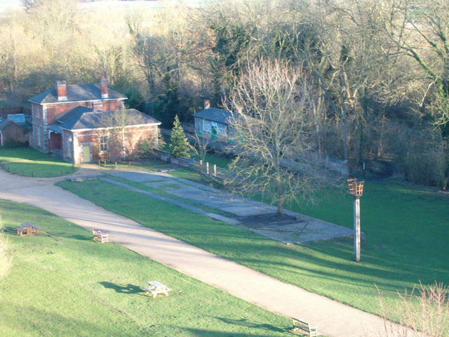
| Sutton Hoo | 4 miles (6.5 km) | Explore the 255 acre estate of this Anglo-Saxon burial site and enjoy lovely views of the River Deben. It's a historically fascinating area set in the beautiful Suffolk countryside and run by the National Trust. There's a number of good walking paths with woodland trails and riverside footpaths to enjoy. The site was discovered in the summer of 1939 and is one of the richest finds in English archaeology. You can learn about the find in the on site exhibition which includes replica treasures and original finds from one of the mounds, including a prince's sword. This circular walk starts from the visitor centre and visits the burial mounds just to the south. This includes the Ship Burial where the remains of a 90ft-long, clinker-built wooden ship of the seventh-century, were found in 1939. From here you can then follow paths through woodland to Ferry Cliff where there are splendid views over the River Deben to the town of Woodbridge and its working Tide Mill. Paths then lead through Deben Wood before crossing the estate and returning to the car park. View Full Details>> | |
| Thetford Forest | 4.3 miles (7 km) | Enjoy miles of cycling and walking trails in this large forest in Suffolk. Cyclists will find 4 way-marked trails of varying distance and difficulty. The Shepherd Trail is a nice easy ride on well defined paths, suitable for families. Experienced mountain bikers can try the exciting Beater trail which takes you through beautiful beech woods on a single track. Walkers can enjoy a number of way-marked walks such as the lovely Nature Trail. This walk features a viewing hide where you can look out for the wildlife in the forest. This includes four types of deer and countless varieities of birds and butterflies. The circular route below starts at the visitor centre and follows cycling and walking tracks around the centre of the forest. If you would like to continue your excercise you could head to the nearby Brandon Country Park. Here you will find beautiful lakeside lawns, a delightful walled garden and an excellent visitor centre. The super Little Ouse Path walking route also runs through the forest. Head a few miles north towards Lynford and you will find the delightful Lynford Arboretum with its peaceful, woodland walking trails. View Full Details>> | |
| Trimley Marshes | 5.3 miles (8.5 km) | Follow the circular trail around this lovely nature reserve near Felixstowe. There's over 200 acres to explore on a series of good footpaths. It's one of the premiere wildlife watching spots in England with a huge variety of water loving birds to look out for. This includes coot, tufted duck, teal, pochard, cormorant, little egrets, gadwall and shoveler. The reserve includes a series of lagoons and lakes with additional waterside paths along the River Orwell. There's also large areas of reedbeds and lovely views across the estuary to enjoy. You can park at the car park at the end of Codry's Lane and pick up the paths from here. Trimley St Mary rail station is also very close by. The Stour and Orwell Walk runs through the reserve so you can continue along this path to extend your walk. Heading west will take you to Levington and then on to Orwell Country Park. Here you'll find over 200 acres of woodland and parkland with more nice footpaths to follow. Also nearby is the delightful Nacton Shores with its beach and river views. View Full Details>> | |
| Tunstall Forest | 10.3 miles (16.5 km) | This large forest in Suffolk has miles of good footpaths and a 10 mile red graded single-track mountain bike trail. The waymarked route is called the Viking Trail and is a narrow flowing singletrack running through the trees, with twists, berms and some short climbs. It's a fun ride and not too challenging though there are some technically tricky bits. The ride starts at the car park off Tunstall Road towards the northern end of the forest. This mountain bike route is designed for cyclists but walkers can easily pick up the forest footpaths from the same start location. You can walk down to Tunstall Common and then continue south to the little village of Chillesford for refreshments. From here you can pick up the Suffolk Coast Path to take you back into the forest and then head west to return to the car park. View Full Details>> | |
| West Stow Country Park | 2.5 miles (4 km) | Enjoy waterside walks alongside a number of pretty lakes and the River Lark in this splendid country park near Bury St Edmunds. The park contains a number of nature trails through heathland and woodland and the fascinating West Stow Anglo-Saxon Village. There is also a wildfowl reserve with a number of bird hides. The park is located a few miles north west of Bury St Edmunds. It is situated on the Lark Valley Path so you could continue your walk along the river if you have time. Following it north west will take you to Icklingham where you will find the pretty Cavenham Heath Nature Reserve. View Full Details>> | |
| Whelnetham Railway Walk | 1.1 miles (1.7 km) | An easy waymarked walk along the old railway line in the village of Little Whelnetham in West Suffolk. View Full Details>> | |
| Woodbridge | 2.1 miles (3.3 km) | The Suffolk town of Woodbridge has some lovely trails to try along the River Deben. You can follow the river north or south with two National Trust properties to visit. Heading north will take you towards Melton where you can cross the river to visit Sutton Hoo. This circular walk heads south along a section of the Fynn Valley Walk to take you to Kyson Hill and Kyson Point on the western side of the river. It's a really lovely stretch of the Deben with lots of little boats and nice views of the surrounding countryside. You can start the walk from the train station which is located right next to the quay. From here you can pick up the Fynn Valley Walk next to the Woodbridge Tide Mill. The Grade I listed building is very well preserved and has a water wheel which still turns and is capable of grinding a wholemeal flour. A mill has operated on the site for 800 years and is now open to the public for tours. Follow the river south and you will soon come to Kyson Hill. The National Trust owned area includes a grassy hill, surrounded by wooded belts, sloping down to the saltings and mudflats of the tidal Deben. It's a great area for bird watching with many species visiting the estuary. Look out for egrets, oyster catchers, plovers, teals, little grebes, redshanks, black tailed godwits, and curlews as you make your way along the river. After admiring the estuary views from the little hill, the walk continues to Kyson Point where there are fine views of Martlesham Creek. The route then follows other paths back to the town through the countryside. View Full Details>> | |
| Wortham Ling | 5.6 miles (9 km) | This walk visits the Wortham Ling Site of Special Scientific Interest near the village of Wortham in Mid Suffolk. View Full Details>> |