Marple Canal Locks Walk

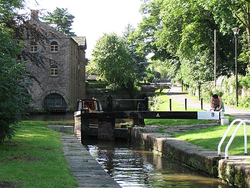
 This easy walk takes you along a particularly lovely section of the Peak Forest Canal in Marple. You'll pass the Marple Lock Flight consisting of a flight of sixteen canal locks over the course of about 1 mile. It's a splendid sight with lots of boats to see in the summer months and nice views of the surrounding countryside.
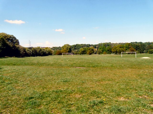
The walk starts from Marple Memorial Park where there's a car park, tree sculptures, sensory gardens and nice views towards the Peak District hills. From the car park follow footpaths leading down to the canal where you can pick up the towpath and head north, passing the lock flight. The walk passes Brabyn's Park before finishing at Marple Aqueduct. The structure was built to carry the lower level of the Peak Forest Canal across a length of the River Goyt. It is the highest canal aqueduct in England and the highest masonry-arch aqueduct in Britain.
You can extend the walk by continuing along the Etherow Goyt Valley Way which will take you west along the river towards Bredbury. Etherow Country Park is also very close by. There's more nice waterside trails along the River Etherow here.
The Macclesfield Canal also starts at the locks. You can follow it south through the countryside towards Bollington and Macclesfield.
Postcode
SK6 6AX - Please note: Postcode may be approximate for some rural locationsMarple Canal Locks Ordnance Survey Map  - view and print off detailed OS map
Marple Canal Locks Open Street Map  - view and print off detailed map
Marple Canal Locks OS Map  - Mobile GPS OS Map with Location tracking
Marple Canal Locks Open Street Map  - Mobile GPS Map with Location tracking
Pubs/Cafes
The Ring O' Bells is a good choice for some refreshments after your walk. Located in Marple the 200 year old pub boasts a large award winning beer terrace/garden overlooking the canal. It's a great place to relax and enjoy a drink in the summer when there are weekly brass band concerts. The friendly pub is located right next to the canal at 130 Church Lane with a postcode of SK6 7AY.
In Marple Bridge The Midland is worthy of consideration. The pub is in a lovely spot overlooking the River Goyt in the heart of the village. You can sit outside on the balcony and enjoy a meal with a view over the water. They're located close to the train station at 26 Brabyns Brow, SK6 5DT.
Further Information and Other Local Ideas
Just to the south east there's the climb to the Mellor Cross to try. The religous cross marks the site where Methodist John Wesley preached during the 18th century. There are fine views from the elevated position of the site. Near is also the pretty little hamlet of Rowarth. Here you will find the Little Mill Inn, a delightful Grade II listed inn set in a former candlewick mill, with a waterwheel in the adjacent stream. The historic mill is well known locally and includes an outdoor area with ducks and geese on the river, chickens roaming free and rabbits in a large outdoor pen. Our walk from the village climbs to the geologically fascinating Cown Edge Rocks and Robin Hood's Picking Rods.
Near there's the historic Chadkirk Country Estate in Romiley. There's a noteworthy 16th century chapel, a little cafe and a walled garden to enjoy here.
For more walking ideas in the area see the Greater Manchester Walks page.


