Retford Canal Walk
![]()
![]() This attractive Nottinghamshire market town has some nice waterside walks along the Chesterfield Canal and the River Idle which run through the area.
This attractive Nottinghamshire market town has some nice waterside walks along the Chesterfield Canal and the River Idle which run through the area.
In the town there's fine Georgian buildings, a spacious square and the interesting Mayflower Trail. On the trail you can learn about the Pilgrim Fathers, who originated from villages of Babworth and Scrooby on the outskirts of East Retford between 1586 and 1605. There's also the Mayflower Pilgrims Visitor Centre to visit in the town.
This route from Retford makes use of the Chesterfield Canal towpath and the Trent Valley Way to create a circular walk around the town. On the way you'll visit the neighbouring villages of Clayworth and North and South Wheatley. There's nice waterside paths and some splendid views of the Nottinghamshire countryside to enjoy on the way.
The walk starts on the canal just to the east of the tourist information centre and the bus station. From here you can pick up the towpath and the Cuckoo Way and head north towards Hayton and Clayworth.
After passing through the village you head east to pick up the Trent Valley Way. Follow the waymarked trail south and it will take you through the countryside to the villages of North and South Wheatley. Here there's a number of 17th century brick houses and a noteworthy ruined church which dates from the 11th century.
You then head south west along Muspit Lane and Howbeck Lane to Clarborough. Shortly after you rejoin the canal and follow it back into Retford.
Retford Ordnance Survey Map  - view and print off detailed OS map
Retford Open Street Map  - view and print off detailed map
Retford OS Map  - Mobile GPS OS Map with Location tracking
Retford Open Street Map  - Mobile GPS Map with Location tracking
Pubs/Cafes
On the walk you could stop off for refreshments at The Boat Inn in Hayton. The pub is located right next to the canal and includes a nice outdoor area with views over the water. You can find the pub at 97 Main Street, Hayton with a postcode of DN22 9LF for your sat navs.
Nearer to Retford is The Hop Pole. It's in another fine spot next to the canal with a lovely beer garden. You can find it on Welham Road with a postcode of DN22 6UG.
Dog Walking
The canal and country trails make for a fine dog walk and the Boat Inn and Hope Pole pubs mentioned above are also dog friendly.
Further Information and Other Local Ideas
To continue your walking around Retford head to the nearby Daneshill Lakes and enjoy more waterside trails around the pretty lakes. Also close by is the lovely Idle Valley Nature Reserve where there's a nice walks along the River Idle and a wide range of flora and fauna to look out for.
You could also head west along the canal and the Cuckoo Way. This will take you towards Ranby and Worksop.
For more walking ideas in the area see the Nottinghamshire Walks page.
Cycle Routes and Walking Routes Nearby
Photos
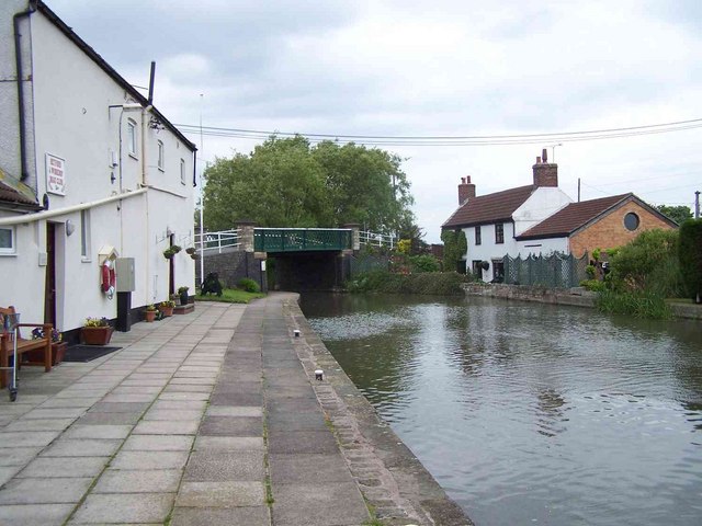
The Chesterfield canal near Clayworth. The houses have the canal on one side and Wheatley Road on the other


