Stowmarket River Walk
![]()
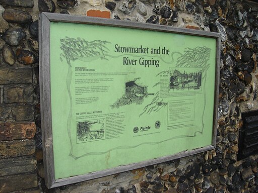
![]() Enjoy a walk along the River Gipping on this walk from Stowmarket to Needham Market. The walk runs for about 4 miles along a flat, waymarked path known as the Gipping Valley River Path. As such it's ideal for an afternoon stroll.
Enjoy a walk along the River Gipping on this walk from Stowmarket to Needham Market. The walk runs for about 4 miles along a flat, waymarked path known as the Gipping Valley River Path. As such it's ideal for an afternoon stroll.
The walk starts on the river in Stowmarket, just to the west of the train station. You then follow the footpath south east past Creeting St Peter and Badley Mill Farm to Needham Market where you finish at the train station. At the end of the walk you can catch the train directly back to Stowmarket or follow the same path back. You could also turn it into a circular walk by following a series of public footpaths through the countryside to the west of the towns. These pass Little London and Combe Wood and give nice views of the Suffolk countryside.
To extend the walk continue south to Needham Lake. The lake has a nice circular footpath to follow around the perimeter. It's a pretty spot and includes a variety of wildlife to look out for on the water. Classed as a nature reserve there are also wetland areas, meadows and a small woodland.
Stowmarket Ordnance Survey Map  - view and print off detailed OS map
Stowmarket Open Street Map  - view and print off detailed map
Stowmarket OS Map  - Mobile GPS OS Map with Location tracking
Stowmarket Open Street Map  - Mobile GPS Map with Location tracking
Walks near Stowmarket
- Gipping Valley River Path - Follow the River Gipping from Stowmarket to Ipswich on this pleasant riverside walk
- Mid Suffolk Footpath - This footpath runs from Hoxne to Stowmarket through the Suffolk countryside
- Ipswich - A circular walk around Ipswich with lovely river views and visits to a series of attractive parks
- Bradfield Woods - This National Nature Reserve near Bury St Edmunds is one of the best places in Suffolk for wildlife
- Needham Lake - Enjoy an easy stroll around Needham Lake on this short walk in Needham Market
- Eye - This walk visits the Suffolk market town of Eye
- Coddenham - This walk explores the parkland, countryside and rivers around the Suffolk village of Coddenham
- Thornham Magna - This attractive Suffolk village includes a 14th century church, a fine 15th century pub and wonderful walking trails in the Thornham Hall Estate.
- Haughley Park - The historic Haughley Park is located just west of the Suffolk village of Haughley.
- Stowupland - This Suffolk village lies just to the east of Stowmarket
Pubs/Cafes
If you continue onto Needham Lake there's an ice cream kiosk in the summer months. It's a nice place to pick up a snack and enjoy a rest next to the water at the end of the walk.
Further Information and Other Local Ideas
The Gipping path continues to Great Blakenham, passing a series of ponds and a Rare Breeds Farm on the way. If you have the time it's worth extending the walk to visit the village. The path eventually leads all the way into Ipswich.
The town is also the start point for the Mid Suffolk Footpath. This long distance trail runs through the countryside to Hoxne, visiting the River Dove and the 11th century Eye Castle on the way.
Just a few miles west of the town there's the Bradfield Woods National Nature Reserve to explore. It's a lovely place for a peaceful stroll with an abundance of flora and fauna to see. The woods are also an ideal place for dog walking with miles of woodland trails to try.
To the north is the noteworthy village of Thornham Magna where you can try the Thornham Walks on the old Thornham Estate. The estate is a great place for easy walks with pleasant woodland trails and a particularly lovely walled garden.
For more walking ideas in the area see the Suffolk Walks page.
Photos
Churchyard at Stowmarket. The church is in the north west corner of the churchyard close to the town centre. This is looking across the widest part of the open space with trees.
River Gipping and Needham Lake. The river flows past the lake as seen in the foreground. The lake was created River Gipping towards Needham Market. The river was running high, and the flow from the tributary can be seen entering the main stream. when building the A14.


