Threlkeld Walks
![]()
![]() This Cumbrian village is located at the foot of Blencathra in the Lake District National Park.
This Cumbrian village is located at the foot of Blencathra in the Lake District National Park.
The popular climb to the exceptional viewpoint often starts from the village. Threlkeld is also at one end of the Keswick Railway Path, a cycling and walking trail running to Keswick along the old railway line. The village includes an 18th century church and two fine pubs dating back to the 17th century.
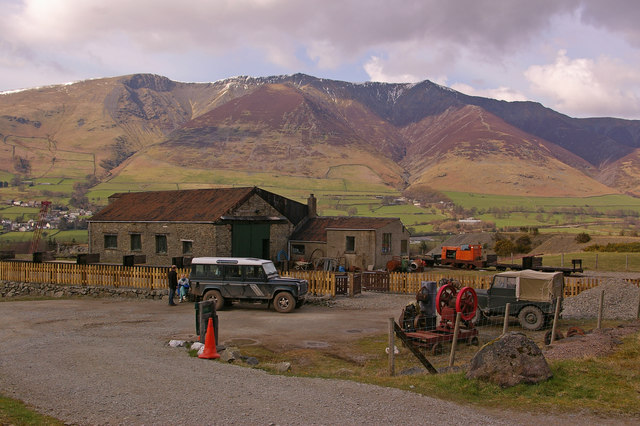
This walk from the village takes you to the Threlkeld Quarry Museum which lies just to the south of the settlement. You can follow footpaths along the Kilnhow Beck and along the River Glenderamackin to reach the quarry. Here you can enjoy a ride on the narrow gauge railway that runs into the old quarry. There's also a collection of historic machinery, such as locomotives and cranes, an underground tour of a realistic mine, a comprehensive geological and mining museum, and mineral panning.
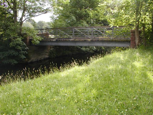
You can extend the walk by heading west along the railway path through the River Greta Valley where there's some lovely views of the surrounding hills.
Postcode
CA12 4SQ - Please note: Postcode may be approximate for some rural locationsThrelkeld Ordnance Survey Map  - view and print off detailed OS map
Threlkeld Open Street Map  - view and print off detailed map
*New* - Walks and Cycle Routes Near Me Map - Waymarked Routes and Mountain Bike Trails>>
Threlkeld OS Map  - Mobile GPS OS Map with Location tracking
Threlkeld Open Street Map  - Mobile GPS Map with Location tracking
Walks near Threlkeld
- Blencathra - This is a fantastic climb to the summit of one of the Lake District's most well known and popular mountains
- Keswick Railway Path - Enjoy an easy cycle or walk along the Keswick Railway Path in the Lake District National Park
- Castlerigg Stone Circle - Visit the Stonehenge of the Lake District on this fascinating circular walk in Keswick.
You can start your walk from the roadside parking spaces at the junction of Eleven Trees and Castle Lane - Latrigg - Climb this popular fell near Keswick on this lovely circular walk in the Lake District National Park
- Great Mell Fell - This walk climbs to Great Mell Fell in the Lake District National Park.
- Gowbarrow Fell - This circular walk visits Aira Force Waterfall before climbing to Gowbarrow Fell above Ullswater Lake
- Mungrisdale - This small village is located in the north eastern corner of the Lake Disitrict.
- Friar's Crag - This short walk in Keswick visits a beautiful viewpoint overlooking Derwentwater
- Walla Crag - This circular walk on Derwentwater climbs to Walla Crag and explores Great Wood in the Lake District
- Catbells from Keswick - Climb to one of the most popular hills in the Lake District on this wonderful walk from the town of Keswick
- Newlands Valley - Enjoy a challenging circular walk around this beautiful, peaceful valley near Keswick
- Keswick to Buttermere Walk - This walk visits Buttermere Lake from the town of Keswick in the Lake District National Park
- Force Crag Mine - This walk visits the historic Force Crag Mine from the Cumbrian village of Braithwaite.
- Keswick Circular Walk - This circular walk from the popular town of Keswick takes you to some of the highlights of this beautiful area of the North Lakes
- Derwent Water - Enjoy a walk along one of the Lake District's most beautiful lakes
- Eycott Hill - This walk visits the Eycott Hill Nature Reserve near Penrith in Cumbria.
Pubs/Cafes
The Horse and Farrier is an historic coaching inn dating to 1688. There's a cosy interior with cartoons around the bar and restaurant area of a previous owner drawn by the famous local artist Wikes.
There's also the Salutation Inn which dates to 1664. Outside there's fine views up to the Blencathra from the lovely south facing garden area. Inside there's a charming interior with flag stone floors, oak beams and roaring log fires. They also do good food and quality accommodation if you need to stay over. You can find the pub at a postcode of CA12 4SQ for your sat navs. It's also dog friendly if you have your four legged friend with you.
Further Information and Other Local Ideas
Just to the east of the village there's the climb to Great Mell Fell. There's a lovely viewpoint here and pleasant woodland areas where you can look out for wildlife including roe deer and green woodpeckers. Gowbarrow Fell and Ullswater Lake are also located in this area.
To the west is Keswick where you can explore the paths around Derwent Water.
Photos
Main street, Threlkeld. The name is of Norse origin and is a combination of thraell, meaning slave or serf, and kelda, meaning a spring or well. Thraell was probably a reference to native Cumbrians subjugated by the incoming Norse.
Threlkeld Quarry Museum. The building is the engine shed, now used to house/restore the locomotives used in the Museum's small railway system. Blencathra is in the background.
Glenderamackin Valley. Looking north from the footpath on the disused railway line (former Keswick to Penrith) towards Gategill Fell. Blencathra has its head in the clouds. The village of Threlkeld can be seen in the middle distance.


