Blencathra Circular Walk
![]()
![]() This is a fantastic climb to the summit of one of the Lake District's most well known and popular mountains. The walk begins at the parking lot in the pretty village of Threlkeld. You then climb Blencathra (or Saddleback) via Scales Fell, Scales Tarn and Sharp Edge. Sharp Edge is a challenging scramble along a narrow crest. Alfred Wainright describes it thus: 'The crest itself is sharp enough for shaving (the former name was razor edge) and can be traversed only a cheval at some risk of damage to tender parts.'
This is a fantastic climb to the summit of one of the Lake District's most well known and popular mountains. The walk begins at the parking lot in the pretty village of Threlkeld. You then climb Blencathra (or Saddleback) via Scales Fell, Scales Tarn and Sharp Edge. Sharp Edge is a challenging scramble along a narrow crest. Alfred Wainright describes it thus: 'The crest itself is sharp enough for shaving (the former name was razor edge) and can be traversed only a cheval at some risk of damage to tender parts.'
From the summit there are fabulous views of the mountains of Galloway, the Southern Uplands, the Border hills, the Cheviots, the Pennines and North Wales. Derwent Water and Thirlmere lakes are also visible.
The walk descends to Knowe Crags and Blease Farm before returning to Threlkeld.
For a shorter/easier walk to the summit please see the Blencathra Easy Route page. This starts from the elevated car park at the Blencathra Field Studies Centre, cutting out some of the ascent.
Blencathra Ordnance Survey Map  - view and print off detailed OS map
Blencathra Open Street Map  - view and print off detailed map
Blencathra OS Map  - Mobile GPS OS Map with Location tracking
Blencathra Open Street Map  - Mobile GPS Map with Location tracking
Pubs/Cafes
Back in Threlkend you can enjoy some well earned refreshments at the noteworthy Salutation Inn. The historic pub dates all the way back to 1664 when it began life as a coaching inn. It's in a great spot with fine views back up to the mountain from the lovely south facing garden area. Inside there's a charming interior with flag stone floors, oak beams and roaring log fires. They also do good food and quality accommodation if you need to stay over. You can find the pub at a postcode of CA12 4SQ for your sat navs. It's also dog friendly if you have your four legged friend with you.
Further Information and Other Local Ideas
The Keswick Railway Path starts/ends at Threlkeld so you can pick this up to continue your walking. The shared cycling and walking trail runs along a disused railway line and is a nice way of reaching the village on foot.
Known as the stonehenge of the Lake District, Castlerigg Stone Circle is also nearby and well worth a visit.
The smaller climb to Latrigg can be picked up just to the north east of Keswick too.
Head south east towards Ullswater and there's two fine climbs in the shape of the National Trust's Great Mell Fell and Gowbarrow Fell. There's excellent views down to the lake from here.
For more walking ideas in the area see the Keswick Walks page.
Cycle Routes and Walking Routes Nearby
Photos
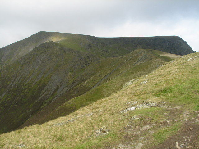
Blencathra's summit as from the ascent via Scales Fell. The dip in the summit ridge, that led to the Fell's alternative name of Saddleback, is well seen from here
Gategill Fell, Blencathra. Looking across from the lower part of Halls Fell. The view comprises the fells around Derwentwater and Newlands.
Halls Fell. Looking down into Doddick Gill and onto the Doddick Fell, another of Blencathra's ridges. Great Mell Fell can be seen across the valley.
Skiddaw from Blencathra. Looking westwards from near the summit. The fells are (from the left) Lonscale Fell (NY2827), Little Man (NY2627) and Skiddaw (NY2629). They are now almost free of snow as this shot was taken in late March 2010. The enclosures in the Glenderaterra valley (NY2927 & 2928) can be seen in the middle distance.


