Wincle Walks

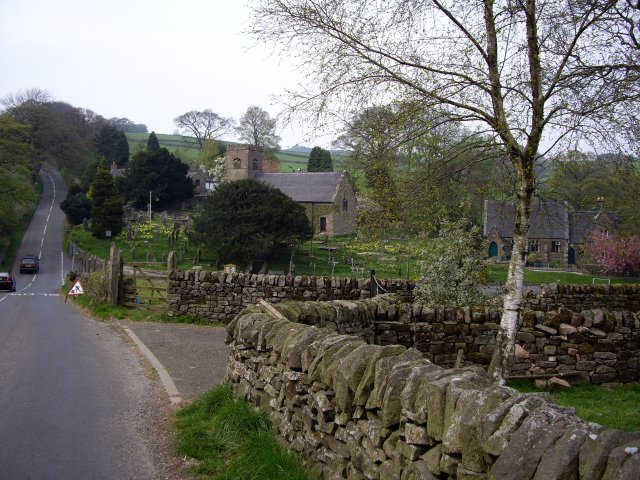
 With an excellent local pub and some fine Peak District scenery this little village is a fine place to start a walk.
This walk from the village visits the Wincle Brewery, the River Dane, Gradbach, Lud's Church and Three Shires Head.
The walk starts from The Ship Inn in Wincle. From here it's a short walk south east to the brewery. The site includes a small shop and tasting room where you can sample some of the 'eccentric' ales brewed here. Near the brewery you cross the river and pick up the Dane Valley Way and follow the waymarked footpath east along the river to Gradbach.
The route continues north to visit one of the highlights of the area at Three Shires Head. This is a point on Axe Edge Moor where the counties of Cheshire, Derbyshire and Staffordshire meet. Here you will also find a Grade II-listed packhorse bridge over the River Dane.
You then retrace your steps to Gradbach where you can explore the wonderful Lud's Church. From here you continue west to Hangingstone Farm before crossing the river at Danebridge and returning to the pub in Wincle.
Postcode
SK11 0QE - Please note: Postcode may be approximate for some rural locationsWincle Ordnance Survey Map  - view and print off detailed OS map
Wincle Open Street Map  - view and print off detailed map
Wincle OS Map  - Mobile GPS OS Map with Location tracking
Wincle Open Street Map  - Mobile GPS Map with Location tracking
Walks near Wincle
- Dane Valley Way - Follow the River Dane through Derbyshire and Cheshire on this fabulous walk from Buxton to Middlewich.
Highlights on the route include the wonderful Three Shires Head where the counties of Cheshire, Derbyshire and Staffordshire meet - Gradbach - This little hamlet in the Peak District is an ideal place to start a walk with several Peak District highlights nearby
- Lud's Church - This walk visits the fascinating deep chasm of Lud's Church on the edge of the Staffordshire Peak District
- Three Shires Head - Explore this beautiful section of the Dane Valley and enjoy rivers, old stone bridges and waterfalls on this lovely walk in the Peak District.
Three Shires Head is a point on Axe Edge Moor where the counties of Cheshire, Derbyshire and Staffordshire meet - The Roaches - This circular walk is one of the most popular in the Peak District and a favourite for many
- Hen Cloud - Enjoy a short climb to Hen Cloud on this walk in the Staffordshire Peak District
- Axe Edge Moor - This expansive area of moorland near Buxton has some fine walking trails to try
- Cheeks Hill - This circular walk climbs to Cheeks Hill on Axe Edge Moor in the Peak District National Park.
- Buxton - The popular spa town of Buxton has a number of waymarked trails taking you though this beautiful area of the Peak District
- Bosley Cloud - This short circular walk visits the Bosley Cloud hill, near Congleton, on the edge of the Peak District
- Bosley Locks - This waterside walk visits the impressive Bosley Locks on the Macclesfield Canal in Cheshire.
- Bosley Reservoir - This reservoir in the Cheshire village of Bosley has a nice waterside walking trail running along it's southern and eastern shore
Pubs/Cafes
The Ship Inn is a nice place for some post walk refreshment. They have a fine menu with open log fires indoors and a nice garden area for warmer days. The building dates all the way back to the 16th century.
Dog Walking
The woods, river and country trails make for a fine dog walk. The Ship mentioned above is also very dog friendly with doggy dinners available.
Further Information and Other Local Ideas
Head west from the village and you can enjoy a climb to Wincle Minn for fine views over the area. To the south there's another major local highlight at The Roaches.
For more walking ideas in the area see the Staffordshire Walks, Peak District Walks and White Peak Walks pages.


