Windrush Way

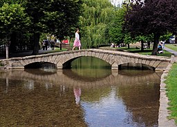
 This lovely walk through the Cotswolds runs from Bourton on the Water to Winchcombe. The path follows the River Windrush to Naunton and proceeds through Hawling and onto Winchcombe. Walk highlights are the easy riverside walking paths and the 15th century, Sudeley Castle with its beautiful, award winning gardens and lovely chapel.
At the western end of the walk the route links up with the Winchcombe Way which can be used to further explore the area.
Windrush Way Ordnance Survey Map  - view and print off detailed OS map
Windrush Way Open Street Map  - view and print off detailed map
Windrush Way OS Map  - Mobile GPS OS Map with Location tracking
Windrush Way Open Street Map  - Mobile GPS Map with Location tracking
Pubs/Cafes
In Bourton head to The Mousetrap Inn for some refreshments. The pub does excellent food and also has its own art gallery with landscape paintings in oil by local artist Silvi Schaumloeffel. There's a cosy, attractive interior with a log fire while outside there's a garden area for warmer days. You can find the inn at Lansdowne with a postcode of GL54 2AR for your sat navs. The pub is also dog friendly if you have your canine friend with you.
Further Information and Other Local Ideas
We'd recommend a visit to the Cotswold Motoring Museum or Birdland in Bourton. They are two of the most popular attractions in the area and well worth a visit if you have time.
For a longer walk along the trail try the Windrush Way Circular Walk. This uses the trail and several other waymarked paths to create a circular route around the area. You'll return to Bourton using parts of the Gloucestershire Way, the Warden's Way and the Heart of England Way passing the picturesque villages of Guiting Power, Naunton and The Slaughters on the way.
For more walking ideas in the area see the Gloucestershire Walks and the Cotswolds Walks pages.
Cycle Routes and Walking Routes Nearby
Photos
The trail near Hawling. The Windrush Way briefly shares the carriageway in the foreground before going south to the right just beyond the signage. The telegraph pole is 18 metres to the west of the eastern edge of this square. The next square east starts just past the entrance to the Way at the right.
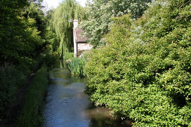
River Windrush, Naunton. As the river Windrush flows through Naunton the village's main street is actually lower than the bed of the river.
Cold Aston river view. The River Windrush is a tributary of the River Thames. From its source near Winchcombe in Gloucestershire, it travels 65 km (40 mi) through Burford and Witney before joining with the Thames at Newbridge in Oxfordshire. The Gloucestershire village of Windrush is named after the river.
Near Hawling. The Windrush Way briefly shares the carriageway in the foreground before going south to the right just beyond the signage. The telegraph pole is 18 metres to the west of the eastern edge of this square. The next square east starts just past the entrance to the Way at the right.
Aylworth barn. Both the footpath and the bridleway forming the combined Windrush Way and the Diamond Way long distance paths cross this minor road from Notgrove to Guiting Power. The footpath runs along the drive of this converted barn and joins up with the bridleway which has crossed the road a little higher up the hill.


