Grand Western Canal

 This splendid waterside walk takes you from Tiverton in Devon to Taunton in Somerset.
The first section of the walk takes you from Tiverton to Greenham along the towpath through the Grand Western Canal Country Park. At Greenham you join the West Deane Way and the walk changes as you start following the dry bed of the canal.
However, the waterside aspect continues as you also join the River Tone which takes you through Bradford on Tone and then onto the finish point in Taunton.
To continue your waterside walking in the Tiverton area you can pick up the Exe Valley Way which runs through the town. You could follow the riverside path south to Brampford Speke and Bickleigh where you'll find the 18th century Bickleigh Mill.
Postcode
EX16 4HX - Please note: Postcode may be approximate for some rural locationsGrand Western Canal Ordnance Survey Map  - view and print off detailed OS map
Grand Western Canal Open Street Map  - view and print off detailed map
Grand Western Canal OS Map  - Mobile GPS OS Map with Location tracking
Grand Western Canal Open Street Map  - Mobile GPS Map with Location tracking
Pubs/Cafes
At the Tiverton end, in the country park, there's The Canal Tea Rooms & Garden to visit. They're in a lovely location and have a delightful garden area next to the canal. They have a good menu with a particularly delicious cream tea option.
At the other end of the route in Taunton there's The Ring of Bells. They serve good quality food and have a large sunny garden for summer days. You can find them at 16-17 St James Street with postcode TA1 1JS for your sat navs.
Dog Walking
The towpath is a nice place to walk your dog. The tea rooms and pub mentioned above are also dog friendly.
Cycle Routes and Walking Routes Nearby
Photos

The Grand Western Canal near Tiverton

By Ayshford Court

The canal from Greenway Bridge

Manley Bridge. With the towpath it forms part of the Grand Western Canal Country Park and provides an 11-mile walking route from Lowdwells to Tiverton, plus a further section into Somerset where the canal no longer holds water.

Ayshford Chapel and Court

Field by the Canal at Sampford Peverell.

Burlescombe. Behind the camera the canal has crossed a shallow valley on embankment running east-south-east; it turns to run north-north-east and in the distance is Burlescombe church. Had the original main line to Exeter been built, this is where it would have junctioned with the Tiverton branch. The Taunton-Exeter railway, which eclipsed the canal, runs nearby

Moorings. Cruisers moored along the canal east of East Manley bridge. These are the only permanent moorings along this short 11 mile stretch of the canal, although visiting boats can moor overnight away from the horseboat route. The canal originally was extended to Taunton to join the Bridgewater Canal, but it was financially unprofitable and the centre part was abandoned after the canal was purchased in 1865 by the Bristol & Exeter Railway (the GWR).
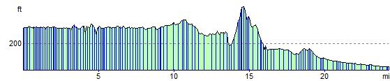
Elevation Profile