Donington on Bain River Circular Walk with OS Map
![]()
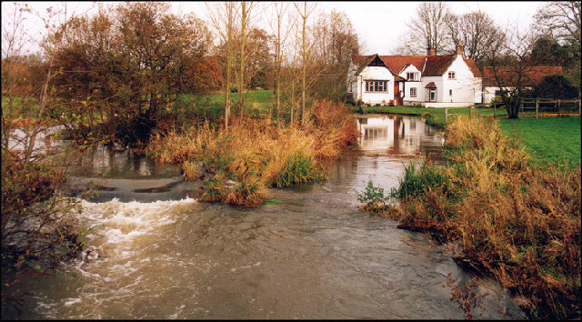
![]() This pretty village is located in the Lincolnshire Wolds AONB, on the banks of the River Bain. It's a great place to start a walk with some beautiful countryside, river views, a 12th century church and a fine 18th century pub to relax in afterwards.
This pretty village is located in the Lincolnshire Wolds AONB, on the banks of the River Bain. It's a great place to start a walk with some beautiful countryside, river views, a 12th century church and a fine 18th century pub to relax in afterwards.
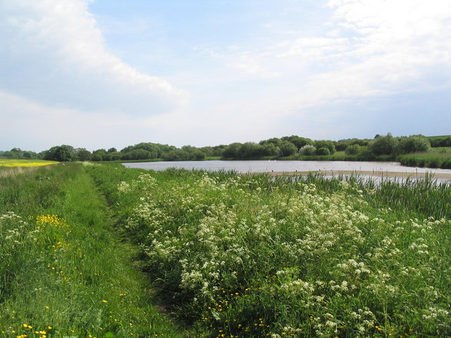
This circular walk from the village first heads north along a section of the Viking Way to Biscathorpe where you will find the site of a deserted medieval village. This opening section follows the River Bain, passing a small lake on the way.
The route then heads east to Gayton le Wold, passing Gayton Manor on the way. You then follow some country trails south through farmland before turning east back to the village.
Postcode
LN11 9TJ - Please note: Postcode may be approximate for some rural locationsDonington on Bain Ordnance Survey Map  - view and print off detailed OS map
Donington on Bain Open Street Map  - view and print off detailed map
*New* - Walks and Cycle Routes Near Me Map - Waymarked Routes and Mountain Bike Trails>>
Donington on Bain OS Map  - Mobile GPS OS Map with Location tracking
Donington on Bain Open Street Map  - Mobile GPS Map with Location tracking
Walks near Donington on Bain
- Louth Canal - Enjoy a waterside walk along the Louth Canal from Louth to Tetney Marshes
- Horncastle - This walk takes you along the old Horncastle Canal and the River Bain from the town centre of this Lincolnshire town.
- Market Rasen - This Lincolnshire based town is located in the West Lindsey district of the county
- Hubbard's Hills - This area of natural beauty in Louth is a lovely place for an afternoon stroll
- Alford - This small market town is located in a lovely spot on the edge of the Lincolnshire Wolds AONB
- Snipe Dales Country Park - Explore 220 acres of country park and nature reserve in the beautiful Lincolnshire Wolds
- Chambers Farm Wood - Enjoy a series of peaceful walking trails in this forest and nature reserve in Wragby
- Woodhall Spa - Woodhall Spa is a very attractive former spa town on the edge of the Lincolnshire Wolds
- Tealby - This pretty village near Market Rasen is surrounded by some lovely rolling Lincolnshire Wolds countryside
- Willingham Woods - These woods near Market Rasen have miles of good footpaths and cycling trails to try.
- Covenham Reservoir - Enjoy a circular walk around this pretty reservoir and along the Louth Canal on this waterside walk in Lincolnshire.
- Belchford - This pretty village lies in the Lincolnshire Wolds, an Area of Outstanding Natural Beauty
- Hagworthingham - This small Lincolnshire village is located in the East Lindsey district near Horncastle
- Biscathorpe - This Lincolnshire Wolds walk takes you from the medieval village at Biscathorpe to another medieval site at nearby Wykeham
- Binbrook - This pretty village is located in the East Lindsey district of Lincolnshire near to the town of Market Rasen.
- Kirkby On Bain - This riverside Lincolnshire village sits in a peaceful rural spot near Horncastle, Woodhall Spa and Coningsby
- Goulceby - Goulceby is a Lincolnshire Wolds village located in the East Lindsey district of the county.
Pubs/Cafes
Head to the Black Horse Inn for some post walk refreshment. The 18th century inn serves high quality food and has a good selection of ales. They also have a nice garden area for warmer days. You can find them on the Main Road with postcode LN11 9TJ for your sat navs.
Dog Walking
The country trails make for a fine dog walk. The Black Horse Inn mentioned above is also dog friendly.
Further Information and Other Local Ideas
Head just a few miles to the east and you can enjoy another nice waterside walk along the Louth Canal. Near here there's also some lovely scenery and fine walking trails in the Hubbard's Hills.
Head south to Goulceby and you could visit the unique landscape of the splendid Red Hill Nature Reserve. There's a steep chalk escarpment with wonderful views and some rare plants and flowers to see here.
For more walking ideas in the area see the Lincolnshire Walks page.


