Tealby Walesby Circular Walk
![]()
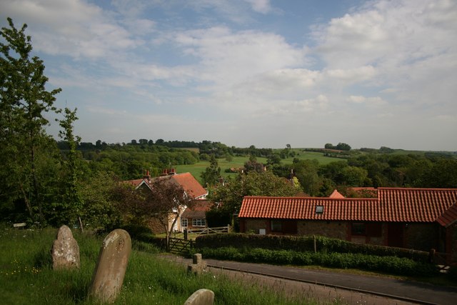
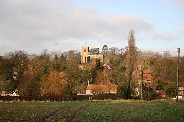
![]() This pretty village near Market Rasen is surrounded by some lovely rolling Lincolnshire Wolds countryside. The historic settlement also includes a noteworthy 12th century church and a thatched pub dating back to the 14th century.
This pretty village near Market Rasen is surrounded by some lovely rolling Lincolnshire Wolds countryside. The historic settlement also includes a noteworthy 12th century church and a thatched pub dating back to the 14th century.
This circular walk from the Tealby takes you to neighbouring Walesby before exploring the woodland trails in Willingham Woods.
The walk starts in the village centre where you can pick up the Viking Way. Follow the waymarked trail north west and it will take you through the countryside to Bedlam Woods, Castle Farm and Risby Manor Farm before arriving at Walesby. The village includes a notable church known as the "Ramblers Church" as it features a 1951 stained glass window detailing walkers and cyclists.
From Walesby you continue west along a country lane before turning south along a bridle track. This will take you through the woodland of the Middle Rasen Plantation, Nova Scotia Bridge and across Walesby Moor to Willingham Woods. The woods are great for cycing and walking with miles of trails to try. There's also pretty ponds and wildlife including woodland birds and deer to look out for here.
From the woods you can pick up a footpath heading east along the River Rase which will take you back to Tealby.
Tealby Ordnance Survey Map  - view and print off detailed OS map
Tealby Open Street Map  - view and print off detailed map
*New* - Walks and Cycle Routes Near Me Map - Waymarked Routes and Mountain Bike Trails>>
Tealby OS Map  - Mobile GPS OS Map with Location tracking
Tealby Open Street Map  - Mobile GPS Map with Location tracking
Pubs/Cafes
Back in the village head to the King's Head for some post walk refreshments. Dating from 1367 the inn is notable as the oldest thatched pub in Lincolnshire. Inside there's a charming interior with a cosy lounge and a restaurant. Outside there's a lovely large garden area to relax in on warmer days. You can find them at 11 Kingsway with a postcode of LN8 3YA for your sat navs.
Dog Walking
The country and woodland trails on the walk are ideal for dogs. The King's Head mentioned above is also dog friendly.
Further Information and Other Local Ideas
To continue your walking in the area follow the Viking Way south east to visit Ludford and the medieval village of Wykeham.
The epic Lindsey Trail passes through the village. This circular cycling and walking route follows a bridleway around the Lincolnshire Wolds AONB. The route runs for over 70 miles and visits nearby Willingham Woods and Market Rasen.
Head a few miles to the south east and you could visit the worthy village of Donington on Bain. Here you'll find a 12th century church, a fine 18th century pub and nice views of the River Bain. Near here there's also Biscathorpe and East Wykeham where there are the sites of two deserted medieval villages to explore.
To the east is Binbrook where there's some nice bridle paths through the Wolds.
For more walking ideas in the area see the Lincolnshire Walks page.


