Morley Walks - Near and Around
![]()
![]() This West Yorkshire town is located close to Leeds and Wakefield. The Leeds Country Way long distance trail passes the town providing an opportunity for walkers to explore the woodland and countryside of the area.
This West Yorkshire town is located close to Leeds and Wakefield. The Leeds Country Way long distance trail passes the town providing an opportunity for walkers to explore the woodland and countryside of the area.
This walk from the town follows a section of the Leeds Country Way and the Kirklees Way to Ardsley Reservoir at West Ardsley, just south of the town. You can pick up the waymarked footpath to the west of the town at Bruntclife. Follow the path south past Birkby Brow Wood and along the Howley Beck to Upper Bartley. The route continues south east past Howley Hall Golf Course to West Ardsley and the reservoir. There's a nice circular waterside path to follow around the lake with good views of the surrounding countryside.
For more details on the history, buildings and transport links in the town see the informative wikipedia page.
Postcode
LS27 8AG - Please note: Postcode may be approximate for some rural locationsMorley Ordnance Survey Map  - view and print off detailed OS map
Morley Open Street Map  - view and print off detailed map
Morley OS Map  - Mobile GPS OS Map with Location tracking
Morley Open Street Map  - Mobile GPS Map with Location tracking
Walks near Morley
- Ardsley Reservoir - This circular walk takes you around Ardsley Reservoir in East Ardsley, near Tingley in Leeds
- Ossett - This West Yorkshire market town is located in the Wakefield area of the county
- Pugneys Country Park - This 250 acre park contains two lakes with pleasant waterside footpaths
- Newmillerdam Country Park - Enjoy cycling and walking paths in this country park in Wakefield
- Wintersett Reservoir - This pretty reservoir near Wakefield has a nice walking trail running along the western side of the water
- Anglers Country Park - Enjoy a peaceful walk or cycle around this pretty country park in Wakefield
- Nostell Priory - Explore 300 acres of parkland and gardens surrounding this 18th-century treasure house near Wakefield
- Wakefield Canal - Follow the Wakefield Branch of the Aire and Calder Navigation Canal from Wakefield to Castleford on this waterside walk in West Yorkshire
- Barnsley Canal - Enjoy a waterside walk or cycle along the Barnsley Canal on this easy route near Royston
- Fitzwilliam Country Park - Enjoy a short circular walk or cycle along the network of way-marked paths in this pretty country park in the Wakefield area of Yorkshire
- Hemsworth Water Park - Enjoy a short stroll along the lakes in this lovely park near Wakefield
- Nostell Priory - Explore 300 acres of parkland and gardens surrounding this 18th-century treasure house near Wakefield
- Ryburn Reservoir and Baitings Reservoir - This walk visits these two pretty reservoirs near Rishworth in West Yorkshire
- Walton Hall Park - A walk around the pretty parkland surrounding Walton Hall in Wakefield
- Ossett - This West Yorkshire market town is located in the Wakefield area of the county
- Leeds Canal Walk - Enjoy a stroll from Leeds city centre to Kirkstall and Shipley on this waterside walk along the Leeds & Liverpool Canal
- Wakefield - This Yorkshire town is a great base for walkers with numerous local parks, canalside trails, several nearby reservoirs and riverside paths along the Calder.
Photos
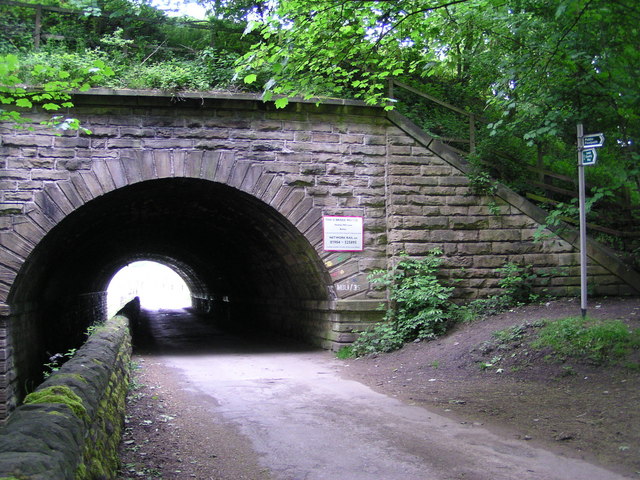
Howley Mill Viaduct on Kirklees Way, Upper Batley The Leeds to Manchester railway line passes over Howley Mill Lane, and Howley Beck, which lies to the left of the narrow road. The footpath sign on the right shows the path to both Howley Hall, which here is the Leeds Country Way meeting the Kirklees Way.


