North Bovey Walks

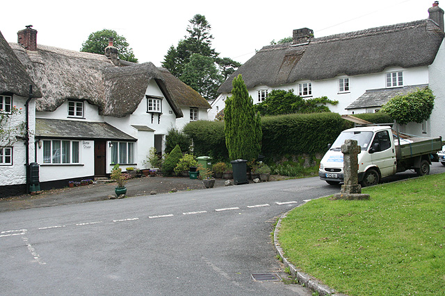
 This attractive Devon based village is located on the south-eastern side of the Dartmoor National Park, just south of Moretonhampstead.
The village is located on the Dartmoor Way, a long distance footpath running to many of the walking highlights of the National Park. There's some nice countryside trails and views of the River Bovey which runs through the area.
Historic local highlights include the ancient church which dates to the 14th century, a notable 13th century pub for refreshments and Grimspound, a Bronze Age Settlement located to the south west.
This little circular walk takes you around the village, visiting the ancient cross and the ford on the river. To continue your walking in the area head south east to visit the popular Lustleigh Cleave. Just to the north west is the Bovey Castle Hotel where you can enjoy a delicious cream team and then a stroll around the attractive grounds.
Please scroll down for the full list of walks near and around North Bovey. The detailed maps below also show a range of footpaths, bridleways and cycle paths in the area.
Postcode
TQ13 8RB - Please note: Postcode may be approximate for some rural locationsNorth Bovey Ordnance Survey Map  - view and print off detailed OS map
North Bovey Open Street Map  - view and print off detailed map
North Bovey OS Map  - Mobile GPS OS Map with Location tracking
North Bovey Open Street Map  - Mobile GPS Map with Location tracking
Walks near North Bovey
- Moretonhampstead - This small Devon town is often described as the gateway to the Dartmoor National Park making it a fine place to start a walk
- Dartmoor Ramble - A wonderful circular walk around the fascinating Dartmoor National Park with plenty of lovely riverside walking and some challenging climbs.
The walk starts near the car park at Bellever and first follows the East Dart River through Postbridge and on to Sittaford Tor where you will pass the historical Grey Wethers Stone Circle - Fingle Bridge to Clifford and Steps Bridge Walk - A woodland walk along the River Teign from Fingle Bridge to Steps Bridge via Clifford Bridge
- Fingle Bridge and Woods - Explore the delightful woods around Fingle Bridge and visit the Iron Age Hill Fort of Wooston Castle on this woodland walk in Dartmoor
- Castle Drogo - Explore the delightful gardens and wider estate surrounding this country house in Drewsteignton, Devon.This is one of the classic circular walks in Dartmoor taking you from Castle Drogo to Fingle Bridge along the wonderful Hunters Path
- River Teign Walk - This walk explores the beautiful Teign Valley, following the River Teign from its source on Dartmoor to Shaldon on the Devon coast
- Lustleigh Cleave - The village of Lustleigh is in a nice position for exploring a lovely part of the Dartmoor National Park
- Kennick Reservoir - This walk visits Kennick Reservoir and its surrounding woodlands, in the Dartmoor National Park
- Trenchford and Tottiford Reservoir - Enjoy an easy walk around these two pretty reservoirs in the Dartmoor National Park
- Becky Falls - This is a circular walk in the Dartmoor's Bovey Valley visiting the beautiful Becky Falls and other local landmarks, beauty spots and villages
- Mardon Down - Climb to Mardon Down on Dartmoor and enjoy wonderful far reaching views over the surrounding area
- Grimspound - This circular walk on Dartmoor, visits the fascinating Bronze Age Settlement of Grimspound
- Bovey Tracey - The town of Bovey Tracey sits in a fine walking location on the edge of the Dartmoor National Park
- Scorhill Stone Circle - This walk visits the Scorhill Stone Circle and the Wallabrook Clapper Bridge in the Teign Valley of Dartmoor.
- Wray Valley Trail - This shared cycling and walking trail runs along a dismantled railway line from Moretonhampstead to Bovey Tracey in Devon.
- Bowermans Nose - This popular circular walk climbs to Bowerman's Nose in the Dartmoor National Park
- Bovey Castle - This walk visits Bovey Castle, a Grade II listed mansion in the Dartmoor National Park.
Pubs/Cafes
The Ring of Bells is an historic thatched pub dating back to the 13th century. They have a lovely large garden area with views of the surrounding moorland. There's also a charming old interior with a 15th-century arched door frame, oak doors, low ceilings with beams, open fireplaces and a grandfather clock built into a wall. They serve good food and a fine selection of ales. You can find them at postcode TQ13 8RB for your sat navs. The inn is dog friendly.


