Shaftoe Crags
![]()
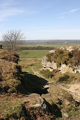
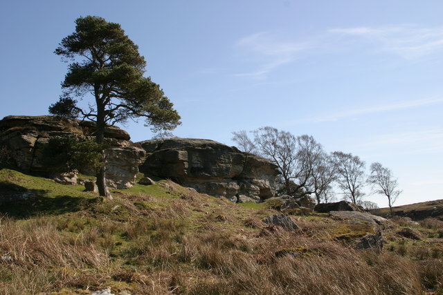
![]() Climb to Shaftoe Crags and enjoy far ranging views over the Northumberland countryside on this circular walk near Morpeth. The area is geologically significant with a number of interesting rock formations including the Devil's Punchbowl. The crags reach a height of nearly 700ft. From this elevated position the views over the surrounding area are magnificent, with the Northumbrian coast visible on a clear day. There are also evidence of ancient occupation with a number of Iron Age burial mounds.
Climb to Shaftoe Crags and enjoy far ranging views over the Northumberland countryside on this circular walk near Morpeth. The area is geologically significant with a number of interesting rock formations including the Devil's Punchbowl. The crags reach a height of nearly 700ft. From this elevated position the views over the surrounding area are magnificent, with the Northumbrian coast visible on a clear day. There are also evidence of ancient occupation with a number of Iron Age burial mounds.
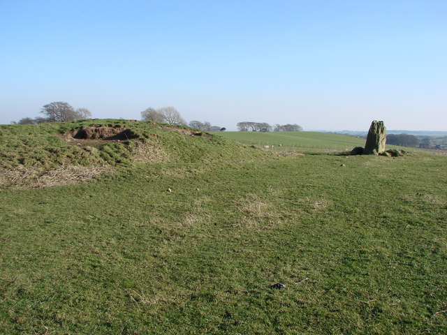
The crags are located just west of Bolam Lake Country Park so you could continue your walking here. There's an old standing stone and Tumulus between the crags and the lake which you'll pass on the way. You could also start the walk from the country park and cross the moorland to the crags. A short distance to the north west you will find the National Trust's Wallington Hall where there's lakes, woodland, parkland and a beautiful walled garden. You can also pick up the circular Wannie Line Walk along the old railway lines here.
Postcode
NE61 4AD - Please note: Postcode may be approximate for some rural locationsShaftoe Crags Ordnance Survey Map  - view and print off detailed OS map
Shaftoe Crags Open Street Map  - view and print off detailed map
*New* - Walks and Cycle Routes Near Me Map - Waymarked Routes and Mountain Bike Trails>>
Shaftoe Crags OS Map  - Mobile GPS OS Map with Location tracking
Shaftoe Crags Open Street Map  - Mobile GPS Map with Location tracking
Explore the Area with Google Street View 
Pubs/Cafes
Head a short distance east from the Crags and you can enjoy a bite to eat at the Bolam Lake Cafe. It is situated next to the Boathouse Wood Car Park, to the north of the lake.
Another good option is to head north from the crags to the village of Middleton. Here you can visit the popular Ox Inn which has a good menu and an outdoor seating area for fine days. You can find it in the village with a postcode of NE61 4QZ for your sat navs.
Dog Walking
The crags are a popular place for a dog walk and the Bolam Lake cafe mentioned above is also dog friendly.
Further Information and Other Local Ideas
The delightful villages of Elsdon and Otterburn are well worthy of a visit. The former includes an ancient church, a large village green, the remains of the old motte and bailey castle and a noteworthy Pele tower. The latter has nice trails along the pretty Otter Burn and the historic Otterburn Hall with its fine architecture and deer park.
Cycle Routes and Walking Routes Nearby
Photos
Salter's Nick, Shaftoe Crags. The old drove road from Scotland to Newcastle via Elsdon passed through this gap.


