Snowdonia Cycle Routes

The Snowdonia National Park has numerous signed cycle routes taking you to some of the most spectacular scenery in the country. With challenging climbs, lakeside trails, exhilarating forest mountain bike trails and several easier off road paths, it's a great place to explore by bike.
Use the links to view full route information including elevation profiles, interactive maps and GPS downloads.
You can also view an overview map of all the routes in the using the Snowdonia Cycle Map>>

Lon Las Ogwen - A traffic free trail running from the coast at Bangor to Llyn Ogwen through the valley of Afon Cegin .

| Route Name | Photo | Distance | Description |
| Bala Lake | 6 miles (9 km) | Enjoy a cycle ride along the beautiful Bala Lake. The route starts on the foreshore in Bala by the visitor centre. It then runs along the southern side of the lake to Llanuwchllyn where you can catch the splendid Bala Lake railway back to Bala. There are super views of the crystal clear lake and of the surrounding Mountains of Snowdonia. View Full Details>> | |
| Barmouth to Machynlleth | 25 miles (40 km) | Travel from Barmouth to Machynlleth along National Cycle 8 route through Snowdonia. You start in Barmouth on the sea front and then cross the Barmouth Bridge over the Afon Mawddach river. The route then joins the traffic free Mawddach Trail taking you along the Mawddach estuary to Dolgellau. You then head south through Snowdonia passing through the villages of Aberllefenni and Corris and enjoying some wonderful scenery as you go. The first part of this section takes place on off road trails before you join an on road section that runs along the River Dulas and into Machynlleth. View Full Details>> | |
| Barmouth to Tywyn | 31 miles (50 km) | Travel from Barmouth to Tywyn along National Cycle Route 8 route through the incredibleSnowdonia National Park and enjoy some stunning views. You start in Barmouth crossing the Barmouth Bridge over the Afon Mawddach river. You then join the traffic free Mawddach Trail taking you along the Mawddach estuary to Dolgellau. The route then turns south on country roads and traffic free paths through the Snowdonia National Park. Highlights on this section are the wonderful views of the Cader Idris mountain and Bird's rock. You finish with an on road section into the coastal town of Tywyn, finishing near the train station. View Full Details>> | |
| Beddgelert Forest | 3 miles (5 km) | This large forest is located near the village of Beddgelert in the Snowdonia National Park. In it you will find miles of walking paths and great mountain bike trails. There are great views towards Snowdon and a nice path around the lovely Llyn Llewellyn. The Welsh Highland Railway also runs through the forest so look out for the fine steam trains as you go. View Full Details>> | |
| Coed Y Brenin Forest Park | 5 miles (8 km) | This large forest in Snowdonia is fantastic for both cycling and walking. For walkers there are 4 well devised, all ability trails taking place on wide well maintained paths. The trails take you along the Afon Eden on a sculpture lined riverside path and along a disused tramway to the old Copper processing mill. If you're looking for more strenuous walking then you can pick up one of the 3 difficult routes. The waterfall trail takes you to the confluence of the Afon Gain and Mawddach with their twin waterfalls. The mountain trail climbs to the Mynydd Penrhos ridge with spectacular views of the surrounding area. Cyclists can follow a National Cycle Network trail which runs through the park. There are also a number of graded mountain bike trails. Depending on your ability and experience you can follow the blue moderate trail for a good introduction to singletrack mountain biking. The red trails are more difficult while the black (severe) trails are for the experienced mountain biker. There are 7 trails in all plus an easy forest road trail that follows the Mawddach river valley. This one is good for families looking for a more relaxing ride! The circular route below starts near the visitor centre and takes you along the National Cycle Network trail and a riverside track. It's suitable for both walkers and cyclists. View Full Details>> | |
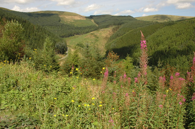
| Dyfi Forest | 7 miles (11 km) | This expansive forest is located in the Dyfi Valley area of the Snowdonia National Park. View Full Details>> | |
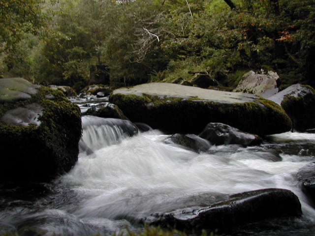
| Gwydyr Forest | 7 miles (11.2 km) | This large area of woodland encircles the popular village of Betws-y-Coed in the Snowdonia National Park. There's miles of footpaths and mountain bike trails with lots of pretty streams, rivers, waterfalls, hills and lakes to see. This long circular route takes you around the area immediately surrounding Betws-y-Coed, following a series of trails to Llyn Elsi, Rhiwddolion, Pentre Du, the Miners Bridge over the River Llugwy and the Clogwyn Cyrau Nature Reserve to the north of the village. The forest stretches for miles so there's huge scope for extending your exercise. Just off this route there is the option of visiting Swallow Falls and Fairy Glen. There's lovely waterside walking here with lots of pretty waterfalls to see. If you head to the northern end of the forest there's several beautiful reservoirs to visit including Llyn Cowlyd, Llyn Crafnant and Llyn Geirionydd. These reservoirs have some lovely circular walking trails with wonderful views of the Carneddau mountains. Near Llyn Geirionydd there's also the delightful Fairy Falls in the village of Trefriw. View Full Details>> | |
| Llanberis Pass | 3 miles (5 km) | This challenging climb in the Snowdonia National Park passes between the mountain ranges of the Glyderau and the Snowdon massif. The ride starts from the car park at Nant Peris and follows the A4086 to Pen-y-Pass. It's about a 3 mile ride (6 miles return journey) with stunning views and a high point of about 1180ft (359 metres). At Pen-y-Pass you can enjoy refreshment at the cafe before turning round and descending back to Nant Peris. You can follow the route by using the google street view link below. It'll give you a good idea of the climbing involved and the scenery you can enjoy on the route. View Full Details>> | |
| Llyn Cwm Bychan | 1 miles (2 km) | Enjoy a short walk or cycle along this pretty lake in the Rhinogs. The lake is one of the sources of the River Artro which flows south westwards through Llanbedr and onwards to the sea. There is a car park at the eastern end of the lake where you can pick up the lakeside trail. It's a good surfaced track, ideal for an easy walk or cycle. The lake is surrounded by hills, rocky outscrops and interesting flora and fauna. If you would like to continue your walking in the area then you could climb Rhinog Fawr for great views over Snowdonia. View Full Details>> | |
| Llyn Trawsfynydd | 8 miles (12.5 km) | Enjoy a long circular walk or cycle around this large lake in in Gwynedd, North Wales. With a total surface area of 4.8 km˛ (1,180 acres) the reservoir is slightly bigger than Wales's largest natural lake, Llyn Tegid (Bala Lake). It's a beautiful spot with lots of wildlife to look out for including Otters, Osprey and rare birds in the woodland sections. Most of the route is suitable for both cyclists and walkers. If you are on a bike please go around the footbridge on the roads though. This trail uses a mixture of footpaths, country lanes and road-side pavements to take you on a tour of the lake and its surrounding countryside. The route starts in the village of Trawsfynydd and heads west to the water where you cross the lake on the footbridge. There's great views in all directions as you cross the narrow bridge. The path then climbs through the woodland and countryside on the western side of the water. This section is quite challenging with the path reaching a height of almost 1000ft (300m). From the high points there are great views over the water to the surrounding hills and mountains of Snowdonia. You then pass along the northern section of the lake, passing the pumping station and the visitor centre. Here you can enjoy refreshments at the cafe which overlooks the water. The final section takes you along the eastern side of the lake on footpaths and pavement during the roadside section along the A470. If you would like to do a shorter route which avoids the roadside section then start from the visitor centre and head west to the dam and then south along the paths on the western side of the water. This is a shared walking and cycle path with bike hire available at the visitor centre. If you would like to continue your walking in the area you could head west and climb to the fascinating stone circle at Bryn Cader Faner or the nearby Foel Penolau in the Rhinogydd range. The Taith Ardudwy Way long distance trail can be picked up near here too. View Full Details>> | |
| Lon Eifion | 11 miles (18 km) | This splendid cycling and walking trail runs along a disused railway path from Caernarfon to Bryncir on the edge of the Snowdonia. It's a good surfaced traffic free path making it ideal for a safe family cycle or a leisurely walk. There are lovely views of the surrounding Welsh Countryside and mountains such as Yr Eifl (or the Rivals) and Snowdon. The route runs alongside the Welsh Highland Railway so you should also see some wonderful steam trains as you go. The route starts at Caernarfon at the impressive Caernarfon Castle, and heads south through the town, crossing the River Seiont on the way. You continue to Llanwnda and Groeslon where you pass the lovely Glynllifon Country Park. It's well worth taking a short detour from the path and visiting the park with its woodland, gardens, parkland and river. There is also a cafe, a maze and exhibits such as steam power pistons restored by Fred Dibnah. The route continues through Penygroes before the final stretch takes you to the finish point at the little village of Bryncir. View Full Details>> | |
| Lon Gwyrfai | 4 miles (7 km) | This shared cycling and walking route runs for just over 4 miles between Rhyd Ddu and Beddgelert in the Snowdonia National Park. View Full Details>> | |
| Lon Las Menai | 4 miles (6.3 km) | This traffic free cycle path runs along a dismantled railway line from Caernarfon to Y Felinheli in Gwynedd. View Full Details>> | |
| Lon Las Ogwen | 11 miles (17.4 km) | This lovely cycle route runs from the coast at Bangor to Llyn Ogwen in the Snowdonia National Park. View Full Details>> | |
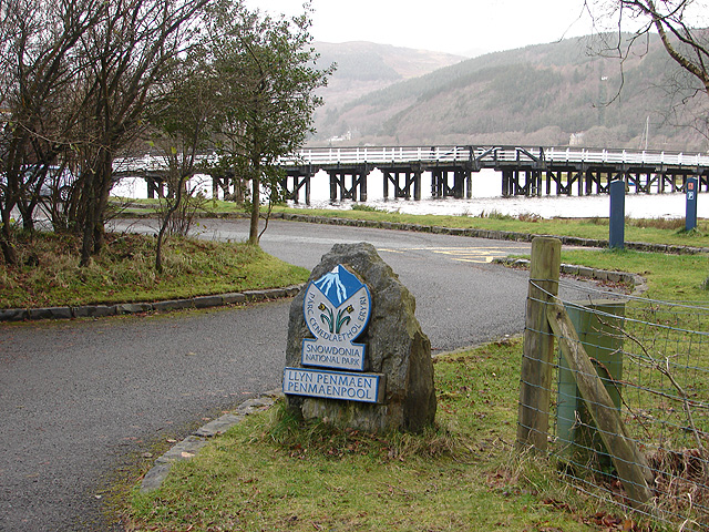
| Mawddach Trail | 9 miles (14 km) | This splendid cycling and walking trail takes you along the old Ruabon to Barmouth railway line on excellent paths. The route runs for about 9 miles from the coastal town of Barmouth to Dolgellau, through the Snowdonia National Park. You start by crossing the Barmouth Bridge over the lovely River Mawddach estuary on the coast of Cardigan Bay. The route then runs right alongside the estuary to Penmaenpool Bridge where you can stop for some riverside refreshments. The final stretch continues along the river to the historic town of Dolgellau. It's a beautiful trail with lots of bird watching opportunities around the estuary. The nearby Cadair Idris makes for a wonderful backdrop for the whole of the route. It's also a very flat trail so it's perfect for people of all abilities. Highlights on the route include the little village of Arthog where you could take a small detour to visit the Arthog Waterfalls. The series of pretty falls run along a stream to the south east of the trail, just before you cross the estuary into Barmouth. To extend your walking in the Barmouth area try the Panorama Walk. View Full Details>> | |
| National Cycle Route 42 | 57 miles (91 km) | This signed Sustrans route runs Chepstow to Glasbury via Usk, Abergavenny and Hay on Wye. View Full Details>> | |
| National Cycle Route 8 | 244 miles (392 km) | This epic Sustrans cycle route runs for nearly 250 miles through some of Wales' most beautiful scenery. View Full Details>> | |
| National Cycle Route 82 | 130 miles (210 km) | This signed Sustrans cycle route runs from Bangor to Fishguard through the Snowdonia National Park. View Full Details>> | |
| Porthmadog to Barmouth | 24 miles (38 km) | Follow National Cycle Route 8 on this lovely coastal ride that passes through the breathtaking Snowdonia National Park. View Full Details>> | |
| Regional Cycle Route 12 - Bwlch y Groes | 24 miles (38.2 km) | A circular cycle route exploring a beautiful section of the Snowdonia National Park. View Full Details>> |