Kegworth Walks
![]()
![]() This large Leicestershire based village has some nice canal and country trails to try.
This large Leicestershire based village has some nice canal and country trails to try.
This circular walk from the village visits the canalised section of the River Soar before heading through the countryside to visit the neighbouring village of West Leake.
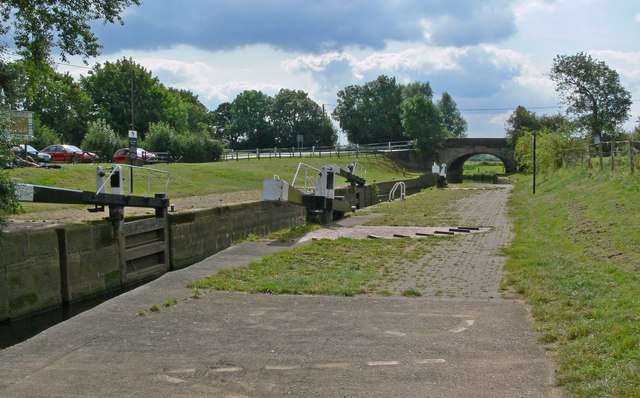
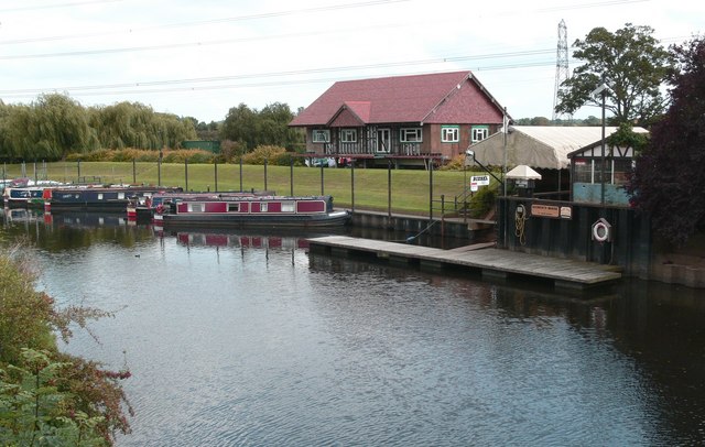
The walk starts from the public car park next to the canal locks on the eastern side of the village. It's a lovely spot for a stroll with a marina, a Grade II listed bridge and lots of boats to see going through the locks.
After exploring the canal you can pick up a section of the Midshires Way and follow the waymarked footpath east along Melton Lane to West Leake.
The route then heads west through Sutton Bonnington to return to the river. Here you'll pass the historic Sutton Bonington Hall, a country house erected in the Queen Anne period and known locally as "The Hall". After passing the village you can then follow a riverside footpath north to return to the car park.
Postcode
DE74 2FR - Please note: Postcode may be approximate for some rural locationsKegworth Ordnance Survey Map  - view and print off detailed OS map
Kegworth Open Street Map  - view and print off detailed map
Kegworth OS Map  - Mobile GPS OS Map with Location tracking
Kegworth Open Street Map  - Mobile GPS Map with Location tracking
Walks near Kegworth
- Trent Lock - This circular walk explores the countryside and waterways surrounding Trent Lock in Long Eaton
- Midshires Way - This route follows public bridleways and quiet country lanes through Middle England, from Bledlow, near Aylesbury in Buckinghamshire, to Stockport in Greater Manchester
- East Leake - This pretty Nottinghamshire village has a picturesque green, a selection of waymarked country trails and a fine local farm to visit
- Loughborough Canal Walk - A waterside walk from Loughborough to Leicester along a section of the Grand Union Canal and the River Soar
- Nottingham Canal - Enjoy a walk or cycle along this pretty canal in Nottingham
- Nottingham Circular Walk - This long circular walk makes use of various waymarked footpaths to take you on a tour of the city's rivers, canals, nature reserves and parks.
The walk starts at the train station and heads a short distance south to the River Trent - Beeston Canal - This walk takes you along the Beeston Canal in Nottingham
- Rushcliffe Country Park - Explore over 200 acres of cycling and walking trails in this popular country park in Ruddington near Nottingham
- Castle Donington - This historic market town in Leicestershire, is located near the National Forest, just north of East Midlands Airport
- St Chad's Water and Church Wilne Reservoir - This walk visits St Chads Water Local Nature Reserve and Church Wilne Reservoir in Draycott in the Erewash district of Derbyshire.
Pubs/Cafes
The Anchor Inn is located very close to the start of the walk, next to the river. They serve good quality food and have some outdoor seating for warmer weather. You can find them on Station Road at postcode DE74 2FR your sat navs.
Dog Walking
The river and country trails make for a fine dog walk and the Anchor mentioned above is also dog friendly.
Further Information and Other Local Ideas
The route can be extend by continuing east to visit East Leake. The village is well worth a visit with a picturesque green, old pubs, a noteworthy 11th century church and the splendid Manor Farm. Here you'll find a 25 acre park with woodlands and a variety of breeds including donkeys, rabbits, guinea pigs, rats, lizards, snakes, parrots and axolotls.
If you follow the Midshires Way north you could visit the popular Trent Lock on the Trent and Mersey Canal in Long Eaton. It's a significant location as the lock marks the point where the River Trent and River Soar meet with the beginning of the Erewash Canal.
Just to the west you could visit neighbouring Castle Donington. Here you can visit Donington Park which is famously used as a motor racing track and is also the venue for the Download Music Festival.
For more walking ideas in the area see the Leicestershire Walks page.
Photos
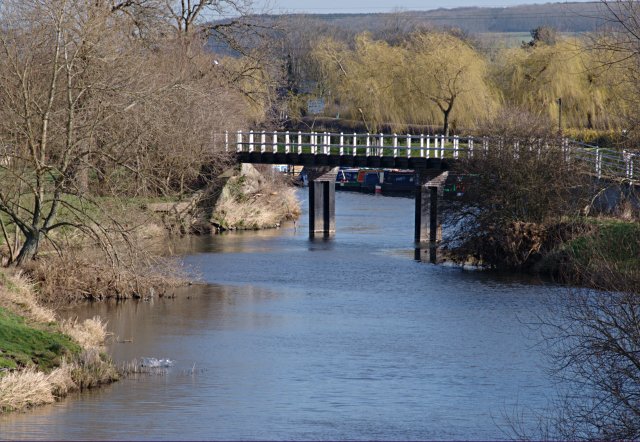
Footbridge over the River Soar. This bridge carries the towpath from New Cut across the original course of the Soar near the village.
Kegworth Bridge. Just to the Northeast of the village in Leicestershire; although this part of the bridge is within Nottinghamshire (as the River Soar forms the boundary). This picture is of the South-eastern span, across the canal cut-through, off the main river. A small pleasure boat is about to pass underneath. Grade II Listed Building originally dating from around 1785 although there has been work to widen and rebuild since then.


