Winchelsea Walks
![]()
![]() This small East Sussex town is a fine place for a historical walk. The town has a rich and fascinating history with several medieval buildings to see. This includes the three medieval gates, an ancient church and the Court Hall which is now a museum.
This small East Sussex town is a fine place for a historical walk. The town has a rich and fascinating history with several medieval buildings to see. This includes the three medieval gates, an ancient church and the Court Hall which is now a museum.
This circular walk from Winchelsea visits Nook Beach and Winchelsea Beach before picking up a section of the Royal Military Canal Path to return you to the town.
Start the walk from the town centre and then follow country lanes south east to Nook Beach on the edge of the Rye Harbour Nature Reserve. You can explore the reserve further on various public footpaths by heading further east from here. Here you will find a number of pretty lakes with a large variety of wildlife to look out for.
This walk continues south east to the beach where you head south west towards the picturesque Colonel Body Memorial Lakes. Near here you can pick up sections of the Royal Military Canal Path and the Saxon Shore Way. Follow the waymarked trails north east along the easy waterside footpath and they will lead you back into Winchelsea.
You can extend the walk by continuing south west along the beach to visit Fairlight Cove where there's some excellent cliff tops sea views to enjoy.
Postcode
TN36 4EN - Please note: Postcode may be approximate for some rural locationsWinchelsea Ordnance Survey Map  - view and print off detailed OS map
Winchelsea Open Street Map  - view and print off detailed map
Winchelsea OS Map  - Mobile GPS OS Map with Location tracking
Winchelsea Open Street Map  - Mobile GPS Map with Location tracking
Walks near Winchelsea
- Royal Military Canal Path - This walking route runs from Pett Level to Seabrook along the Royal Military Canal
- Hastings to Winchelsea Coastal Walk - This lovely walk follows the Saxon Shore Way and the Royal Military Canal Path from Hastings to Winchelsea
- Fairlight - This East Sussex based village has some lovely coastal trails, a fine local country park and a canalside path for walkers to try.
- Hastings Circular Walk - This fine circular walk around Hastings visits the coast and countryside to the east of the town
- Hastings Country Park - Enjoy over 600 acres of beautiful parkland and coast on this circular route in Hastings
- Rye Circular Walk - This route from Rye uses two of the area's long distance footpaths to create a circular walk around the town
- Rye Harbour - This lovely walk takes you around Rye Harbour Nature Reserve on the Sussex coast
- Camber Sands - Enjoy a walk or cycle along National Cycle Network Route 2 from Rye to the beautiful Camber Sands
- Dymchurch - This Kent based visit is located on the coast near Romney Marsh, Hythe and Folkestone
- High Weald Landscape Trail - Explore the High Weald AONB on this fabulous 90 mile walk that links the ridge-top villages and historic gardens for which the area is famous
- Sussex Border Path - A fabulous long distance walk following the Sussex county border from Thorney Island in West Sussex to Rye in East Sussex
- 1066 Country Walk - Follow in the steps of William the Conqueror on this historic walk through the Sussex countryside which commemorates the famous battle in 1066.
- Peasmarsh - This pretty East Sussex village is located in a lovely spot in the High Weald AONB near Rye.
- Icklesham - This East Sussex village is located near Winchelsea and Rye in the Rother district of the county.
Pubs/Cafes
Back in the town you can enjoy some post exercise rest and refreshment at the New Inn. The pub dates back to 1778 and includes a beamed interior and a nice walled garden area outside. They also provide rooms if you would like to stay in the area. You can find them on German Street at a postcode of TN36 4EN for your sat navs. The pub is dog friendly.
Further Information and Other Local Ideas
The long distance 1066 Country Walk passes through the town. The popular trail follows in the steps of William the Conqueror, visiting several local historic sites including Pevensey Castle, Herstmonceux Castle and Battle Abbey which is set on the site of the 1066 Battle of Hastings.
Cycling Information: National Cycle Route 2 runs through the town. The signed Sustrans cycle route can be followed west to Hastings or north east to Rye.
Photos
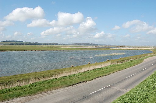
Royal Military Canal at Winchelsea. The canal was built in the early 19th century as a defence-line against the highly anticipated invasion by Napoleon. It passes the eastern side of the town and connects to the river Brede.


