North Devon Coast Walks

The North Devon Coast AONB is a fantastic place for walking with numerous lovely coastal villages and some dramatic scenery. It covers 171 square kilometres (66 sq mi) of coastal landscape from the border of Exmoor National Park at Combe Martin, through the mouth of the Taw & Torridge Estuary to the Cornish border at Marsland Mouth.
Use the links to view full route information including elevation profiles, interactive maps and GPS downloads.
You can also view an overview map of all the routes in the using the North Devon Coast Walk Map>>
*New* - Walks and Cycle Routes Near Me Map - Waymarked Routes and Mountain Bike Trails>>
| Route Name | Photo | Distance | Description |
| Appledore | 6.2 miles (10 km) | This pretty Devon village is located at the mouth of the River Torridge, near the towns of Barnstaple and Bideford. There's nice walks along the river and along the estuaries of both the Taw and Torridge to the north of the village. This circular walk follows the South West Coast Path along the estuary to the nearby Northam Burrows Country Park where there are miles of nice trails and fine views of the coast to enjoy. Start the walk from the pretty quay in Appledore and head north along the river to West Appledore. The path bends round to the west towards Northam Burrows and the Royal Devon Golf Club. In the park you will find over 600 acres of grassy coastal plain, salt marsh and sand dunes. The trail heads round the coast toward the visitor centre on the western side. Here you'll pass Sandymere before picking up a country lane taking you to Pampley Bridge and Appledore Bridge. From here you can pick up the coast path to take you back into Appledore. You could extend the walk by continuig south from Northam Burrows to visit the attractive seaside village of Westward Ho. View Full Details>> | |
| Baggy Point | 4.7 miles (7.5 km) | This popular walk in the North Devon AONB visits Baggy Point, a dramatic headland with wonderful coastal views over the beautiful Croyde Bay. The circular walk runs for just over 4 miles with some moderate climbs along the waymarked, cliff top path. View Full Details>> | |
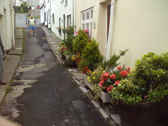
| Bideford | 6.2 miles (10 km) | This attractive North Devon town has some lovely walks along the estuary of the River Torridge. There's also two significant waymarked trails which pass through the area, a lovely country park and a nature reserve to explore. This circular walk takes you along both sides of the river, using sections of the South West Coast Path and the Tarka Trail long distance trails. It requires a ferry trip from Instow to Appledore which is only available in the summer months. The walk starts on Bideford Long Bridge which connects the old part of the town with East-the-Water on the right bank of the Torridge. It is one of the longest mediaeval bridges in England, being 677 feet (222 yards) long with 24 arches. Cross the bridge to the eastern side and you will come to Chudleigh Fort. The fort was built in about 1642 during the English Civil War. It was then reconstructed in the 19th-century and has been a Grade II listed building since 1949. There is also a nice park with a war memorial here as well. On the eastern side of the water you pick up the Tarka Trail and follow it north to Torridge Bridge, Westleigh and Instow. Instow is a lovely little village with a pretty quay with views over to Appledore on the other side. There is a small river beach and sand dunes, that home some rare species of orchid including the pyramid orchid. From the quay you can pick up a summer ferry to take you over the river to Appledore. Here you can pick up the South West Coast Path and follow it south through Northam to return to Bideford. View Full Details>> | |
| Bossington Hill | 2.8 miles (4.5 km) | Enjoy fabulous views of the Exmoor coastline on this bracing climb near Porlock. The area also includes attractive flora including bell heather, ling heather and western gorse. Look out for wildlife including buzzards, peregrine falcons, kestrels. The walk starts from the car park at the end of Hill Road, just east of the village of Bossington. You then head north along public footpaths before picking up a section of the South West Coast Path to take you towards the hill summit. From here there are lovely views over the Bristol Channel to the Welsh coast. An alternative route is to follow the coast path from the village of Bossington to Hurlstone Point. Then turn south to reach the hill. You can easily extend the walk by exploring the Holnicote Estate and climbing to Selworthy Beacon. The beacon is located just to the east of Bossington Hill. Also nearby are the settlements of Porlock and Porlock Weir. Porlock Weir is particularly lovely, with 17th century cottages and a delightful harbour. View Full Details>> | |
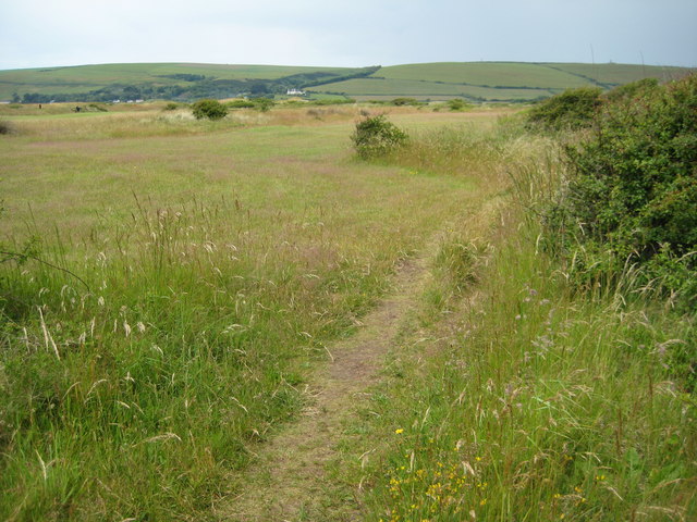
| Braunton Burrows | 3.7 miles (6 km) | This circular walk explores the expansive sand dune system of a beautiful nature reserve on the North Devon Coast. On the way you can enjoy a variety of wildlife, coastal views and several species of specialised plants. Braunton Burrows covers nearly 900 hectares making it the second largest dune system in England. Almost 500 species of plant have been recorded making Braunton the most biodiverse parish in England. Plant species include sea stock, sand toadflax, bee orchid and water germander. It's also great for wildlife with hundreds of rabbits, 33 species of butterfly and birds which include the Ringed Plover. You can easily extend your walk by heading to the coast and enjoying a stroll along the lovely Saunton Sands on the Croyde Bay and Saunton Sands Walk. The Tarka Trail also passes the reserve so you could pick this up and head to the estuary of the Rivers Taw and Torridge which is a short distance away. This circular walk starts from the car park at the end of Sandy Lane but you could also start from Braunton village and follow the Tarka Trail to the reserve. View Full Details>> | |
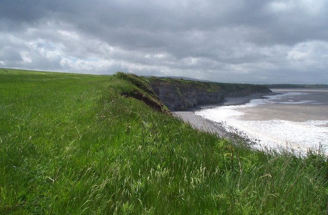
| Combe Martin | 7.5 miles (12 km) | This pretty coastal village is located on the north-west edge of the Exmoor National Park, close to some spectacular coastal scenery. Three significant long distance trails also pass the village so it is easy to explore the area on well maintained, waymarked footpaths. This loop takes you to some of the highlights to the east of the village including the highest point on the South West Coast Path. Starting in the village you pick up the Samaritans Way South West and head east past Lester Cliff and Wild Pear Beach to Little Hangman Cliff. The route climbs east to Great Hangman in the Hangman Hills. There's a cairn and fine views from the 1044 feet (318 metres) high summit here. The route continues past Girt Down to Holdstone Down where you can follow a circular footpath around Holdstone Hill. The route then returns to Combe Martin via Girt Down Farm, Netherton and Knap Down. View Full Details>> | |
| Culbone Church | 4.5 miles (7.2 km) | Visit England's smallest church on this lovely circular walk in the Exmoor National Park. The route includes coastal views, woodland sections and nice countryside views. The walk starts from the car park in Porlock Weir and heads west along the pretty quay to Worthy Wood. Here you pick up the Worthy Toll Road and follow it up to Yearner Mill Bridge where you turn north west towards the 17th century Parsonage Farm. You descend into the woodland of Withy Combe before coming to Culbone Church. The Grade I listed building is thought to be pre-Norman in origin, with a 13th-century porch, and late-15th-century nave. It seats around 30 people and services are still held there. The walk proceeds through Culbone Combe with pretty streams and attractive walnut and oak woodland. The final section runs through Yearnor Wood, passing the picturesque Worthy Toll Gate before returning to the car park. View Full Details>> | |
| Dunkery Beacon | 4.7 miles (7.5 km) | This walk climbs to Dunkery Beacon on Dunkery Hill, the highest point in Exmoor and Somerset. From the 1,703 feet (519 metre) summit there are fabulous views over Exmoor, the Brecon Beacons, Bodmin Moor, Dartmoor, the Severn Bridges and the Bristol and English Channels. The walk starts at the Dunkery Hill car park taking you up the hill to the beacon before heading into the delightful Dunkery and Horner Wood National Nature Reserve. The reserve covers 4000 acres/1604 hectares and is owned and managed by the National Trust. It consists of upland heath and woodland with a variety of wildlife including pied flycatcher, wood warbler, lesser spotted woodpecker, redstart and dipper. It also supports 14 of the 16 UK bat species, including barbastelle and Bechstein bats. You should also see several Exmoor Ponies and Exmoor's Iconic Red Deer. At the hill summit there's a handy toposcope where you can see all of the landmarks that are visible. If you would like to continue your walk you could head to the nearby Selworthy Beacon in the Holnicote Estate. Here you can enjoy more fabulous views of the Exmoor coast. The long distance Coleridge Way also passes close to the hill. You could pick this up and head north to the coast and visit Porlock and Porlock Weir. View Full Details>> | |
| Dunster Castle | 8.1 miles (13 km) | Explore the parkland, woodland and Historic Deer Park surrounding this Norman Castle near Minehead. From the castle there are fabulous views towards the Bristol channel, the Quantock hills and Exmoor. View Full Details>> | |
| Heddon Valley | 3.5 miles (5.6 km) | Enjoy an easy waterside walk through the beautiful Heddon Valley in Exmoor. The riverside footpath leads through woodland before the beautiful coast and cliffs of Heddon's mouth come in to view. The walk starts at the National Trust car park and heads north through Heddon's Mouth Wood to the coast through Heddon's mouth with its imposing cliffs. The point where the valley opens out to reveal the sea and cliffs is really lovely. The path then leads down to the pebble beach where you will find a 19th century lime kiln. The area is great for wildlife spotting. Look out for otters and various birds suchs as dippers, grey wagtails and herons. In summer the area is covered with yellow gorse flowers and heather. The route then continues east to the lovely wooded cove at Woody Bay with its secluded pebble beach. If you would like to extend your walking in the area then you could head east towards Trentishoe Down for views of the beautiful Elwill Bay. You could also climb the Hangman Hills for tremendous views over Combe Martin. View Full Details>> | |
| Ilfracombe to Combe Martin | 5 miles (8 km) | A popular coastal walk between these two North Devon settlements, using a section of the South West Coast Path. The route runs for a distance of about 5 miles so it's perfect for an afternoon walk. It's undulating path with some moderate climbs but with great views all the way from the elevated position of the cliff top path. The walk starts on the front in Ilfracombe and heads east past Capstone Point where there is a bench and a telescope to enjoy the view. You continue to Beacon Point which marks the northern side of Hillsborough Down and has nice views over Hele Bay. You continue past Samson's Bay and Widmouth Head before passing a series of caves on the outskirts of Combe Martin. The final section passes another fine viewpoint at Lester Point before coming into Combe Martin itself. View Full Details>> | |
| Lynton and Lynmouth | 6.8 miles (11 km) | The town of Lynton and village of Lynmouth sit side by side on the Exmoor coast in north Devon. It's a splendid place for walkers with a number of long distance trails passing through the beautiful area. As well as the wonderful coastal views there's also nice woodland trails and riverside paths along the East Lyn River. This 7 mile circular walk visits some of the highlights of the area using waymarked trails on good paths. Starting in the centre of Lynton you first follow a section of the South West Coast Path east towards the picturesque harbour village of Lynmouth. The path descends to the village which sits at the confluence of the West Lyn and East Lyn rivers, in a gorge 700 feet (210 m) below Lynton. You continue towards Countisbury where you can climb to Foreland Point Lighthouse at the most northerly point along the Devon and Exmoor coast. From here there are great views across the Bristol Channel to the Welsh coast. The route then descends back to the hamlet of Countisbury before coming to Watersmeet. The delightful area includes 2000 acres of river gorge and woodland with the opportunity for refreshments at the riverside tea garden at Watersmeet House. The walk then follows a section of the Tarka Trail back to Lynton. There's lots of good options for continuing your walking in the area. One of the highlights is the climb to the Valley of the Rocks. This dry valley contains the geological marvels known as the Lynton Beds. You could follow the South West Coast Path east and visit Culbone Wood and the delightful village of Porlock Weir. You could also follow the Two Moors Way and Tarka Trail south to the Cheriton Ridge in the Exmoor National Park. The Samaritans Way South West also passes through the area. View Full Details>> | |
| Mortehoe Circular | 4.7 miles (7.5 km) | This circular walk from Mortehoe visits Morte Point, Rockham Bay and Bull Point on the North Devon Coast. It's a lovely section of Exmoor coast with dramatic cliffs, beautiful countryside and pretty beaches. The area is managed by the National Trust so there are good footpaths and facilities in the area. The walk starts from the village of Mortehoe where there is a village car park. You follow a footpath through the countryside to Morte Point where there are some fascinating rock formations and great views towards Lundy Island. You then head east along the coast path to Bull Point, passing the lovely Rockham Bay and beach on the way. You should see lots of pretty wildlflowers in the summer along this stretch. Just after Bull Point you pick up an inland footpath which takes you back to the village. Here you can enjoy refreshments at the Smuggler's Rest pub. You could also visit the Mortehoe Musuem and learn about the interesting history of smuggling and shipwrecks in the area. View Full Details>> | |
| Northam Burrows Country Park | 4.7 miles (7.5 km) | Explore over 600 acres of grassy coastal plain, salt marsh, sand dunes and grasslands in this coastal country park in Devon. The park overlooks the beautiful Taw Torridge Estuary within an Area of Outstanding Natural Beauty. At the northern end of Westward Ho! beach is the Northam Burrows Centre. The centre has a wealth of information about the park and also runs family activities during the summer months. The South West Coast Path runs through the park so there is scope for continuing your walk along the beautiful Devon coast in either direction. The park is located just north of Bideford between Westward Ho and Appledore. You can reach the park easily from the village along the coast path. See the circular Appledore Walk for more details. Our Bideford Circular Walk also runs close to the park and is a good way of reaching the park from Bideford or for extending your exercise. View Full Details>> | |
| Porlock and Porlock Weir | 5.6 miles (9 km) | This circular walk from the town of Porlock uses sections of the South West Coast Path and the Coleridge Way to take you on a tour of the coast and woods surrounding the town. The walk starts in Porock and follows the South West Coast Path east to Bossington before turning west along Porlock Bay to the pretty village of Porlock Weir. View Full Details>> | |
| Tarka Trail | 78.9 miles (127 km) | This wonderful walk through Devon follows the path taken by Tarka the Otter in the book of that name. It is a circular walk starting and finishing in Barnstaple on the River Taw. After following the river for a short section you will head through Landkey Newton and East Buckland to the Exmoor National Park. The route then reaches Lynmouth where a splendid coastal section that takes you through Ilfracombe, Woolacombe and Croyde. The final section follows the estuary of the River Taw through Braunton and then back into Barnstaple. This part of the route passes the beautiful Braunton Burrows Nature Reserve. View Full Details>> | |
| The Hangman Hills | 4.7 miles (7.5 km) | A challenging circular walk visiting Little Hangman and Great Hangman Hills near Combe Martin in Devon. The walk starts in Combe Martin and heads east to Little Hangman Hill via Lester Point. You continue by climbing the 1044 feet (318 metres) high Great Hangman Hill. It is England's highest sea cliff and the highest point on the South West Coast Path. At the summit you wil find a cairn and can enjoy fabulous views over the surrounding coast and countryside. The route then descends through the countryside to Knap Down, before returning to Combe Martin. Here you can wander through the pretty village, admire the beautiful Combe Martin Bay and reward yourself with refreshments at one of the excellent pubs. There's also fine views over Holdstone Down and towards Lundy Island. In the summer months look out for pretty flowers such as primroses and violets and wildlife including warblers and various coastal birds. If you would like to extend your walking in the area then you could head east along the coast to the lovely Heddon Valley. Here you will find riverside walking trails and the imposing cliffs of Heddon's Mouth. View Full Details>> | |
| West Somerset Coast Path | 24.9 miles (40 km) | Follow the beautiful Somerset coast through the Quantock Hills Area of Outstanding Natural Beauty on this lovely coastal walk. The walk begins at the car park at Steart, next to the wildlife rich Bridgwater Bay National Nature Reserve Nature Reserve and the Steart Marshes. You then follow the path west, along the coast, to the town of Watchet with its pretty harbour and piers. From Watchet, you continue to Minehead along Blue Anchor Bay and Dunster Beach Nature Reserve. Here you could take a short detour inland and visit Dunster Castle where there is a lovely large deer park. View Full Details>> | |
| Westward Ho | 5.3 miles (8.5 km) | Westward Ho! is a lovely seaside village in North Devon with a nice beach and some great coastal walking. This circular walk takes you from the town to the nearby Northam Burrows Country Park using a section of the South West Coast Path National Trail. View Full Details>> | |
| Woolacombe to Croyde | 5.9 miles (9.5 km) | A fine coastal walk between these two North Devon villages. You'll pass the sand dunes of Woolacombe Warren, the wonderful headland at Baggy Point and the lovely Croyde Bay. It's about a 6 mile walk with somer moderate climbs so a reaonable level of fitness is required. Starting in Woolacombe the path heads south along Woolacombe Sand and Morte Bay. On your left are the attractive hills of Woolacombe Down. You continue along the beautiful long stretch of beach to Putsborough before heading out to Baggy Point. Here you will find sandstone rocks popular with climbers and splendid views towards Lundy Island. The final section runs along the headland before finishing at Croyde Sands. View Full Details>> |