Edge Hill Walk
![]()
![]() This walk visits Edge Hill from the village of Ratley in Warwickshire. The area is the site of a famous historical battle and includes some pleasant woodland trails, fine views and a noteworthy 18th century inn.
This walk visits Edge Hill from the village of Ratley in Warwickshire. The area is the site of a famous historical battle and includes some pleasant woodland trails, fine views and a noteworthy 18th century inn.
The walk starts in Ratley where you can pick up the Macmillan Way long distance trail. Follow the waymarked footpath north west and it will take you to Edge Hill. Here you'll find some woodland trails heading south west towards Westcote Manor.
On the way you'll pass the 18th century Castle Inn. From the elevated spot there are some fine views across the surrounding countryside towards the site of the Battle of Edgehill, a pitched battle of the First English Civil War. It was fought on Sunday, 23 October 1642 and was the first battle of the war. The inconclusive result of the battle prevented either faction from gaining a quick victory in the war, which would eventually last four years.
Edge Hill Ordnance Survey Map  - view and print off detailed OS map
Edge Hill Open Street Map  - view and print off detailed map
*New* - Walks and Cycle Routes Near Me Map - Waymarked Routes and Mountain Bike Trails>>
Edge Hill OS Map  - Mobile GPS OS Map with Location tracking
Edge Hill Open Street Map  - Mobile GPS Map with Location tracking
Pubs/Cafes
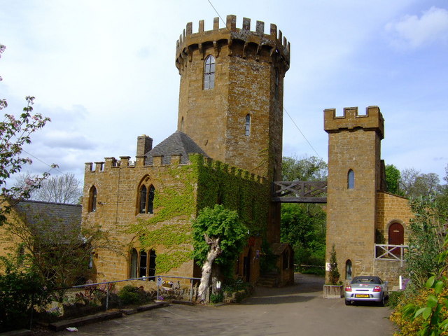
On the route you could stop off at The Castle at Edge Hill. There's a fine restaurant here serving delicious dishes. It includes a lovely terrace and garden with wide ranging views. The pub’s octagonal tower dates from 1742 and marks the spot where, on the afternoon of Sunday 23 October 1642, King Charles I raised his standard and summoned his officers about him to prepare for war. One of the bars inside contains replicas of armour and weapons used during the battle. You can find them at postcode OX15 6DJ for your sat navs.
Dog Walking
The woodland trails on the hill are ideal for a dog walk. The Castle Inn mentioned above is also very dog friendly with water bowls available.
Further Information and Other Local Ideas
The Battlefields Trail passes the site. This long distance footpath links three of England's most significant Battlefields:
Edgcote (1469) in Northamptonshire
Cropredy Bridge (1644) in Oxfordshire
Edgehill (1642) in Warwickshire. You could follow the trail north west to Radway and Kineton. In Radway you could visit the Battle of Edgehill exhibition. A free and interactive visitor exhibition adjacent to the battlefield in St Peter's Church. Information boards, artefacts, specially commissioned films and interactive displays explain the events of the momentous battle.
Head east and you could visit the National Trust's Farnborough Hall near Avon Dassett.
Follow the Warwickshire Centenary Way south west and you will soon come to neighbouring Tysoe where you could enjoy a climb to the Tysoe Windmill. The photogenic old mill sits on top of a 184 metre hill with excellent views over the Cotswolds.
For more walking ideas in the area see the Warwickshire Walks page.
Cycle Routes and Walking Routes Nearby
Photos
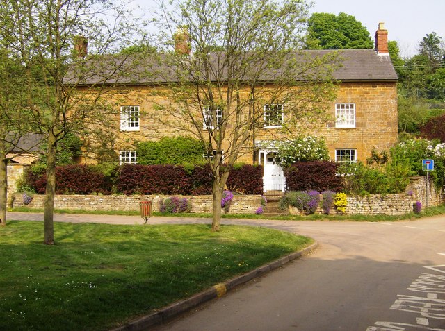
The Green, Ratley. The footpath from Warmington enters the village at the no-through road sign to the right.
Footpath in Castle Wood. A well maintained footpath runs along the whole length of Edge Hill within Castle Wood, sometimes towards the top of the scarp, sometimes lower down. The woodland is dense so views towards the northwest are limited but there is plenty of interest within the wood itself.
Rock formations near Edge Hill Farm. Another view of the rock formations at the top of the Edge Hill scarp, in the woodland. The limestone is very crumbly and the scarp is gradually retreating, but the many trees are well established and rooted.
Ridge and furrow below Edgehill. Where the path comes out of the woodland there is a wonderful view across the Vale. The village of Radway lies at the bottom of the slope, with the battlefield beyond. One could not ask for a better context within which to try to appreciate the battlefield landscape as it was in 1642.


