County Durham Cycle Routes

County Durham contains scenery and towns full of character so there is plenty to enjoy for the cyclist.
Use the links to view full route information including elevation profiles, interactive maps and GPS downloads.
You can also view an overview map of all the routes in the using the County Durham Cycle Map>>
There are several National Cycle Networksigned routes in the county many of which have been mapped and can be viewed and downloaded below.
For more information on cycle routes in County Durham including tips, advice and free cycle maps please click here
*New* - Walks and Cycle Routes Near Me Map - Waymarked Routes and Mountain Bike Trails>>
| Route Name | Photo | Distance | Description |
| Auckland Walk | 4.7 miles (7.5 km) | A short cycle and walking route along a dismantled railway line from Spennymoor to Bishop Auckland. This is a nice, easy route ideal for families. View Full Details>> | |
| Billingham to Hartlepool | 9.9 miles (16 km) | Starting near Billingham rail follow National Cycle Route 14 first through Cowpen Bewley Woodland Park before finishing on a lovely coastal stretch along Tees Bay. View Full Details>> | |
| Brandon - Bishop Auckland Walk | 8.7 miles (14 km) | This is a nice easy cycling and walking path that follows a disused railway line from Brandon, near Durham to Bishop Auckland. You will pass through the villages of Brancepeth and Willington, shortly before joining the River Wear for the final stretch into Bishop Auckland. There are fine views of the surrounding countryside and of the Newton Cap Viaduct just before entering Bishop Auckland. The Lanchester Valley Walk and the Deerness Valley Way pass close to the trail. View Full Details>> | |
| Castle Eden Walkway | 9.3 miles (15 km) | Enjoy a cycle or walk along this disused railway line which runs along National Cycle Network Route 1. It's a nice easy traffic free ride for families or beginners. The route starts to the west of the County Durham village of Castle Eden and heads south through Wingate to Station Town. You continue past the pretty Hurworth Burn Reservoir. There's a nice circular trail around the water and some benches where you can stop for a rest. It's a lovely peaceful spot with lots of birds to look out for on the water. The route then continues past Brierley Wood and Thorpe Wood Nature Reserve, where there are more wildlife spotting opportunites. The route finishes at the lovely Wynyard Woodland Park. This country park in Billingham has woodland trails, a wildflower meadow and a planetarium and observatory. There's also a nice cafe where you can refresh yourself after your exercise. Near the start of the route there is the splendid Castle Eden Dene National Nature Reserve. The reserve contains a wide variety of flora and fauna, woodland trails and the pretty Castle Eden Burn. View Full Details>> | |
| Coast to Coast Whitehaven to Tynemouth | 136.7 miles (220 km) | This is the complete C2C National Cycle route crossing the country from east to west along a number of cycle tracks/paths and minor roads. You will see some spectacular scenery as you pass through the Cumbrian Lake District and Northumberland before the last leg through County Durham and the finish point at Tynemouth Pier on the east coast of England. See the Whitehaven to Sunderland page for the other C2C section. View Full Details>> | |
| Consett to Sunderland | 28 miles (45 km) | Travel from Consett along the C2C National Cycle route to Roker Pier in Sunderland. This can be completed as the 3rd leg of the C2C ride following from Whitehaven to Penrith and Penrith to Consett. Highlights on this ride include a long stretch along the Consett and Sunderland Railway Path before cruising by the river weir and ending up on the east coast of England by Roker Pier. You'll also pass Beamish Woods where there's some nice woodland trails and the views of the River Team. View Full Details>> | |
| Consett to Tynemouth | 28 miles (45 km) | Travel from Consett along the C2C National Cycle route to Tynemouth Pier. This can be completed as the 3rd leg of the C2C ride following from Whitehaven to Penrith and Penrith to Consett. This is a fairly flat ride with highlights including a stretch along the River Derwent before following the Tyne into Newcastle Upon Tyne and finishing on the East coast of England. View Full Details>> | |
| Cowpen Bewley Woodland Park | 3.1 miles (5 km) | This country park in Billingham is the perfect place for a peaceful afternoon stroll. The park consists of grassland, a lake, a series of ponds and a beck flows which around the boundary of the park. The lake is fantastic for birdwatching - look out for coot, pochard, swans, grebes, herons and the tufted duck. For cyclists National Cycle Route 14 runs through the park. View Full Details>> | |
| Deerness Valley Railway Path | 8.1 miles (13 km) | This cycle or walk along a dismantled railway line runs from Stonebridge to Crook through the beautiful Deerness Valley. The path passes the villages of Ushaw Moor and Esh Winning and and woodland at Holburn and Woodhouses Wood. There are also lovely waterside stretches along the River Deerness to enjoy. The path can be accessed to the west of the city of Durham. The Brandon - Bishop Auckland Walk and the Lanchester Valley Walk run very close to the trail. View Full Details>> | |
| Derwent Reservoir Durham | 11.2 miles (18 km) | Enjoy a cycle around Derwent Reservoir in Durham. The route takes you around the reservoir on country roads and past the pretty Pow Hill Country Park. The reservoir is located a few miles west of Consett and close to the delightful village of Blanchland. View Full Details>> | |
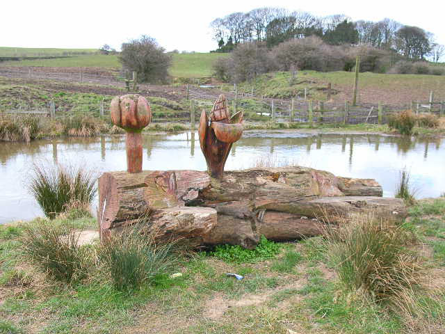
| Derwent Valley Walk | 11.2 miles (18 km) | This lovely railway path runs from Swalwell, near Gateshead, to Consett alongside the River Derwent and is suitable for walkers and cyclists. You will pass the villages of Rowlands Gill, Hamsterley and Ebchester on the way. The path also takes you through Derwent Walk Country Park and there is a woodland section at Byerside Wood. At the park you could cross to the to the western side of the river and visit Thornley Woods where there's a sculpture trail and a visitor centre with lots of information about the area. Also of interest is the National Trust owned Gibside near Rowlands Gill. This is well worth a visit with its 18th-century landscape park and nature reserve. View Full Details>> | |
| Great North Forest Heritage Trail | 65.2 miles (105 km) | This circular cycle and walking route takes you through the countryside of this former mining area in Tyne and Wear. The trail passes Pelton, Bournmoor, Hetton-Le-Hole, the Penshaw Monument and Witherwack. The route includes a section along the River Wear in Sunderland and a delightful coastal section visiting Whitburn, Marsden Bay, the splendid magnesian limestone cliffs at the Leas in South Shields and Souter Lighthouse. You will also visit Lumley Castle - a 14th century quadrangular castle at Chester-le-Street with lovely gardens. Also of interest is the Penshaw Monument - a folly situated on on Penshaw Hill dedicated to John George Lambton, first Earl of Durham. The video below shows the splendid views from this most beloved landmark which appears on the badge of Sunderland Football Club. Near Stanley the route visits the oldest single-arch railway bridge in the world at Causey Arch. View Full Details>> | |
| Hadrians Cycleway | 174 miles (280 km) | This is the complete route for the Hadrian's Cycleway which runs from east coast of England to the west coast passing through some fabulous scenery. There's some fascinating history too with views of the famous ancient wall and a visit to a series of Roman forts. View Full Details>> | |
| Haltwhistle to Tynemouth | 57.2 miles (92 km) | This route is the final leg of 3 making up the Hadrians Cycleway. The ride has some fabulous scenery as you pass through the counties of County Durham, Northumberland and Tyne and Wear and the city of Newcastle. View Full Details>> | |
| Hamsterley Forest | 9.3 miles (15 km) | Hamsterley Forest is a great place for exciting mountain bike trails, leisurely family cycle rides or peaceful woodland walking. There are three colour coded, way-marked mountain bike trails in the forest. The blue trail follows purpose built cycle tracks and the Bedburn Beck through the southern part of the forest at a leisurely pace. It's suitable for families and people looking for a gentle introduction to off road cycling. The red trail goes further into the forest and climbs to a point with fabulous views of the surrounding area before descending on an exciting single track running along Euden Beck. The black trail is the most severe trail and suitable for experienced mountain bikers. Cycle hire is available from the start of route below. Walkers will find five way-marked trails of varying lengths and difficulty to follow. These include an easy, riverside stroll along Bedburn Beck and longer trails with climbs and a visit to Blackling Hole waterfall. The route mapped out below is suitable for both leisure walkers and cyclists looking for a fairly easy ride. View Full Details>> | |
| Hardwick Hall Country Park | 1.9 miles (3 km) | This large ornamental park surrounds a fine 18th century hall and is located in Sedgefield in County Durham. Hardwick includes a 17-acre lake and a number of ornamental features, including temples, grottoes and follies. There are woodland trails and a lovely waterside path around the lake to enjoy. There is also a visitor centre, gift shop and cafe. View Full Details>> | |
| Hartlepool to Seaham | 20.5 miles (33 km) | This ride starts near the quay in Hartlepool and follows National Cycle Route 14 to Seaham. The route follows an off road track for most of the way and passes near Peterlee and Hetton-Le-Hole before finishing close to the harbour at Seham. View Full Details>> | |
| Haswell to Hart | 9.8 miles (15.8 km) | An easy shared cycling and walking route running from Haswell to Hart. View Full Details>> | |
| Lanchester Valley Walk | 11.8 miles (19 km) | This shared cycling and walking path uses the route of the railway originally built to carry iron ore to Consett Steelworks. The path runs from Durham to Consett passing Bearpark, Langley Park and Lanchester. Route highlights include the 13th century Beaurepaire Priory at Bearpark, Lanchester Roman Fort and some lovely views of the River Browney. It's a fairly flat path which runs for about 12 miles. The Brandon - Bishop Auckland Walk and the Deerness Valley Way run close to the trail. View Full Details>> | |
| Middlesbrough to Darlington | 19.9 miles (32 km) | Follow National Cycle Route 1 and 14 on this pleasant ride. You start by following the River Tees to Stockton on Tees before quiet roads take you onto Oak Tree. Here you join a dismantled railway path for an off road stretch taking you into Darlington where you finish at the train station. Much of this ride is on off road paths making it a nice leisurely ride. View Full Details>> | |
| Middlesbrough to Durham | 34.2 miles (55 km) | Travel from Yorkshire into County Durham along National Cycle Route 1 and 14. You begin near the train station in Middlesbrough and head to Stockton on Tees along an off road section by the River Tees. The route then turns north along the Castle Eden Walkway for more off road riding taking you through the Castle Eden Walkway Country Park. You continue to Haswell where you turn east towards Durham finishing with a pleasant stretch along the River Wear. View Full Details>> | |
| National Cycle Route 14 | 88.2 miles (142 km) | Sustrans Route 14 runs from Darlington to South Shields through County Durham and Tyne and Wear. View Full Details>> | |
| National Cycle Route 165 | 72.1 miles (116 km) | Travel from Barnard Castle to the coast at Whitby on this long distance Sustrans cycle route. View Full Details>> | |
| Penrith to Consett | 52.8 miles (85 km) | Travel from Penrith in the Cumbrian Lake District along the C2C National Cycle route to Consett in Durham. This can be completed as the 2nd leg of the C2C ride following from Whitehaven to Penrith. View Full Details>> | |
| Sunderland to Middlesbrough | 39.1 miles (63 km) | Travel between these two major north eastern cities along National Cycle Route 1 and 14 on this interesting ride. The route starts in Sunderland with a long off road section to coastal Seaham. On the way you will pass through Ryhope and the lovely Cherry Knowle (below). There then follows another traffic free section along the Haswell to Hart Countryside Walk & the Castle Eden Walkway taking you to Stockton on Tees. View Full Details>> | |
| Tunstall Reservoir | 1.9 miles (3 km) | Follow the footpath around this pretty reservoir and nature reserve near Wolsingham in Country Durham. View Full Details>> | |
| Waskerley Way | 9.9 miles (16 km) | This is a shared cycling and walking path that follows the route of the old Stanhope and Tyne Railway line. The path starts near Consett and runs to Weather Hill passing through woodland and open moorland. You will also pass the delightful Smiddy Shaw Reservoir, Hisehope Reservoir, Waskerley Reservoir and Tunstall Reservoir near the village of Wolsingham. View Full Details>> | |
| Whitehaven to Sunderland | 133.6 miles (215 km) | This is the complete C2C National Cycle route crossing the country from east to west along a number of cycle tracks/paths and minor roads. You will see some spectacular scenery as you pass through the Cumbrian Lake District and Northumberland before the last leg through County Durham and the finish point at Roker Pier on the east coast of England at Sunderland. See the Whitehaven to Tynemouth page for the other section. View Full Details>> |


Your Submitted Routes
| Route Name | Distance | Difficulty |
| Durham Esh Circular | 26 miles (42 km) | **** |