Warwickshire Centenary Way
![]()
![]() Starting at Kingsbury Water Park (video below) in the north of the county this lovely walk takes you through the River Tame Valley, Atherstone Ridge, Nuneaton, Coombe Abbey Park at Coventry (video below), Kenilworth, Warwick, Leamington Spa, Burton Dassett Hills, Avon Dassett, Edge Hill, Shipston on Stour and Ilmington Downs.
Starting at Kingsbury Water Park (video below) in the north of the county this lovely walk takes you through the River Tame Valley, Atherstone Ridge, Nuneaton, Coombe Abbey Park at Coventry (video below), Kenilworth, Warwick, Leamington Spa, Burton Dassett Hills, Avon Dassett, Edge Hill, Shipston on Stour and Ilmington Downs.
The route then finishes at Upper Quinton on the edge of the Cotswolds, just south of Stratford Upon Avon.
Highlights include the historic castles in Warwick and Kenilworth plus lovely riverside sections along the River Avon and River Leam. There's also some lovely Cotswolds scenery and typical pretty villages with thatched cottages and Norman churches.
The path is well waymarked with a green and white disc picturing a bear.
Please click here for more information
Warwickshire Centenary Way Ordnance Survey Map  - view and print off detailed OS map
Warwickshire Centenary Way Open Street Map  - view and print off detailed map
Warwickshire Centenary Way OS Map  - Mobile GPS OS Map with Location tracking
Warwickshire Centenary Way Open Street Map  - Mobile GPS Map with Location tracking
Pubs/Cafes
Near to the picturesque reservoir in Shustoke you'll find the 18th century Plough Inn for a pit stop. They do a lovely Sunday lunch which you can enjoy in the fine garden area on warmer days. Inside there's a charming interior with low ceilings and nooks and crannies. You can find them on the Green at postcode B46 2AN for your sat navs. They're also dog friendly if you have your canine friend with you.
Further Information and Other Local Ideas
As you pass through the Harbury area you will be able to enjoy views of the Chesterton Windmill. The 17th century mill is something of a local landmark and well worth a small detour from the route.
Cycle Routes and Walking Routes Nearby
Photos

Part of the 98 mile long Warwickshire Centenary Way close to Northend village. Due west of this point, the M40 motorway crosses the grid square.

On a frosty morning, the Centenary Way passes Castle Farm.

The path crosses the stream and continues on its (muddy) way.

The trail heads for Kenilworth. Seen from a mound beside Middle Woodloes. The pylon on the left marks a sharp change of direction of the power lines. The woods are part of the complex shown on OS as Larch Covert.

Tysoe Windmill. You will pass close to this photogenic in the village of Middle Tysoe. The mill is located just to the south of the village and worth a small detour for the views from the 184 metre high windmill hill.

Bridge over the mill stream. Footbridge forming part of The Centenary Way at Fell Mill, River Stour.

Centenary Way towards Honington. Grassy footpath and country view in early spring.

The Coventry Canal, Bedworth. This just north of Bulkington Bridge (No 14). The Act of Parliament enabling the construction of the Coventry Canal was passed in 1768, and construction as far as Atherstone by 1771 was followed by the company running out of money and the sacking of James Brindley. One of the purposes of the canal was to provide Coventry with a regular supply of cheap coal from the Bedworth coalfield, which it already did by 1769. The towpath here is used as part of The Centenary Way, a long distance walking path covering about 100 miles in Warwickshire.
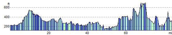
Elevation Profile