Scottish Borders Walks

The Scottish Borders region extends from the northern boundary marked by the Pentland, Moorfoot, and Lammermuir Hills, bordering the Lothians, down to the Cheviot Hills and the River Tweed in the south, which mark the border with England. This area, along with Dumfries & Galloway, is collectively known as the Southern Uplands of Scotland. With a series of stunning lochs, historic abbeys and beautiful coastline there are plenty of wonderful options for walkers.
Use the links to view full route information including elevation profiles, interactive maps and GPS downloads.
You can also view an overview map of all the routes in the using the Scottish Borders Walk Map>>
| Route Name | Photo | Distance | Description |
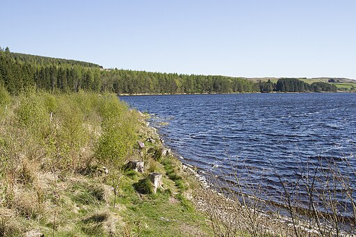
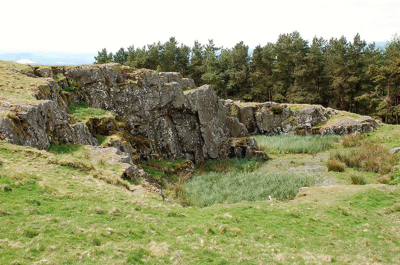
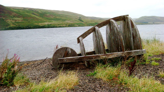
| Alemoor Loch | 1 miles (1.2 km) | This walk visits a beautiful loch in the Scottish Borders near Hawick. View Full Details>> | |
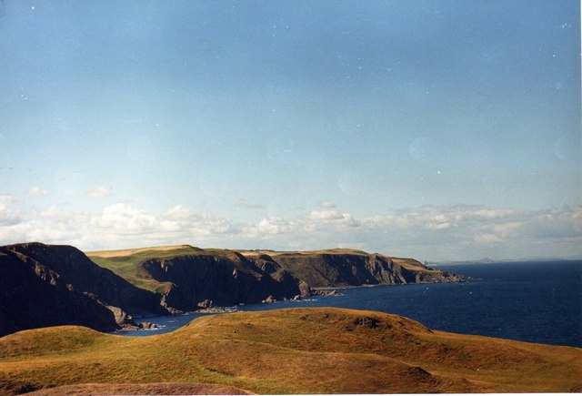
| Berwickshire Coastal Path | 30 miles (48 km) | Follow the Berwickshire Coastal Path from Berwick on Tweed in Northumberland, to Cockburnspath, in the Scottish Borders. There's some spectacular coastal scenery to enjoy as you pass along the Northumberland and Scottish cliff tops. There are also a series of pretty coastal villages with delightful harbours including Burnmouth, Eyemouth, St Abbs and Cove. The Berwick Walls Walk is a worthy walk to do at the start of the route. View Full Details>> | |
| Borders Abbeys Way | 67 miles (108 km) | Explore the Scottish Borders and visit several historical ruined abbeys on this interesting and beautiful circular walk. You'll visit Kelso Abbey, Melrose Abbey, Dryburgh Abbey and Jedburgh Abbey while there is also a waterside section along the River Teviot and views of the Eildon Hills to enjoy. View Full Details>> | |
| Cross Borders Drove Road | 52 miles (84 km) | This 52 mile walking route runs from Little Vantage to Hawick through some beautiful Scottish Borders countryside. It runs along the old drove road where cattle and sheep were driven through West Linton to Peebles and Traquair, and then on to Hawick via the Yarrow Valley. View Full Details>> | |
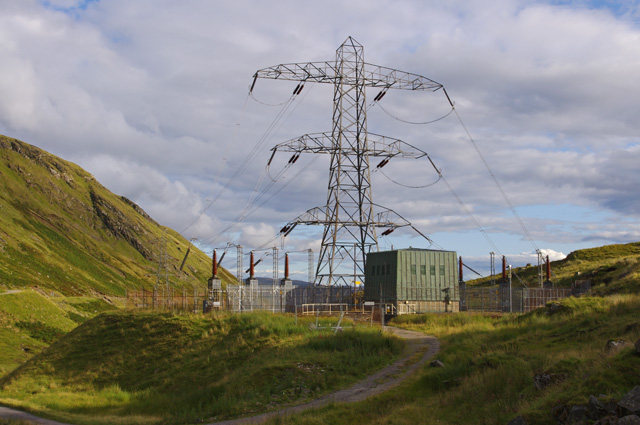
| Cruachan Dam and Falls of Cruachan Waterfall | 2 miles (3 km) | This walk visits the Falls of Cruachan waterfall before heading to the nearby Cruachan Reservoir dam in Argyll and Bute. View Full Details>> | |
| Daer Reservoir | 5 miles (8 km) | This walk visits Daer Reservoir in the Lowther Hills of South Lanarkshire in the Southern Uplands of Scotland. It's a lovely peaceful place for a walk with fine scenery to enjoy. View Full Details>> | |
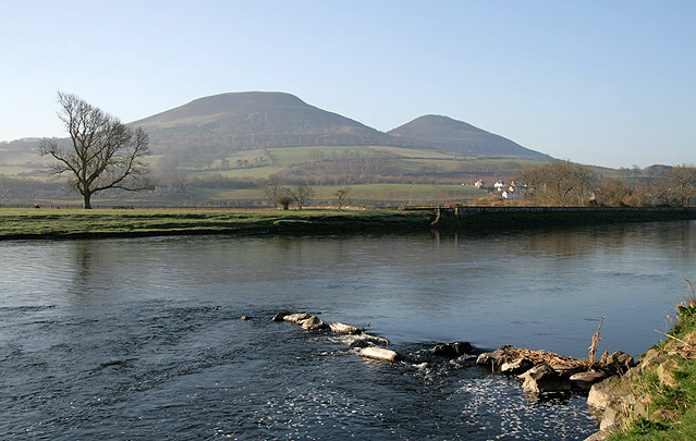
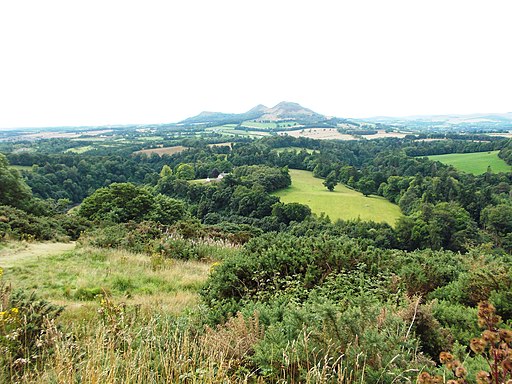
| Eildon Hills | 5 miles (8.1 km) | This circular walk climbs to a series of wonderful viewpoints above the town of Melrose on the Scottish Borders. The Eildon Hills consist of three peaks of about 400 metres with wonderful views to Melrose Abbey, Leaderfoot Viaduct and the surrounding countryside of the Borders. The walk starts in Melrose next to the abbey. From here you can pick up the St Cuthbert's Way long distance trail and follow it south towards the hills. You then follow a different path on your right up to Eildon Mid Hill. At 422m (1,385 ft) it is the highest of the peaks and includes a trig point and a view indicator at the summit. There are fabulous views over the surrounding area from here. After taking in the views the route then heads south to visit Eildon Wester Hill (371m) where there are great views back to the other two hills. The route then turns north to visit Eildon North Hill (404m), the final of the 3 peaks. This hill was the site of a large Bronze Age Settlement which included 300 hut circles. There is also some evidence that prehistoric peoples regarded the Eildon Hills as a holy place and scholars believe they may have been a place of ceremonial gatherings. There are several holy springs around the base of the hills, now dedicated to Christian saints, but probably originally sacred to Celtic deities. The final section of the walk descends from the north hill to Eildontree Stone where you pick up a secton of the Borders Abbeys Way to take you towards Newstead before returning to Melrose. View Full Details>> | |
| Eyemouth to St Abbs Walk | 10 miles (16 km) | This walk from the settlement follows a section of the Berwickshire Coastal Path to neighbouring St Abbs Head. It's about a 5 mile hike to the headland, so roughly 10 miles there and back. View Full Details>> | |
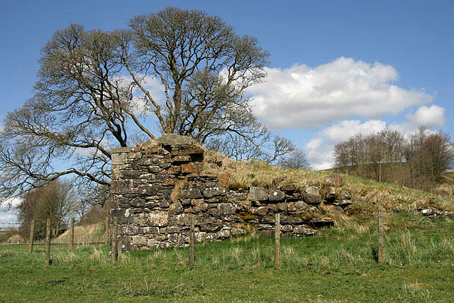
| Fast Castle | 1 miles (1.3 km) | This walk visits the splendidly positioned Fast Castle on the Scottish Borders coast. View Full Details>> | |
| Fatlips Castle | 1 miles (1 km) | This walk climbs to a wonderfully positioned peel tower in Roxburghshire, in the Scottish Borders. View Full Details>> | |
| Harestanes | 5 miles (7.4 km) | This circular walk visits the Harestanes countryside centre near Jedburgh in the Scottish Borders. View Full Details>> | |
| Hirsel Estate | 4 miles (6.5 km) | Enjoy an easy walk around the Hirsel Estate and country park in Coldstream. In the park you will find the lovely Hirsel Lake which is a great place for bird watching. Look out for Herons, Kingfishers, Ducks, Geese and Reed Bunting from the bird hide. The walk also visits the adjacent Dunglass Wood with miles of peaceful waymarked woodland trails. You'll also cross the pretty Leet Water and enjoy views of the surrounding countryside. View Full Details>> | |
| Jedburgh | 2 miles (3.2 km) | This lovely town in the Scottish Borders has some interesting historic sites and some fine riverside footpaths. View Full Details>> | |
| John Buchan Way | 14 miles (23 km) | A walk through the Scottish borders named after John Buchan, the author of The Thirty-Nine Steps, who lived in the area. View Full Details>> | |
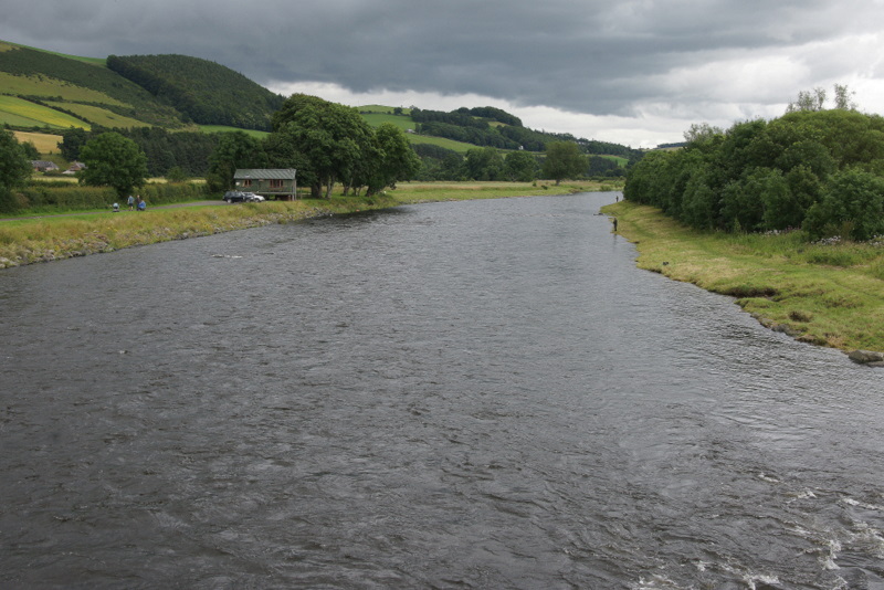
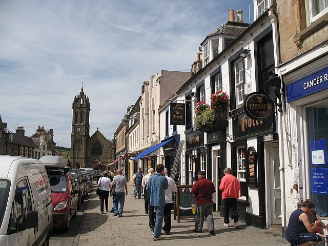
| Kelso | 7 miles (11 km) | This town in the Scottish Borders is a fine place for riverside walking. View Full Details>> | |
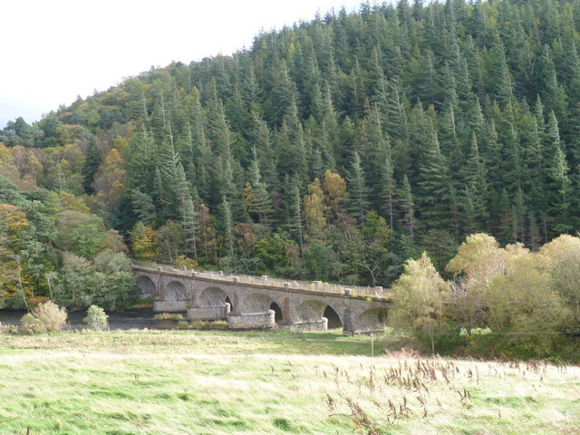
| Leaderfoot Viaduct | 5 miles (8 km) | This walk takes you to the impressive Leaderfoot Viaduct in Melrose on the Scottish Borders. The disused railway viaduct crosses the River Tweed a few miles east of the town. Start the walk from Melrose Abbey and head north to the River. You can then pick up a nice riverside path heading east to the structure. Here you'll also find the Drygrange Old Bridge, a road bridge dating from 1776, and its modern successor sitting just to the east of the viaduct. To the south you will find the fascinating Roman settlement of Trimontium where there are great views back to the viaduct. Cross the river on the new bridge an you can enjoy more fine views down the Tweed. View Full Details>> | |
| Megget Reservoir | 6 miles (9.8 km) | This walk visits the expansive Megget Reservoir in the Scottish Borders. It's a beautiful and tranquil place, ideal for a peaceful walk in stunning surroundings. View Full Details>> | |
| Melrose | 10 miles (16.7 km) | This town in the Scottish Borders is a fine place for walkers with an historic abbey, riverside trails and nearby hill climbs to enjoy. View Full Details>> | |
| Neidpath Tunnel | 3 miles (4.3 km) | This circular walk explores the old Neidpath Railway in Peebles, in the Scottish Borders. View Full Details>> | |
| Newcastleton Railway Walk | 2 miles (3.6 km) | This walk takes you along the now disused Border Union Railway line in the village of Newcastleton in the Scottish Borders. View Full Details>> | |
| Norham | 4 miles (6 km) | This Northumberland village is located on the River Tweed next to the Scottish border. View Full Details>> | |
| Peebles | 8 miles (12.8 km) | This lovely circular walk explores the area around the Scottish Border town of Peebles. View Full Details>> | |
| Pennine Way | 268 miles (431 km) | This fabulous 268 mile path takes you through three of England's finest national parks. You start near Edale in the beautiful Derbyshire Peak District and head north towards the Yorkshire Dales National Park. The final section takes you over Hadrian's Wall in the stunning Northumberland National Park before crossing the England-Scotland border and finishing in the village of Kirk Yetholm in Scotland. Though the path is often challenging you're rewarded with some of the most breathtaking views in the country. Highlights on the path include the beautiful Malham Cove, the heather moorland of the Marsden Moor Estate, the Malham Tarn Estate and the stunning Kisdon Force waterfall in the Yorkshire Dales National Park. You'll also enjoy a waterside section along the River Tees in Teesdale which leads to Low Force Watefall and High Force Waterfall. The path also passes through Bronte country in West Yorkshire where you can visit the Bronte Waterfall and Top Withens. View Full Details>> | |
| Portmore Loch | 1 miles (2 km) | This tranquil reservoir near Peebles in the Pentland Hills is a lovely place for a quiet stroll. View Full Details>> | |
| Romans and Reivers Route | 52 miles (84 km) | This long distance route follows the old Roman Roads from the Ae Forest to Hawick. Though classed as a walking route much of the trail is also suitable for cyclists with mile of forestry trails to enjoy. View Full Details>> | |
| Scotts View | 1 miles (1.2 km) | This walk visits a splendid viewpoint in the Scottish Borders, near Melrose. View Full Details>> | |
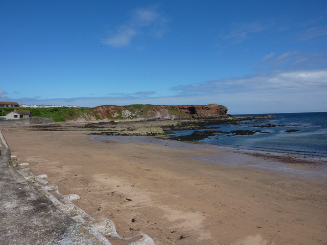
| St Abbs | 3 miles (5 km) | This walk in the Scottish Borders follows a section of the Berwickshire Coastal Path to St Abbs Head and lighthouse. It's a rugged stretch of coast with some interesting rock formations and fine sea views. View Full Details>> | |
| St Cuthbert's Way | 63 miles (101 km) | This walk runs from Melrose in the Scottish Borders to Lindisfarne Castle and Holy Island. The route is typically walked from west to east in four stages: Melrose to Harestanes - this section takes in Melrose Abbey, the River Tweed and the Eildon Hills before coming to the 18th century Monteviot House on the River Teviot at Harestanes. Harestanes to Yetholm - a challenging section taking you to the highest and midway point of the route at the summit of Wideopen Hill. The section also passes through Cessford Moor and past Cessford Castle before reaching Town Yetholm on Bowmont Water. Yetholm to Wooler - a wide open section which takes you into Northumberland National Park and has terrific views of the Cheviot Hills. You'll climb Yeavering Bell hill near Wooler where you can find the largest Iron Age hillfort in the region. There's also some attractive woodland at Wooler Common, the photogenic Hethpool Linn waterfall in the College Valley and views of Humbleton Hill where there is another hillfort to see. Wooler to Lindisfarne - the final section passing Doddington Moor and Buckton Moor before finishing on Holy Island. On the way you'll also pass St Cuthbert's Cave. View Full Details>> | |
| St Mary's Loch | 6 miles (9.5 km) | This walk visits St Mary's Loch near Selkirk in the Scottish Borders. It's a beautiful place for a walk with fine views across the clear waters to the surrounding hills. The site is also notable as the largest natural loch in the Scottish Borders. View Full Details>> | |
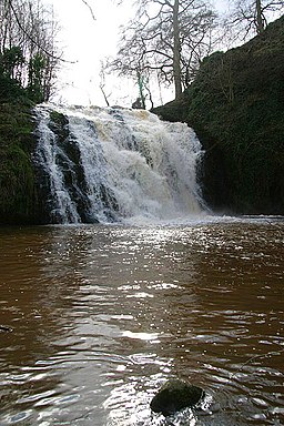
| Stichill Linn | 2 miles (3.8 km) | This walk visits the pretty Stichill Linn Waterfall in the Scottish Borders near Kelso. View Full Details>> | |
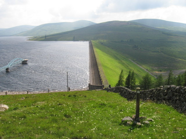
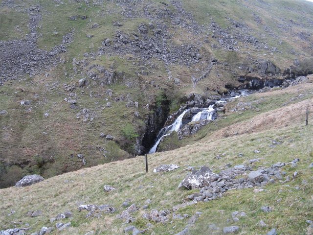
| Talla Reservoir | 7 miles (11 km) | This walk visits Talla Reservoir and waterfall in the Scottish Borders near Biggar. View Full Details>> | |
| Tweed Valley Railway Path | 6 miles (10.3 km) | This shared cycling and walking trail runs along a disused railway line from Innerleithen to Peebles in the Scottish Borders. View Full Details>> | |
| Tweedbank to Melrose | 3 miles (5 km) | This waterside walk follows riverside trails and a popular section of the Southern Upland Way from Tweedbank to Melrose in the Scottish Borders. View Full Details>> | |
| Whiteadder Reservoir | 1 miles (1.6 km) | This walk visits the Whiteadder Reservoir in the Lammermuir Hills of East Lothian. View Full Details>> | |
| Windy Gyle | 10 miles (16 km) | Climb to the summit of this hill in the Cheviots and enjoy fabulous views into Scotland and England as you stand high on the border. This challenging circular route runs for a distance of about 10 miles using the bridleways and footpaths that cross the area. The walk begins from the Wedder Leap car park and heads towards Shorthope hill, crossing the River Coquet and following the Rowhope Burn as you go. You continue the climb to Little Ward Law before coming to Russel's Cairn at the 619 m (2,031 ft) summit of Windy Gyle. From here there are wonderful views over the Scottish Borders, the Eildon Hills and Edinburgh. You begin the descent by heading west along the Pennine Way and then south towards Swineside Law and Hindside Knowe. Shortly after you cross the River Coquet and return to the car park. This is a challenging walk but the footpaths are generally good and you're rewarded with some stunning scenery. To continue your walking in the Cheviots you could climb the highest hill - The Cheviot. View Full Details>> | |
| Wooler Common | 4 miles (6 km) | Explore this attractive area of woodland and common land on this walk in the Northumberland National Park. It's a very peaceful area with lovely views of the Cheviot Hills, two pretty ponds and an easy access trail to try. The town of Wooler is a popular base for walkers with direct access to the Cheviot Hills. The common is also a short walk from the town centre. Just follow the St Cuthbert's Way long distance trail south west and you soon come to the site. View Full Details>> |