Cheviots Walks

Use the links to view full route information including elevation profiles, interactive maps and GPS downloads.
You can also view an overview map of all the routes in the using the Cheviots Walk Map>>
*New* - Walks and Cycle Routes Near Me Map - Waymarked Routes and Mountain Bike Trails>>
| Route Name | Photo | Distance | Description |
| Alwinton Copper Snout and Clennell Street Circular Walk | 8.3 miles (13.3 km) | This circular walk explores a lovely part of Upper Coquetdale near Alwinton in the Northumberland National Park. View Full Details>> | |
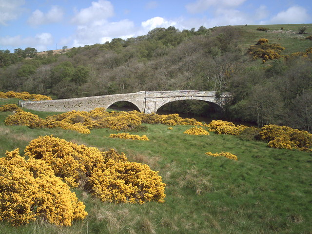
| Alwinton River Alwin Circular Walk | 5 miles (8 km) | This Northumberland based village has some lovely heather moorland, riverside trails, interesting geology, hill climbs and a historic old castle to explore. It's located in a splendid spot in Upper Coquetdale at the point where the River Alwin meets with the River Coquet. The village also has an interesting history with a 12th century Norman church and a fine old pub to visit. View Full Details>> | |
| Border County Ride | 80.8 miles (130 km) | This long distance circular route follows the Border County Ride through the Cheviots, Northumberland and along the England - Scotland border. View Full Details>> | |
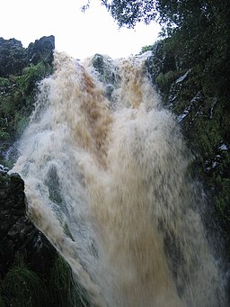
| Davidsons Linn | 9.9 miles (16 km) | This walk visits a remote waterfall in the Northumberland National Park. View Full Details>> | |
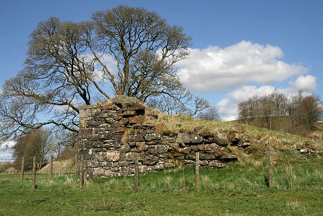
| Fatlips Castle | 0.6 miles (1 km) | This walk climbs to a wonderfully positioned peel tower in Roxburghshire, in the Scottish Borders. View Full Details>> | |
| Harbottle Crags and Woods Walk | 5 miles (8 km) | This circular walk from the Northumberland village of Harbottle climbs to Cold Law, Dove Crag and Harbottle Crags. View Full Details>> | |
| Harestanes | 4.6 miles (7.4 km) | This circular walk visits the Harestanes countryside centre near Jedburgh in the Scottish Borders. View Full Details>> | |
| Hedgehope Hill | 5.6 miles (9 km) | Climb to the 714 metres (2,343 ft) summit of Hedgehope Hill in the Cheviots on this challenging circular walk. The walk begins at the parking area at Langleeford by the Harthope Burn. You then ascend towards Housey Crags and Long Crags and onto the summit where there are fabulous views towards the coast and Lindisfarne Castle. You can descend the same way or head towards Harthope Linn waterfall where you can follow the Harthope Burn back to Langleeford. View Full Details>> | |
| Hepburn Woods | 2.5 miles (4 km) | This walk visits Hepburn Woods in Northumberland. There's miles of peaceful woodland trails and some fine views from the adjacent Hepburn Crag. View Full Details>> | |
| Hethpool Linn | 5 miles (8 km) | This walk in Northumberland visits the Hethpool Linn waterfall before a climb to the hillfort at West Hill. The falls are located in the College Valley, a beautiful and peaceful area with lots of interesting flora and fauna. View Full Details>> | |
| Humbleton Hill | 5 miles (8.1 km) | Enjoy a walk to Humbleton Hill from Wooler and take in the great views over the Cheviot Hills. The walk starts in the popular walking town of Wooler. Begin by following country lanes west out of the town to Wooler Common where you can pick up a trail along the Humbleton Burn. After about a mile you turn north, following a section of the St Cuthbert's Way past Brown's Law. You then branch to the right to pick up the trails that will take you up to the Humbleton Hill summit. Here you will find the remains of an Iron Age hillfort and splendid views towards Yeavering Bell, the Northumberland coast and the Scottish Hills. The hill is also of historical significan being the site of the Battle of Homildon Hill fought between the English and Scottish armies in 1402. View Full Details>> | |
| Ingram Brough Law Hill Fort and Cochrane Pike Walk | 5 miles (8 km) | This circular walk in the Ingram Valley climbs to the hill fort at Brough Law before heading to the nearby Cochrane Pike. View Full Details>> | |
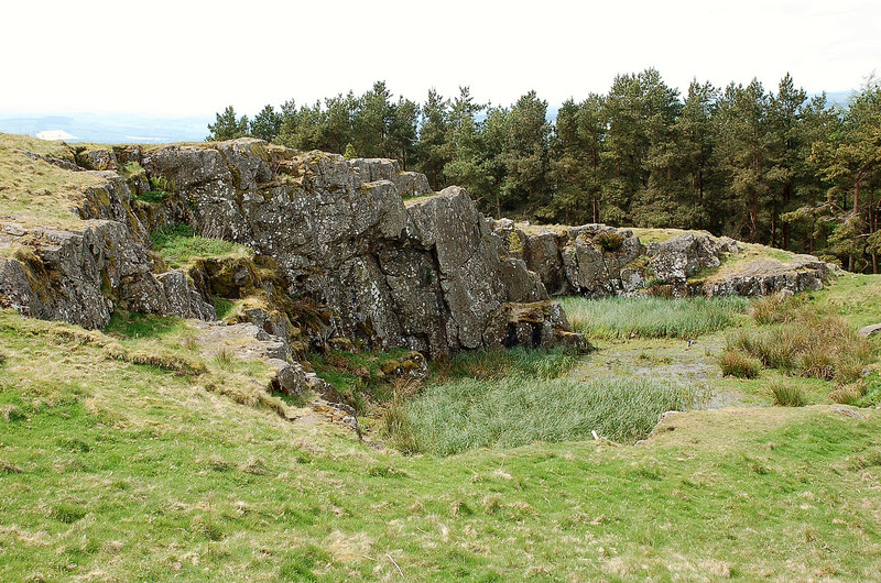
| Ingram Valley | 13.7 miles (22 km) | This walk takes you on a tour of the beautiful Ingram River Breamish Valley in the Northumberland National Park. You'll pass along rivers and burns with miles of open moorland and the Cheviot Hills making a splendid backdrop. The walk starts at the village of Ingram and heads west along the River Breamish and the Greensidehill burn towards Brough Law and Linhope. At Hartside you turn south and head towards Alnhamoor crossing the river as you go. You continue to Little Dod before picking up Salter's Road (a track) to climb High Cantle hill. You continue east towards Linhope where you can take a short detour to visit the splendid Linhope Spout waterfall. From Linhope you soon pick up the country lane from the start of the walk which will return you to Ingram. If you'd like to continue your walks in the area then you could climb the nearby Hedgehope Hill and The Cheviot. View Full Details>> | |
| Kershope Forest | 11.2 miles (18 km) | This circular walk explores the expansive Kershope Forest in Cumbria. The route runs for just over 11 miles with some climbs to the fells within the forest. View Full Details>> | |
| Kielder Forest Lakeside Way | 21.7 miles (35 km) | This fantastic circular cycling and walking route takes you around the beautiful Kielder Water in Kielder Forest Park, Northumberland. The route is known as the Lakeside Way and follows the shoreline of the reservoir on a lovely multi-user track. Along the way you can see twenty pieces of outdoor public art including the futuristic Belvedere shelter and the three large rotating Janus Chairs. There's excellent wildlife spotting opportunities with Ospreys regularly seen around the reservoir. The route also passes Kielder Dam and Kielder Castle where you will find an excellent visitor centre with exhibitions, information and a cafe. The castle is also the centre for cycling within the park - you can hire a bike here or get your own repaired. It is located at the northern tip of the reservoir at Kielder village. If you're looking for a more challenging cycle ride you will also find several colour coded mountain bike trails within the park. They range from the easy Borderline trail to the thrilling Deadwater black trail. For great views over the Lake District and the Scottish Hills you could climb Deadwater Fell from Kielder Castle. A few miles to the north there's a nice climb to Girdle Fell with great views over the lovely Catcleugh Reservoir. View Full Details>> | |
| Kielder Reservoir | 10.3 miles (16.5 km) | Enjoy a walk along the southern end of this expansive reservoir in Northumberland. The route visits the Bullcrag Peninsula and the Kielder Dam with fine views across the water throughout. The impressive man made reservoir is notable as the largest artificial lake in the United Kingdom by capacity of water. View Full Details>> | |
| Linhope Spout | 3.1 miles (5 km) | This short walk takes you to this lovely waterfall in the Ingram Valley. The walk starts at Hartside where there is parking available by the roadside. You then follow a country lane to Linhope where you cross the River Breamish and ascend to the waterfall and Linhope burn on public footpaths. The waterfall is an impressive 60 foot (18m) chute of water landing into a deep plunge pool below. On the walk there are splendid views of Great Standrop and Hedgehope Hill. Look out for Curlew and red squirrels on the way. Our Ingram Valley and River Breamish Valley circular walks both pass close to the falls. For a longer walk you could start from the Ingram Bridge car park and follow either of these trails to Linhope. Back in Ingram there's the option of visiting the nice Ingram Cafe where there's a good range of meals and snacks to enjoy after your exercise. If you'd like to continue your walking in the area then you could climb the nearby Hedgehope Hill and The Cheviot. View Full Details>> | |
| Newcastleton Railway Walk | 2.2 miles (3.6 km) | This walk takes you along the now disused Border Union Railway line in the village of Newcastleton in the Scottish Borders. View Full Details>> | |
| Otterburn Ranges | 11.8 miles (19 km) | This walk explores the Otterburn Ranges, an expansive Ministry of Defence owned area of the Northumberland National Park. View Full Details>> | |
| Redesdale Forest Three Kings Stone Circle and Hindhope Linn Walk | 3.7 miles (6 km) | This circular walk in the Redesdale Forest visits the Three Kings Stone Circle and the lovely Hindhope Linn waterfall. View Full Details>> | |
| River Breamish Valley | 13 miles (21 km) | This circular walk takes you along a lovely section of the River Breamish in the Cheviots. Start the walk from the village of Ingram where there is a handy public car park. Follow country lanes west towards the hill of Brough Law where there are the remnants of a Bronze Age settlement. The route then climbs to Hartside Hill where there are more ancient settlements, a cairn and fine views over the area. From the hill summit the route descends to the River Breamish where you can pick up some nice riverside paths. Bridleway lead you west to High Cantle where the route turns east toward Linhope. Here you can take a small detour from the route to visit Linhope Spout waterfall. The waterfall is an impressive 60 foot (18m) chute of water landing into a deep plunge pool below. After passing Linhope the route returns to the car park in Ingram, passing Hartside on the way. For an aternative route around the valley try our Ingram Valley Walk which visits Little Dodd. You could also try the climb to The Cheviot for fabulous views over the valley and beyond. View Full Details>> | |
| Ros Castle | 1.6 miles (2.5 km) | This walk climbs to an Iron Age Hillfort and splendid viewpoint in Northumberland. View Full Details>> | |
| Shepherds Cairn | 5.6 miles (9 km) | This circular walk takes you to the Shepherd's Cairn memorial near Alnham in the Northumberland National Park. View Full Details>> | |
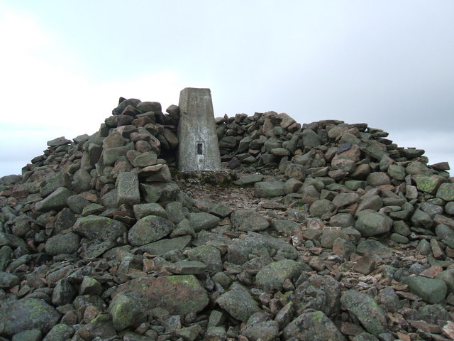
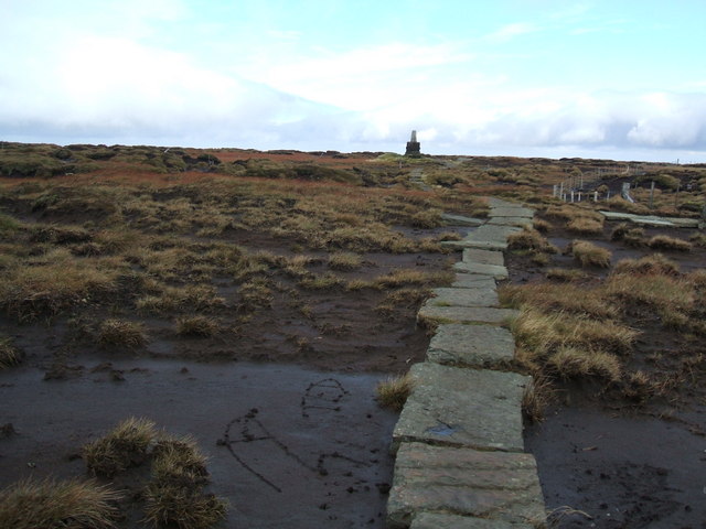
| The Cheviot | 8.7 miles (14 km) | This circular walk climbs to the 815 m (2,674 ft) summit of the highest hill in the Cheviot hills. The walk begins at the parking area at Langleeford by the Harthope Burn. The route then ascends along public footpaths and with the burn on your left. You continue to Cairn Hill passing the pretty Harthope Linn waterfall on the way. At Cairn Hill you pick up the Pennine Way to take you to the summit. This section takes place on stone slabs through an area of peat bog. At the summit you can enjoy excellent views of the North Sea, the Lake District Fells, Cross Fell and the Lammermuir Hills. You then descend back to Langleeford via Scald Hill. View Full Details>> | |
| Thrunton Woods | 5.3 miles (8.5 km) | Enjoy miles of cycling and walking trails in this large area of woodland near Alnwick. View Full Details>> | |
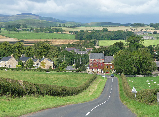
| Whittingham | 5.4 miles (8.7 km) | This pretty rural village in Northumberland sits in a scenic spot on the River Aln. View Full Details>> | |
| Windy Gyle | 9.9 miles (16 km) | Climb to the summit of this hill in the Cheviots and enjoy fabulous views into Scotland and England as you stand high on the border. This challenging circular route runs for a distance of about 10 miles using the bridleways and footpaths that cross the area. The walk begins from the Wedder Leap car park and heads towards Shorthope hill, crossing the River Coquet and following the Rowhope Burn as you go. You continue the climb to Little Ward Law before coming to Russel's Cairn at the 619 m (2,031 ft) summit of Windy Gyle. From here there are wonderful views over the Scottish Borders, the Eildon Hills and Edinburgh. You begin the descent by heading west along the Pennine Way and then south towards Swineside Law and Hindside Knowe. Shortly after you cross the River Coquet and return to the car park. This is a challenging walk but the footpaths are generally good and you're rewarded with some stunning scenery. To continue your walking in the Cheviots you could climb the highest hill - The Cheviot. View Full Details>> | |
| Wooler Common | 3.7 miles (6 km) | Explore this attractive area of woodland and common land on this walk in the Northumberland National Park. It's a very peaceful area with lovely views of the Cheviot Hills, two pretty ponds and an easy access trail to try. The town of Wooler is a popular base for walkers with direct access to the Cheviot Hills. The common is also a short walk from the town centre. Just follow the St Cuthbert's Way long distance trail south west and you soon come to the site. View Full Details>> | |
| Yeavering Bell | 3.1 miles (5 km) | Climb to the summit of this hilll in the Cheviots and visit the largest Iron Age hillfort in the region. The walk starts near Kirknewton at the Gefrin lay-by where there is some roadside parking. From here you head south climbing to the fort on public footpaths and the St Cuthbert's Way long distance path. View Full Details>> |