White Peak Walks

This stunning area of the Peak District is categorised by caves, limestone gorges and dry river valleys. It's splendid for walkers with highlights include a series of wonderful dales including Miller's Dale, Lathkill Dale and the popular Dovedale.
Use the links to view full route information including elevation profiles, interactive maps and GPS downloads.
You can also view an overview map of all the routes in the using the White Peak Walk Map>>
*New* - Walks and Cycle Routes Near Me Map - Waymarked Routes and Mountain Bike Trails>>
| Route Name | Photo | Distance | Description |
| Alstonefield | 6.2 miles (10 km) | This walk takes you from the Staffordshire village of Astonefield to Dovedale in the Peak District. View Full Details>> | |
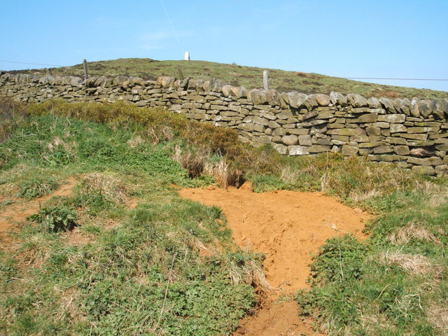
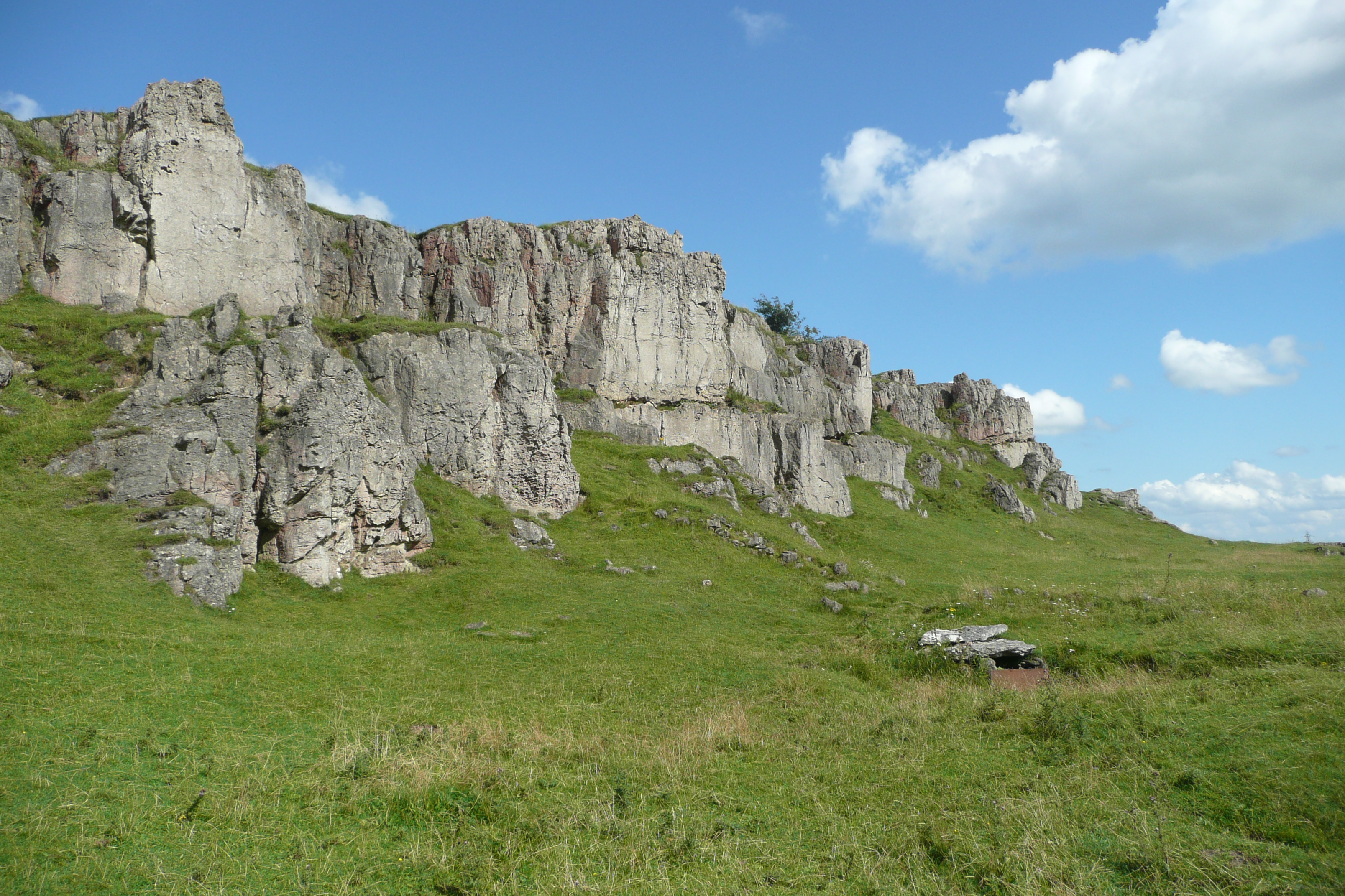
| Arbor Low | 0.9 miles (1.5 km) | Visit this Neolithic henge monument and enjoy some lovely moorland scenery on this fascinating circular walk in the Peak District. The site is located a few miles west of Youlgreave. You can park at Upper Oldhams Farm just off Long Rake. Walk through the farm (there is a Ł1 charge per person) and then climb towards Arbor Low. The limestone circle sits in an elevated position with super views over the White Peak area of the Peak District. The henge is one of the most well preserved in Britain with 50 large limestone slabs and fragments. It's an atmospheric place, thought to date back to 2500BC to 1500 BC. After you have explored the stone circle you can head south west to Gib Hill where you will find an ancient burial mound. The High Peak Trail and the Midshires Way both pass close to the site at Parsley Hay. You could pick up these long distance footpaths to extend your walking in the area. Heading north west will take you to Pomeroy while heading south takes you towards Hartington and the Biggin Dale Nature Reserve. Just over a mile to the north you'll find the beautiful Lathkill Dale. This is a great place to extend your walking in the White Peak. There are wonderful limestone cliffs and the rushing waters of the River Lathkill to enjoy. View Full Details>> | |
| Ashbourne to Dovedale Circular Walk | 8.1 miles (13 km) | This circular walk takes you from the popular town of Ashbourne to the beautiful Dovedale in the Peak District. You'll also visit the wonderful viewpoint at Thorpe Cloud. The route runs for just over 8 miles with a moderate climb on the way. The walk starts just to the north of the town where you can pick up the Tissington Trail. View Full Details>> | |
| Ashford in the Water | 1.2 miles (2 km) | The pretty Peak District village of Ashford in the Water has some nice walking trails to try along the River Wye. It's a picture postcard area with quaint stone cottages, nice pubs and lovely views of the river and the old Sheep Wash Bridge. This short walk takes you from Ashford in the Water to the nearby town of Bakewell. It's about a one mile walk, passing Ashford Lake and Lumford Mill with river views on the way. You can return the same way or get the bus back from Bakewell. View Full Details>> | |
| Bakewell Railway Walk | 7.5 miles (12 km) | This circular railway walk from Bakewell uses part of the Monsal Trail to take you to the nearby Monsal Head. You'll then visit the neighbouring village of Ashford in the Water before returning to the town. View Full Details>> | |
| Bakewell River Circular Walk | 9.6 miles (15.5 km) | The market town of Bakewell makes and excellent base for exploring the Derbyshire Dales area of the Peak District National Park. This long circular walk visits some of the villages, parks, woods and hills surrounding the town. There's lots to see with riverside paths, historic halls and beautiful countryside. The walk starts in the centre of the town and then climbs past Bakewell Hill Golf Club towards Calton Pasture where there are nice pockets of woodland and good views of the surrounding area. On this section you climb to a height of well over 800ft with a trig point on Calton Pasture to look out for. From here you descend to New Piece Wood before reaching the village of Edensor. The little village is noted for the Grade I listed St Peter's Church. Many of the Dukes of Devonshire, are buried in the churchyard. There is also the Cavendish Memorial, an early 17th century church monument to Henry and William Cavendish, commemorating the sons of Sir William Cavendish and Bess of Hardwick. Near the church you can enjoy refreshments at the delightful Edensor Tea Cottage. The walk continues to the nearby Chatsworth Park. The magnificent park is one of the highlights of the Peak District and well worth visiting if you have time. In the park you will find 1000 acres of parkland and gardens with views of the River Derwent, woodland trails and fallow deer. At Chatsworth you can pick up the Derwent Valley Heritage Way and enjoy a waterside walk south along the River Derwent. On this section you pass Calton Lees before coming to the village of Rowsley. The little village is notable as the point where the River Wye flows into the River Derwent. There's also the Grade-II listed Peacock hotel, which dates from the middle of the 17th century. The 19th century St Katherine’s Church is also noteworthy. The 7th Duke of Rutland laid coins of every value, from a sovereign to half a farthing in the foundation of the church. After leaving Rowsley the walk heads west through Manners Wood before coming to Haddon Hall and Park. The fine country house on the River Wye is one of the seats of the Duke of Rutland. The hall originates from the 11th century with the medieval and Tudor hall dating from the 13th to the 17th centuries. Haddon Hall was used as the setting for Thornfield Hall in the 2006 BBC television version of Jane Eyre, starring Toby Stephens and Ruth Wilson. You can explore the lovely grounds with Elizabethan terraced gardens and views over the River Wye. You can generally visit the hall during the summer months. The final section of the walk follows the River Wye, back into Bakewell where you can enjoy refreshments at one of the many pubs and cafes. View Full Details>> | |
| Bakewell to Chatsworth Walk | 3.7 miles (6 km) | Walk from the town of Bakewell to the magnificent Chatsworth House in the Peak District. View Full Details>> | |
| Baslow | 8.7 miles (14 km) | The pretty Peak District village of Baslow gives access to a number of great walking routes. The popular village sits on the River Derwent which is spanned by a 17th-century bridge. There's also a pretty village green and nice pubs and cafes for refreshments. This circular walk visits Baslow Edge, Curbar Edge and Froggatt Edge before returning to the village along the River Derwent. There's great views from over the moors from Curbar Edge and interesting geological features. Along the river there's weirs, mills and the villages of Grindleford and Calver. View Full Details>> | |
| Baslow Edge | 1.9 miles (3 km) | A circular walk up to Baslow Edge in the Peak District National Park. The route runs for about 2 miles with a moderate climb on the way. From the elevated position of the Edge there are fine views over the countryside to Chatsworth Park. You'll also pass some interesting gritstone rock formations and a monument to a famous figure from British history. You can start the walk from the public car park just to the east of Curbar and just north of Baslow Edge. From here you can pick up trails heading south up to the Edge. Here you'll pass the noteworthy Eagle Stone which people like to climb up for better views and a wee challenge. Also near here is Wellington's Monument. The stone cross is dedicated to the Duke of Wellington and a celebration of his victory at the battle of Waterloo. After rounding the stone and monument the route follows alternative trails back to the car park. View Full Details>> | |
| Beeley | 8.2 miles (13.2 km) | This circular walk visits the delightful village of Beeley in the Derbyshire Dales. View Full Details>> | |
| Beresford Dale | 2.5 miles (4 km) | This walk takes you into the pretty Beresford Dale National Nature Reserve in the Derbyshire Peak District. It's a very peaceful and attractive area of the Dove Valley with riverside paths, weirs, woodland, wildflowers and birdlife to enjoy. This circular walk starts from the village of Hartington. From the western side of the village you can pick up a footpath heading south into Beresford Dale. You'll soon come to the reserve where you'll pass a series of weirs, wooden footbridges, limestone scenery and a Pike Pool. Just before Wolfscote Dale the route turns around, picking up other footpaths and country lanes to return you to the village. Back in the village you can enjoy refreshments at the Devonshire Arms pub. The quaint old 17th century pub has a lovely large beer garden to relax in during the warmer months. To extend your walk continue south to Wolfscote Dale, Milldale and the hugely popular Dovedale. View Full Details>> | |
| Biggin Dale | 4 miles (6.5 km) | This walk explores the beautiful Biggin Dale National Nature Reserve in the Peak District. View Full Details>> | |
| Birchen Edge | 1.6 miles (2.5 km) | Climb to this gritstone edge and enjoy wonderful views over the Derwent Valley in the Peak District. You can start the walk from the Robin Hood pub car park just to the south of Birchen Edge. From here you can pick up the footpaths to take you across the gritstone edge to the wonderful view point where you will find Nelson's Monument. Next to this are three boulders carved with the names of three of Nelson's ships: Victory, Defiance and Royal Soverin. It's a splendid spot with interesting rock formations and fabulous views over the surrounding area. Just to the west you'll find Gardom's Edge. A public footpath runs past it towards Eagle Stone and Baslow Edge. This is a good option if you'd like to further explore this geologically fascinating area. You should see lots of rock climbers as you go. Birchen Edge is located very close to the splendid Chatsworth Park. Here you'll find 1000 acres of parkland to explore with views of the River Derwent, woodland trails and fallow deer. The Derwent Valley Heritage Way also passes nearby Baslow so you can enjoy a riverside stroll through the area. Also nearby is the spectacular Curbar Edge which has more interesting rock formations and expansive views of the Eastern Moors. View Full Details>> | |
| Bradford Dale | 2.4 miles (3.8 km) | This lovely riverside walk from Youlgreave takes you along the River Bradford before climbing above the village for some great views. Start the walk in the village and follow Hollywell Lane to the river. Here you can pick up a section of the Limestone Way long distance footpath. Follow the trail west along the river passing a number of weirs and some woodland below Moatlow Knob. The river bends round to the south near Middleton where you pick up footpaths taking you up to Wensley Hill. The route then descends back to the river where you enjoy a final riverside section back to Hollywell Lane. View Full Details>> | |
| Castle Naze | 0.6 miles (1 km) | This walk visits an elevated fort near Chapel en le Frith in the White Peak area of the Peak District. View Full Details>> | |
| Chatsworth Park | 5.6 miles (9 km) | This circular walk takes you around the splendid Chatsworth Park in the Derbyshire Peak District. There's 1000 acres of parkland to explore with views of the River Derwent, woodland trails and fallow deer. The park is in a great location for walking with some great options for extending your exercise. You could pick up the Derwent Valley Heritage Way long distance footpath which runs past the estate. You can follow it north to Baslow or south to Calton Lees. About a mile north east of Chatsworth you can enjoy a climb to Birchen Edge. The gritstone edge provides stunning views over the Derwent Valley from the high points. The park is not far from the lovely town of Bakewell. You could reach it by following the Bakewell Circular Walk from the town. This visits the nearby village of Edensor and the medieval Haddon Hall which is also well worth a visit. View Full Details>> | |
| Chelmorton | 9 miles (14.5 km) | This circular walk explores the area around the Peak District village of Chelmorton near Buxton in the White Peak. The interesting village includes typical limestone walls, an 18th century pub, an 11th century church and the Illy Will Water stream running through the settlement. View Full Details>> | |
| Derwent Valley Heritage Way | 51 miles (82 km) | Follow the River Derwent through the Derbyshire Peak District on this stunning walk. The path runs from Derwent Mouth, Shardlow and passes through Derby, Belper and Matlock on your way to the finish point at Ladybower Reservoir, Heatherdene. Highlights on the route include a lovely section along the Cromford Canal from Cromford to Ambergate. You'll also pass the splendid Chatsworth Park with its 1000 acres of parkland with woodland trails and fallow deer. At Matclock you will pass High Tor hill where you can enjoy some wonderful views over the surrounding area. View Full Details>> | |
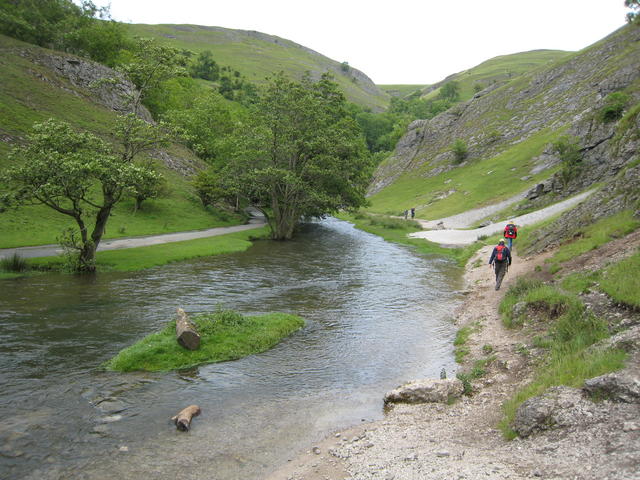
| Dovedale | 2.5 miles (4 km) | The beautiful Dovedale is one of the must see areas in the Peak District. The area attracts a million visitors each year because of its stunning natural beauty. The walk starts at the Dove Dale car park, near Thorpe. It's a large car park so there should be spaces available most of the time. You then head north along the River Dove to the famous Dovedale Stepping Stones. The stones were first set down in the 19th century for Victorian tourists to cross the river. It's a lovely place to stop for a while, with great views of Thorpe Cloud, a large limestone hill towering over the river. From the stones you continue north to Lovers' Leap. Legend says that a young woman who believed her lover had been killed in the Napoleonic Wars threw herself from the rock. She was saved when her skirt caught in the branches of a tree below. When she returned home, she heard her lover was still alive. You can use the steps provided to climb this rock formation for splendid views of the dale. The next section takes you to the fascinating Reynard's Cave, passing the huge Tissington Spires on the way. You can enter the huge natural arch of Reynard's Cave and enjoy wonderful views of the area. You continue to Pickering Tor and then onto the imposing Dove Holes caves, before the final stretch to the village of Milldale. Here you can enjoy refreshments at the tea shop before the return leg. If you would like to continue your walking in the area then you could head to the nearby Ilam Park. The park can be easily reached from the same start point for this walk by following a footpath west for about a mile. Youl can then visit Bunster Hill, Hinkley Wood and the beautiful Ilam Hall gardens. If you continue north along the riverside path you will come to Wolfscote Dale and Biggin Dale nature reserves. For a longer route try our Dovedale Circular Walk which starts from the delightful village of Tissington and makes use of two of the long distance trails which run through the area. View Full Details>> | |
| Dovedale Circular Walk | 9.6 miles (15.5 km) | This popular circular walk takes you from Dovedale to Milldale using sections of the Tissington Trail and Limestone Way to take you on a tour of this popular area of the Peak District. It's just under 10 miles and includes riverside paths, woodland sections and some moderate hill climbs. The walk starts in the little village of Tissington where parking is available. It's a popular and picturesque place with pretty little cottages and a village pond. From Tissington you can pick up a section of the Limestone Way and follow it south west to Thorpe, passing Tissington Hall on the way. The 17th-century Jacobean mansion is Grade II* listed and includes pretty garden terraces and a stable block. It is open to the public at certain times of the year. From Thorpe you head west to St Mary's Bridge on the River Dove, where you pick up a riverside footpath heading north towards Thorpe Cloud and the photogenic Dovedale Stepping Stones. The delightful valley is one of the most popular places in the national park with its distinctive limestone scenery, fascinating caves and diverse plant life. You continue north past Bunster Hill, the Dove Hole Caves and the striking Ilam Rock before coming to Milldale. Here you turn east away from the river, towards Alsop en le Dale, where you pick up the Tissington Trail. The shared cycling and walking trail will take you south east back to the village and the finish point. On the open sections of the trail there are seats where you can enjoy fine views of the surrounding Derbyshire countryside. If you enjoy this walk then you could try our Ilam Circular Walk which is of a similar length and level of difficulty. View Full Details>> | |
| Eyam Circular Walk | 5.1 miles (8.2 km) | A circular walk around the Peak District village of Eyam, visiting Eyam Edge, Bretton Moor and the village of Foolow. Starting from the village centre you head north to the Plague Stone and Bole Hill. Soon after you come to Sir William Hill Road whcih you follow west to Eyam Edge and Bretton Moor. There's some lovely views of the White Peak from the elevated position of William Hill and the adjacent moor. The route then descends to Bradshaw Lane which you follow to the small village of Foolow. Here you'll find a nice village green with an ornate medieval cross and the Grade II listed St Hugh’s Church. From Foolow you can pick up a public footpath heading east across farmland back into Eyam. View Full Details>> | |
| Foolow | 4.8 miles (7.8 km) | This Derbyshire village lies just to the west of Eyam in the Peak District National Park. View Full Details>> | |
| Gradbach | 13 miles (21 km) | This little hamlet in the Peak District is an ideal place to start a walk with several Peak District highlights nearby. The hamlet includes a free car park and an 18th century mill. The mill is now a decent Youth Hostel so you can stay over if you need to as well. View Full Details>> | |
| Great Longstone | 2.4 miles (3.8 km) | This Derbyshire Dales based village is a great base for exploring some of the Peak District's highlights. It's an historic area with a 13th century church and 18th century hall. Neighbouring Little Longstone, further west, has a 17th-century manor house and still has its village stocks. View Full Details>> | |
| Grindleford to Hathersage Walk | 3.1 miles (5 km) | This walk takes you along the River Derwent from Grindleford to Hathersage along the River Derwent. The walk runs for just under 3 miles, making use of the waymarked Derwent Valley Heritage Way for most of the way. On the route you'll pass the ancient Padley Chapel and enjoy nice river views. The walk has train stations at both ends so you have the option of catching the train back. The walk starts from Grindleford train staion which is reachable from Sheffield and Manchester Piccadilly. You then head west past Padley Chapel before turning north through Coppice Wood to the river. The riverside path takes you past Kettle House and Leadmill before turning north east to take you into Hathersage. You could turn it into a longer circular walk by returning via Hathersage Booths and Oxhay Wood, just to the east of the river. View Full Details>> | |
| Haddon Hall | 2.5 miles (4 km) | This walk visits Haddon Hall near Bakewell and Over Haddon in the Derbyshire Peak District. View Full Details>> | |
| Hartington | 5.9 miles (9.5 km) | This pretty village is a great base for exploring some of the highlights of the popular Dove Dale area of the Peak District. The village includes attractive houses and a pretty green and duck pond. There's also an interesting history with the
13th century parish church of Saint Giles and the 17th century Hartington Hall. Hartington is popular with tourists so there are good facilities with a car park, pubs, a youth hostel and a visitor centre at Hartington signal box, on the site of the former Hartington railway station. From the village you can directly explore the lovely Beresford Dale and Wolfscote Dale Nature Reserves, just to the south of the centre. This then leads you into Dovedale which is one of the highlights of the Peak District. Just to the east of the village you can pick up the Tissington Trail. This cycling and walking trail follows a disused railway line through some stunning scenery. Right next to that is the High Peak Trail which also follows an old railway line from Cromford to Dowlow. These two rail trails are a great way to explore the Peak District on foot or by bike. The fascinating Neolithic henge monument of Arbor Low is also within easy reach of the village. The limestone circle sits in an elevated position with super views over the White Peak area of the Peak District. The Midshires Way and Pennine Bridleway long distance trails can also be picked up just to the east of the village. The circular walk below takes you from the village through Wolfscore Dale before returning through the adjacent Biggin Dale. View Full Details>> | |
| Hulme End | 9.9 miles (16 km) | This challenging circular walk from the village of Hulme End visits several Peak District highlights. View Full Details>> | |
| Ilam Circular Walk | 8.4 miles (13.5 km) | Explore Ilam Park before heading into the beautiful Manifold Valley on this circular walk in the Staffordshire Peak District. The route runs for just over 8 miles and includes some moderately challenging hill climbs, so a reasonable level of fitness is required. The walk starts in the parking area of the National Trust owned Ilam Park. The park is a great base for exploring the White Peak area of the national park and includes lovely gardens and the Grade II* listed Ilam Hall. You can follow footpaths west across the park before crossing the River Manifold and climbing past Musden Low hill where there are great views over the area. The route continues west past the village of Calton before coming to the River Hamps where you pick up the Manifold Way long distance trail. At Beeston Tor you have the option of continuing north along the River Manifold but this route turns south east past Old Park Hill. You'll pass the ruins of Throwley Old Hall before following country lanes to Rushley and then back to Ilam Park. If you enjoy this walk then you could head east from the park and try our Dovedale Circular Walk. The route visits the beautiful valley of the River Dove with its fascinating limestone rock formations, interesting plant life and cave system. You can also pick up the long distance Limestone Way and explore the Peak District's finest limestone scenery. View Full Details>> | |
| Ilam Dovedale Circular Walk | 6.8 miles (11 km) | This circular walk takes you from Ilam Park into the beautiful Dovedale in the White Peak. It's about a 7 mile walk with a moderate climb on the way so a reasonable level of fitness is required. View Full Details>> | |
| Ilam Park | 1.2 miles (2 km) | Ilam Country Park is a delightful open space owned by the National Trust. It is situated on the River Manifold about five miles north west of Ashbourne in the Staffordshire and Derbyshire Peak District. Highlights in the park include Ilam Hall and gardens, Bunster Hill, Hinkley Wood, a Visitor Centre, tea-room and shop. The park is perfect for a short riverside stroll in one of the prettiest areas in England. It's easy to extend your walk in this beautiful area by heading to the nearby Dovedale. You can follow a footpath east for about 1 mile to reach the River Dove and the famous Dovedale Stepping Stones. You could also try our Ilam Circular Walk which starts from the park. It explores the valleys of the River Manifold and the River Hamps to the west of Ilam Park. View Full Details>> | |
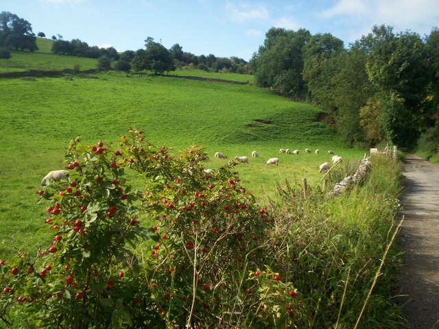
| Lathkill Dale | 8.1 miles (13 km) | Enjoy a splendid riverside walk in the beautiful Lathkill Dale in the Peak District. The dale is a peaceful, atmospheric area flanked with large limestone cliffs and woodland. Along the River Lathkill you'll pass pretty waterfalls and weirs and a wide variety of flora and fauna. Look out for birds such as ducks, herons, wagtails, dippers, waterhens and coots. The river is very clear and pure so it's easy to spot fish swimming alongside you on your walk. Along the river there are also interesting flora such as wildflowers and the rare wild plant Jacob's Ladder. This circular walk begins in the lovely village of Monyash at the excellent Bulls Head Pub, and follows footpaths through Bagshaw Dale to the river. You follow the river to Over Haddon where you can stop for refreshments at the splendidly positioned Lathkil Hotel. You then return on the same path for about half the way, before crossing the river and picking up the Limestone Way to take you back to Monyash. This is a super, varied walk with riverside, woodland and countryside sections to enjoy. Most of it is fairly flat so it's suitable for people of all abilities. View Full Details>> | |
| Litton Mill | 5.6 miles (9 km) | This circular walk visits the historic Litton Mill near Tideswell in the Derbyshire Dales. View Full Details>> | |
| Lud's Church | 3.1 miles (5 km) | This walk visits the fascinating deep chasm of Lud's Church on the edge of the Staffordshire Peak District. It's a lovely place for a walk with nice views of the Dane Valley and woodland trails through Forest Wood and Gradbach Wood near the chasm. You can start the walk from the car park off Gradbach Mill Lane, about a mile to the east of the cave. From here you can pick up the Dane Valley Way and follow the River Dane to the chasm. The Millstone Grit geological formation is covered in moss and has an unusual atmospheric feel to it. It's 100 metres (328ft) long and 18 metres (59 ft) deep so you can walk along for quite a way between the tall mossy rocks. After exploring Lud's church you can explore the surrounding woodland before crossing Black Brook and returning to the car park along the riverside path. This area of the White Peak is great for walkers so there's lots of options for extending your walk. You could continue west along the Dane Valley Way and visit nearby Danebridge. From the same car park you can visit Three Shires Head. The beautiful area is where the counties of Cheshire, Derbyshire and Staffordshire meet. There's lots of pretty waterfalls and a wonderful grade II listed packhorse bridge over the River Dane. Just to the south of Lud's Church you will find The Roaches. The elevated rocky ridge, includes fascinating rock formations and wonderful views of the surrounding countrsyide. View Full Details>> | |
| Magpie Mine | 1 mile (1.6 km) | This walk visits the Magpie Mine from the Derbyshire village of Sheldon. The trail exposes you to the interesting industrial heritage of the area. There's also some fine views of the surrounding White Peak limestone countryside from the photogenic site. View Full Details>> | |
| Manifold Way | 8.1 miles (13 km) | Follow the River Manifold and the River Hamps through the Manifold Valley on this splendid shared walking and cycling path through the Peak District. The path runs from Waterhouses to Hulme End along a former railway line with beauitful Peak District Scenery to enjoy. The route passes Beeston Tor, Wetton Mill and the wonderful Thor's Cave which is well worth exploring. View Full Details>> | |
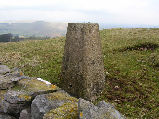
| Middleton Top | 6.8 miles (11 km) | At Middleton Top you will find an excellent visitor centre with a number of good walking trails to try. The site includes the Middleton Top Engine House which you can visit on certain weekends throughout the year. Built in 1829 it was used to haul wagons up the Middleton incline and has been recently restored. This circular walk takes you west from the centre to Harboro Rocks, before returning via Griffe Grange and Middleton Moor. The route makes use of some of the popular waymarked trails which run through the area. Starting from the centre car park you head west along the High Peak Trail. The shared walking and cycle path follows a disused railway line from Cromford to Dowlow. This section will take past Eniscloud Farm to Harboro Rocks. There's super views from here over the Peak District and the lovely Carsington Water. Just after passing the rocks you turn north east to pick up a section of the Limestone Way. A footpath then turns south east to take you through Griffe Grange before passing the quarries on Middleton Moor. The route then turns south to return you to the visitor centre and the finish point of the walk. Another good walk to try from the centre is the hike to the Cromford Black Rocks. View Full Details>> | |
| Minninglow | 1.1 miles (1.7 km) | This walk climbs to Minninglow Hill in the White Peak area of the Peak District National Park. View Full Details>> | |
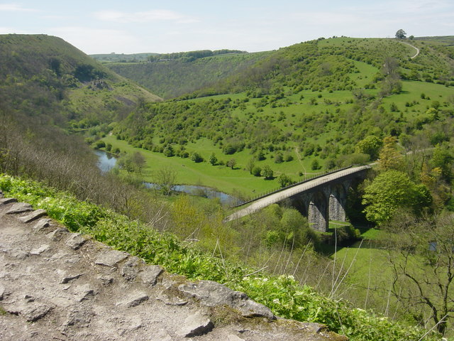
| Monsal Head | 1.2 miles (2 km) | This circular walk from Monsal Head crosses the Headstone Viaduct for fine views across the Derbyshire Dales. View Full Details>> | |
| Monsal Trail | 9.9 miles (16 km) | Follow the Monsal Trail through the Peak District National Park on this cycling and walking path. The trail follows a disused railway line from Chee Dale near Buxton to Bakewell with the first section following the River Wye to Monsal Head via Cressbrook Dale and Miller's Dale. This popular beauty spot includes shady wooded valleys, rushing rivers and lots of interesting flora and fauna. At Monsal Head you will pass over the impressive Headstone Viaduct, built in 1836. The second section runs onto Bakewell passing Great Longstone with more stunning views to enjoy. View Full Details>> | |
| Monyash | 11.2 miles (18 km) | A circular walk from the village of Monyash visiting Youlgreave, Bradford Dale and the popular Lathkill Dale. The pretty village makes a good base for exploring the limestone scenery of the White Peak. There's a nice village green, pub, cafe and a notable Grade II listed church with Norman sections and a 15th century font. From the car park in the village you can pick up the Limestone Way long distance footpath. The trail runs south east, passing Fern Dale and Cales Dale before coming to Bradford Dale. Here you can follow nice riverside trails along the River Bradford into Youlgreave. In the village there are a number of good pubs where you could stop for refreshments at what is roughly the half way point on the walk. The route leaves the village, heading north east to the River Lathkill near Alport. Follow the river north, crossing the bridge at Conksbury before entering Lathkill Dale. View Full Details>> | |
| Padley Gorge Circular Walk | 3.1 miles (5 km) | This circular walk takes you through the beautiful Padley Gorge, part of the wider Longshaw Estate in the White Peak area of the Peak District National Park. The route runs for a distance of just over 3 miles and includes some moderate climbs. You'll reach a height of over 1000ft from the high points with great views to enjoy over the Peak District hills and a series of photogenic waterfalls. The walk starts from Grindleford Station but you could just as easily start from the car park at the Longshaw Estate visitor centre which is also on the route. From the station you can pick up the Padley Gorge Trail and follow it along the pretty Burbage Brook which runs through the wooded gorge. At Burbage Bridge you turn south east, passing the Fox House Inn and the Longshaw Estate visitor centre. The centre is housed in the Shooting Lodge and includes nice tea rooms where you could stop for refreshments. The final section runs through Granby Wood and the oak woodland of Yarncliff Wood before returning to the station. View Full Details>> | |
| Parwich | 10.3 miles (16.6 km) | This attractive Peak District village has a nice village green, picturesque old limestone cottages, an historic church and a fine 17th century pub to relax in after your walking. View Full Details>> | |
| Rowsley | 8.7 miles (14 km) | This village is located in a lovely spot in the Derbyshire Dales area of the Peak District. It is notable as being on the border of the Peak District National Park which runs through the village west of the River Wye and immediately to the north of Chatsworth Road. Rowsley is also near the point where the River Wye flows into the River Derwent. The village is home to the Peak Shopping Village. There's a good range of stores with plenty of eateries for refreshment. At the time of writing a new nature reserve on the banks of the Derwent is being created by the shopping outlet and Derbyshire Wildlife Trust. View Full Details>> | |
| Stoney Middleton | 3.1 miles (5 km) | Enjoy a short walk through the pretty Coombs Dale on this route from the village of Stoney Middleton. There's some nice limestone scenery, attractive woodland, and nice views over the surrounding Peak District countryside. Just to the west of the village centre you can pick up a footpath heading south to Coombs Dale. Here you follow a tree lined bridleway through the dale. You head towards Deep Rake at the southern end of the dale. Here you have the option of heading a short distance to the west and enjoying a walk along Longstone Edge. The limestone ridge runs from east to west for about 6 kilometres (3.7 mi), from the village of Calver to the River Wye at Monsal Dale. There's fabulous over the White Peak from the 395 metres (1,296 ft) high point. You could also head north east to Calver Peak and the village of Calver. This walk follows other footpaths back through the dale before returning to Stoney Middleton. Back in the village you can enjoy refreshments at the walker friendly Lover's Leap cafe or the Moon Inn pub. View Full Details>> | |
| Thor's Cave | 1.6 miles (2.5 km) | This walk takes you to the stunning natural cavern
of Thor's Cave in the Manifold Valley area of the Peak District. There is a good footpath through the countryside from the nearby village of Wetton which takes you to the cave. Once there you can enter the cave and enjoy the fascinating rock formations and mineral colours. It's a magical place with interesting nooks and crannies to explore. There are also great views of the Manifold Valley through the cave entrance. You can return to Wetton along the same path and then enjoy refreshments at the 18th century Royal Oak Inn. It's also nice to have a stroll around Wetton Village with its little cottages, village green and church which has a 14th century tower. The River Manifold and the Manifold Way run right past the caves so an alternative route would be to start from Waterhouses and follow the lovely riverside path to the cave. If you'd like to cycle to the cave you can hire bikes from the Manifold Valley Cycle Centre and follow the Manifold Way to the cave. If you'd like to extend your walking in the area then you could visit the nearby Dovedale where you will find a lovely walking path along the River Dove to the famous stepping stones. View Full Details>> | |
| Thorpe Cloud | 1.2 miles (2 km) | This short walk climbs to the top of Thorpe Cloud in the Peak District. This small hill can be climbed from the Dove Dale car park. It's a short climb on good footpaths with the reward of wonderful views over the beautiful Dovedale Thorpe Cloud reaches a height of 287 m (942 ft). It was used in the 2010 film of Robin Hood, starring Russell Crowe. To continue your walking in the area you could visit Ilam Park and Dovedale. View Full Details>> | |
| Weaver Hills | 5.6 miles (9 km) | This circular walk explores the Weaver Hills area of the White Peak. View Full Details>> | |
| Wetton | 3.1 miles (5 km) | This pretty Peak District village is in a fine location for exploring the mills and caves of the River Manifold Valley and the White Peak . View Full Details>> | |
| White Peak | 22.4 miles (36 km) | A long circular walk around the White Peak area of the Peak District. The route uses some of the area's waymarked long distance trails to take you on a tour of several of the White Peak's highlights. The walk is just over 22 miles in distance and quite challenging in parts so is best completed over 2 days. You can start off in the popular town of Bakewell where you can pick up the Monsal Trail. The shared cycling and walking trail will take you north west to Monsal Head, site of the photogenic Headstone Viaduct. You then head west through a series of beautiful dales along the River Wye. You'll pass Cressbrook before coming to the lovely Miller's Dale where there's shady wooded valleys, rushing rivers and lots of interesting flora and fauna to see. The trail continues through Chee Dale, Wye Dale and Deep Dale where you pick up a section of the Midshires Way to take you south east to Chelmorton. Near here you join the Limestone Way which takes you to Monyash. Here you enter another highlight of the White Peak at Lathkill Dale. The dale is a peaceful, atmospheric area flanked with large limestone cliffs and woodland. After passing through the dale you emerge near Over Haddon where you follow public footpaths back through the countryside to Bakewell. View Full Details>> | |
| Wolfscote Dale | 7.5 miles (12 km) | This walk visits Wolfscote Dale in the Dove Dale area of the Peak District. You can start the walk from the village of Hartington just north of the dale. There's a car park and cafe in the village so it makes a good start and end point for the walk. The footpaths then head south to Beresford Dale Nature Reserve where there's riverside paths, weirs, woodland, wildflowers and birdlife to enjoy. The route then crosses a wooden footbridge and leads you into the Wolfscote Dale Nature Reserve. The footpath winds its way along the River Dove with woodland sections and a number of weirs to enjoy. It's a beautiful area with the option of continuing south along the river to Milldale and then on to Dovedale. You could also visit the nearby Ilam Park where there are beautiful gardens and views of the River Manifold. Just to the east of Wolfscote Dale is the Biggin Dale Nature Reserve. You could return to Hartington on the footpath through the reserve. It's a lovely area with lots of interesting plants and flowers to look out for. The dale is located near to the pretty village of Alstonefield which makes a worthy alternative start point for the walk. View Full Details>> |