County Durham Walks

Use the filter to show walks of a certain type such as woods, reservoirs, hills, long distance, country parks, canals and rivers.
In the spring walkers flock to the beautiful bluebell woods in the County Durham area. Click the 'Woodland' button below to see these.
Use the links to view full route information including elevation profiles, interactive maps and GPS downloads.
You can also view an overview map of all the routes in the using the County Durham Walk Map>>
*New* - Walks and Cycle Routes Near Me Map - Waymarked Routes and Mountain Bike Trails>>
| Filter: |
| Route Name | Photo | Distance | Description |
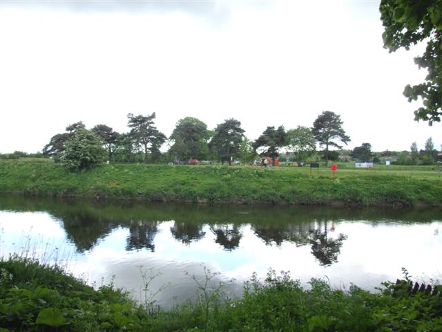
| Allensford Country Park | 3.1 miles (5 km) | Enjoy riverside woodland walks and magnificent views of the Derwent Valley in this country park near Consett. The River Derwent runs right through the park, with riverside footpaths to follow. The park has picnic tables, a shop and a nature trail in Deneburn Wood. View Full Details>> | |
| Auckland Walk | 4.7 miles (7.5 km) | A short cycle and walking route along a dismantled railway line from Spennymoor to Bishop Auckland. This is a nice, easy route ideal for families. View Full Details>> | |
| Balderhead Blackton and Hury Reservoirs | 4.7 miles (7.5 km) | This walk visits a series of picturesque reservoirs in Baldersdale, on the east side of the Pennines. The walk starts at the parking area at the eastern end of Balderhead Reservoir where there are wonderful views over the water to the surrounding countryside. You then head around Blackton Reservoir to the western end of Hury Reservoir, before returning to Balderhead via the Pennine Way. It's a fairly easy walk with some waterside sections and wonderful views of the beautiful Baldersdale. The area around Blackton Reservoir is a nature reserve so look out for a variety of wildlife on your walk. View Full Details>> | |
| Barnard Castle | 3.7 miles (6 km) | Enjoy a walk around the historic castle and along the River Tees on this walk in County Durham. It's a fascinating town with a 12th century castle and the ruins of Egglestone Abbey. This walk starts in the centre of town and follows a section of the long distance Teesdale Way along the River Tees. You'll pass the castle before coming to the ruined abbey where you can cross the river on Abbey Bridge. You can then follow other public footpaths on the other side of the river back to the town. The 12th century castle ruins are well worth exploring with nice views over the Tees Gorge, a sensory garden of scented plants and remains of the medieval chapel of St Margaret. Egglestone Abbey ruins are another major highlight on the walk. The atmospheric ruins overlook the river and include remains of a 13th century church and a range of living quarters, with evidence of an ingenious toilet drainage system. Another must see in the town is the Bowes Museum. The museum is located just to the east of the river and contains a nationally renowned art collection with works by El Greco, Francisco Goya, Canaletto, Jean-Honore Fragonard and Francois Boucher. There's also beautiful landscaped gardens to explore. View Full Details>> | |
| Barningham Trail | 24.2 miles (39 km) | Travel through the beautiful Yorkshire Dales National Park on this circular walk around the pretty village of Barningham in County Durham. The walk passes through the stunning Arkengarthdale- the northernmost of the Yorkshire Dales where there are stunning views of the Pennine Hills to enjoy. View Full Details>> | |
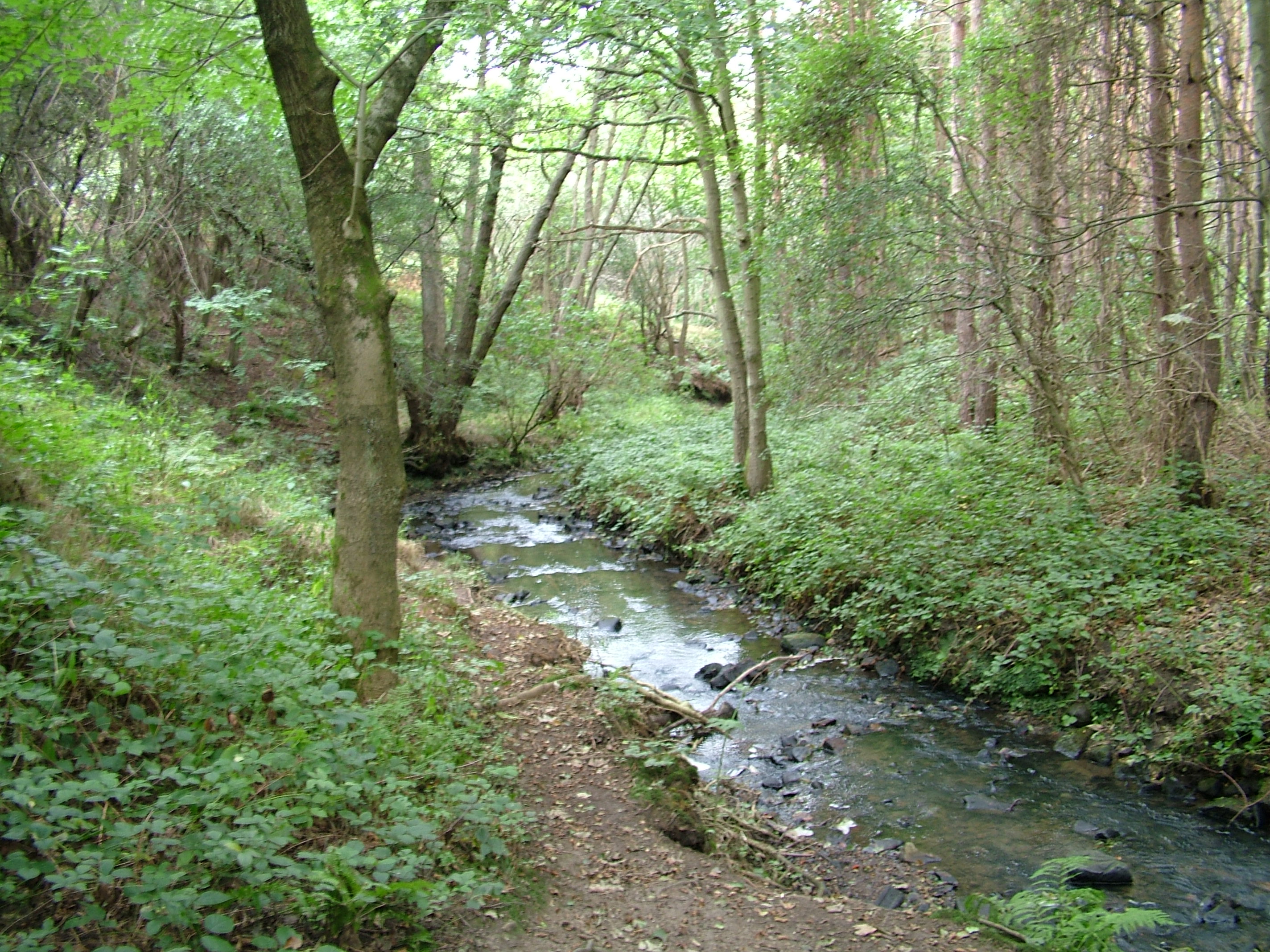
| Beamish Woods | 2.2 miles (3.5 km) | These pretty woods in the village of Beamish have some nice woodland trails to try. There's also some waterside paths along the River Team and bluebells in springtime. This circular walk runs for about 2 miles taking you through Ousbrough Woods to Ousbrough Hill. About a mile north west of the site there's another nice woodland walk in the grounds of Beamish Hall. The 18th-century country house includes 24 acres of grounds with themed family trails at certain times of the year. Also nearby is the excellent Beamish Museum. The open-air museum is a fascinating place for a stroll with original and replica buildings, a large collection of artifacts, working vehicles and equipment, as well as livestock and costumed interpreters. The Consett and Sunderland Railway Path runs past the woods so you could pick this up to continue your walking in the area. View Full Details>> | |
| Billingham Beck Valley Country Park | 0.9 miles (1.5 km) | This country park is located on the south western side of Billingham, on the pretty Billingham Beck. View Full Details>> | |
| Bishop Auckland | 4.3 miles (7 km) | This fine town in County Durham has some excellent walking opportunites with the River Wear and River Gaunless running through the town. There's also the expansive parkland surrounding the splendid castle and plenty of attractive country walks in the surrounding countryside. This circular walk around Bishop Auckland makes use of the Brandon - Bishop Auckland Walk and Weardale Way long distance paths. It also visits the historic Auckland Castle and park which is one of the highlights of the area. Start the walk in the town centre and then follow the Brandon - Bishop Auckland Walk north out of the town along a disused railway path. It takes you to the River Wear where you can enjoy waterside paths south of Willington. In this area you will also pass the picturesque Hunwick Gill where there are pretty waterfalls at the point where it flows into the Wear. At Hunwick you can then follow the Weardale Way long distance trail back towards the town. On the way back the route heads east along the river to visit Auckland Castle and Jock's Bridge over the river. For a fee you can explore the castle grounds which include a deer park, a walled garden, woodland trails and river paths. Other walks around the town include the Auckland Walk which takes you along a disused railway line to Spennymoor. If you head west out of the town along the Weardale Way you can visit Marston Lake. View Full Details>> | |
| Bishop Middleham Quarry | 0.6 miles (1 km) | This walk takes you to the Bishop Middleham Quarry near Sedgefield, County Durham. View Full Details>> | |
| Blackhall Rocks Walk | 2.5 miles (4 km) | This circular walk explores the Blackhall Rocks Nature Reserve on the Durham coast. View Full Details>> | |
| Brandon - Bishop Auckland Walk | 8.7 miles (14 km) | This is a nice easy cycling and walking path that follows a disused railway line from Brandon, near Durham to Bishop Auckland. You will pass through the villages of Brancepeth and Willington, shortly before joining the River Wear for the final stretch into Bishop Auckland. There are fine views of the surrounding countryside and of the Newton Cap Viaduct just before entering Bishop Auckland. The Lanchester Valley Walk and the Deerness Valley Way pass close to the trail. View Full Details>> | |
| Burnhope Reservoir | 2.5 miles (4 km) | Enjoy a peaceful circular walk around this reservoir in Weardale. There's a parking area at the south eastern tip of the water where you can start your walk. Follow the trails around the reservoir where there are some woodland trails and lakeside paths to enjoy. It's a very quiet place with a series of picnic tables where you can stop to enjoy the lovely scenery of the North Pennines AONB. View Full Details>> | |
| Castle Eden Dene | 3.1 miles (5 km) | Enjoy miles of woodland trails, pretty streams, rushing waterfalls and an abundance of wildlife in this splendid nature reserve in Peterlee. The reserve is the largest area of semi-natural woodland in north-east England. There are well surfaced trails running along the pretty Castle Eden Burn and through the atmospheric gorge. There are two waymarked nature trails to try. The Yew trail runs for 2 miles following the Yew markers. On this trail you'll pass the reserve's majectic Yews and climb Craggy Bank where you can look out for nuthatches and goldcrests. The Squirrel trail also runs for about 2 miles following the squirrel markers. The reserve contains over 450 species of plant including wild garlic (ransoms) with their distintive aroma, pretty yellow primroses, lily-of-the-valley and bird's-nest orchid. In the spring months there are also carpets of bluebells to admire. It's great for wildlife too. Look out for roe deer, foxes and numerous different types of bird as you make your way along the trails. You can start your walk from the car park on Stanhope Chase. National Cycle Network Route 1 passes through Peterlee and close to the reserve if you would like to visit by bike. Please note that cycling is not permitted within the reserve though. This walk starts at the Stanhope Chase car park and explores the western section of the reserve. You can head east and walk all the way to the coast where you can pick up the Durham Coastal Footpath. To extend your walking in the area you can pick up the Castle Eden Walkway and follow the disused railway line to the lovely Wynyard Woodland Park. If you follow the coast path north towards Seaham you could visit the lovely Hawthorn Dene Nature Reserve. The coastal reserve has more nice woodland trails and interesting flora and fauna. View Full Details>> | |
| Castle Eden Walkway | 9.3 miles (15 km) | Enjoy a cycle or walk along this disused railway line which runs along National Cycle Network Route 1. It's a nice easy traffic free ride for families or beginners. The route starts to the west of the County Durham village of Castle Eden and heads south through Wingate to Station Town. You continue past the pretty Hurworth Burn Reservoir. There's a nice circular trail around the water and some benches where you can stop for a rest. It's a lovely peaceful spot with lots of birds to look out for on the water. The route then continues past Brierley Wood and Thorpe Wood Nature Reserve, where there are more wildlife spotting opportunites. The route finishes at the lovely Wynyard Woodland Park. This country park in Billingham has woodland trails, a wildflower meadow and a planetarium and observatory. There's also a nice cafe where you can refresh yourself after your exercise. Near the start of the route there is the splendid Castle Eden Dene National Nature Reserve. The reserve contains a wide variety of flora and fauna, woodland trails and the pretty Castle Eden Burn. View Full Details>> | |
| Causey Arch | 1.9 miles (3 km) | Visit the the oldest surviving single-arch railway bridge in the world and enjoy woodland trails along the Causey Burn on this lovely circular walk in Stanley. The site includes interesting geology and views of the Tanfield railway which runs through the area. Also look out for the replica of an old wooden horse drawn coal truck. At its peak the track would see hundreds of these waggons carrying coal to the bridge. The bridge dates from 1725 and is a wonderful example of 18th century civil engineering. From the top of the arch there are splendid views down to the streams and woodland below. The walk lasts for about 2 miles on fairly flat footpaths, but with a couple of moderate climbs on the way. After your exercise you can enjoy rest and refreshments at the nice on site tea room. The walk starts from the car park just off the Causey Road. You could also start from Causey Arch railway station which is one of the stops on the Tanfield Heritage Railway. It's the oldest railway in the world, operating a passenger service every Sunday and on some other selected days. The railway runs on the former colliery wooden waggonway, using a number of preserved industrial steam locomotives. View Full Details>> | |
| Chester-le-Street | 2.3 miles (3.7 km) | This pleasant circular walk in the town of Chester-le-Street visits the riverside gardens and Lumley Castle. You can start the walk from the parking area at the riverside park, just to the east of the city centre. You could also start from the train station and walk a short distance through the town to the river. In the pretty park there are wildflower meadows, sculptures, artist-designed ornamental gardens, a cafe and nice riverside footpaths. After exploring the park, cross Lumley Bridge and pick up the Weardale Way which will take you along the River Wear to Lumley Castle. View Full Details>> | |
| Coatham Woods | 2.2 miles (3.6 km) | These woods near Stockton on Tees have 2 waymarked walking trails for you to try. There's attractive broadleaved and conifer woodland, meadows and ponds to see on the site. It's also a nice place for wildlife spotting with owls, deer and foxes to look out for. You can park at the car park just off Longnewton Lane to start your walk. You could also start from Longnewton village if you prefer. View Full Details>> | |
| Consett and Sunderland Railway Path | 28 miles (45 km) | A walk or cycle along a disused railway path from Consett to Sunderland. The path starts at Consett and heads east towards the coast passing Stanley and Chester-le-Street before joining the River Wear and following it to Sunderland harbour. You'll also pass Beamish Woods where there's some nice woodland trails and the views of the River Team. View Full Details>> | |
| Cow Green Reservoir and Cauldron Snout | 9.9 miles (16 km) | This walk takes you along the beautiful Cow Green Reservoir to the spectacular Cauldron Snout waterfall in the North Pennines AONB. You start off at the car park at Cow Green Reservoir which is located on the eastern side of the water at a postcode of DL12 0HX. From here you head 2 miles south along the reservoir to the waterfall, passing the impressive Cow Green Dam on the way. Cauldron Snout is a very powerful waterfall on three levels. At 200 yards (180 m) long, it is reckoned to be the longest waterfall in England. At the waterfall you have the option of heading back to the car park or continuing along the Pennine Way and the River Tees towards Langdon Beck. The path runs right along the river to Sayer's Hill and Harwood Beck with plenty of wild moorland scenery to enjoy. View Full Details>> | |
| Cowpen Bewley Woodland Park | 3.1 miles (5 km) | This country park in Billingham is the perfect place for a peaceful afternoon stroll. The park consists of grassland, a lake, a series of ponds and a beck flows which around the boundary of the park. The lake is fantastic for birdwatching - look out for coot, pochard, swans, grebes, herons and the tufted duck. For cyclists National Cycle Route 14 runs through the park. View Full Details>> | |
| Darlington | 5.6 miles (9 km) | The Teesdale Way runs through the large market town of Darlington in County Durham. You can explore part of the lovely Tees valley on this circular walk using the long distance waymarked trail. Starting at Blackwell at the south western corner of the town you can pick up the trail and follow the river south to Croft-on-Tees. The route passes Stapleton Manor and Monk End Wood on the western side of the river before coming to the village. You can then cross the river and follow the path back to Darlington on the eastern side of the water. This section runs through Oxneyfield and a golf course before returning to Blackwell. On this section there are nice views of the River Skerne which runs parallel to the Tees. View Full Details>> | |
| Deerness Valley Railway Path | 8.1 miles (13 km) | This cycle or walk along a dismantled railway line runs from Stonebridge to Crook through the beautiful Deerness Valley. The path passes the villages of Ushaw Moor and Esh Winning and and woodland at Holburn and Woodhouses Wood. There are also lovely waterside stretches along the River Deerness to enjoy. The path can be accessed to the west of the city of Durham. The Brandon - Bishop Auckland Walk and the Lanchester Valley Walk run very close to the trail. View Full Details>> | |
| Derwent Valley Walk | 11.2 miles (18 km) | This lovely railway path runs from Swalwell, near Gateshead, to Consett alongside the River Derwent and is suitable for walkers and cyclists. You will pass the villages of Rowlands Gill, Hamsterley and Ebchester on the way. The path also takes you through Derwent Walk Country Park and there is a woodland section at Byerside Wood. At the park you could cross to the to the western side of the river and visit Thornley Woods where there's a sculpture trail and a visitor centre with lots of information about the area. Also of interest is the National Trust owned Gibside near Rowlands Gill. This is well worth a visit with its 18th-century landscape park and nature reserve. View Full Details>> | |
| Durham Coastal Footpath | 11.2 miles (18 km) | This walk follows a beautiful section of the Durham heritage coast from Seaham to Crimdon Park, just outside Hartlepool. The path starts by Seaham harbour and heads south to Easington Colliery, passing Shippersea Bay and the lovely Hawthorn Dene on the way. This delightful reserve is run by the Durham Wildlife Trust and consists of woodland and limestone hay meadows. The path continues south, passing Horden and Peterlee with more stunning cliff top views. Around Peterlee you will pass the wonderful Castle Eden Dene National Nature Reserve. It is the largest area of semi-natural woodland in north-east England and a major highlight on the route. The last section of the walk then takes you to the finish point at Crimdon Park just north of Hartlepool. View Full Details>> | |
| Durham Riverside Walk | 8.2 miles (13.2 km) | This splendid walk around Durham visits many of the city highlights including the River Wear, Durham Castle, the cathedral, Old Durham Gardens and the Durham Botanical Gardens. There's so much to see with wonderful architecture, historical sites, beautiful gardens and countryside views across the river. The walk starts next to Durham Castle on the east bank of the River Wear. The Norman castle stands on top of a hill above the river on Durham's peninsula, opposite Durham Cathedral. It was originally built in the 11th century as a projection of the Norman kings' power in the north of England. It is now owned by the University College but the public can view the castle's wonderful architecture through guided tours. The castle is part of a UNESCO World Heritage Site with the nearby Durham Cathedral. It dates from the 11th century and includes fine Romanesque and Norman architecture. You can climb the 217ft (66m) high central tower for fantastic views over the city and surrounding area. After exploring the castle and cathedral rejoin the riverside path and head south past the stone-arched Prebends Bridge. The path rounds the peninsula, passing close to several historic sites including university buildings, Durham Market Square, the Grade I listed Kingsgate Bridge and the mediaeval Elvet Bridge. The trail then heads east, passing Pelaw Wood before leaving the river to visit Old Durham Gardens. The delightful gardens are on two levels and include orchards, a walled garden and a gazebo. After exploring the gardens you return to the waterside path and continue to Shincliffe Bridge, where you cross the river and follow the Houghall Discovery trail through the woods to the Durham University Botanic Garden. Here you'll find exotic plants from all over the world including many from the far east. There's also glasshouses, an arboretum, an Alpine garden and a bamboo grove. After strolling round the gardens you return to the riverside path and head back to the city centre along the Wear. Much of this walk uses the Weardale Way long distance trail. You can extend your walking in the area by following the trail south towards Willington, while heading north will take you to Chester-le-Street. There's also several nice trails to pick up just to the west of the city centre. The Brandon - Bishop Auckland Walk, the Lanchester Valley Walk and the Deerness Valley Way all follow disused railway lines through the countryside surrounding the city. View Full Details>> | |
| Egglestone Abbey | 3.1 miles (5 km) | This circular walk visits the remains of the 12th century Egglestone Abbey near Barnard Castle in County Durham. View Full Details>> | |
| Finchale Abbey | 1 mile (1.6 km) | This walk visits the ancient Finchale Abbey in Framwellgate Moor, County Durham. View Full Details>> | |
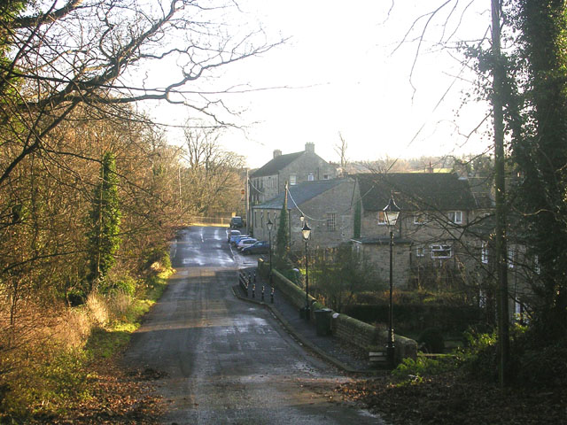
| Frosterley | 2.5 miles (4 km) | This County Durham based village has lots of nice waterside trails along the River Wear and the Bollihope Burn which run through the area. It is also accessible on the heritage Weardale Railway, a popular tourist highlight of the local area. View Full Details>> | |
| Grassholme Reservoir | 3.1 miles (5 km) | This circular walk follows the footpath around this lovely reservoir in upper Teesdale. The reservoir is surrounded by the Lune Valley countryside and woodland. The route runs for just over 3 miles on a fairly flat path so suitable for most abilities. Grassholme Reservoir is located a few miles south of Middleton in Teesdale. View Full Details>> | |
| Great North Forest Heritage Trail | 65.2 miles (105 km) | This circular cycle and walking route takes you through the countryside of this former mining area in Tyne and Wear. The trail passes Pelton, Bournmoor, Hetton-Le-Hole, the Penshaw Monument and Witherwack. The route includes a section along the River Wear in Sunderland and a delightful coastal section visiting Whitburn, Marsden Bay, the splendid magnesian limestone cliffs at the Leas in South Shields and Souter Lighthouse. You will also visit Lumley Castle - a 14th century quadrangular castle at Chester-le-Street with lovely gardens. Also of interest is the Penshaw Monument - a folly situated on on Penshaw Hill dedicated to John George Lambton, first Earl of Durham. The video below shows the splendid views from this most beloved landmark which appears on the badge of Sunderland Football Club. Near Stanley the route visits the oldest single-arch railway bridge in the world at Causey Arch. View Full Details>> | |
| Greta Bridge | 4 miles (6.4 km) | This walk visits the picturesque village of Greta Bridge in County Durham. View Full Details>> | |
| Hamsterley Forest | 9.3 miles (15 km) | Hamsterley Forest is a great place for exciting mountain bike trails, leisurely family cycle rides or peaceful woodland walking. There are three colour coded, way-marked mountain bike trails in the forest. The blue trail follows purpose built cycle tracks and the Bedburn Beck through the southern part of the forest at a leisurely pace. It's suitable for families and people looking for a gentle introduction to off road cycling. The red trail goes further into the forest and climbs to a point with fabulous views of the surrounding area before descending on an exciting single track running along Euden Beck. The black trail is the most severe trail and suitable for experienced mountain bikers. Cycle hire is available from the start of route below. Walkers will find five way-marked trails of varying lengths and difficulty to follow. These include an easy, riverside stroll along Bedburn Beck and longer trails with climbs and a visit to Blackling Hole waterfall. The route mapped out below is suitable for both leisure walkers and cyclists looking for a fairly easy ride. View Full Details>> | |
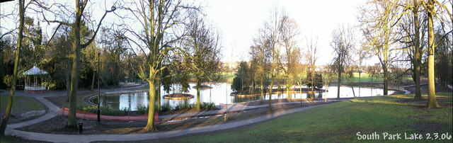
| Hardwick Hall Country Park | 1.9 miles (3 km) | This large ornamental park surrounds a fine 18th century hall and is located in Sedgefield in County Durham. Hardwick includes a 17-acre lake and a number of ornamental features, including temples, grottoes and follies. There are woodland trails and a lovely waterside path around the lake to enjoy. There is also a visitor centre, gift shop and cafe. View Full Details>> | |
| Hartlepool | 10.3 miles (16.5 km) | This town on the north east coast has some nice walks to try along its beaches, nature reserve and old quay. View Full Details>> | |
| Haswell to Hart | 9.8 miles (15.8 km) | An easy shared cycling and walking route running from Haswell to Hart. View Full Details>> | |
| Hawthorn Dene | 3.4 miles (5.5 km) | This delightful nature reserve near Easington has nice footpaths to follow. The paths will take you through attractive woodland and along the pretty Hawthorn Burn. The reserve is located just to the south of Seaham. You could follow the Durham Coastal Footpath to reach the site. Alternatively there is a car park just to the north of the reserve. From here you can pick up the footpaths east through the reserve to the coast. You'll pass the railway viaduct before coming to Hawthorn Hive, with cliffs and rocky shore. Look out for a variety of flora and fauna including snowdrops, wild garlic and bluebells in the spring. Notable wildlife includes jay, treecreeper, great spotted woodpecker and roe deer. If you would like to extend your walk you could follow the coast path south and visit the lovely Castle Eden Dene. Here you will find miles of woodland trails, pretty streams, rushing waterfalls and an abundance of wildlife in this splendid nature reserve in Peterlee. View Full Details>> | |
| High Cup Nick | 8.7 miles (14 km) | This circular walk explores High Cup Nick, a spectacular glacial valley and one of the major highlights in the North Pennines AONB. The whole of the valley is within an area mapped as open country under the Countryside and Rights of Way Act 2000 hence there is a general right for walkers to roam at will. The section of the Pennine Way running through the area is also a bridleway therefore legally available to cyclists and horseriders too. This 8 mile route begins at the village of Dufton in the Eden Valley and starts by following the Pennine Way to Dod Hill and Peeping Hill. You continue your ascent to High Cup Nick where there is a waterfall and great views of the u-shaped glacial valley, the Eden Valley, Dufton Pike and Murton Pike. You'll also pass Nichol's Chair, a notable pinnacle of this rock on the northern side of the valley. It is named after a local cobbler who, for a bet, practised his craft perched on its summit. This first section along the Pennine Way is the shortest way to the summit. It's also easy to follow as it runs along a signposted trai. The walk then descends through High Cup Gill where you will pass boulder fields on your way to High Cup Gill Beck. You continue along the beck through Middletongue Crag to Harbour Flatt where you join a country lane, taking you back to Dufton. This is a special place with some spectacular geological wonders to enjoy. It is quite a steep and challenging climb but the footpaths are generally good for most of the walk. An alternative route starts from Cow Green Reservoir, approaching High Cup from the east and following the Pennine Way to the summit. If you would like to continue your walk you could head to the nearby Cow Green Reservoir and visit the wonderful Cauldron Snout waterfall. The circular High Force Waterfall Walk is another major highlight of the area. You could also head to Cross Fell for more wonderful views of the area. View Full Details>> | |
| High Force Waterfall | 6.8 miles (11 km) | Visit the spectacular Low Force and High Force waterfalls on this waterside circular walk in the North Pennines Area of Outstanding Natural Beauty. The walk runs for about 6.5 miles with some moderate climbs along the way. You start off from the Bowlees Visitor Centre, where car parking is available. A short walk from here takes you to the River Tees and the 18 foot (5.5m) Low Force Waterfall. Here you cross a bridge over the river and pick up the Pennine Way, following it west through riverside woodland to High Force Waterfall. It's one of the biggest waterfalls in England and a spectacular sight with the water dropping 70 feet (21m) into a plunge pool below. The site also includes ancient rocks formed over 300 million years ago. From here you can return to the start point the same way but this route climbs to the hills to the south of the river. You'll reach a height of over 1300ft around Whiteholm Bank, with splendid views over the area to enjoy. The walk then descends back to the river and the car park. This walk takes you along the free southern bank of the river but if you would like to visit the northern bank then access is via a private footpath on the Raby estate for which a fee is charged. See the link below for more details. View Full Details>> | |
| Hurworth Burn Reservoir | 1.4 miles (2.3 km) | This route visits a pretty reservoir near Peterlee and Stockton-on-Tees. The reservoir is in a nice rural spot where the River Skerne is joined by Hurworth Burn anout 3 miles from its source. There's a good circular trail to follow around the water running for about 1.5 miles. It's a peaceful place with a number of benches where you can rest and enjoy the fine country views across the water. View Full Details>> | |
| Hurworth on Tees | 5.5 miles (8.8 km) | This riverside village is located just a few miles south of Darlington in County Durham. The village is a good place to start a walk with a number of footpaths and a noteworthy pub dating back to the 1400s. View Full Details>> | |
| Lanchester Valley Walk | 11.8 miles (19 km) | This shared cycling and walking path uses the route of the railway originally built to carry iron ore to Consett Steelworks. The path runs from Durham to Consett passing Bearpark, Langley Park and Lanchester. Route highlights include the 13th century Beaurepaire Priory at Bearpark, Lanchester Roman Fort and some lovely views of the River Browney. It's a fairly flat path which runs for about 12 miles. The Brandon - Bishop Auckland Walk and the Deerness Valley Way run close to the trail. View Full Details>> | |
| Langdon Beck | 0.8 miles (1.3 km) | This walk takes you along the Langdon Beck in the hamlet of Langdon Beck in the civil parish of Forest and Frith, County Durham. View Full Details>> | |
| Locomotion Way - Stockton and Darlington Railway Walk | 3.4 miles (5.4 km) | This shared walking and cycling path follows the Locomotion Way from Shildon to Newton Aycliffe in County Durham. View Full Details>> | |
| Low Barns Nature Reserve | 1 mile (1.6 km) | This walk visits the Low Barns Nature Reserve in Witton-le-Wear, County Durham. View Full Details>> | |
| Middleton in Teesdale | 7.1 miles (11.5 km) | This market town in County Durham is positioned in a scenic area in the North Pennines Area of Outstanding Natural Beauty (AONB). You can explore the area on the Pennine Way long distance trail which runs past the town. The river Tees also runs through the area with the Teesdale Way another great option for walkers. This walk picks up a nice section of the Pennine Way to take you to the nearby Grassholme and Selset Reservoirs. On the way you'll pass Kirkcarrion, an eye-catching clump of trees surmounting a rocky hill overlooking the Brough to Middleton-in-Teesdale road. You'll also skirt the south-eastern flank of Harter Fell which reaches a height of 481 metres about 1 km north of the hamlet of Thringarth. There's fine views over the AONB from the high points. The final section takes you through pretty Lunedale, finishing at Grassholme Reservoir. There's a circular footpath here around the water which is surrounded by the lovely Lune Valley countryside and woodland. View Full Details>> | |
| Pennine Way | 267.8 miles (431 km) | This fabulous 268 mile path takes you through three of England's finest national parks. You start near Edale in the beautiful Derbyshire Peak District and head north towards the Yorkshire Dales National Park. The final section takes you over Hadrian's Wall in the stunning Northumberland National Park before crossing the England-Scotland border and finishing in the village of Kirk Yetholm in Scotland. Though the path is often challenging you're rewarded with some of the most breathtaking views in the country. Highlights on the path include the beautiful Malham Cove, the heather moorland of the Marsden Moor Estate, the Malham Tarn Estate and the stunning Kisdon Force waterfall in the Yorkshire Dales National Park. You'll also enjoy a waterside section along the River Tees in Teesdale which leads to Low Force Watefall and High Force Waterfall. The path also passes through Bronte country in West Yorkshire where you can visit the Bronte Waterfall and Top Withens. View Full Details>> | |
| Piercebridge | 3.1 miles (5 km) | This walk visits the interesting Piercebridge Roman Fort before following the Teesdale Way along the River Tees to nearby Gainford. There's much to enjoy with some fascinating history, lovely riverside paths and some attractive Teesdale countryside to enjoy on the way. View Full Details>> | |
| Pow Hill Country Park and Derwent Reservoir | 7.1 miles (11.5 km) | This walk explores Pow Hill Country Park and the expansive Derwent Reservoir in County Durham. The park has some lovely waterside trails with splendid views across the reservoir. There's also a small woodland area with picnic tables. The walk starts in Pow Hill at the car park. You can explore the park before following a footpath south east to the dam. Then cross the impressive dam and follow the tracks round to Cronkley before finishing at the Millshield picnic area. The reservoir is one of the biggest inland waters in England, stretching for 3.5 miles (5.6 km) and covering an area of 4 km˛. Along the trail you can look out for a wide variety of pretty wildflowers. There's attractive heathland with pretty heather, foxgloves and dog violet. You can also see lots of wildlife on the water including Great crested grebes and crossbill. Keep your eyes peeled for red squirrels in the conifer plantation of Pow Hill. View Full Details>> | |
| Raby Castle | 1.9 miles (3 km) | Enjoy a lovely walk through the 200 acres of deer park and gardens surrounding this 14th century castle near Darlington and Staindrop. There are several well surfaced walking trails taking you through peaceful woodland, through the deer park and between Low Pond and High Pond. There are also the delightful 18th century ornamental Walled Gardens with Yew Hedges, trees, plants, fountains, statues and ornaments from the 18th and 19th century. View Full Details>> | |
| Rainton Meadows | 1.1 miles (1.7 km) | This walk visits the Rainton Meadows Nature Reserve near West Rainton and Houghton le Spring, County Durham. View Full Details>> | |
| Romaldkirk | 5 miles (8 km) | This picturesque village in County Durham is surrounded by some beautiful Teesdale countryside. There's also a noteworthy Saxon Church and a fine 18th century coaching inn to relax in after your exercise. View Full Details>> | |
| Seaham | 6.8 miles (11 km) | The town of Seaham is located on the Durham Coast, just south of Sunderland. This walk follows a section of the Durham Coastal Footpath from the town to nearby Peterlee and the Castle Eden Dene Nature Reserve. It's about a 7 mile walk along a reasonably flat path with fine sea views for the duration of the route. The walk starts on the harbour in Seaham where you can pick up the waymarked footpath. Follow it south and it will take you past Chourdon Point, Shippersea Bay and the Easington Colliery. This section also passes Hawthorn Dene. You could take a detour from the route to visit the nature reserve which includes attractive woodland and the pretty Hawthorn Burn. The next stage takes you past the waterfall at Fox Holes Dene before coming to Horden Point and Hartlepool Point, where the route finishes. If you head west from here you can visit the Castle Eden Dene Nature Reserve. Here you'll find woodland trails, pretty streams, rushing waterfalls and plenty of wildlife to look out for. View Full Details>> | |
| Seaham to Crimdon Walk | 10.4 miles (16.7 km) | This coastal walk takes you along a section of the Durham Coastal Footpath from Seaham to Crimdon. View Full Details>> | |
| Sedgefield | 6.8 miles (11 km) | This attractive town in County Durham has some fine country walks and is well known as the site of the historic Hardwick Hall. It also sticks in people's minds as former Prime Minister Tony Blair was the MP for the Sedgefield constituency from 1983 to 2007. The town resembles a village with a number of photogenic eighteenth century houses surrounding a pretty green. There is also a fine medieval church with a noteworthy tower to see. View Full Details>> | |
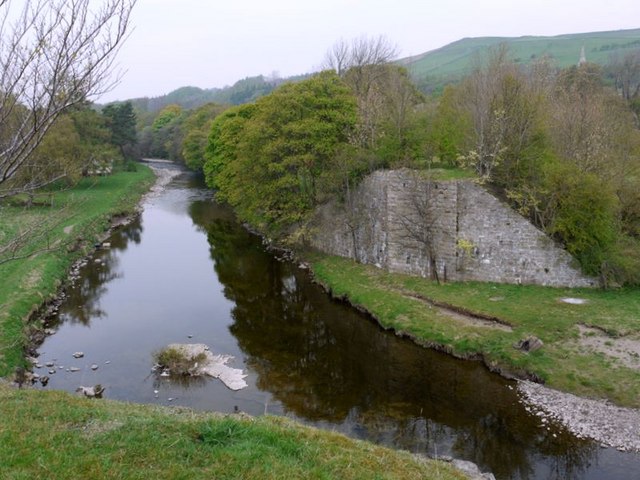
| Stanhope | 5 miles (8 km) | This small market town is located in County Durham on the River Wear. There's some nice riverside and countryside trails to try in the area. It's surrounded by the moorland of the North Pennines where there are lots of good opportunities for walkers too. The town is also notable as the current terminus of the Weardale Railway, a historic heritage railway. It runs from Bishop Auckland, with stations at Frosterley, Wolsingham and Witton-le-Wear. This walk takes you from the town to nearby Frosterley on the Weardale Way. The waymarked trail runs along the river and through the attractive countryside to the south east of the town. At the end of the walk you could return on the same paths or catch the splendid Weardale Railway back to Stanhope. You can extend the walk by continuing east to Wolsingham. View Full Details>> | |
| Stockton on Tees | 1.7 miles (2.8 km) | This market town in County Durham has some nice riverside trails, local country parks, nature reserves and woodland areas to explore on foot. View Full Details>> | |
| Tees Barrage Walk | 3.7 miles (6 km) | This waterside walk in Stockton-on-Tees explores the riverside paths next to the River Tees Barrage. The 3.5 mile circular route runs on nice flat trails on both sides of the river. The route starts from the car park on the northern side of the river near to the Tees Barrage. The barrage is used to control the flow of the river, preventing flooding and the effects of tidal change. It consists of a river barrage, road bridge, footbridge, barge lock, fish pass and white water course. The area is used for watersports such as canoeing, jet skiing, dragonboat racing and incorporates a 1 km rowing course. You start by crossing the river on the barrage footbridge before heading west along the path to the impressive Infinity Bridge. The bridge links the Teesdale Business Park and the University of Durham's Queen's Campus in Thornaby-on-Tees on the south bank of the Tees with the Tees Valley Regeneration's Ł320 million North Shore development on the north bank. The name derives from the infinity symbol formed by the bridge and its reflection. The route continues past the University Colleges to the Victoria Bridge where you cross to the other side of the river. Here you can pick up the Teesdale Way and follow it east along the northern side of the river, back to the car park. View Full Details>> | |
| Tees Railway Walk | 2.5 miles (4 km) | This walk runs along the old trackbed of the Tees Valley Railway, from Cotherstone to Romaldkirk. The railway was originally opened in 1868 and closed in 1965. It ran for just over 8 miles between Barnard Castle and Middleton-in-Teesdale on the South Durham & Lancashire Union Railway. The walk runs for about 2.5 miles on a reasonably flat path with nice views of the surrounding Teesdale countryside. In the summer months you can see lots of wildflowers and butterflies along the path. You can extend the walk by continuing to Mickleton and Lonton. View Full Details>> | |
| Teesdale Way | 92 miles (148 km) | Follow the River Tees from Dufton, in Cumbria, to Redcar on the North Yorkshire coast. The first section takes you through the Pennine Hills, from Dufton to Forest-in-Teesdale. There is some spectacular scenery as you pass through Dufton Fell and then past Cow Green Reservoir before joining the River Tees near the village of Forest-in-Teesdale. This section is coincident with the Pennine Way National Trail and includes several beautiful waterfalls as shown in the video below. From Forest-in-Teesdale you continue along the river passing Newbiggin, Middleton in Teesdale and Egglesdon Hall on your way to Barnard Castle. Here you will find two fascinating historical buildings in the 12th century Barnard castle and the ruined abbey at nearby Egglestone. You can also try our Teesdale Way Circular Walk here which runs along both sides of the river from the castle to the villages of Egglestone, Romaldkirk and Cotherstone. The next section runs from Barnard Castle to Darlington. This section very closely follows the banks of the River Tees, passing Whorlton and the interesting Roman Fort at Piercebridge on the way. From Darlington you continue east towards Stockton-on-Tees. This section takes you past Teesside Airport and the pretty town of Yarm. The final section takes you through the industrial landscape of Stockton on Tees and Middlesbrough, passing the impressive Infinity Bridge, and the Tees Barrage. View Full Details>> | |
| Teesdale Way Circular Walk | 12 miles (19.3 km) | This is a fine circular walk using a section of the Teesdale Way between Barnard Castle and Eggleston. It runs for about 12 miles using waymarked footpaths on both sides of the river. You'll visit the villages of Egglestone, Romaldkirk and Cotherstone, while enjoying some splendid scenery. The walk starts in the popular town of Barnard Castle, situated on the River Tees. The attractive town includes a historic 12th century castle where the walk begins. The castle includes views over the Tees Gorge, a sensory garden of scented plants and the fascinating remains of the medieval chapel of St Margaret. From here you pick up the riverside path heading north west towards Cotherstone Crag. There then follows a short woodland section through Shipley Wood before coming to Eggleston where you cross the river. The return leg follows the trail along the western side of the Tees, with the first section taking you to the little village of Romaldkirk. Here you will find a pretty village green and a noteworthy church. The Grade 1 listed building, contains surviving sections of Anglo-Saxon walls either side of the chancel arch, as well as a late medieval rood stair, a stone tomb effigy of Hugh Fitz Henry (who died on campaign with Edward I in 1305) in chain mail, and a 12th-century font. You continue toward Cotherstone, crossing the River Balder and passing the remains of Cotherstone Castle on the way. The final section takes you through Pecknell Wood before returning to Barnard Castle. View Full Details>> | |
| Tunstall Reservoir | 1.9 miles (3 km) | Follow the footpath around this pretty reservoir and nature reserve near Wolsingham in Country Durham. View Full Details>> | |
| Waldridge Fell Country Park | 2.2 miles (3.5 km) | Enjoy fantastic views of the surrounding countryside in this country park in Chester-le-Street. There are a number of waymarked routes running through this area of lowland heath. The park is full of interesting plantlife and wildlife including Stonechat, Roe Deer and the Emperor Moth. To extend your walking in the area you can head east and visit the riverside park, the 14th century Lumley Castle. Here you can pick up the Weardale Way for a nice riverside stroll. The long distance Great North Forest Heritage Trail and the popular Consett and Sunderland Railway Path pass just to the north of the park. View Full Details>> | |
| Waskerley Way | 9.9 miles (16 km) | This is a shared cycling and walking path that follows the route of the old Stanhope and Tyne Railway line. The path starts near Consett and runs to Weather Hill passing through woodland and open moorland. You will also pass the delightful Smiddy Shaw Reservoir, Hisehope Reservoir, Waskerley Reservoir and Tunstall Reservoir near the village of Wolsingham. View Full Details>> | |
| Weardale Way | 77.1 miles (124 km) | Follow the River Wear from the coast at Sunderland to Killhope Lead Mining Museum in the Pennines. The walk can be split into the following stages: Sunderland to Durham - Starting on the coast at Roker, follow the river past the Sunderland docks and through the city. You'll pass the Wearmouth Bridge, the Stadium of Light, the Penshaw Monument, James Steel Park in Washington and Chester-le-Street before heading into the countryside around Great Lumley and arriving at Durham soon after. View Full Details>> | |
| Whitworth Hall Country Park | 3.1 miles (5 km) | Explore 73 acres of parkland surrounding the Grade II listed stately mansion of Whitworth Hall in Spennymoor. You can hand feed the resident fallow deer, stroll around the ornamental lake and then follow the peaceful woodland walk. There is also a pretty Victorian garden containing England's most northerly vineyard. The Weardale Way walking route runs along the River Wear just to the north of the park. View Full Details>> | |
| Wolsingham | 4.2 miles (6.7 km) | This walk takes you along the Weardale Way from Wolsingham to nearby Frosterley. View Full Details>> | |
| Wynyard Woodland Park | 1.9 miles (3 km) | Formerly known as the Castle Eden Walkway Country Park this park in Billingham has numerous woodland footpaths and a visitor centre. View Full Details>> |