North Downs Walks

Use the links to view full route information including elevation profiles, interactive maps and GPS downloads.
You can also view an overview map of all the routes in the using the North Downs Walk Map>>
*New* - Walks and Cycle Routes Near Me Map - Waymarked Routes and Mountain Bike Trails>>
| Route Name | Photo | Distance | Description |
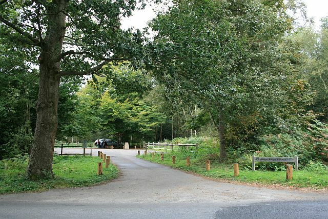
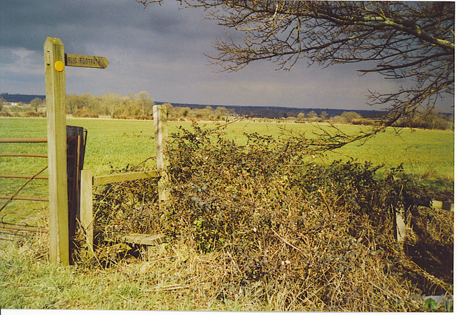
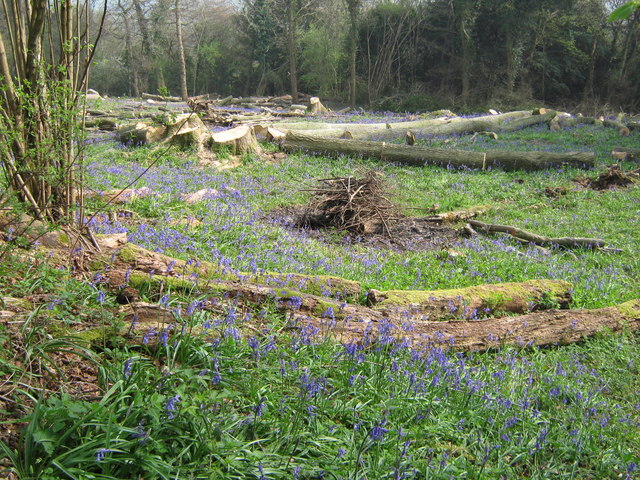
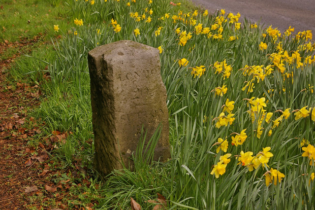
| Abinger Roughs | 1.9 miles (3 km) | This circular walk in Abinger Hammer takes you around an attractive, elevated woodland area. Start your walk from the car park at the eastern end of the site. From here you can pick up nature trails heading west towards Arbinger Hammer. There's a series of nice shady woodland paths and in the spring months you can see carpets of bluebells and lots of lovely Rhododendrons flowering. The Roughs also include magnificent oak trees, open glades and fine views over the North Downs from the high points. At the western side of the woods you will find the delightful village of Arbinger Hammer. In summer the village green is popular with people picnicing on the grass whilst watching a game of cricket in surroundings which are quintessentially English. The River Tillingbourne also flows through the village. Brown trout regurlarly swim in the stream and the occasional larger rainbow trout can also be sighted. You can enjoy refreshments in the delightful Abinger Hammer Village Shop & Tea Rooms which has a nice garden from which you can watch the cricket. View Full Details>> | |
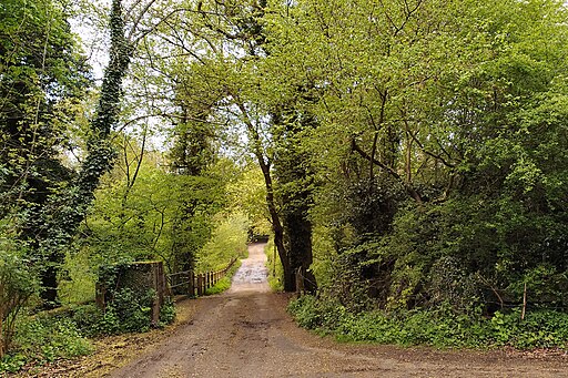
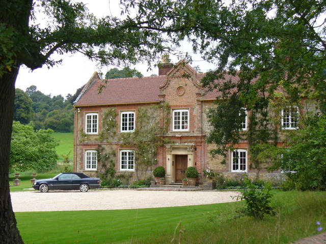
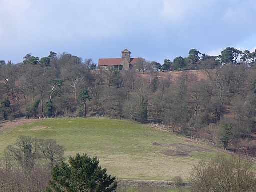
| Albury Park | 2.5 miles (4 km) | Explore the Albury Estate on this pleasant walk in Surrey. There's 150 acres of parkland with lots of walking trails to try. Features include peaceful woodland, pretty lakes and the River Tillingbourne. There is also the Grade II listed Albury country house and the Saxon Old St Peter and St Paul's Church to see. The walk starts from the Grade I listed church and follows footpaths through woodland and parkland to the nearby village of Shere. Here you will find a Norman church, old village houses and a tea room for refreshments. The walk then follows the Fox Way and other footpaths to return you to Albury. If you'd like to extend your walk then you could continue along the Fox Way to the nearby Blackheath Common. The tranquil Silent Pool is also nearby. View Full Details>> | |
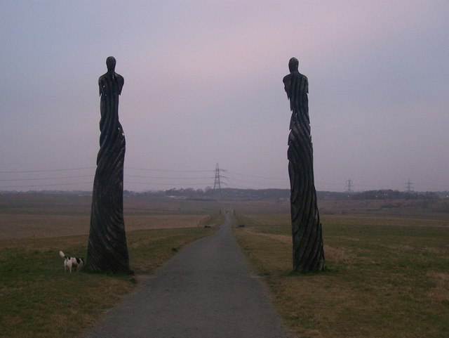
| Aldershot | 11.5 miles (18.5 km) | This Hampshire town sits in the north east corner of the county in the Rushmoor area. There's good walking opportunities along the canal and river which run through the town. There's also expansive areas of woodland to the west and a number of pretty parks and lakes on the fringes on the town. This waterside walk around the town takes you along the Blackwater River and the Basingstoke Canal which run through the area. It's nice easy walking on flat footpaths with a visit to a local nature reserve and a lakeside park to enjoy as well. The walk starts at the car park at the Rowhill Nature Reserve just to the south west of the town centre and the train station. In the 55 acre reserve you will find the source of the Blackwater River and deciduous woodland. In the spring months you can see lots of pretty bluebells. From here you can pick up the Blackwater Valley Footpath and follow the waymarked footpath east along the river in Weybourne to the pretty Badshot Lea Big Pond. You continue east past Pea Bridge and Badshot Lea before turning north at Aldershot Park. The trail then runs along the eastern fringes of the town before coming to Gold Valley Lakes and the Lakeside Nature Reserve. View Full Details>> | |
| Ashford | 10.6 miles (17 km) | This Kent town is ideally positioned for walkers on the edge of the Kent Downs and the North Downs. There are also nice waterside paths along the river Great Stour which runs through the centre of Ashford. This route uses sections of the Stour Valley Walk and the North Downs Way to take you up to the splendid Wye Downs just to the north east of the town. On the way you'll enjoy riverside paths along the River Stour, visit the lovely village of Wye and enjoy wonderful views over the area from the high points on the Wye and Broad Downs. View Full Details>> | |
| Ashford Hill Nature Reserve | 2.2 miles (3.5 km) | Explore the old water meadows and woodland in this pretty nature reserve near Newbury. You can start the circular walk from the car park at the Ship Inn in the village of Ashford Hill. From here you pick up footpaths through the nature reserve towards Haughurst Hill and Sleepers Copse. The reserve is great for wildlife spotting with several species of butterfly to look out for amongst the wildflowers. Back in the little village you can enjoy refreshments at the Ship Inn. The Brenda Parker Way long distance footpath runs through the reserve so there is scope for extending your walk. Also nearby is Wasing Wood, riverside paths along the River Enborne and Greenham Common. The expansive area of heathland is covered in heather and gorse and has nice wide footpaths, wetland areas and wildflower filled grasslands with horses and ponies to look out for. To the east you'll find Pamber Forest with more peaceful woodland trails to try. View Full Details>> | |
| Aylesford | 3.7 miles (6 km) | This delightful Kentish village is a fine spot for riverside walks and access to the North Downs countryside. There's also some interesting history with an old priory, a medieval castle and a nearby museum to visit. View Full Details>> | |
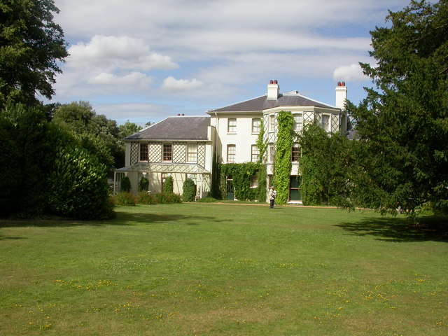
| Biggin Hill | 9 miles (14.5 km) | This circular walk from Biggin Hill explores the farmland and woodland to the north of the town. On the way you'll visit the villages of Downe and Cudham, while also exploring the lovely High Elms Country Park. The route also passes the noteworthy Down House, former residence of Charles Darwin. The town is notable as one of the highest points of Greater London, rising to over 210 metres (690 ft) above sea level. It's home to London Biggin Hill Airport and located close to the North Downs which you can explore on the North Downs Way. View Full Details>> | |
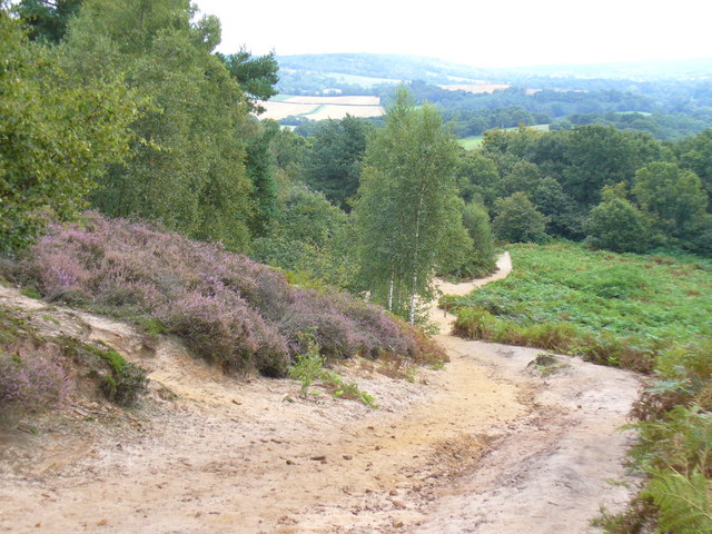
| Blackheath Common | 2.5 miles (4 km) | This large area of heathland and woodland near Albury is very popular with walkers and cyclists. There's 250 acres to explore on a myriad of footpaths and bridleways. The area consists of lowland heathland, woodland and acid grassland. You can park at the Blackheath car park on Blackheath Lane to start your circular walk across the common. Chilworth railway station is also just to the north of the common. This is another good start point if you are coming by public transport. The paths then take you across the common and through Blackheath Forest. There's some nice sandy paths and lots of pretty heather to look out for in the late summer. View Full Details>> | |
| Blue Bell Hill | 1.9 miles (3 km) | Visit the Blue Bell Hill viewpoint on this circular walk on the North Downs Way near Chatham. From the hill there are great views over the River Medway and North Downs. The south west side of Blue Bell Hill is a Site of Special Scientific Interest with several rare plant species. The hill is also home to Kit's Coty chamber tomb, a Neolithic chambered long barrow which forms part of the Medway megaliths. The megaliths were constructed from local sarsen stone and soil between the 4th and 3rd millennia BCE. Our longer Medway Megaliths Walk visits three of the stones and starts from the same car park. View Full Details>> | |
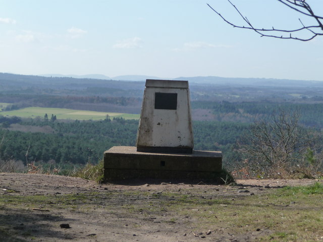
| Botley Hill | 3.5 miles (5.7 km) | This circular walk explores the area around Botley Hill, the highest point in the North Downs. It's an interesting area with fine views, woodland areas and a historic farmhouse pub for post walk refreshment. View Full Details>> | |
| Camer Park | 4 miles (6.5 km) | This is a short walk through Camer Country Park and into the surrounding countryside and woodland. The park is located close to Meopham train station and parking is also available at the western end of the park. In the park you will find 40 acres of ancient parkland, grassland and woods. There's also good facilities such as a cafe and refreshment kiosk. This walk starts at the car park and takes you through the park to the adjacent Henley Wood and then through some lovely countryside to the pretty village of Luddesdown. The walk makes use of the Wealdway long distance footpath, so you could continue along this trail to extend your walk. Also just to the north is Shorne Woods Country Park where you'll find 288 acres of rolling woodlands, wetlands and meadows. The park is located close to Rochester and Chatham. View Full Details>> | |
| Canterbury to Dover Walk | 19.9 miles (32 km) | This walk takes you from the cathedral city of Canterbury to the famous port of Dover. The route runs for a distance of about 20 miles along a section of the North Downs Way. The route starts in the city centre near the famous cathedral, where you can pick up the North Downs Way. The waymarked path leads you south east towards St Augustine's Abbey which is worth a small detour from the path. The abbey ruins date from the 6th century and are now owned by English Heritage. The route then leaves the city and heads out into the countryside toward Patrixbourne and then onto the village of Bridge where you will pass the noteworthy Higham Park. Here you will find a Grade II listed neoclassical style house and gardens. The Palladian fronted house dates from the mid 18th century. The next stage takes you through Womenswold to Shepperdswell. At ashley you turn south toward Pineham before coming into Dover. Here you can extend your walk by visiting the fascinating Dover Castle or visiting the famous White Cliffs on the Dover Cliffs Walk. View Full Details>> | |
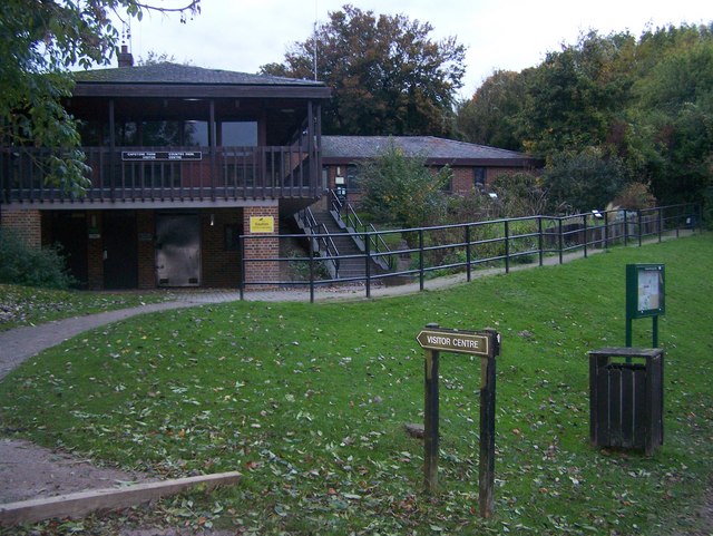
| Capstone Farm Country Park | 5.6 miles (9 km) | Enjoy several cycling and walking trails in this delightful country park near Gillingham. The park is located in the beautiful North Downs with ancient woodlands, old orchards, a freshwater lake and wildflower meadows to explore. There's excellent facilities with a Visitor Centre, cafe and picnic areas. View Full Details>> | |
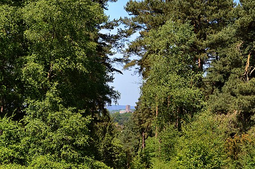
| Chantry Wood | 2.2 miles (3.5 km) | Explore 200 acres of woodland and meadows on this circular walk to Chantry Wood and Chantries Hill in Guildford. There's miles of woodland trails to follow with the North Downs Way passing along the northern edge of the forest (you can see some of this section on the google street view link below). There's a fair amount of climbing on the trails with nice views over the surrounding area from the high points. Look out for carpets of pretty bluebells in the springtime and a variety of birdlife all year round. This walk starts at the car park at the eastern end of the woods and follows the North Downs Way across the northern edge before picking up other trails to return you to the start point. View Full Details>> | |
| Chilham | 3.7 miles (6 km) | This circular walk takes you around the Kent village of Chilham, visiting the River Great Stour, Chilham Lake and Denge Wood. It's a very picturesque place with pretty cottages and a noteworthy old manor house. The route starts in the delightful village centre near to Chilham Castle. The site includes a fine manor house which dates from the early 17th century and a Norman Keep. It is the oldest building in the village, dating from 1174 and is still inhabited - making it perhaps one of the oldest dwellings in the UK. From here you head east through the village toward Bagham before picking up paths along the Great Stour River. These lead you to the pretty Chilham lake which includes a beautiful 5-storey watermill and is a popular spot for fishing. At the eastern end of the lake you can pick up the Stour Valley Walk and follow it back towards the village. On the way you will skirt the edge of Denge Wood which is a nice place to extend your walk. The woods include a number of different type of orchid and are an important habitat for nesting and migratory birds including the nightingale, chiffchaff, and spotted flycatcher. After passing the woods the route returns to the village where you can enjoy refreshments at one of the two large pubs. This includes the Woolpack and the White Horse, the latter of which dates from the 16th century. View Full Details>> | |
| Chilworth Gunpowder Mills | 1.1 miles (1.8 km) | This interesting historical walk takes you along the Chilworth Gunpowder Mills near Guildford. View Full Details>> | |
| Cobham | 5.6 miles (9 km) | This village in Kent has some fine walking trails to try. This circular walk takes you to some of the highlights of the area including Cobham Park, Jeskyns Park and Shorne Woods Country Park. The walk starts in the village and heads east into Cobham Park. The area is run by the National Trust and includes woodland pasture and an 18th century Darnley Mausoleum. It was designed by James Wyatt for the 4th Earl of Darnley of Cobham Hall according to detailed instructions in the will of the 3rd Earl of Darnley. The site includes a tree trail with a collection of ancient and veteran trees which were formerly part of the Darnley Estate and deer park. The route then bends round to the north to visit Shorne Woods Country Park. Here you will find hundreds of acres of rolling woodlands, wetlands and meadows which can be explored on a variety of waymarked trails. After exploring the park, the route heads south past Ashenbank Wood before branching off to the west to visit Jeskyns Park. Here you'll find woodlands, ponds, orchards and wildflower meadows to explore. After leaving the park it is a short stroll back to Cobham village where the route finishes. The route passes close to Ranscombe Farm Country Park at the eastern fringes. View Full Details>> | |
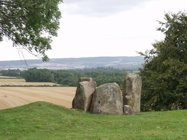
| Coldrum Long Barrow | 5 miles (8 km) | This circular walk visits the ancient Coldrum Long Barrow before exploring the woodland trails in Trosley Country Park. The Long Barrow is about 3,000 years old and the only one in the Medway Valley to remain virtually intact. View Full Details>> | |
| Colley Hill | 1.9 miles (3 km) | Climb to the 722 ft (220 m) summit of Colley Hill on this walk in the North Downs. Colley Hill is located just to the west of Reigate Hill. It's a satisfying climb with great views over Surrey to the South Downs. You start off at the Wray Lane car park near Gatton Park and follow the North Downs Way west to the hill summit. You'll pass Reigate Fort, woodlands and grassland with pretty wildflowers in the summer. As you climb you can enjoy great views of Box Hill and Leith Hill. You'll also pass the interesting Inglis Memorial. If you'd like to extend your walk then the Reigate Hill and Gatton Park Walk also starts from the Wray Lane car park. View Full Details>> | |
| Compton Littleton and Loseley Park | 3.4 miles (5.5 km) | A lovely circular walk taking you to the villages of Compton and Littleton before visiting the delightful Loseley Park, near Guildford in Surrey. The walk starts near Compton and makes use of a section of the North Downs Way to take you through the peaceful woodland of East Warren and West Warren, to the north of Loseley Park. You then turn south to Littleton before following public footpaths which skirt the edge of Loseley Park. For a fee you can gain full access to the grounds which include a series of stunning gardens. This walk follows publicly accessible paths to Polsted Manor before returning to the start point. View Full Details>> | |
| Coulsdon South Circular Walk | 9 miles (14.5 km) | This circular walk from Coulsdon South train station makes use of some of the area's waymarked footpaths to take you on a tour of the hills, countryside and woods to the south of Coulsdon. The route run for just over 8 miles and is a great way to enjoy some nice North Downs scenery from the outskirts of London. Starting from the train station you immediately pick up the London Loop and follow it south across Farthing Downs. The downs are a large area of chalk grassland surrounded by attractive woodland and countryside. The trail then leads through Happy Valley Park where you will find Devilsden Wood and more chalk grassland with interesting flora such as the rare man orchid and round-headed rampion. You then branch of to the east to visit Coulsdon Common. The (127 acre) public open space has some nice woodland and grassland to explore. The path continues past Dean Hill and Piles Wood before coming to Chaldon. Near here you pick up a section of the North Downs Way. Follow this west past Hilltop Farm before picking up the Downland Circular Walk. This will take you north past Tollsworth Manor, a 15th Century Grade II listed house with a 17th and 19th century extension. The final section takes you north past Alderstead Heath to return to Farthing Downs and the train station. View Full Details>> | |
| Crondall | 10.6 miles (17 km) | This attractive Hampshire village is located in the Hart District of the county. The historic settlement includes a number of listed buildings including a noteworthy Norman church and a 500 year old pub. View Full Details>> | |
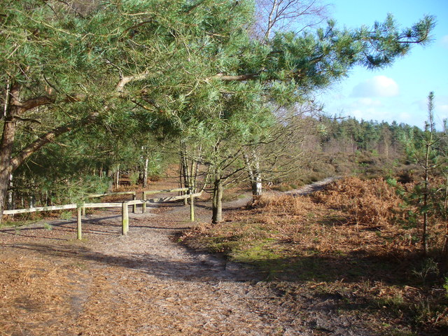
| Crooksbury Hill | 0.9 miles (1.5 km) | This short circular walk climbs to Crooksbury Hill near Farnham in Surrey. There's a car park directly below the hill where you can pick up a short trail to take you to the hill summit. From here you can enjoy fine views over the surrounding countryside of the North Downs. The route then descends through the pine woodland to the ancient earthwork at Soldiers Ring. You can then follow a bridleway south and then west to return you to the car park. View Full Details>> | |
| Denbies Hillside | 1.9 miles (3 km) | Explore this lovely area of the North Downs on this short circular walk. You can start the walk from the Denbies Hillside car park on Ranmore Common. There's waymarked trails, woodland paths and great views of Leith Hill and Dorking from the high points. There's also lots of interesting plants and wildlife to look out for. Several species of orchid grow on the hillside and there are a vairiety of butterflies to see in the summer months. The area also includes the Denbies Wine Estate which contains the largest vineyard in England, representing more than 10 per cent of the plantings in the whole of the United Kingdom. There's an excellent visitor centre with a working winery where you can learn all about the wine making process. View Full Details>> | |
| Denge Wood | 5.6 miles (9 km) | These attractive woods are located a few miles west of Canterbury, near the delightful village of Chilham, and on the dip slope of the North Downs and the Kent Downs AONB. There are miles of footpaths to follow around the site with a wide variety of flora and fauna to look out for on the way. This circular walk starts from Chilham where there is a train station just to the east of the village. From here you can follow footpaths south over the River Great Stour to the expansive woods. The site includes a number of different type of orchid and are an important habitat for nesting and migratory birds including the nightingale, chiffchaff, and spotted flycatcher. You may also see fallow deer and roe deer if you are fortunate. View Full Details>> | |
| Detling Hill | 3.1 miles (5 km) | This walk climbs to Detling Hill, just to the east of the village of Detling in Kent. The hill is located in the Kent Downs area of the North Downs and provides fine views over the surrounding countryside from the summit. You can start the walk from Detling village and follow the North Downs Way east to Gorse Farm before picking up other paths to take you to the hill top which stands at a height of 200 m (660 ft). View Full Details>> | |
| Devils Kneading Trough | 1.2 miles (2 km) | The Devil’s Kneading Trough is a striking natural amphitheatre located near Wye in Kent, within the North Downs Area of Outstanding Natural Beauty. This dramatic dry valley is one of the finest examples of its kind in England, carved out over thousands of years by glacial meltwater. From the top, visitors are rewarded with sweeping views over the Kent Downs and the expansive Wye National Nature Reserve. On clear days, it is possible to see the English Channel and even the distant coastline of France. The surrounding landscape is characterised by rolling chalk hills, ancient woodlands, and vibrant wildflower meadows, making it a picturesque spot for walkers and nature enthusiasts alike. View Full Details>> | |
| Dorking | 8.1 miles (13 km) | A long circular walk around the Surrey Hills town of Dorking, making use of some of the fine waymarked trails which run through the area. You'll follow sections of the Mole Gap Trail, the North Downs Way and the Greensand Way to take you on a walking tour of the surrounding countryside. There's some splendid North Downs scenery and a visit to the popular Box Hill Country Park to enjoy. The walk starts in the town centre at the beginning of the Mole Gap Trail. The path leads north through the lovely Denbies Hillside. The National Trust run area includes waymarked trails, woodland paths and great views of Leith Hill and Dorking from the high points. On your left you'll also pass the Denbies Wine Estate which contains the largest vineyard in England, representing more than 10 per cent of the plantings in the whole of the United Kingdom. Near Westhumble the route picks up the North Downs Way and heads east towards Box Hill Country Park. The park has miles of woodland paths and nice riverside trails along the River Mole where you can find the picturesque stepping stones. There's also the Box Tree cafe and fine views over the Weald to enjoy here. You continue along the path towards Betchworth, turning south at Brockham Hills. The footpaths will take you to the village of Brockham where there's a pretty village green and nice views of the River Mole which flows west through the village. Here you pick up the Greensand Way and follow it west back into Dorking. View Full Details>> | |
| Fox Way | 39.1 miles (63 km) | This circular walk takes you on a tour of the countryside, woodland and canals surrounding Guildford in Surrey. You will pass through the stunning North Downs and Surrey Hills AONBs, visting a series of pretty villages, historical sites and sites of scientific interest. The walk starts and ends at the village of Ripley and first visits the Silent Pool. This interesting site is run by the Surrey Wildlife Trust as part of the Albury Estate. It's peaceful, eerie charm is popular with walkers and passers by as it's linked to a folklore tale that says King John abducted a woodcutter’s daughter who drowned in the pool. According to local legend, the maiden can be seen at midnight. The path then heads on through the attractive village of Shere. There's nice pubs for refreshments here, lots of pretty cottages, shops including a blacksmith and trekking shop, a tea house, art gallery, and a noteworthy Norman church. From here it is not far to another highlights on the walk at Blackheath Common. With 250 acres of attractive heathland it is popular with local cyclists and walkers. You'll also pass the delightful Albury Park with its peaceful woodland, pretty lakes and Saxon Church. View Full Details>> | |
| Godstone | 3.7 miles (6 km) | Godstone is a very pretty village in Surrey with the typical English village green and cricket pitch. It's also surrounded by the lovely countryside of the North Downs and the Greensand Ridge that crosses Kent and Surrey. This circular walk from the village takes you to a series of pretty local ponds before climbing onto the Greensand Way at Tilburstow Hill. On the way there's some nice waterside stretches, woodland sections and good views from the high points. The walk starts in the village centre and follows footpaths east to Bay Pond and Glebe Water. You then head south across Leigh Place Pond where you pick up the Greensand Way. Follow the waymarked footpath south west past Tilburstow Hill where there's some nice woodland trails. After passing the common and hill the route turns north through Garston Park to return you to the village. View Full Details>> | |
| Guildford | 19.9 miles (32 km) | The town of Guildford has a huge selection of walks to choose from with several long distance trails, hill climbs, parks, rivers and canals to explore. This long circular walk makes use of some of the waymarked footpaths running through the area, showcasing the best of the surrounding North Downs countryside. You'll follow sections of the Fox Way, North Downs Way, Wey South Path and Downs Link long distance trails on this 20 mile tour of the area. The route starts in the town centre, near the castle. From here you can pick up the Wey South Path and follow the River Wey to Shalford Park. You then pick up the North Downs Way and head east towards St Martha's Hill, passing Pewley Down on the way. From the St Martha's Hill viewpoint there are tremendous views over Newlands Corner and the surrounding Surrey Hills. The walk then descends past the 17th century Chilworth Manor to Blackheath Common. The 250 acre common consists of lowland heathland, woodland and acid grassland. Look out for pretty heather in the autumn months. At the common the route turns west, following a section of the Downs Link to Chinthurst Hill and Bramley. Here you link up with the Fox Way which takes you to Farley Hill before coming to Godalming. There's a nice waterside section along the River Wey Navigation Canal to enjoy here. After leaving the canal the trail continues through Upper and Lower Eashing before passing through Shackleford Heath. You then skirt the edge of Puttenham Common where there's miles of good walking trails and two large ponds. The route then bends round to the east, passing Puttenham, Compton, Littleton and Loseley Park. The park has a series of splendid gardens and attractive grounds surrounding Loseley House. Shortly after Littleton you return to the River Wey for a final waterside section to take you back into Guildford. View Full Details>> | |
| Guildford to Chilford | 9.2 miles (14.8 km) | This circular walk from Guildford visits the 17th century Chilworth manor. It's about a 3 mile walk from the town to the house. This walk continues to Blackheath Common and Shalford before returning to Guildford along the River Wey. The walk starts on the River Wey Navigation in Guidlford and heads south along the water to Shalford Park. Here you can pick up the North Downs Way and follow it east to St Martha's Hill. The hill summit stands at 574 feet (175 m) and commands wonderful views over the Surrey Hills. There are also a number of nice woodland trails, attractive grassland and a number of interesting plants. From the hill it is a short descent to Chilworth Manor which is grade II listed by Historic England. The house is surrounded by lovely gardens which include a fine terraced walled garden, topiary, herbaceous borders, sculptures, mature trees and stew ponds that date back a 1000 years. From the house it is a short walk south west to the village of Chilworth. The village is in an attractive location occupying both sides of the River Tillingbourne between outcrops of the Greensand Ridge. There's a nice gastro-pub in the village where you can stop for refreshments at what is roughly the half way point of the walk. After passing the manor the walk continues to Blackheath Common. The 250 common is covered with footpaths taking you to lowland heathland, woodland and acid grassland. From the common you follow the Downs Link west towards Shalford. Here you pick up a lovely waterside footpath along the River Wey to take you back into Guildford. View Full Details>> | |
| Hogs Back | 10.6 miles (17 km) | This walk explores the scenic ridge of the Hog's Back in the North Downs near Guildford in Surrey. View Full Details>> | |
| Hollingbourne | 5.6 miles (9 km) | This attractive Kent based village has some fine trails through the North Downs to try. It's also a historic place with over a hundred listed buildings including some fine timber framed structures on Eyhorne Street and the noteworthy All Saints Church which dates from the 14th century. View Full Details>> | |
| Jeskyns Park | 1.6 miles (2.5 km) | Explore the woodlands, ponds, orchards and wildflower meadows in this country park near Gravesend. Walkers can enjoy a number of waymarked surfaced paths and an 8km grass trail. There are also easy surfaced paths for cyclists. These are good for families looking for a safe ride. There's lots to see with 100 acres of meadowland with over 40 species of wildflower. You can also explore the orchards with apple, plum, cherry and pear trees. At Henhurst Lake you can look out for water loving wildlife while the woodland area and glades are a lovely tranquil place for a stroll too. If you'd like to extend your outing then you could head to the nearby Shorne Woods Country Park where you'll find 288 acres of rolling woodlands, wetlands and meadows. Our Circular Walk around Cobham visits Shorne Woods, Jeskyns Park and also takes you to Cobham Woods which is run by the National Trust. View Full Details>> | |
| Kemsing | 4.2 miles (6.8 km) | This rural Kent village is located in an attractive area of the North Downs, just north of Sevenoaks. View Full Details>> | |
| Leatherhead | 11.2 miles (18 km) | The town of Leatherhead is in a good position for walking, situated on the edge of the North Downs and Surrey Hills AONB. There's nice riverside trails along the River Mole and miles of woodland footpaths in the nearby Box Hill and Norbury Parks to the south. View Full Details>> | |
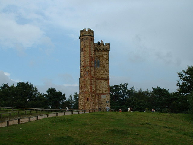
| Leith Hill | 3.7 miles (6 km) | Climb to the highest point in the South East on this challenging circular walk in the Surrey Hills AONB. View Full Details>> | |
| Leybourne Lakes Country Park | 3.7 miles (6 km) | Enjoy peaceful, waterside walking and cycling at Leybourne Lakes Country Park, near Maidstone in Kent. In the park you will find 230 acres of lakes and woodland providing a peaceful location for wildlife and birdwatching. The expansive park includes several lakes with the River Medway running along the eastern section of the park. View Full Details>> | |
| Limpsfield Common | 1.9 miles (3 km) | Limpsfield Common and Limpsfield Chart in the Surrey Hills have some nice woodland trails to try. There's hundreds of attractive beech trees and carpets of bluebells in the spring. At the eastern end of the common you will find a lovely community orchard which is a haven for wildlife and wildflowers. It's a nice spot for a picnic with lots of butterflies fluttering around the blossoms in the spring months. View Full Details>> | |
| Medway Megaliths | 3.3 miles (5.3 km) | This interesting walk visits the site of a number of Early Neolithic chambered long barrows and megalithic monuments located in the lower valley of the River Medway, near Chatham. The circular walk starts from the car park at the Blue Bell Hill picnic site, just to the south of the village. From here you can pick up the Maidstone Centenary Walk and follow it south west towards Eccles. You then turn south towards Hale Farm towards the site of the megaliths. These include Kit's Coty House and Little Kit's Coty House, constructed circa 4000 BCE, during the Early Neolithic period of British prehistory, surviving today in a ruined state. Archaeologists have established that the monument was built by pastoralist communities shortly after the introduction of agriculture to Britain from continental Europe. You'll also pass the Coffin Stone, a large sarsen stone located close to the other two monuments. Various archaeologists have argued, that the stone was part of a chambered long barrow constructed in the fourth millennium BCE, during Britain's Early Neolithic period. It is a rectangular stone lying flat and measuring 4.4 metres (14 ft) long and 2.8 metres (9.2 ft) wide. After exploring the stones the walk picks up a section of the North Downs Way to take you back to the car park. View Full Details>> | |
| Medway Valley Walk | 28 miles (45 km) | This is a lovely, easy riverside walk along the River Medway from Tonbridge to Rochester. You start at Tonbridge castle and head east towards Maidstone via Yalding and East Farleigh. The second section takes you onto Rochester via the attractive Allington Lock. The landscape is varied and includes woodland, orchards, meadows and farmland. You will also pass through a series of pretty riverside villages and towns which are steeped in history. For wildlife lovers look out for Kingfishers and listen out for the sweet song of the nightingale. Route highlights include the pretty Leybourne Lakes Country Park around Aylesford and Snodland. You could also take a small detour near Burham to visit the ancient Medway Megaliths. View Full Details>> | |
| Newlands Corner | 2.2 miles (3.5 km) | This lovely beauty spot on the North Downs is great for walking with a number of footpaths to try. There's several nice woodland trails and open chalk downland with wonderful views over the Surrey Hills. This circular walk starts from the excellent Newlands Corner Visitor centre where you will find information, a cafe, picnic tables and a car park. It's located just a few miles east of Guildford town centre so is easily accessible. The walk follows the North Downs Way and other footpaths around the visitor centre. You'll visit Albury Downs and Walnut Tree Bottom with lots of opportunities to sit on one of the many benches and soak in the splendid views. It's a great area for flora and fauna. In the summer the grassland is covered with a variety of wildflowers. In the woodland area you may see roe deer, green woodpeckers, nuthatches and tawny owls. View Full Details>> | |
| North Downs Way | 152.9 miles (246 km) | This beautiful trail starts in Farnham, Surrey and heads east through the stunning North Downs to the historic city of Canterbury in Kent. The path runs for 153 miles taking you through some stunning scenery, including the Surrey Hills and Kent Downs Areas of Outstanding Natural Beauty. In addition to the wonderful rolling countryside you will pass through a variety of interesting towns including Godalming, Guildford, Dorking, Merstham, Otford, Chilham, Rochester and Dover, where the views of the white cliffs from the trail are stunning. View Full Details>> | |
| Otford Circular Walk | 6.8 miles (11 km) | A popular circular walk from the Kent village of Otford, visiting the River Darent, Shoreham, Great Wood and the Otford Mount viewpoint. The route runs for about 7 miles with some moderate hill climbs on the way. From the high points there are fine views over the countryside of the lovely Darent Valley. The walk starts from Otford train station which is easily accessible from London Victoria. The journey takes a little over half an hour and there's 2 trains an hour. From the station head west and you will soon come to the River Darent. Here you can pick up the waymarked Darent Valley Path and follow it north to Shoreham, passing the golf course on the way. After exploring Shoreham the route turns south east, taking you to Dunstall Farm and Magpie Bottom. At Eastdown you turn south to follow woodland trails through Great Wood. At the southern end of the woods you join with the North Downs Way, following the waymarked path west through Hilydeal Wood to Otford Mount. There's some fine views over the North Downs from the elevated position of the Mount. After desceding the hill the trail soon returns you to the train station where the route finishes. In the village you can also pay a visit to the ruins of the 15th century Otford Palace. The principal surviving remains are the North-West Tower, the lower gallery, now converted to cottages, and a part of the Great Gatehouse. It's located just a short hop south west of the train station. View Full Details>> | |
| Oxted Circular Walk | 9.9 miles (16 km) | This circular walk from Oxted explores the countryside and woodlands to the east of the Surrey town. You'll visit Limpsfield Common, Crockhamhill Common and the 17th century Squerryes Court. The route runs for about 10 miles and follows a mixture of waymarked trails and public footpaths with some moderate hill climbs on the way. From the high points there are splendid views of the surrounding countryside of the High Weald and the North Downs. The walk starts from Oxted train station which is about 20 miles (32.69 km) from London Bridge. There are regular trains from the capital to the commuter town, taking about half an hour. From the station you head south through the town to meet up with the Greensand Way. Follow the waymarked trail east and it will take you through Limpsfield Common, Tenchleys Park, Limpsfield Chart and Crockhamhill Common. Limpsfield Common is owned by the National Trust and includes hundreds of attractive beech trees and carpets of bluebells in the spring. At the eastern end of the common you will find a lovely community orchard which is a haven for wildlife and wildflowers. At Crockhamhill Common you turn north toward Westerham where the route visits Squerryes Court. This fine 17th century manor house is surrounded by extensive gardens which are well worth exploring. After exploring the gardens you head south west to Limpsfield Chart before turning north west past the golf course. The final section heads west through Oxted to return to the train station. View Full Details>> | |
| Pamber Forest | 2.5 miles (4 km) | This large forest in Tadley covers nearly 500 acres. It is criss crossed with numerous footpaths ideal for a peaceful stroll. The area consists of Oak and Birch ancient woodland and heathland. The pretty Honeymill Brook also runs through the forest. The area is great for wildlife with many species of butterfly to look out for. White admiral, purple emperor and silver-washed fritillary are just a few you may see as you make your way through the woods. Birds such as Blackcap and Green woodpeckers are regular visitors to the woods too. Interesting flora includes wild daffodils, honeysuckle and lovely purple heather. This circular route is more suited for walking but on the eastern side of the forest you will find a bridleway which is good for cycling. This runs from Pamber heath to Bridle's Copse, passing Silchester Common on the way. View Full Details>> | |
| Peaslake | 10.6 miles (17 km) | This village in Surrey is in a nice location for exploring the Surrey Hills and Greensand Ridge. This circular walk takes you to some of the highlights of the area including the expansive woodland of Hurt Wood, the iconic Leith Hill and the pretty Abinger Common. The route runs for a distance of just over 10 miles with some moderate climbs on the way. The walk starts in the village and heads south through Hurt Wood where you can see lots flowering Rhodedendron in the spring months. At the Duke of Kent School you can pick up the Greensand Way. The long distance, waymarked trail will guide you east through Pasture Wood and then up on to the summit of Leith Hill. The hill is the highest point in the South East and the highest hill on the Greensand Ridge. On the summit of Leith Hill is an 18th century Gothic tower, with panoramic views northwards to London and south to the English Channel. After taking in the views the route turns north towards Broadmoor before heading west to Abinger Common. Here you'll find miles of nice woodland trails, ponds, streams and great views from the many viewpoints on the expansive common. The route continues west, passsing the village of Holmbury St Mary, before a final woodland section takes you back into Peaslake. View Full Details>> | |
| Pewley Down | 6.2 miles (10 km) | This walk visits the Pewley Down viewpoint near Guildford. The route includes a canal-side stretch and a visit to Chantry Woods, before climbing the hill. The walk starts on the River Wey Navigation Canal near to the train station in Guildford. You follow the Wey South Path along the canal to Shalford Park where you pick up the North Downs Way. Follow it east and it will take you through Chantry Wood. The woods have some nice trails to try and pretty bluebells in the spring. Just before you reach Halfpenny Lane you turn north west and follow the Mile Path bridleway up to Pewley Down. From here there's nice views over the surround North Downs countryside and woodland. View Full Details>> | |
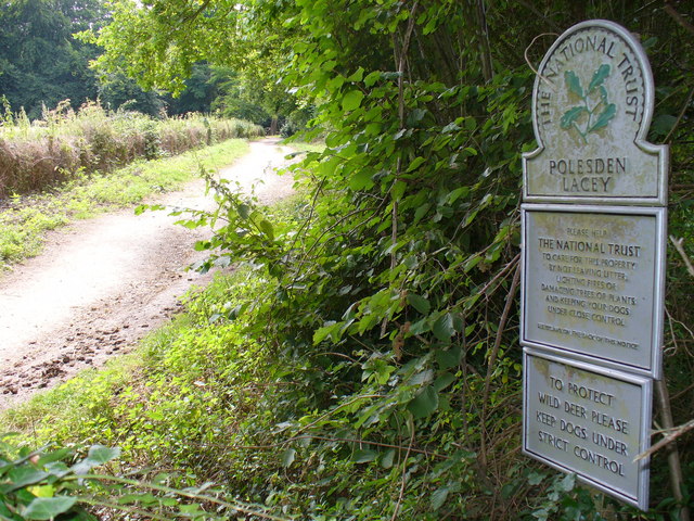
| Polesden Lacey | 3.7 miles (6 km) | A walk around the beautiful grounds of this Edwardian house at Great Bookham, near Dorking, Surrey. There are over 1400 acres of parkland and gardens to explore with magnificent views of the North Downs hills throughout. View Full Details>> | |
| Ranmore Common | 3.7 miles (6 km) | This circular walk explores Ranmore Common in the North Downs, near Dorking. It is an excellent area for walking with miles of good footpaths taking you through woodland and open downland, with great views of the Surrey Hills. The walk starts from the Denbies Hillside car park and follows the North Downs Way across grassy chalk downland where you will see various types of orchids growing in the summer months. You then pick up bridleways through the common where you will find sheltered woodland trails and some climbs with great viewpoints. The bridleways are also great for cyclists. View Full Details>> | |
| Ranscombe Farm Country Park | 4.7 miles (7.5 km) | Explore 560 acres of meadows and woodland in this large nature reserve on the slopes of the North Downs in Kent. The park is perfect for peaceful walks with a number of rare species of plant including meadow clary, rough mallow and six species of orchid to be seen. View Full Details>> | |
| Reigate Hill and Gatton Park | 5.9 miles (9.5 km) | This circular walk explores Reigate Hill and Gatton Park in the North Downs. It's a great area for walking with the North Downs Way and other good footpaths to follow. View Full Details>> | |
| Rochester | 9.3 miles (15 km) | This lovely riverside walk takes you from Rochester to Aylesford along the River Medway. The route runs for a distance of about 9 miles, along a nice flat section of the Medway Valley Walk. The walk starts at the impressive Rochester Castle, next to the river, in the fine Kent town. The castle sits on the eastern bank of the river and includes a noteworthy 12th-century keep, which is one of the best preserved in England or France. The site is run by English Heritage and includes extensive grounds and gardens. From the castle you head south west along the river, passing Baty's Marshes and then under the Medway Bridges which carry the M2 and the Eurostar railway from the Channel Tunnel to London. You continue through Wouldham Marshes to the village of Wouldham where there are nice views over the river to Halling Common and salt marsh. The next stage takes you towards Burham Marshes where you have the opportunity to take a detour from the route and visit the interesting Medway Megaliths. The ancient stones are located just to the east of Burham. This route continues south past Bushy Wood to the town of Aylesford. You could extend the walk by crossing the river here and heading up to Leybourne Lakes Country Park. There's miles of nice waterside trails to try here. View Full Details>> | |
| Shere | 9 miles (14.5 km) | The attractive Surrey village of Shere is in a great location for exploring the Surrey Hills and the North Downs. This circular walk makes use of the North Downs Way and other public footpaths to visit some of the highlights of the area including Newlands Corner, St Martha's Hill and Albury Park. The route runs for a distance of 9 miles with some moderate climbs along the way. From the high points there are splendid view over the surrounding countryside to enjoy. The walk starts in the village centre and heads north past Netley Park to meet with the North Downs Way. Follow the waymarked path west and it will take you past Chantry Wood and Clandon Downs to Newlands Corner. The lovely beauty spot is one of the highlights of the area and is very popular with walkers and cyclists. There's several nice woodland trails and open chalk downland with wonderful views over the Surrey Hills. You can also look out for wildlife including roe deer, green woodpeckers, nuthatches and tawny owls. The route continues west to St Martha's Hill, another fine spot for walkers. The hill summit stands at 574 feet (175 m) and commands wonderful views of the surrounding area. There are also a number of nice woodland trails, attractive grassland and a number of interesting plants. After taking in the views the route heads south past Chilworth Manor, a 17th century manor house and Grade II listed building. You then pick up public footpaths to take you south east eventually reaching the woodland of Albury Warren. Here you reach Albury Park where you will find 150 acres of parkland with lots of walking trails to try. Features include peaceful woodland, pretty lakes and views of the River Tillingbourne. There is also the Grade II listed Albury country house and the Saxon Old St Peter and St Paul's Church to see. After exploring the park you follow footpaths back into Shere where there are some quality pubs for refreshments after your walk. It's also nice to stroll around the village where you will find pretty cottages, shops including a blacksmith and trekking shop, a tea house, art gallery, and a noteworthy Norman church. View Full Details>> | |
| Shorne Woods Country Park | 2.5 miles (4 km) | This park near Gravesend has 288 acres of rolling woodlands, wetlands and meadows that can be explored via a variety of waymarked trails, suitable for cyclists and walkers. The park has excellent on site facilities including a visitor centre, cafe, a sensory garden, fishing lakes, a trim trail and picnic and play areas. If you'd like to extend your outing then you could head to the nearby Jeskyns Park which has woodlands, ponds, orchards and wildflower meadows to explore. Our Circular Walk around Cobham visits Shorne Woods and also takes you to Cobham Woods which is run by the National Trust. You can also find more walking trails at the nearby Camer Park which is near Meopham. View Full Details>> | |
| Silent Pool | 1.2 miles (2 km) | This tranquil lake in the North Downs has a pleasant circular walkway and surrounding woodland trails. You can start your walk from the parking area just off the A25, a few miles east of Guildford. The pool is a popular destination with an eerie stillness and folklore tales. It is said King John on his horse abducted a woodcutter's daughter who was forced into the deep water and drowned. View Full Details>> | |
| Skimmington Castle Walk | 4.3 miles (7 km) | The Skimmington Castle pub is a great place to visit and start a walk from. This circular walk from the inn takes you to two of the highlights of the area at Reigate Heath and Colley Hill. The walk starts from the good sized car park at the pub which is located between Reigate Hill and Reigate Park on Bonnys Road. From here you pick up footpaths heading north through the heath where there's a windmill, pretty heather and acid grassland. You then follow Clifton Lane north before picking up a section of the North Downs Way to climb Colley Hill. Standing at a height of 722 ft (220 m) the hill commands fine views over the surrounding countryside of the North Downs. The route then descends east with the option of continuing to the nearby Reigate Hill. This route turns south, picking up a section of the Greensand Way and following the waymarked path back to Skimmington. View Full Details>> | |
| St Martha's Hill | 1.9 miles (3 km) | This circular walk visits the lovely St Martha's Hill in the North Downs, near Guildford. From the high points there are tremendous views of the Surrey Hills and Newlands Corner. The walk starts from the St Martha's Hill, Guildford Lane Car Park, just east of the hill. You then follow the North Downs Way to the high point and the 19th century church of St Martha's. The hill summit stands at 574 feet (175 m) and commands wonderful views of the surrounding area. There are also a number of nice woodland trails, attractive grassland and a number of interesting plants. View Full Details>> | |
| Waverley Abbey | 1.2 miles (2 km) | This walk visits the ruins of Waverley Abbey in Farnham, Surrey. View Full Details>> | |
| Westerham | 7.9 miles (12.7 km) | Westerham is located in the Sevenoaks District of Kent, a great location for exploring the beautiful Kent Downs. This 8 mile circular walk makes use of the Greensand Way and other footpaths to visit Chartwell House and Toys Hill, two of the major highlights of the area. The walk starts from the town centre where you can pick the Greensand Way, waymarked footpath. Follow the trail south and it will soon take you past the noteworthy Squerryes Court. The late 17th-century manor house is surrounded by extensive gardens and parkland and is a grade I listed building. You continue south along woodland trails to Goodley Stock and Crookhammill Common where there are nice views toward Edenbridge. View Full Details>> | |
| Western Heights Dover | 2.8 miles (4.5 km) | This walk explores a fascinating series of forts, strong points and ditches located in Dover. The forts were created during the 18th and 19th centuries to protect the key port of Dover from both seaward and landward attack. There are good footpaths to follow around the elevated site which includes nice views towards Dover Castle and the North Downs. Start the walk from Drop Redoubt Fort at the eastern end of the complex. It's located just to the south of Piory rail station and just behind the pier and marina. The construction of the Redoubt was in two periods: the first being from 1804-1808 during the Napoleonic Wars, and the second from 1859-1864 following the recommendations of the 1859 Royal Commission. Follow the footpaths west and they will take you to the noteworthy Knights Templar Church. The ruins date from the 11th century and are located on Bredenstone hill. The route continues west to the second fort on the complex, known as 'The Citadel'. This structure was formerly a young offenders' institution, and was most recently used as the Dover Immigration Removal Centre. In the 19th century it contained barracks, stores and magazines arrayed around a large parade ground. At the Citadel Battery the route turns around and heads east along the southern part of the site. To continue your walking in the area head east and visit the historic Dover Castle and the famous White Cliffs on our Dover Cliffs Walk. The North Downs Way also runs through the site so you could pick this up easily too. View Full Details>> | |
| Woldingham | 5 miles (8 km) | A circular walk from Woldingham train station taking you into the Surrey Hills AONB. The route runs for about 5 miles, exploring the countryside and woods to the south of the village. View Full Details>> | |
| Wye Crown | 4 miles (6.5 km) | Enjoy a short walk to Wye Crown in the beautiful Wye Downs. The hill figure is one of the landmarks of the area and a great spot to enjoy views over the Kent Downs AONB. The circular walk starts in the village of Wye just to the west of the Downs. You can pick up the North Downs Way and follow the waymarked trail east to the Wye Crown. View Full Details>> | |
| Wye Downs | 7.6 miles (12.2 km) | Explore this lovely area of chalk downland and woodland near Wye in Kent. Wye Downs is a nature reserve with several dramatic coombes formed in the ice age. This includes the Devils Kneading Trough, a steep-sided valley with views of Romney Marsh, the Weald and the English Channel. The area is also home to interesting flora and fauna including several species of rare orchid. View Full Details>> |