Northumberland Walks

Use the filter to show walks of a certain type such as woods, reservoirs, hills, long distance, country parks, canals and rivers.
In the spring walkers flock to the beautiful bluebell woods in the Northumberland area. Click the 'Woodland' button below to see these.
Use the links to view full route information including elevation profiles, interactive maps and GPS downloads.
You can also view an overview map of all the routes in the using the Northumberland Walk Map>>
*New* - Walks and Cycle Routes Near Me Map - Waymarked Routes and Mountain Bike Trails>>
| Filter: |
| Route Name | Photo | Distance | Description |
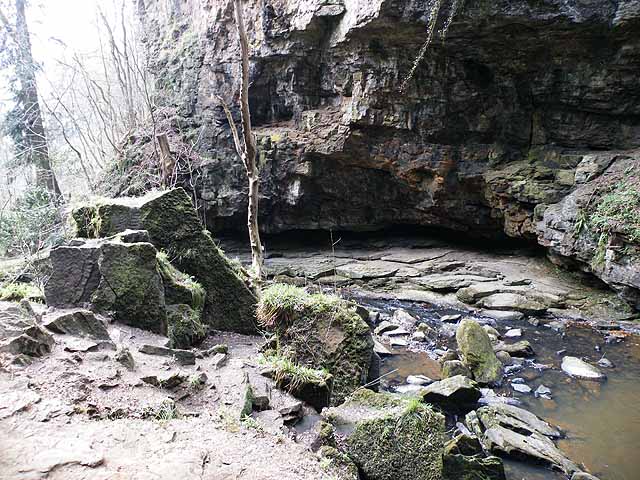
| Allen Banks and Staward Gorge | 3.1 miles (5 km) | Enjoy a waterside walk along the River Allen and through a beautiful wooded gorge on this easy walk in the North Pennines AONB. View Full Details>> | |
| Alnwick | 2.1 miles (3.3 km) | This attractive town in Northumberland is surrounded by lovely countryside and a number of large parks which are ideal for walkers. The main highlight is the expansive Hulne Park located right next to the town. It's proximity to the wonderful Northumberland Coast also presents a number of good walking options. You could visit the atmospheric ruins of Dunstanburgh Castle or pick up the long distance St Oswald's Way. Our Alnwick to Bamburgh Walk links the two historic castles using the coastal path. View Full Details>> | |
| Alnwick to Bamburgh Walk | 21.1 miles (34 km) | This walk takes you from Alnwick Castle to Bamburgh Castle on the Northumberland Coast Path. You'll travel between the two historic castles using country paths before picking up the coastal trail to take you along a lovely section of the English coast. The route runs for about 21 miles passing through a series of delightful fishing villages with some spectacular cliff tops views and gorgeous beaches. The walk starts from the 11th century Alnwick Castle and follows the pavement of the road to Denwick, about 1 mile to the east. You then follow a mixture of footpaths and bridleways east to Longhoughton. Soon after you come to the coast where you turn north and head to Howick and Craster. The small fishing village has an attractive harbour and pretty cottages to see. The next stage takes you to the noteworthy Dunstanburgh Castle, about a mile north of Craster. The photogenic castle was built in the 14th century, being one of the largest and grandest fortifications in Northern England at the time. The dramatic ruins are now a popular tourist attraction, standing on a remote headland with fine views of Embleton Bay. The route continues along Embleton Bay and Newton Haven where there are beautiful beaches and the lovely Newton Pool Nature Reserve. Soon after you come to Beadnell Bay with its 2 mile long sandy beach. The area contains a nationally important colony of little tern and the largest mainland colony of Arctic tern in the United Kingdom. The final section takes you from Beadnell to Bamburgh Castle via Seahouses. There's nice sand dunes and fine views of the castle as you approach the village. The castle is open to the public and well worth a visit if you have time. There's fine state rooms, an art gallery, a stable block and a 12th century keep which is the oldest surviving part of the castle. You can extend the walk by visiting the nearby Budle Bay on our lovely Bamburgh to Budle Bay Circular Walk which starts at the castle. View Full Details>> | |
| Amble to Warkworth Walk | 3.1 miles (5 km) | This walk explores the Northumberland Coast around the town of Amble before following the River Coquet to nearby Warkworth. The walk is quite easy, running for about 3 miles on flat paths. The route starts from the car park on the coast at Amble Links, just to the east of the town. From here you can pick up the Northumberland Coast Path and follow it north towards the harbour with views of Coquet Island as you go. The island is home to several varieties of nesting sea birds, including puffins and the rare Roseate tern. Access is restricted but you can catch boat trips around the site. At the harbour you come to the mouth of the River Coquet and the north and south piers. Follow paths around the marina which will lead you to the main road. A shared cycle and walking path runs alongside the road and the river leading you into Warkworth. Here you can enjoy riverside paths taking you past the medieval bridge to the fine ruined castle. View Full Details>> | |
| Aydon Castle | 2.1 miles (3.3 km) | This circular walk visits the historic Aydon Castle before exploring the surrounding countryside on a series of footpaths and country lanes. The site is located near Corbridge and includes a fine 13th century English manor house surrounded by peaceful woodland. The house was built by Robert de Reymes, a wealthy Suffolk merchant, in 1296, adjacent to the steep valley of the Cor Burn. You can enjoy a stroll around the castle grounds and the pretty walled orchard before heading through the countryside to the village of Aydon. The walk then follows country lanes back to the Cor Burn bridge before returning to the castle. View Full Details>> | |
| Bamburgh to Budle Bay Circular Walk | 4.7 miles (7.5 km) | This circular walk takes you from Bamburgh Castle to the lovely Budle Bay, part of the Lindisfarne National Nature Reserve. It's a lovely stretch of coast with fine views across to the Farne Islands and lots of interesting birdlife to look out for on the way. The walk starts from the car park of the Grade I listed Bamburgh Castle. The castle is open to the public and well worth a visit if you have time. There's fine state rooms, an art gallery, a stable block and a 12th century keep which is the oldest surviving part of the castle. From here you can follow the coastal road north west to Bamburgh Moor and Budle Point. It's a stunning area with interesting rock formations, sand dunes, a beautiful beach and fine views over to the nearby Lindisfarne Castle and Holy Island. There's also lots of wildlife to look out for including grey seals, Pinkfooted and greylag geese, wigeons, grey plovers and bar-tailed godwits. After passing the Heather Cottages the route reaches Kiln Point where you turn south towards Budle. Footpaths across farmland then reach the B1342 road which you can follow back to the castle. The St Oswald's Way long distance footpath runs along this section of coast so you could extend your walk by continuing along the trail. Our Alnwick to Bamburgh Walk links the two historic castles using a section of the path. View Full Details>> | |
| Beadnell to Low Newton | 4 miles (6.5 km) | A popular walk from the Northumberland village of Beadnell to Low Newton By Sea along section of the Northumberland Coast Path. It's a lovely area with splendid views over Beadnell Bay and a visit to the National Trust owned Newton Pool Nature Reserve. The delightful village is a popular tourist spot situated in the Northumberland Coast Area of Outstanding Natural Beauty. As such it's a great base for exploring the area on foot. The walk starts at Beadnell Harbour where there's lots of little fishing boats and an attractive beach with sand dunes. You then pick up the footpaths and head south along the lovely Beadnell Bay with its 2 mile long sandy beach. The area contains a nationally important colony of little tern and the largest mainland colony of Arctic tern in the United Kingdom. After passing the bay you come to Newton Pool. The nature reserve has a number of hides where you can look out for a variety of water loving birds on the small lakes. At the coastal Newton Haven you may also see seals. This walk finishes at the reserve but you can continue south along footpaths to Embleton Bay and the impressive Dunstanburgh Castle. The dramatic ruins are now a popular tourist attraction, standing on a remote headland with fine views of Embleton Bay and Craster. Head north to visit working fishing port of Seahouses, which also serves the tourist trade, being the embarkation point for visits to the Farne Islands.Seahouses to Beadnell The long distance St Oswald's Way also passes through the area and is another good option for extending your walk. View Full Details>> | |
| Bedlington Country Park | 1.6 miles (2.5 km) | Enjoy nice woodland trails along the River Blyth in this country park in Bedlington, Northumberland. The walk starts from the main car park at Bedlington Bridge. From here you can follow a nice riverside footpath heading south to Humford Mill. There's attractive woodland and stepping stones over the Blyth to enjoy. The area is a designated nature reserve so look out for a variety of woodland birds and interesting flora. You can also follow trails north east from the car park and head along the river through Bebside Wood to Furnace Bridge. The park runs into the adjacent Plessey Woods Country Park. If you continue south west through Humford Woods you will soon come to the site. View Full Details>> | |
| Berwick Walls Walk | 1.2 miles (2 km) | Explore the Elizabethan town walls of Berwick-Upon-Tweed on this interesting circular walk. The easy walk runs for just over a mile so should suit most abilities. Along the way there's nice views of the River Tweed, the Royal Tweed Bridge and the impressive Royal Border Bridge, part of the East Coast Main Line. Other highlights include a number of Bastions (forts) and the Bell Tower which was built in 1577. The route starts at the Cumberland Bastion at the northern end of the Northumberland based town. The path then heads east to the Brass Bastion and the 15th century Church of the Holy Trinity on the north eastern corner of the walls. You then turn south along the eastern portion, passing the Windmill Bastion on the way. The walls then head west along the River Tweed Estuary to Coxon's tower, set photogenically next to the river at the south western corner. The route turns north here, passing along the river quay to Megs Mount at the north western end. From here it is a short stroll back to the Cumberland Bastion where the route finishes. To continue your walking in the area you could pick up the Berwickshire Coastal Path which starts in the town. Follow the waymarked path north and you can visit the lovely Marshall Meadows Bay. View Full Details>> | |
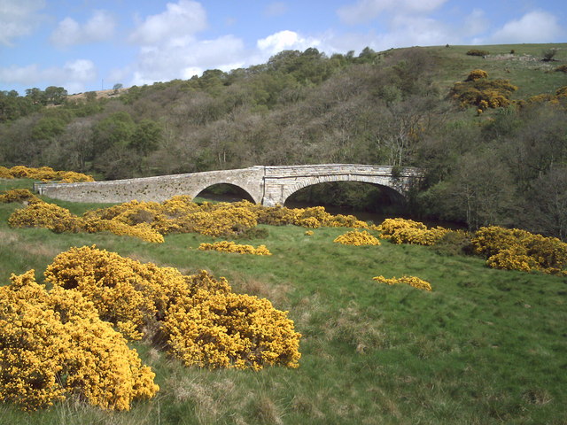
| Berwickshire Coastal Path | 29.8 miles (48 km) | Follow the Berwickshire Coastal Path from Berwick on Tweed in Northumberland, to Cockburnspath, in the Scottish Borders. There's some spectacular coastal scenery to enjoy as you pass along the Northumberland and Scottish cliff tops. There are also a series of pretty coastal villages with delightful harbours including Burnmouth, Eyemouth, St Abbs and Cove. The Berwick Walls Walk is a worthy walk to do at the start of the route. View Full Details>> | |
| Blanchland | 1.2 miles (2 km) | Enjoy a circular river walk on this easy route in the pretty Northumberland village of Blanchland. It's a gem of place with picturesque cottages, set against a backdrop of deep woods and open moors. The village was largely built of stone from the remains of the 12th-century Abbey. It's situated in a great spot in the Derwent Valley area of the North Pennines Area of Outstanding Natural Beauty. The walk follows a section of the River Derwent from Blanchland to Baybridge, with the option of returning through the countryside or on the opposite side of the river. View Full Details>> | |
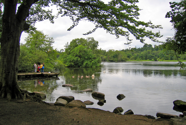
| Bolam Lake Country Park | 1.6 miles (2.5 km) | Enjoy peaceful lakeside walking and cycling in this delightful country park in Northumberland. Bolam lake is located less than 10 miles from Morpeth in the heart of the Northumberland countryside. There are woodland paths, grassland and a super visitor centre with cafe, shop and information area. Cyclists please keep to the marked bridleway and give way to walkers. If you would like to continue your walking in the area then you could head a few miles north to Hartburn Glebe where there are peaceful woodland trails, a pretty river and a variety of wildlife to look out for. Another good option is to climb to the nearby Shaftoe Crags. The crags are located just a mile west of the park and include interesting rock formations and wonderful views over the Northumberland countryside. A short distance to the north west of the crags you will find the National Trust's Wallington Hall where there's lakes, woodland, parkland and a beautiful walled garden. View Full Details>> | |
| Border County Ride | 80.8 miles (130 km) | This long distance circular route follows the Border County Ride through the Cheviots, Northumberland and along the England - Scotland border. View Full Details>> | |
| Cragside Country Park | 5 miles (8 km) | This is a circular walk around the gardens of the beautiful Cragside Estate in Rothbury, Northumberland. View Full Details>> | |
| Cramlington | 3.4 miles (5.5 km) | The Northumberland town of Cramlington is located just to the north of Newcastle upon Tyne on the border between Northumberland and North Tyneside. The town has a few nice country parks and woodland areas to visit in the locality. This circular walk visits Plessey Woods Country Park to the north of the town. View Full Details>> | |
| Craster | 2.3 miles (3.7 km) | A circular walk around the Northumberland village of Craster, visiting the Arnold NWT Nature Reserve and the interesting cliff formations at Cullernose Point on the coast. The small fishing village is located in the Northumberland Coast Area of Outstanding Natural Beauty. It has a pretty harbour and nice coastal footpaths to try. The village is located just to the south of the striking ruins of Dunstanburgh Castle. This circular walk heads in the other direction to visit Cullernose Point where you will find basaltic cliffs which are a significant feature of the local landscape. The walk then passes along a quiet country lane to visit the Arnold Memorial Northumberland Wildlife Trust Reserve where you can look out for various migrant birds and red squirrels. View Full Details>> | |
| Craster to Alnmouth | 7.1 miles (11.5 km) | Enjoy a walk along the beautiful Northumberland Coast Path on this route from Craster to Alnmouth. Along the way there's lovely beaches, interesting rock formations and fine views to enjoy. The walk starts by the attractive harbour of this little fishing village. Head south and you will soon come to Cullernose Point where there are some striking basaltic cliff formations. You continue past Rumbling Kern, an inlet near Howick , with more interesting geology and fine sea views. Around here you will also pass the picturesque Howick Dene. It's a lovely spot where the Howick Burn runs through woodland to meet the sea. There's a pretty beach, a footbridge over the burn and more interesting rock strata. The next stage takes you past some lovely beaches at Sugar Sands, Howdiemont Sands and the little village of Boulmer. You then head past Boulmer Haven and Seaton Point before coming to the finish of the walk with lovely views of Alnmouth Bay. View Full Details>> | |
| Craster to Dunstanburgh Castle | 6.8 miles (11 km) | This walk takes you along a beautiful stretch of the Northumberland Coast Path from Craster to Dunstanburgh Castle and then on to Embleton Bay and the Newton Pool Nature Reserve. Dunstanburgh Castle was built in the 14th century, being one of the largest and grandest fortifications in Northern England at the time. The dramatic ruins are now a popular tourist attraction, standing on a remote headland with fine views of Embleton Bay and Craster. This walk starts at the small fishing village of Craster and follows the coastal path past the castle to Embleton Bay where you will find a lovely beach and sand dunes. You continue to the Newton Pool Nature Reserve where you can use the bird hides to look out for Herons and Barn Owls. View Full Details>> | |
| Deadwater Fell | 5.3 miles (8.5 km) | Climb to the summit of Deadwater Fell in Kielder Forest and enjoy wonderful views over Northumberland and Scotland. The 1900 feet (571 metres) fell sits on the England-Scotland border about 2.5 miles north of Kielder. You can start the walk from Kielder Castle and follow footpaths through woodland and across open moorland to the hill summit. From here there are great views towards the Lake District, the Pentland Hills near Edinburgh and the North Sea coast. This route is for walkers but there is also a good mountain bike trail which you can follow all the way to the summit. If you would like to continue your walking in the area then you could try the Kielder Forest Lakeside Way and enjoy views across Kielder Water. View Full Details>> | |
| Druridge Bay Country Park | 3.1 miles (5 km) | This beautiful country park on the Northumberland coast consists of three miles of beach and sand dunes, a large freshwater lake, peaceful woodland and meadows. The coastline is simply stunning with a lovely cycling and walking path running alongside the beach. You could continue your outing by following the coast north towards Amble with views of Coquet Island, or head south to Newbiggin-By-The-Sea. There are several nature reserves in the area so there are plenty of opportunities for bird watching too. View Full Details>> | |
| Farne Islands | 0.6 miles (1 km) | The Farne Islands are located just 1.5 miles from the Northumberland Coast at Bamburgh. You can catch a boat from Seahouses harbour to Inner Farne, the largest of the islands. Here you can see colonies of grey seals and up to 37000 pairs of puffins. The islands attract many other seabirds including Guillemots, Razorbills, Sandwich Terns, Common Terns, Roseate Terns, Arctic Terns, Shags, Cormorants and Eider Ducks. There is a lovely walkway around Inner Farne taking you past the interesting buildings which date from the monastic period. These include the remains of the old Guest House, the Chapel of St Cuthbert with fine stained-glass windows and the Pele Tower. The islands are run by the National Trust so entry is free for members. To continue your walking in the area try the Seahouses to Bamburgh walk and visit the fascinating coastal castle. The long distance St Oswald's Way also passes the islands and is a great way to explore the Northumberland Coast AONB. View Full Details>> | |
| Fontburn Reservoir | 3.7 miles (6 km) | This circular walk takes you around the lovely Fontburn Reservoir in Northumberland. The walk starts at the car park on the eastern edge of the reservoir and follows a waterside path along the southern shoreline. At the western end of the reservoir the path heads through woodland before climbing towards Priest's Knowe where there are lovely views of the reservoir. You then descend to Ritton White House before another short woodland section takes you back to the car park. All the while there are wonderful views of the surrounding countryside, particularly the Simonside Hills and Harwood Forest. The route runs for about 4 miles with some small climbs, so suitable for most abilities. If you would like to continue your walking in the area then you could pick up the St Oswald's Way and explore the beautiful Simonside Hills. View Full Details>> | |
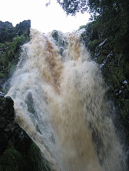
| Hareshaw Linn | 3.1 miles (5 km) | This walk takes you to the beautiful Hareshaw Linn waterfall in the Northumberland National Park. The walk begins in the village of Bellingham and follows footpaths through ancient woodland and over six bridges to the 9 metre high waterfall. On the way you will pass a series of smaller waterfalls on the pretty Hareshaw Burn. Look out for wildlife including red squirrels, great spotted woodpeckers, wood warblers, badgers and bats on the way. The Pennine Way runs past the falls so you could pick this up to continue your walking in the area. View Full Details>> | |
| Hartburn Glebe | 0.9 miles (1.5 km) | Explore these pretty little woods in the village of Hartburn on this short walk in Northumberland. A river runs through the area with a deep pool reputed to have been used to hide silver and valuables during Viking Raids. Look out for wildlife including red squirrels, badgers and otters and various interesting plants and flowers. There's also a splendid Grade ll listed grotto near the river. It was created in the 18th century as a changing area for ladies wishing to bathe in the Hart Burn. Hartburn Glebe is situated about 6 miles (10 km) to the west of Morpeth. View Full Details>> | |
| Hedgehope Hill | 5.6 miles (9 km) | Climb to the 714 metres (2,343 ft) summit of Hedgehope Hill in the Cheviots on this challenging circular walk. The walk begins at the parking area at Langleeford by the Harthope Burn. You then ascend towards Housey Crags and Long Crags and onto the summit where there are fabulous views towards the coast and Lindisfarne Castle. You can descend the same way or head towards Harthope Linn waterfall where you can follow the Harthope Burn back to Langleeford. View Full Details>> | |
| Hexham to Corbridge | 5 miles (8 km) | A lovely walk from Hexham to Corbridge with some nice woodland trails and a riverside section in Corbridge. The walk also visits the interesting Coria Roman site in Corbridge at the end of the route. Starting in the Hexham town centre the walk heads south east into Dukeshouse Wood. Follow the woodland trails east past Duke's House towards Dilston where you will pass Dilston Castle, a ruined 15th-century tower house. At Dilston you pick up a trail along Devil's Water where there are a series of waterfalls. You follow the river north to the point where it meets the River Tyne and then turn east to Corbridge Bridge. The 17th-century stone bridge will take you across the river into Corbridge. Turn left and you can follow another riverside path to the Corbridge Roman Site. It's a fascinating site with information boards detailing the Roman occupation which ran until the 5th century. You can also discover Roman armour and trinkets uncovered with the Corbridge Hoard at the museum. The Hoard was one of the most significant finds in Roman history, providing a fascinating insight into the life of a soldier on the Hadrian's Wall. View Full Details>> | |
| Hexham to Hadrian's Wall Walk | 12.4 miles (20 km) | This walk takes you along the Weardale Way long distance trail from Hexham to Chester's Roman Fort on Hadrian's Wall. It's about a 6.5 mile walk from the town to the fort using the waymarked trail. It passes through some lovely countryside with river views and a stretch along the Hadrian's Wall Path National Trail towards the end of the route. You can pick up the trail in the town and follow it north over the River Tyne at Hexham Bridge. You'll pass Tyne Green Country park on your left hand side. There's some lovely views of the river and tree lined paths here. Keep heading north through the countryside to Acomb and Fallowfield. Shortly after you will meet with Hadrian's Wall Path which you can follow west to Chester's, next to the village of Walwick. Also known as Cilurnum it is considered to be the best preserved Roman cavalry fort along Hadrian's Wall. The site is now preserved by English Heritage as Chester's Roman Fort. There is a museum on the site, housing finds from the fort and elsewhere along the wall. View Full Details>> | |
| Housesteads | 4 miles (6.5 km) | Visit the fascinating Housesteads Roman Fort on this circular walk around Hadrian's Wall in the Northumberland National Park. The fort dates from AD 124 and includes a barracks block, hospital, Commander's House, granaries and communal toilets which are all still visible today. You can start the walk from the Housesteads car park on the Military Road just south of the fort. You then climb steadily up to the fort where you can explore the buildings and enjoy wide ranging views over the surrounding countryside, woodland and hills. The walk then heads west along Housesteads Crags and Hotbank Crags where you can actually walk on a section of the wall. Just before Crag Lough you turn north and then east, following another footpath past Ridley Common and Broomlee Lough. After rounding King's Wicket, you pass Milecastle 36, King's Hill and Clew Hill before returning to the fort and the car park. To extend your walk you can continue west along the path and visit the iconic Sycamore Gap. The famous tree was voted England's tree of the year in 2016. It is located just over a mile west of Housesteads near to the pretty Crag Lough. Another option is to pick up the Pennine Way and follow it between Broomlee Lough and Greenlee Lough towards Haughton Common. Greenlee Lough is also a nature reserve and one of the most significant wetland sites in the UK. If you head east along Hadrian's Wall Path you will soon come to Carrawburgh which was the site of a 3˝ acre auxiliary fort. View Full Details>> | |
| Howick Hall | 4.2 miles (6.7 km) | This circular walk visits the lovely gardens at Howick Hall before heading through the countryside to visit the coastal village of Craster. View Full Details>> | |
| Hulne Park | 8 miles (12.8 km) | This beautiful estate in Alnwick has several waymarked walking trails to try. The walled park was landscaped by the famous Capability Brown. It includes the historic sites of Hulne Priory, Alnwick Abbey, and Brizlee Tower. There's also nice sheltered woodland trails and views of the River Aln which runs through the park. Opening times for the public are between 11am and sunset on most days. You can phone the estate office on 01665 510777 to check before you go. Please note cycles and dogs are not permitted. Start the walk from the Hulne Park entrance, on the western side of the town. Follow the trails past Hollin Hill and White Hill to Brizlee Tower. This Grade 1 listed folly was erected in 1781 for Hugh Percy, 1st Duke of Northumberland. There's wonderful views over North Northumberland, the Borders and the coast from the top of the tower, though this is not normally open to the public. The trails then head towards East Brizlee Bridge where you cross the River Aln. You then follow trails along the river to Palmstrother Haugh and on to Hulne Priory. The priory was founded in the 13th century and substantial ruins still survive today. From the priory more nice riverside woodland trails take you round to Filbert Haugh and then back to the entrance. On the other side of the river you'll pass Alnwick Abbey which was founded in the 12th century. An architecturally impressive 14th century gatehouse still remains. View Full Details>> | |
| Humford Woods | 3.7 miles (6 km) | These woods in Bedlington have nice trails to follow along the River Blyth. It's a peaceful place for a stroll with the stepping stones and the woodland wildlife the main highlights. You can park at the car park at Humford Mill and follow trails south along both sides of the river. The trails will eventually lead you to Plessey Woods Country Park just north of Cramlington. Here you'll find 100 acres of woodland and meadow with miles of cycling and walking trails. The woods are also next to Bedlington Country Park where you can extend your walk in the other direction. View Full Details>> | |
| Ingram Valley | 13.7 miles (22 km) | This walk takes you on a tour of the beautiful Ingram River Breamish Valley in the Northumberland National Park. You'll pass along rivers and burns with miles of open moorland and the Cheviot Hills making a splendid backdrop. The walk starts at the village of Ingram and heads west along the River Breamish and the Greensidehill burn towards Brough Law and Linhope. At Hartside you turn south and head towards Alnhamoor crossing the river as you go. You continue to Little Dod before picking up Salter's Road (a track) to climb High Cantle hill. You continue east towards Linhope where you can take a short detour to visit the splendid Linhope Spout waterfall. From Linhope you soon pick up the country lane from the start of the walk which will return you to Ingram. If you'd like to continue your walks in the area then you could climb the nearby Hedgehope Hill and The Cheviot. View Full Details>> | |
| Isaac's Tea Trail | 36 miles (58 km) | Follow in the footsteps of the legendary tea seller Isaac Holden on this challenging circular walk through the North Pennines. The walk starts at the pretty village of Allendale Town, and heads south along the River East Allen and through West Allen Dale to Nenthead, where you will find the interesting Nenthead Mining Centre. Another lovely waterside section along the River Nent then takes you to Alston, before turning north towards Kirkhaugh. One option is to take the fantastic South Tynedale Railway from Alston to Kirkhaugh (video below). The route then heads along the River South Tyne and then up to Ouston Fell before joining the River West Allen for another riverside section. The final leg follows the River East Allen back into Allendale town. The walk is waymarked with a green disc featuring a portrait of Isaac Holden. Around Alston the trail links with the South Tyne Trail. The riverside cycling and walking trail takes you from Tyne Head to Haltwhistle with more great views of the North Pennines. You can also pick up the Pennine Way in the same area. View Full Details>> | |
| Kielder Forest Lakeside Way | 21.7 miles (35 km) | This fantastic circular cycling and walking route takes you around the beautiful Kielder Water in Kielder Forest Park, Northumberland. The route is known as the Lakeside Way and follows the shoreline of the reservoir on a lovely multi-user track. Along the way you can see twenty pieces of outdoor public art including the futuristic Belvedere shelter and the three large rotating Janus Chairs. There's excellent wildlife spotting opportunities with Ospreys regularly seen around the reservoir. The route also passes Kielder Dam and Kielder Castle where you will find an excellent visitor centre with exhibitions, information and a cafe. The castle is also the centre for cycling within the park - you can hire a bike here or get your own repaired. It is located at the northern tip of the reservoir at Kielder village. If you're looking for a more challenging cycle ride you will also find several colour coded mountain bike trails within the park. They range from the easy Borderline trail to the thrilling Deadwater black trail. For great views over the Lake District and the Scottish Hills you could climb Deadwater Fell from Kielder Castle. A few miles to the north there's a nice climb to Girdle Fell with great views over the lovely Catcleugh Reservoir. View Full Details>> | |
| Lambley Viaduct | 1.6 miles (2.5 km) | Visit this hugely impressive structure on this short walk in Northumberland. The landmark was built in 1852 and consists of 9 arches standing at a height of 35 metres (110 feet) above the South Tyne River. The walk starts from the car park at Coanwood about a mile from the viaduct. You can then follow a section of the South Tyne Trail to the viaduct. If you prefer you could visit the area from nearby Haltwhistle by following the trail from there. It is suitable for both cyclists and walkers. It's a beautiful area with the river flanked by attractive woodland. There are also lovely views of the surrounding North Pennines countryside. Please note that although it's a short walk there are some steep steps and moderate climbs. It's easy to extend your walk if you have time. You can continue along the South Tyne Trail south towards Slaggyford. The Pennine Way also runs just to the west of the viaduct. Pick this up and you can explore Lambley Common. View Full Details>> | |
| Lindisfarne Castle and Holy Island | 3.7 miles (6 km) | This is an atmospheric circular walk around the fascinating Holy Island in Northumberland. View Full Details>> | |
| Linhope Spout | 3.1 miles (5 km) | This short walk takes you to this lovely waterfall in the Ingram Valley. The walk starts at Hartside where there is parking available by the roadside. You then follow a country lane to Linhope where you cross the River Breamish and ascend to the waterfall and Linhope burn on public footpaths. The waterfall is an impressive 60 foot (18m) chute of water landing into a deep plunge pool below. On the walk there are splendid views of Great Standrop and Hedgehope Hill. Look out for Curlew and red squirrels on the way. Our Ingram Valley and River Breamish Valley circular walks both pass close to the falls. For a longer walk you could start from the Ingram Bridge car park and follow either of these trails to Linhope. Back in Ingram there's the option of visiting the nice Ingram Cafe where there's a good range of meals and snacks to enjoy after your exercise. If you'd like to continue your walking in the area then you could climb the nearby Hedgehope Hill and The Cheviot. View Full Details>> | |
| Morpeth | 6.8 miles (11 km) | Enjoy nice trails along the Wansbeck River in the historic market town of Morpeth in Northumberland. View Full Details>> | |
| Northumberland Coast Path | 62.8 miles (101 km) | This epic long distance walk runs along the Northumberland coast from Cresswell to Berwick Upon Tweed. View Full Details>> | |
| Northumberlandia | 0.9 miles (1.5 km) | This interesting country park is located just to the west of the town of Cramlington in Northumberland. View Full Details>> | |
| Plessey Woods Country Park | 3.1 miles (5 km) | This pretty country park is situated on the River Blyth at Hartford Bridge, 5 miles south of Morpeth and north of Cramlington. There are 100 acres of woodland and meadow to explore and a lovely long waterside stretch along the River Blyth. There's also an abundance of wildlife with woodpecker, nuthatch, tree creeper, kingsfisher, red squirrel, roe deer and fox. There are a number of self guided walking trails and a bridleway for cyclists. The park has an excellent visitor centre with maps, guides and a cafe. If you have time you could head half a mile east to Bedlington Country Park where there are more riverside trails to try through Humford Woods. View Full Details>> | |
| Queen Elizabeth II Country Park | 1.6 miles (2.5 km) | Enjoy a short cycle or walk around the large lake in this pretty country park near Ashington. The lake is surrounded by woodland and grassland and there is also a miniature railway to ride. The park is situated on the site of the Woodhorn Colliery and the old colliery buildings have now been turned into a museum. Queen Elizabeth II Country Park is located near the Northumberland Coast between Newbiggin By the Sea and Ashington. Druridge Bay Country Park is only a few miles north so you could continue your walk or ride along the coast to this beautiful park. View Full Details>> | |
| Roughting Linn | 5.3 miles (8.5 km) | Enjoy a walk from the village of Ford to this beautiful hidden gem in Northumberland. The walk starts at the remains of Ford castle and heads east into some beautiful countryside. You pass the Ford Moss Nature Reserve where you can see birds such as red grouse, meadow pipit and woodcock. You can also see reptiles such as common lizards and adders. You continue from the reserve towards Goatscrag Hill before coming to the beautiful waterfall on the Broomridgedean Burn. Return to Ford on the same path. View Full Details>> | |
| Seahouses to Bamburgh | 3.1 miles (5 km) | Walk along the golden sands of the Northumberland Coast, on this walk from Seahouses to the striking Bamburgh Castle. It's a lovely setting with the path running along the beach with the castle making a wonderful backdrop for the duration of the walk. There's also attractive sand dunes, pretty wildflowers and great views over to the nearby Farne Islands. Starting from Seahouses Harbour it's about a 3 mile walk to the castle along the beach. It's a nice flat, easy walk with a short climb up to the Grade I listed castle. The castle is open to the public and well worth a visit if you have time. There's fine state rooms, an art gallery, a stable block and a 12th century keep which is the oldest surviving part of the castle. To extend your walking in the area you can head south on the Seahouses to Beadnell Walk. The St Oswald's Way long distance trail also passes through the area. You could follow it north and visit the Lindisfarne National Nature Reserve. Here you can look out for grey seals and birds including pale-bellied brent goose, wigeon, teal, pintail, merlin, dunlin, bar-tailed godwit. Just north from the castle is the lovely Budle Bay. You can explore the area on our Bamburgh to Budle Bay Circular Walk which starts at the castle. View Full Details>> | |
| Seahouses to Beadnell | 3.1 miles (5 km) | This popular walk runs between this two lovely villages in the Northumberland Coast AONB. It's about a 3 mile walk along a section of the Northumberland Coast Path, so 6 miles there and back. The route takes place on a fairly flat section of the St Oswald's Way long distance trail. There's pretty harbours, lovely beaches and lots of wildlife to look out for on the way. Seahouses is a working fishing port, which also serves the tourist trade, being the embarkation point for visits to the Farne Islands. The route starts at Seahouses Harbour and heads towards North Sunderland Point. You continue south towards the golf course, the pretty Annstead Burn and Annstead Beach. The route passes alongside the lovely beach where you will find attractive sand dunes and wildlflowers such as Dog Rose and Marram Grass. You soon come to Beadnell, passing the village, before finishing at the harbour where you can enjoy great views across Beadnell Bay. To extend the route you can continue on the Beadnell to Low Newton Walk. This includes a visit to the National Trust owned Newton Pool Nature Reserve. Head north along the St Oswalds Way and you can visit the dramatic Bamburgh Castle on the Seahouses to Bamburgh Walk. View Full Details>> | |
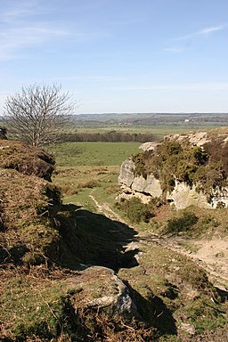
| Shaftoe Crags | 1.9 miles (3 km) | Climb to Shaftoe Crags and enjoy far ranging views over the Northumberland countryside on this circular walk near Morpeth. The area is geologically significant with a number of interesting rock formations including the Devil's Punchbowl. The crags reach a height of nearly 700ft. From this elevated position the views over the surrounding area are magnificent, with the Northumbrian coast visible on a clear day. There are also evidence of ancient occupation with a number of Iron Age burial mounds. View Full Details>> | |
| Simonside Hills | 6.8 miles (11 km) | The Simonside Hills are a fabulous place for walkers with miles of footpaths taking you through woodland and moorland to wonderful viewpoints. You'll pass interesting rock formations, rocky outcrops and acres of forest as you make your way through this wildly beautiful area of the Northumberland National Park. View Full Details>> | |
| Slalely Forest | 7.5 miles (12 km) | This large area of coniferous woodland is located a few miles south of Hexham. There's miles of nice wide trails suitable for mountain bikers or walkers. In the forest you'll find a mixture of spruce, pine and larch trees with lots of wildlife to look out for. Keep your eyes peeled for nightjar and red squirrels as you make your way through the woods. There's also a sculpture trail at the eastern side of the woods. To the east of the woods you will find the noteworthy Slalely Hall. The Edwardian mansion is now a hotel set in 1000 acres of beautiful grounds. In the grounds there are Japanese Gardens, wide lawns and wonderful views of the surrounding countryside. View Full Details>> | |
| South Tyne Trail | 23 miles (37 km) | Travel through the fabulous North Pennines and enjoy some spectaular scenery on this shared walking and cycle path.
The trail starts off at Tyne Head - the source of the River South Tyne. You then head north to Garrigill along the river passing the impressive Ashgill Force waterfall as you go. The trail continues to Alston where you will run alongside the fabulous South Tynedale Steam Railway (see video). From Alston you head through Slaggyford and Lambley where you will pass the Grade I listed Featherstone Castle and the striking structure that is Lambley Viaduct. The final section takes you through Coanwood to the finish point at Haltwhistle rail station. This is a terrific riverside trail with moors, fells and beautiful countryside to take in. The route links with Isaac's Tea Trail and the Pennine Way around Alston. View Full Details>> | |
| St Cuthbert's Way | 62.8 miles (101 km) | This walk runs from Melrose in the Scottish Borders to Lindisfarne Castle and Holy Island. The route is typically walked from west to east in four stages: Melrose to Harestanes - this section takes in Melrose Abbey, the River Tweed and the Eildon Hills before coming to the 18th century Monteviot House on the River Teviot at Harestanes. Harestanes to Yetholm - a challenging section taking you to the highest and midway point of the route at the summit of Wideopen Hill. The section also passes through Cessford Moor and past Cessford Castle before reaching Town Yetholm on Bowmont Water. Yetholm to Wooler - a wide open section which takes you into Northumberland National Park and has terrific views of the Cheviot Hills. You'll climb Yeavering Bell hill near Wooler where you can find the largest Iron Age hillfort in the region. There's also some attractive woodland at Wooler Common, the photogenic Hethpool Linn waterfall in the College Valley and views of Humbleton Hill where there is another hillfort to see. Wooler to Lindisfarne - the final section passing Doddington Moor and Buckton Moor before finishing on Holy Island. On the way you'll also pass St Cuthbert's Cave. View Full Details>> | |
| St Oswald's Way | 96.9 miles (156 km) | Explore the coastline, islands, river valleys, hills, villages, forests and farmland of Northumberland and follow in the footstepts of St. Oswald - the King of Northumbria in the early 7th Century, who played a major part in bringing Christianity to the region.
The walk begins on Holy Island next to Lindisfarne Priory (video below) and heads to Belford before starting the wonderful coastal section from Bamburgh to Warkworth. The Northumberland coastline is really beautiful, passing Bamburgh Castle (video below), Beadnell Bay, Embleton Bay, Dunstanburgh Castle and Alnmouth Bay before finishing at Warkworth near the castle. The route then heads inland along the River Coquet to Rothbury before turning south through the Simonside Hills and Harwood Forest to Kirkwhelpington. View Full Details>> | |
| Sycamore Gap | 3.4 miles (5.5 km) | Sycamore Gap was voted England's tree of the year in 2016. It stands in a dramatic dip next to Hadrian's wall in the Northumberland National Park. The tree is known as the 'Robin Hood' tree after famously featuring in the film 'Robin Hood Prince of Thieves' starring Kevin Costner. This circular walk makes use of the Hadrian's Wall Path and the Pennine Way to take you to the iconic tree and around the pretty Crag Lough. The walk starts at the Steel Rigg car park just to the west of the tree. You then pick up the footpath to Steel Rigg and on to Sycamore Gap. After taking some photos of the strikingly positioned tree the path continues around Crag Lough. The route then follows public footpaths back to the car park, passing Hound Hill on the way. You can extend your walk by continuing east along the path to Hotbank Crags and Housesteads Wood. Here you can physically walk on Hadrian's Wall for a short section. There's some magnificent views on this elevated section of the path. If you keep heading east you will soon come to the famous Housteads Roman Fort. The fascinating fort dates from AD 124 and is well worth a visit. The barracks block, hospital, Commander's House, granaries and communal toilets are all still visible today. You can virtually explore the footpath around Sycamore Gap on the google street view link below. View Full Details>> | |
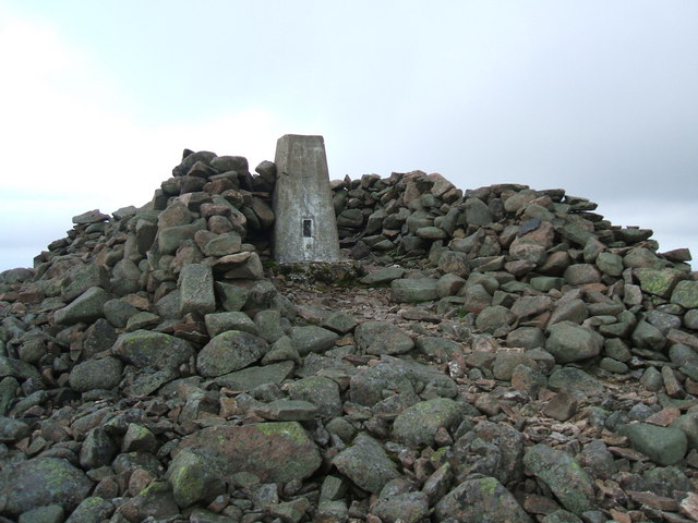
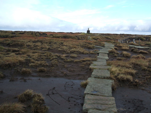
| The Cheviot | 8.7 miles (14 km) | This circular walk climbs to the 815 m (2,674 ft) summit of the highest hill in the Cheviot hills. The walk begins at the parking area at Langleeford by the Harthope Burn. The route then ascends along public footpaths and with the burn on your left. You continue to Cairn Hill passing the pretty Harthope Linn waterfall on the way. At Cairn Hill you pick up the Pennine Way to take you to the summit. This section takes place on stone slabs through an area of peat bog. At the summit you can enjoy excellent views of the North Sea, the Lake District Fells, Cross Fell and the Lammermuir Hills. You then descend back to Langleeford via Scald Hill. View Full Details>> | |
| Thrunton Woods | 5.3 miles (8.5 km) | Enjoy miles of cycling and walking trails in this large area of woodland near Alnwick. View Full Details>> | |
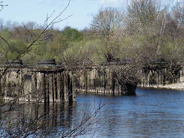
| Tyne Green Country Park | 1.9 miles (3 km) | Enjoy a riverside walk or cycle along the River Tyne in this country park in Hexham. There are lovely tree lined avenues to stroll down, a golf course and club house, play area, cafe and watersports centre. Tyne Green is also good for birdwatching - look out for Goosander, Goldeneye and Teal on the river. The park is located right next to Hexham railway station. View Full Details>> | |
| Usway Burn - River Coquet - Upper Coquetdale Walk | 13.7 miles (22 km) | Enjoy some lovely waterside walking along the Usway Burn and the River Coquet on this route in the Upper Coquetdale area of the Northumberland National Park. The walk begins next to the parking area at Alwinton and follows a footpath to the Usway Burn. You follow the path north along the burn with waterfalls, woodland paths and wonderful views of the Cheviots. Just after entering the edge of Kidland Forest you turn south and head towards Barrowburn. View Full Details>> | |
| Wainwright's Coast to Coast | 182.7 miles (294 km) | Travel from the west coast of England to the east along this breathtaking route devised by Alfred Wainwright. View Full Details>> | |
| Wallington Hall | 2.2 miles (3.5 km) | Explore the Wallington estate on this walk in Northumberland. Here you will find a country house and pretty gardens. The grounds are lovely and include lakes, woodland, parkland and a beautiful walled garden. The estate is located about 12 miles west of Morpeth. View Full Details>> | |
| Walltown Crags | 3.7 miles (6 km) | Visit one of the best preserved sections of Hadrian's Wall on this short walk in Northumberland. The walk starts at the car park near Greenhead and follows the Hadrian's Wall Path to Walltown Crags. There are splendid views towards Haltwhistle and the River South Tyne. View Full Details>> | |
| Wansbeck Riverside Country Park | 1.6 miles (2.5 km) | Enjoy 275 acres of riverside parkland in this delightful country park near Ashington. The park is situated on a particularly beautiful part of the River Wansbeck with peaceful woodland that includes Oak, Beech, Silver Birch, Hazel, Sycamore, Ash, Scots Pine, Hawthorn and Willow. View Full Details>> | |
| Warkworth River Walk | 1.7 miles (2.8 km) | Enjoy a nice stroll along the River Coquet on this easy circular walk in the popular village of Warkworth. The walk starts from the ancient bridge of two arches which crosses the river, just north of the castle. The medieval bridge also includes an old fortified gateway. Head west along the river and you will soon come to the noteworthy St Lawrence church. The large Norman church dates from the 12th century with construction started in 1132. It was built not only as a holy place but also as a sanctuary for the villagers in dangerous times, such as the battle of Alnwick in 1174. You continue around the bend of the river to Warkworth Castle. The substantial ruins of the medieval castle sit next to the river in a very photogenic spot. Follow the path along Mill Walk Wood to Howlet Hall where you leave the river and follow a footpath south. Another path then heads east taking you to the castle where the walk finishes. English Heritage own the site so you have to pay a fee to fully explore the castle. Upon entry you can see how the powerful Dukes of Northumberland, the Percy family lived. There's also great views of the river and coast from the castle walls. View Full Details>> | |
| Warkworth to Alnmouth | 3.4 miles (5.5 km) | This is another splendid stretch of the Northumberland Coast Path, with a historic castle, beautiful beaches, interesting villages and lovely bays to enjoy. View Full Details>> | |
| Windy Gyle | 9.9 miles (16 km) | Climb to the summit of this hill in the Cheviots and enjoy fabulous views into Scotland and England as you stand high on the border. This challenging circular route runs for a distance of about 10 miles using the bridleways and footpaths that cross the area. The walk begins from the Wedder Leap car park and heads towards Shorthope hill, crossing the River Coquet and following the Rowhope Burn as you go. You continue the climb to Little Ward Law before coming to Russel's Cairn at the 619 m (2,031 ft) summit of Windy Gyle. From here there are wonderful views over the Scottish Borders, the Eildon Hills and Edinburgh. You begin the descent by heading west along the Pennine Way and then south towards Swineside Law and Hindside Knowe. Shortly after you cross the River Coquet and return to the car park. This is a challenging walk but the footpaths are generally good and you're rewarded with some stunning scenery. To continue your walking in the Cheviots you could climb the highest hill - The Cheviot. View Full Details>> | |
| Wylam | 12.4 miles (20 km) | This pleasant riverside village is located in a lovely spot, a few miles west of Newcastle. View Full Details>> | |
| Yeavering Bell | 3.1 miles (5 km) | Climb to the summit of this hilll in the Cheviots and visit the largest Iron Age hillfort in the region. The walk starts near Kirknewton at the Gefrin lay-by where there is some roadside parking. From here you head south climbing to the fort on public footpaths and the St Cuthbert's Way long distance path. View Full Details>> |