West Midlands Walks

Use the links to view full route information including elevation profiles, interactive maps and GPS downloads.
You can also view an overview map of all the routes in the using the West Midlands Walk Map>>
*New* - Walks and Cycle Routes Near Me Map - Waymarked Routes and Mountain Bike Trails>>
| Route Name | Photo | Distance | Description |
| Balsall Common | 9 miles (14.5 km) | This village near Coventry is surrounded by some lovely countryside with a major long distance trail running right through it. View Full Details>> | |
| Barr Beacon | 0.8 miles (1.3 km) | This walk climbs to one of the highest spots in the Birmingham area. The beacon is located to the north of the city, not far from Walsall. View Full Details>> | |
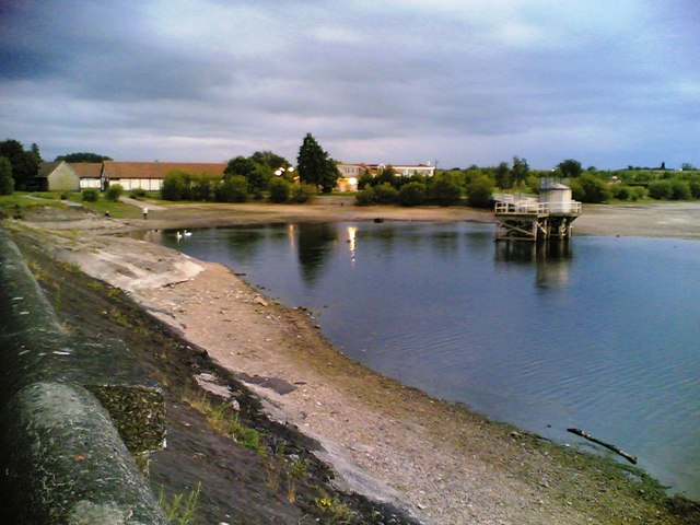
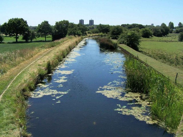
| Barston Lakes | 1.1 miles (1.8 km) | This walk takes you around Barston Lakes near the village of Barston in the West Midlands. View Full Details>> | |
| Bartley Reservoir | 0.9 miles (1.5 km) | Enjoy an easy stroll along this pretty reservoir in Bartley Green, Birmingham. It's a lovely spot with sailboats on the water, views to the city and lots of birdlife to look out for. The reservoir is known as the place where Bill Oddie did much of his early birdwatching. To extend your walk you could visit Senneleys Park or head south to Frankley Reservoir. Both of these sites are very close by. Heading south west will take you up to Frankley Beeches where there's a nice viewpoint and some woodland trails. View Full Details>> | |
| Beacon Way | 15.5 miles (25 km) | This is the section of the Beacon Way from Sandwell to Chasewater, taking in the nature reserves, canals and woodland around Walsall. You start by the restored, Victorian Sandwell Park Farm in West Bromwich and head through the lovely Sandwell Valley Country Park. You continue past Rushall Junction and onto Barr Beacon where there are splendid views of the surrounding countryside. Pleasant waterside sections along the Rushall Canal and Wyrley and Essington Canal lead you to the finish point at Chasewater Country Park. View Full Details>> | |
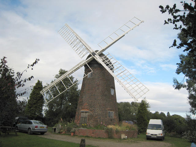
| Berkswell Circular Walk | 7.8 miles (12.6 km) | This village near Coventry has a number of good waymarked footpaths to try. The historic village also includes some notable features including a Norman church, a Grade II listed 16th century inn and the Berkswell Windmill which dates back to 1826. There's also a pretty village green and some picturesque thatched cottages to admire in this delightful settlement. View Full Details>> | |
| Birmingham and Fazeley Canal | 14.9 miles (24 km) | Enjoy a walk or cycle along the Birmingham and Fazeley Canal from the city centre of Birmingham to the town of Fazeley in Staffordshire. Along the way there's lots of pretty locks, old bridges, nature reserves and wildlife to look out for. You start off at Old Turn Junction near the National Indoor Arena in Birmingham and head through Aston and Tyburn where you pass close to Pype Hayes Park. The large park has 100 acres to explore with a lake, ornamental gardens and woodland. It's just north of the canal at Tyburn and worth a short detour. Just next to the park there is the pretty Plantsbrook Nature Reserve which consists of open water, wetland, woodland and meadow. You leave the city and head through Minworth and Cudworth before coming to the splendid Kingsbury Water Park. The 600 acre country park is a major highlight on the route. It consists of 15 lakes with miles of good cycling and walking trails to try. The final section takes you from Kingsbury Water Park to the town of Fazeley near Tamworth. On the way you'll pass Middleton Lakes RSPB reserve with 400 acres to explore. It's a great place for wildlife watching with common pochard, tufted duck and smew to look out for. View Full Details>> | |
| Bourn Brook Walkway | 3.5 miles (5.7 km) | This cycle or walk runs along a surfaced path from Harbourne Lane to Woodgate Valley Country Park. View Full Details>> | |
| Bournville | 1.2 miles (2 km) | Explore the fascinating little village of Bournville on this short walk in Birmingham. The area is famous for the Cadbury World chocolate factory producing Bournville chocolate and other confectionary. The village is very pretty with old buildings and fine houses created to originally house the factory workers. It's a nice place for a stroll with good footpaths through Bournville park with its pretty stream, gardens and a lake where you can see lots of little model boats in operation. The start point for the walk is the 14th century Selly Manor. It is located near to Bournville Green and not far from Bournville train station. The old house includes a magnificent cruck-framed medieval hall and pretty gardens. You can explore the house and museum for a small fee. The walk then heads across Bournville Green where you can see a number of historic buildings with an information panel describing the area. After leaving the green head across the A4040 at the traffic lights and you will enter Bournville Park. Here you can enjoy a pleasant stroll along the Merrits Brook Greenway to the little lake. You can circle the lake on waterside footpaths before returning to the green on the same paths. To extend your walk you can continue along the brook to the nearby Manor Farm Park and Ley Hill Park. On the way you will pass waterfalls, lakes, woodland and gardens with good footpaths and cycling trails. You could also pick up the Worcester and Birmingham Canal which runs through nearby Stirchley. View Full Details>> | |
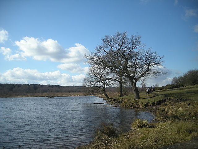
| Chasewater Country Park | 3.7 miles (6 km) | Enjoy a lovely waterside walk or cycle around Chasewater in Burntwood, near Lichfield. The park is nearly 900 acres in size with over 200 acres of water. A cycling and walking path runs right around the perimeter of the large lake. There is also a steam railway, bird hides and a visitor centre. For those wishing to continue their exercise the Beacon Way links to the park. View Full Details>> | |
| Cole Valley | 9.9 miles (16 km) | This easy cycling and walking route runs along the River Cole through Birmingham. View Full Details>> | |
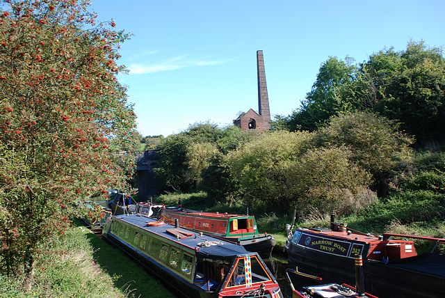
| Coventry Canal | 37.9 miles (61 km) | Enjoy waterside cycling and walking along the 38 mile long Coventry Canal towpath. Walkers can follow the whole of the route while cyclists can enjoy lovely sections through Coventry and from Marston Junction to Nuneaton. The canal runs from the centre of Coventry to Fradley Juction, passing through Bedworth, Nuneaton, Atherstone, Polesworth and Tamworth. Highlights along the canal include the vibrant Coventry Canal Basin with its shops, businesses and art gallery. You'll also pass the splendid Hartshill Country Park which has miles of footpaths and wonderful views over the Anker Valley. There's also some wonderful countryside to enjoy and a series of artworks by local artists on the Arts Trail from the Basin to Hawkesbury Junction. At the end of the route at Fradley Junction there is a nature reserve with excellent bird watching opportunities. View Full Details>> | |
| Coventry Way | 39.8 miles (64 km) | This walk circles the countryside around Coventry taking you through some fine Warwickshire countryside and a series of interesting villages. The walk starts in the village of Meriden at the geographical centre of England. You then head towards Kenilworth with its impressive castle - described by architectural historian Anthony Emery as the 'finest surviving example of a semi-royal palace of the later middle ages, significant for its scale, form and quality of workmanship'. The route continues towards Stoneleigh and the fascinating Grade I listed Stoneleigh Abbey. View Full Details>> | |
| Dudley Canal | 3.7 miles (6 km) | Follow the Dudley Canal from Warren's Hill Park to Leasowes Park on this waterside walk through Blackheath and Halesowen in Birmingham. The route makes use of the Monarch's Way long distance footpath to link these two lovely open spaces. The walk starts at the car park at Warren's Hall Country Park in Sandwell. You then head through the park with its ponds, canals, grassland and small wooded areas. It's a lovely start to the walk with the park's footpaths leading to the canal. On the way you'll pass Cobb's Engine House. The eye catching building is a scheduled ancient monument and a Grade II listed building built around 1831. It housed a stationary steam pump used to pump water from Windmill End Colliery and other mines in the area. After passing through the park you pick up the canal path and head south through Old Hill and Coombeswood to Halesowen. Here the route finishes at the splendid Leasowes Park. The historically significant park consists of 141 acres of woodland, grassland, streams, waterfalls and large ponds. If you keep following the Monarch's Way south past the park you'll soon come to the atmospheric remains of Halesowen Abbey. The abbey is owned by English Heritage and was originally founded in 1215 under a grant from King John of England. View Full Details>> | |
| Edgbaston Reservoir | 1.6 miles (2.5 km) | This pretty reservoir in the centre of Birmingham has a nice circular walking trail running around the perimeter. There's a good sized car park at the south eastern end of the water. You can pick up the well surfaced trail from here. It runs for just over a mile and a half with lovely views across the water and some woodland and grassland areas. You can walk along the dam and enjoy great views of the cityscape of Birmingham. The site is also a local nature reserve so look out for a wide variety of birdlife on the water. If you'd like to extend your walk you can pick up the Harborne Walkway in the adjacent Summerfield Park. The nice surfaced path runs along a disused railway line from Summerfield Park to Harborne. You are also very close to the Worcester and Birmingham Canal so you could pick this up and enjoy a waterside walk or cycle along the towpath. Just head a short distance north from the water to Rotton Park and you will find the canal. View Full Details>> | |
| Grand Union Canal Walk | 145.4 miles (234 km) | Follow the towpath of Britain's longest canal from London to Birmingham on this fabulous waterside walk. You start in West London in a lively and attractive area with canalside bars and restaurants, before heading towards the Chiltern Hills, on through rural Northamptonshire and Warwickshire and into the Birmingham suburbs. Highlights include:
| |
| Halesowen | 6.8 miles (11 km) | This circular walk from Halesowen visits the historic Halesowen Abbey before a stroll along the old Halesowen Railway path. View Full Details>> | |
| Hampton in Arden | 4.3 miles (7 km) | This West Midlands based village includes a train station, a good 17th century village pub and a pleasant local nature reserve for easy walks. View Full Details>> | |
| Harborne Walkway | 1.6 miles (2.5 km) | Follow the Harborne Walkway along a disused railway line from Summerfield Park to Harborne on this easy walk or cycle in Birmingham. The path is well surfaced so it's an easy, safe cycle ride to try in the city centre. It's also a nice atmospheric stroll with shady woodland and the pretty Summerfield Park to explore at one end of the route. Right next to the park you will find Edgbaston Reservoir. You can follow the surfaced track around the water to extend your walk. You are also very close to the Worcester and Birmingham Canal so you could pick this up and enjoy a waterside walk or cycle. View Full Details>> | |
| Heart of England Way | 101.3 miles (163 km) | Follow the Heart of England Way through the Midlands of England. The walk starts from Milford Common on Cannock Chase and heads through Staffordshire, Warwickshire and Gloucestershire before finisihing at Bourton on the Water in the Cotswolds. Major towns and cities on the route include:
| |
| Highgate Common | 2.8 miles (4.5 km) | This walk follows the numerous trails on Highate Common - a designated country park and local nature reserve near Wolverhampton. Here you will find 320 acres of lowland heath covered with heather, broom and gorse. There are also areas of woodland, with silver birch, pendunculate oak and coniferous plantation. Also look out for a variety of wildlife including lizards, Slow Worms, Grass Snakes, Rabbits, Bush-crickets, moths, beetles, flies, and Dragonflies. If you would like to continue your walk then the Staffordshire Way is a good option as it runs right through the park. The park is located a few miles south west of the city of Wolverhampton. View Full Details>> | |
| Illey Way | 3.7 miles (6 km) | The Illey Way runs along an old railway line from Waseley Hills Country Park to Woodgate near Halesowen. The well defined trail runs through some nice countryside and woodland passing Illey Pastures and Illey. You can start the walk from the Waseley Hills car park. It's a lovely park with 150 acres of rolling hills, pastures and woodland with panoramic views over Worcestershire from Windmill Hill. The trail then heads north through the countryside, passing the village of Illey before finishing at Woodgate near the pretty Woodgate Valley Country Park. Here you will find 450 acres of rich meadows, woodland and small ponds with the Bourn brook running through the heart of the park. View Full Details>> | |
| Kingfisher Country Park | 3.1 miles (5 km) | Enjoy walking and cycling along the River Cole in this pretty country park in South Birmingham. The area includes a number of nature reserves, Babbs Mill Lake and Shard End Lake. In the park you'll find grassland, wetland and woodland. The main attraction is the nice waterside cycling and walking path along the river. There's also lots of wildlife to look out for including herons, kingfishers, skylarks, water voles and mink. The Solihull Way passes along the eastern end of the park so you could pick this up to continue your walk. You can follow it to Chelmsley Wood and Alcott Wood along the Kingshurst Brook. View Full Details>> | |
| Kingswinford Railway Walk | 7.5 miles (12 km) | A circular walk from Kingswinford along a disused railway track, visiting Wombourne and the Staffordshire and Worcestershire Canal. View Full Details>> | |
| Leasowes Park | 0.9 miles (1.5 km) | Enjoy an easy stroll around this park and nature reserve in Halesowen near Birmingham. The park covers 141 acres and has well laid out, surfaced footpaths to follow. The park has many very pretty features with woodland, grassland, streams, waterfalls and large ponds which attract a variety of wildlife. Look out for dragonflies, toads, kingfisher and newts in the wetland areas and woodpeckers, tawny owls and badgers in the woodland. The park has an interesting history having been designed by the poet William Shenstone between 1743 and 1763. The Leasowes is considered to be one of the first natural landscape gardens in England. As such it is one of the most significant parks in the country. The Monarch's Way long distance footpath runs past the park so you can pick this up to extend your walk. If you follow it north you'll pass along the Dudley Canal to Mucklow Hill and Blackheath. Head south and you will soon come to the atmospheric remains of Halesowen Abbey. The abbey is owned by English Heritage and was originally founded in 1215 under a grant from King John of England. Also nearby is the lovely Woodgate Valley Country Park. View Full Details>> | |
| Malvern and Brueton Park | 1.9 miles (3 km) | This lovely park in Solihull has nice footpaths and a cycle trail to follow. The 130 acre site includes a large lake, woodland, ornamental gardens and a local nature reserve which includes the delightful Brueton Tree Trail. Follow the trail and look out for several different tree species including English Oak, Giant Redwood, Maidenhair and Indian Bean Tree. There's also an excellent visitor centre with a wealth of information about the area. There is a car park off Warwick Road where you can start your exercise. Solihull train station is less than a mile away so you could come by public transport too.The park also hosts a popular parkrun every Saturday morning at 9:00 am. To contiinue your walk you could pick up the Solihull Way which passes the park's western side. If you head north you will soon come to the Grand Union Canal where you can enjoy a waterside stroll along the towpath. Head south along the trail and you will come to the Stratford Upon Avon Canal. Also nearby is Tudor Grange Park which includes a lake, the Alder Brook stream, a cycle track and a pitch and putt course. View Full Details>> | |
| Monarch's Way | 615.2 miles (990 km) | This incredible 615-mile walk approximates the escape route taken by King Charles II in 1651 after being defeated in the Battle of Worcester. The Monarch's Way starts at Worcester then travels north to Boscobel and then south to Stratford upon Avon. It then continues south through the Cotswolds to Stow on the Wold before turning south west towards Bristol via Cirencester. The route then heads south through the Mendip Hills to Wells and then on through Somerset towards Yeovil and then south west to Charmouth. You then follow the Dorset coast before turning north again to Yeovil, before heading east across the Downs to Brighton and then onto the finish point at Shoreham-by-Sea. The walk also takes you through two World Heritage Sites, one National Park and six Areas of Outstanding Natural Beauty. For those interested in the history of the walk there is ample opportunity to learn and discover more with a series of museums and historical sites dotted throughout the route. The walk is waymarked with a picture of the ship The Surprise, the Prince of Wales crown and the Royal Oak tree at Boscobel House. The route has been split into two separate gpx files. The first includes the section from Worcester to Bridport via the Midlands and Somerset. View Full Details>> | |
| New Hall Valley Country Park | 1.9 miles (3 km) | This pretty country park in Sutton Coldfield has good cycling and walking trails to try. National Cycle Network route 534 runs through the park and there are other surfaced paths for walkers. There are waterside paths along the Plants Brook, wildflower meadows and woodland trails. It's great for wildlife with lots of different bird species and butterflies. Look out for Kingfishers, Grey Heron, Dippers and Reed Bunting around the brook. You may also see birds of prey such as Buzzards, Kestrel and Sparrow Hawks. Other interesting features include the 18th century water mill and the 16th century Vesey Cottage. If you would like to continue your exercise then you could head a mile south to Pype Hayes park. National Cycle Network route 534 runs from New Hall Valley to Pype Hayes along the brook. At Pype Hayes Park you will find more cycling and walking trails. Also nearby is Sutton Park with 200 acres of open heathland, woodlands, wetlands, marshes and lakes. View Full Details>> | |
| North Worcestershire Path | 31.1 miles (50 km) | This walk runs from Bewdley to Shirley, West Midlands through four beautiful country parks. You start in Bewdley on the River Severn and follow the river to Upper Arley, passing Trimpley Reservoir and the delightful Arley Arboretumon the way. The next section takes you through Eymore Wood and then onto Drakelow before entering Kingsford Country Park. Here you will find the magnificent Kinver Edge and 200 acres of woodland and heathland. You continue east to Cookley, where you will cross the River Stour, and then onto Hagley and the 18th century Hagley Park and gardens. From Hagley you soon come to the next walk highlight at Clent Hills Country Park. This section offers marvellous views of the surrounding countryside. You then continue through Dales Wood to Waseley Hills Country Park and Lickey Hills Country Park with more panoramic views of Worcestershire to enjoy. View Full Details>> | |
| Oxford Canal Walk | 77.1 miles (124 km) | Follow the Oxford Canal from Oxford to Coventry on this splendid waterside walk. You follow the towpath of the canal for the duration of the route meaning this is a fairly easy walk (providing you don't do at all at once!) You will pass through a series of delightful villages including Thrupp, Lower Heyford, Banbury, Cropredy, Braunston Turn and Rugby before finishing at Hawkesbury Junction in Coventry. The peaceful south Midlands countryside, a series of pretty locks and several excellent canal side pubs make this walk a fantastic experience. Highlights include the delightful Port Meadow at the start of the route in Oxford, great views of the River Cherwell through Oxfordshire and the stunning gardens at Rousham Park. View Full Details>> | |
| Park Lime Pits | 1.2 miles (2 km) | Enjoy a short walk around this country park and nature reserve in Walsall. In the park you will find tranquil pools, mature woodland, streams and over 300 species of plants. It's also a nature reserve so look out for a variety of birds including lapwings and yellowhammers. The park is located on the Beacon Way so there is the option of continuing your walk along the Rushall canal which runs past the park. Just to the south you will find the lovely Walsall Arboretum where there are nice surfaced paths to follow around the 80 acre park. View Full Details>> | |
| Pype Hayes Park | 1.6 miles (2.5 km) | Enjoy cycling and walking trails in this large park in Sutton Coldfield. National Cycle Network route 534 runs through the park along the Plans Brook and there are other cycle trails on the western side of the park. There's 100 acres to explore with a lake, ornamental gardens and woodland. It's a nice area for a safe, family cycle or an afternoon stroll. To extend your outing you could head a mile north to New Hall Valley Country Park. You can follow National Cycle Network route 534 along the Plans Brook to get to New Valley where you will find more good cycling and walking trails and an 18th century water mill. Also nearby is Sutton Park with 200 acres of open heathland, woodlands, wetlands, marshes and lakes. Just to the south of the park you can pick up the Birmingham and Fazeley Canal at Tyburn and enjoy a waterside cycle or walk. View Full Details>> | |
| Saltwells Nature Reserve | 1 mile (1.6 km) | This walk explores the Saltwells Nature Reserve in Dudley. The site is one of the UK's largest urban nature reserves covering 247 acres. View Full Details>> | |
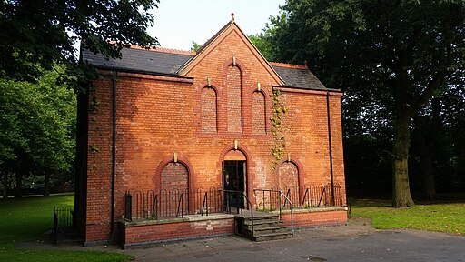
| Sandwell Valley Country Park | 4.3 miles (7 km) | This super country park in West Bromwich is perfect for a short cycle or walk. In the park you will find a fully restored working Victorian farm with grazing meadows, walled kitchen gardens, Grade II listed buildings, a small museum and tea rooms. The park is also a RSPB nature reserve with several small lakes and bird hides. For cyclists there is an excellent mountain bike trail and National Cycle Network route number 5 runs through the park. There are also several lovely walking trails taking you along the lakes and the River Thame to the nature centre. With 660 acres to explore there is plenty to keep you busy for the day but if you'd like to continue your walk the Beacon Way walking route runs through the park. View Full Details>> | |
| Sarehole Mill | 0.9 miles (1.5 km) | This walk visits the pretty Sarehole Mill in Birmingham. There's nice trails to follow along the River Cole heading north from the mill to the Shire Country Park Great Mill Meadows. View Full Details>> | |
| Sheldon Country Park | 4.7 miles (7.6 km) | A short walk or cycle through the pretty Sheldon Country Park in Birmingham. The park covers just over 300 acres and includes open grassland, wetlands and mature woodland. There is also a restored Rectory Farm with Jersey cattle, pigs, goats, ponies, ducks, chickens and geese. View Full Details>> | |
| Sherbourne River Valley | 11.2 miles (18 km) | This waymarked trail follows the Sherbourne River through the city of Coventry and the surrounding countryside. View Full Details>> | |
| Shropshire Union Canal | 65.9 miles (106 km) | Travel from the ourskirts of Wolverhampton to Ellesmere Port on this long distance waterside walk along the Shropshire Union Canal. The route starts at Autherley Junction in the Oxley area of Wolverhampton. You follow the canal north into the countryside, passing Pendeford Mill Nature Reserve where there are good bird watching opportunities. You continue north to Brewood and Wheaton Aston before passing Belvide Reservoir. The canal enters Shropshire, passing Market Drayton before entering Cheshire where you pass Audlem with views of the River Weaver. The route then passes through Nantwich and Chester before finishing at Ellesmere Port where you join with the Manchester Ship Canal and the River Mersey. The canal also links with the Llangollen Canal and the Montgomery Canal which run into Wales. View Full Details>> | |
| Solihull | 26.1 miles (42 km) | This large town is located in the West Midlands, near Birmingham. It is notable as the most affluent town in the West Midlands region and in 2013 was named the "best place to live" in the United Kingdom by a uSwitch Quality of Life survey. For walkers there's a wide range of options with two canals, local country parks, wildlife filled nature reserves, peaceful local woods, historic National Trust properties and several waymarked walks taking you into the surrounding Warwickshire countryside. View Full Details>> | |
| Solihull Way | 18.6 miles (30 km) | Starting at Earlswood Lakes head through Solihull to Castle Bromwich Hall. The path first takes you over the Stratford Upon Avon Canal and then along the Grand Union Canal. You then pass through Elmdon Park and Sheldon Country Park and past Birmingham International Airport before finishing at the Jacobean Mansion at Castle Bromwich Hall. View Full Details>> | |
| South Staffordshire Railway Walk | 11 miles (17.7 km) | This easy route follows a dismantled railway line from Wolverhampton to Pensett. View Full Details>> | |
| Stourbridge Canal | 3.4 miles (5.5 km) | Enjoy an easy waterside walk along this pretty canal in the West Midlands. The walk starts in the town of Stourbridge in the West Midlands and heads to Stourton Bridge in Staffordshire. Here the canal links with the Staffordshire and Worcestershire Canal. There's lots of pretty locks and some lovely countryside as you make your way into Staffordshire. View Full Details>> | |
| Stratford Upon Avon Canal | 26.1 miles (42 km) | Enjoy waterside cycling and walking on this 26 mile canal which runs from Stratford Upon Avon to Birmingham. The whole route can be walked while cyclists can enjoy the sections from Stratford Upon Avon to Wilmcote at one end and through the outskirts of Birmingham at the other. The route starts in the centre of Stratford Upon Avon and passes through a series of pretty villages before entering the outskirts of Birmingham and finishing in King's Norton. There's lots of pretty locks and some lovely Warwickshire countryside to enjoy. Around Solihull you'll pass close to Earlswood Lakes which is well worth a small detour. You'll also pass close to the lovely Baddesley Clinton. Here you will find a moated manor house surrounded by gardens and woodland. Near here there's also the option of visiting the tudor Packwood House. You could try our Lapworth Circular Canal Walk which visits both of these interesting properties. Also, around Kingswood the canal links up with the Grand Union Canal Walk so you can easily pick up another super canal trail. View Full Details>> | |
| Sutton Coldfield | 87 miles (140 km) | This Birmingham based town is the home of the splendid Sutton Park which lies just to the west. The expansive park includes 200 acres of open heathland, woodlands, wetlands, marshes and lakes. View Full Details>> | |
| Sutton Park | 4.3 miles (7 km) | This splendid park in Sutton Coldfield in Birmingham is the largest urban park in Europe and the largest outside a capital city. It covers 2,000 acres and includes numerous cycling and walking trails. A National Nature Reserve and a Site of Special Scientific Interest, Sutton Park is a mixture of open heathland, woodlands, wetlands, marshes and lakes. For walkers there are currently 5 self-guided routes around the site. Cyclists please note that National Cycle Route 534 travels through the park and is part of an extensive new route between Sutton Coldfield and Castle Vale. There is an excellent visitor centre with gift shop, interpretive displays and maps. Sutton Park is located about six miles north of Birmingham City Centre. If you would like to extend your outing then you could visit the nearby New Hall Valley Country Park and Pype Hayes Park where you will find more good cycling and walking trails. View Full Details>> | |
| Walsall Arboretum | 1.9 miles (3 km) | This delightful arboretum has a series of good footpaths to follow around the site. There's 80 acres (32 ha) to explore with lakes, ponds and a waterside stroll along the pretty Hoor Brook. Look out for an extraordinary 10000 species of tree and shrub as you make your way through the area. The park also has an interesting history as one of the oldest parks in the borough, being originally opened in 1874. There's a car park at the south eastern end of the park off Broadway North. From here you can pick up the surfaced paths through the park to Hatherton Lake at the other end. The park hosts a popular parkrun every Saturday morning at 9:00 am. It's easy to extend your walk by visiting the nearby Park Lime Pits. The park incldues ponds, woodland, streams and over 300 species of plants. Here you can also pick up the Beacon Way long distance trail and enjoy a waterside walk along the Wyrley and Essington Canal. Just to the north is the pretty Mill Lane Nature Reserve with ponds and the Ford Brook running through it. Just to the west you will find the Walsall Canal where you can enjoy a walk or cycle along the towpath. View Full Details>> | |
| Walsall Canal | 8.1 miles (13 km) | Enjoy a waterside walk or cycle along the Walsall Canal on this easy route in the West Midlands. The canal runs for about 8 miles through western Walsall with a nice towpath to follow along the water. It makes for a pleasant afternoon stroll or a nice flat ride suitable for beginners or families. Along the way you'll pass a series of pretty locks, interesting old mills and the Tame Valley Canal. Near the start of the route you pass close to Walsall Arboretum which is well worth a small detour. The route starts at Birchills Junction just to the east of Reedswood Park. You can also pick up the canal from the train station or bus station. It's about 5-10 minute walk from both. You follow the canal south through Birchills before turning west towards Darlaston. Here you pick up a section of the Monarch's Way heading to Moxley before finishing at Ryders Green Junction where you meet the Wednesbury Old Canal. View Full Details>> | |
| Warley Woods | 1.2 miles (2 km) | This 100 acre park is located in the Smethwick area of Birmingham. View Full Details>> | |
| Wolverhampton Canal Walk | 1.9 miles (3 km) | Explore the Birmingham Canal on this short walk through the centre of Wolverhampton. View Full Details>> | |
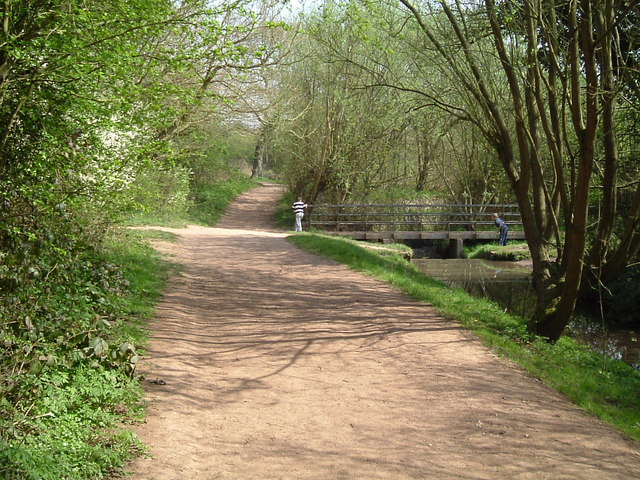
| Woodgate Valley Country Park | 2.8 miles (4.5 km) | A short route around the delightful Woodgate Valley Country Park in Birmingham. The park contains 450 acres of rich meadows, woodland and small ponds with the Bourn brook running through the heart of the park. There is also an excellent visitor centre and an Urban Farm with a variety of animals to see. To continue your walking in the area you could head a couple of miles to the west and visit the pretty Leasowes Park. Here you'll find more good footpaths taking you to 141 acres of woodland, grassland, streams, waterfalls and large ponds. The Illey Way also starts from Woodgate. The path runs along an old railway line from Waseley Hills to Woodgate, passing through some nice countryside. View Full Details>> | |
| Worcester and Birmingham Canal | 31.1 miles (50 km) | Follow the Worcester and Birmingham Canal from the vibrant centre of Birmingham, through the green hills of Worcestershire, to the cathedral city of Worcester. After leaving Birmingham you enter the countryside and will encounter a series of locks including Tardebigge Locks. With 30 locks in about 2 miles, Tarddebigge is the longest in the country, and also one of the steepest. This is a nice easy waterside walk, suitable for all walkers. Highlights on the route include the chocolate factory at the pretty model village of Bournville. It's well worth a short detour from the towpath to explore the village with its historic buildings and pretty little park. Around Droitwich Spa the canal links with the Droitwich Canal which will take you west through the town into the surrounding countryside. View Full Details>> | |
| Wyrley and Essington Canal | 20.3 miles (32.6 km) | This walk takes you along the Wyrley and Essington Canal from Wolverhampton to the Rushall Canal in Walsall. View Full Details>> |