Surrey Walks

Use the filter to show walks of a certain type such as woods, reservoirs, hills, long distance, country parks, canals and rivers.
In the spring walkers flock to the beautiful bluebell woods in the Surrey area. Click the 'Woodland' button below to see these.
Use the links to view full route information including elevation profiles, interactive maps and GPS downloads.
You can also view an overview map of all the routes in the using the Surrey Walk Map>>
| Filter: |
| Route Name | Photo | Distance | Description |
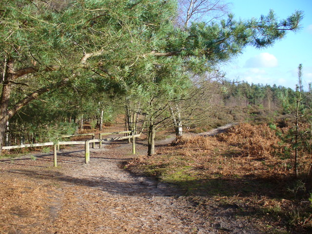
| Abinger Common | 4 miles (7.2 km) | Enjoy a walk across Abinger and Wotton Commons before a climb to Leith Hill on this circular walk in the Mole Valley. There's miles of nice woodland trails, ponds, streams and great views from the many viewpoints on the expansive common. It's quite a challenging walk with several hill climbs so a good level of fitness is required. The walk starts at the Friday Street car park close to the pretty Mill Pond. From here you can pick up the trails heading south across Abinger Bottom to Wotton Common. You then climb to the highest point in the South East on Leith Hill where you will find an 18th century Gothic tower, with panoramic views northwards to London and south to the English Channel. After taking in the views the route descends to Duke's Warren and Whiteberry Hill, before crossing Broadmoor and returning to the car park. After your walk you can enjoy refreshments at the Stephan Langton Inn on Friday Street. The country pub is located just south of the mill pond and serves Modern British cuisine and craft ales. The Greensand Way long distance trail runs through the southern end of the common so you can pick this up to extend your walking in the area. Heading west will take you to Hurt Wood and Winterfold Forest in Peaslake. Here you'll find miles of great mountain bike trails and footpaths. Also nearby is the climb to Holmbury Hill where there are more wonderful views over the Surrey Hills to enjoy. View Full Details>> | |
| Albury Park | 2 miles (4 km) | Explore the Albury Estate on this pleasant walk in Surrey. There's 150 acres of parkland with lots of walking trails to try. Features include peaceful woodland, pretty lakes and the River Tillingbourne. There is also the Grade II listed Albury country house and the Saxon Old St Peter and St Paul's Church to see. The walk starts from the Grade I listed church and follows footpaths through woodland and parkland to the nearby village of Shere. Here you will find a Norman church, old village houses and a tea room for refreshments. The walk then follows the Fox Way and other footpaths to return you to Albury. If you'd like to extend your walk then you could continue along the Fox Way to the nearby Blackheath Common. The tranquil Silent Pool is also nearby. View Full Details>> | |
| Ashtead Common National Nature Reserve | 3 miles (5 km) | This 500 acre ancient wooded common is also a National Nature Reserve. There are miles of quiet cycling and walking paths taking you to woodland, scrub grassland, a meadow, ponds and streams. There are also two ancient Scheduled Monuments - a Roman villa and a triangular earthwork. The route below begins and ends at the conveniently located Ashtead Railway Station at the southern end of the common. The adjacent Epsom Common is a great option if you would like to continue your outing. Horton Country Park is nearby while the Thames Down Link also runs past the site. View Full Details>> | |
| Banstead Downs | 3 miles (5 km) | This walk crosses Banstead Downs Site of Special Scientific Interest in Surrey. The downs are very pretty in the summer with the open grass chalkland covered in a variety of wildflowers. You'll pass Gally Hills and through some attractive woodland as you make your way along the path. From the high points there are great views towards the city of London. The downs support a huge variety of interesting plants and flowers. Look out for common spotted orchid, early purple orchids, vetch, horse-shoe vetch, ox-eye daisy and purging flax. Wildlife includes roe deer, fox, rabbit and stoat. Notable bird sightings include Kestrels, Buzzards and Sparrowhalk. In the summer months you can see lots of butterflies around the wildflowers. Keep your eyes peeled for Common Blue, Chalkhill Blue and Marbled White. You can start your walk from Banstead rail station which is right next to the downs. From here pick up the London Loop footpath to take you across the site. To extend your walking in the area you could follow the London Loop north to Nonsuch Park. It's a lovely park with wide lawns, pretty gardens, woodland and the impressive Nonsuch Mansion. If you head east you'll soon come to Oaks Park in Carshalton. It's a pretty little park with a nice cycling and walking trail. Just to the south of Banstead you'll find Banstead Woods. The lovely bluebell woods have a nice nature trail to try. View Full Details>> | |
| Banstead Heath | 3 miles (5 km) | This large open space in Banstead has lots of walking trails to follow. There's also bridleways which are suitable for cyclists. Part of the Banstead Commons the heath covers 760 acres with miles of paths popular with dog walkers and cyclists. It's a very pretty area with meadow grasses, wildflowers, woodland and mixed heather. It's great for wildlife too with Linnet, Yellowhammers, Redpoll, Reed Bunting and a variety of butterflies to look out for. The Epsom Downs circular walk skirts the heath so you could pick this up to extend your walk. Also nearby are Banstead Downs and Banstead Woods. View Full Details>> | |
| Banstead Woods | 2 miles (4 km) | These lovely woods in Surrey have miles of well marked walking paths and a nature trail to follow. There's over 230 acres to explore with lots of pretty bluebells in the spring months. The area also includes the Park Downs area of common land which is designated as a site of special scientific interest. You can start your walk from the Holly Lane car park at the north eastern corner of the woods. Chipstead and Kingswood train stations are also very nearby. The car park gives direct access to the nature trail where you can see lots of interesting flora and fauna. Look out for wild primroses, purple emperor butterflies and willow warblers as you make your way along the ancient woodland trail. You can extend your walking in the area by picking up the Banstead Countryside Walk. This 5 mile self guided trail explores Chiphouse Wood, Ruffett Wood and the attractive countryside surrounding the town. If you enjoy this walk then you could head a couple of miles north and visit Banstead Downs. The downs are located just to the north of the town and consist of open grass chalkland, wildflowers and nice views towards London from the high points. A couple of miles to the west is Epsom Common where you can explore the famous racecourse and enjoy attractive chalk downland, grassland and woodland. View Full Details>> | |
| Basingstoke Canal Walk | 33 miles (53 km) | Follow the Basingstoke canal from Up Nately to Woodham, on this delightful waterside walk. The walk passes Fleet, Woking, Farnborough and Aldershot. There's lots of pretty locks and regular views of the lovely Hampshire and Surrey countryside. The walk starts from Up Nately, located just to the east of the town of Basingstoke. You then head east passing the ruins of Odiham Castle which was built by King John in the early part of the 13th century. The route continues past North Warnborough to Dogmersfield Park. The canal runs through the park which also has some nice woodland trails and a pretty lake. You continue east past Crookham Village before heading through the large town of Fleet. The route then passes through the woodland of the Forest of Eversley to Aldershot. Here you head through the lovely Lakeside Nature Reserve where there are a series of lakes and lots of wildlife to look out for. At Aldershot the canal turns north toward Frimley Lodge Park where you turn east to Woking. Shortly after the route comes to an end at Woodham, on the outskirts of Weybridge. Here the canal joins with the River Wey Navigation which you could follow north to Weybridge and the River Thames. View Full Details>> | |
| Bedfont Lakes Country Park | 2 miles (3 km) | This water-focused nature reserve, has 180 acres of rolling meadows, woodlands and lakes. Over 300 plants and 140 bird species have been recorded in the park. The park offers a wide range of activities including, walking, picnics, a trim trail, orienteering and fishing. Bedfont Lakes is located near Ashford train station. View Full Details>> | |
| Blackheath Common | 2 miles (4 km) | This large area of heathland and woodland near Albury is very popular with walkers and cyclists. There's 250 acres to explore on a myriad of footpaths and bridleways. The area consists of lowland heathland, woodland and acid grassland. You can park at the Blackheath car park on Blackheath Lane to start your circular walk across the common. Chilworth railway station is also just to the north of the common. This is another good start point if you are coming by public transport. The paths then take you across the common and through Blackheath Forest. There's some nice sandy paths and lots of pretty heather to look out for in the late summer. View Full Details>> | |
| Blackwater Valley Footpath | 23 miles (37 km) | This is a nice easy waterside walk along the Blackwater River from Aldershot to Swallowfield. The walk starts at the delightful Rowhill Nature Reserve in Aldershot and heads along the river to Farnborough, passing Gold Valley Lakes and Willow Park on the way. From Farnborough you continue through Frimley Hatches Nature Reserve and Blackwater to the splendid Tri Lakes Country Park near Yately. The final section takes you on to Swallowfield via Eversley. View Full Details>> | |
| Bourne Woods Farnham | 2 miles (3.5 km) | Enjoy a walk around these attractive woods in Farnham, Surrey. View Full Details>> | |
| Box Hill Country Park | 2 miles (4 km) | This park is run by the National Trust and has a number of splendid walking trails to enjoy. There are panoramic views of the western Weald and a riverside stroll along the River Mole. There are also excellent facilities with the Box Tree cafe and shop which sells local produce. Box Hill is located just north of Dorking in Surrey. This circular walk visits some of the highlights of the park including the popular Stepping Stones, Broadwood's Tower and lovely woodland of the Happy Valley. The walk starts from the visitor centre near to Box Hill Fort. This scheduled ancient monument is a relic from the 1890s, when a chain of such sites were built to defend London in case of invasion by France or Russia. Follow the waymarked trails south and then west past the Swiss Cottage, the former home of John Logie Baird, the inventor of television. One of his earliest transmissions was from the top of Box Hill. After passing the cottage you pick up a riverside trail along the River Mole. This will pass the stepping stones which are a popular beauty spot in the park. The walk then heads east to explore the Happy Valley area of the park. Here you'll find a series of nice woodland trails with some moderate climbs to Flint Hill. There's lovely views of the Surrey Hills from the high points which climb to a height of over 500ft. This includes the Salomons memorial viewpoint which is probably the most well known spot in the park, attracting almost 1 million visitors each year. It's named after Leopold Salomons, who gave 230 acres of Box Hill land to the National Trust in 1914. The views over the lush green fields, rolling hills and expansive woodland below are simply wonderful. Atfer taking in the views the walk descends back to the car park and visitor centre where you can enjoy refreshments at the cafe. View Full Details>> | |
| Brighton Way | 54 miles (87 km) | A super route though the South Downs from Horley to Brighton. The trail passes Crawley, Haywards Heath and Burgess Hill before finishing on the south coast. The walk has several train stations dotted along the route so you can easily do this one in manageable sections. Highlights include the Ardingly Nature Reserve and Ardingly Reservoir near Balcombe. Near here there's also fine views of the impressive Ouse Valley Viaduct, one of the most photographed sites on the path. The walk also climbs Ditchling Beacon where there are fabulous views of the South Downs. View Full Details>> | |
| Chantry Wood | 2 miles (3.5 km) | Explore 200 acres of woodland and meadows on this circular walk to Chantry Wood and Chantries Hill in Guildford. There's miles of woodland trails to follow with the North Downs Way passing along the northern edge of the forest (you can see some of this section on the google street view link below). There's a fair amount of climbing on the trails with nice views over the surrounding area from the high points. Look out for carpets of pretty bluebells in the springtime and a variety of birdlife all year round. This walk starts at the car park at the eastern end of the woods and follows the North Downs Way across the northern edge before picking up other trails to return you to the start point. View Full Details>> | |
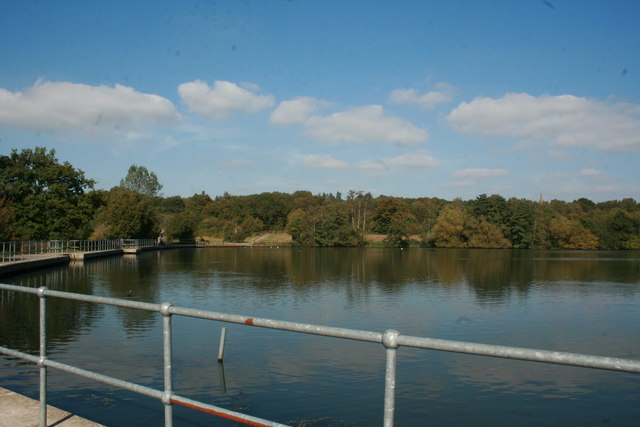
| Chobham Common | 3 miles (5.5 km) | Enjoy a circular walk or cycle around this large common in Surrey. The common covers hundreds of acres and has a series of good footpaths over grassland, lowland heath and woodland. The area is also crisscrossed with wide bridleways which are ideal for an off road cycle. Chobham Common is the largest National Nature Reserve in the south east of England. As such there is a diverse range of flora and fauna. Look out for over 100 species of bird including the rare dartford warbler, the hobby and the nightjar. In the wetland areas look out for frogs, newts, adders, grass snakes, lizards, slow worms, foxes and possibly deer. Plants and flowers include purple heather, gorse and orchids. It's a really attractive area with lots of nice stony footpaths to follow. You could easily spend a few hours strolling around looking out for wildlife. This circular walk starts at the car park on Staple Hill and follows various footpaths past Albury Bottom to Gracious Pond. You then follow woodland paths and bridleways back to the car park. If you would like to continue your walk then you could head a few miles north to the lovely Virginia Water Lake. View Full Details>> | |
| Claremont Park | 2 miles (4 km) | This is a walk through Claremont Park and the beautiful Claremont Landscape Garden in Esher. The park boasts a wonderful large lake, wide lawns and an unusual turfed amphitheatre. If you would like to continue your exercise why not visit the nearby Esher Common with its footpaths, woodland, ponds and cycle track. View Full Details>> | |
| Colley Hill | 2 miles (3 km) | Climb to the 722 ft (220 m) summit of Colley Hill on this walk in the North Downs. Colley Hill is located just to the west of Reigate Hill. It's a satisfying climb with great views over Surrey to the South Downs. You start off at the Wray Lane car park near Gatton Park and follow the North Downs Way west to the hill summit. You'll pass Reigate Fort, woodlands and grassland with pretty wildflowers in the summer. As you climb you can enjoy great views of Box Hill and Leith Hill. You'll also pass the interesting Inglis Memorial. If you'd like to extend your walk then the Reigate Hill and Gatton Park Walk also starts from the Wray Lane car park. View Full Details>> | |
| Colne Valley Way | 11 miles (17 km) | Travel through the Colne Valley on this walk from Staines to Uxbridge.
The walk starts by the River Thames in Staines and begins with a lovely section around King George VI and Wraysbury Reservoirs that takes you to Colnbrook. This section also passes across the delightful Staines Moor where you enjoy views of the Wraysbury River and River Colne. The area of grassland attracts grazing horses and cattle with a variety of birdlife around the streams and reservoirs. From Colnbrook you continue north with a waterside section along the River Colne with views of Little Britain lake. The walk finishes at Uxbridge in the London Borough of Hillingdon. The trail also runs close to the pretty Harmondsworth Moor Country Park. Just to the east of Staines Moor the park has some nice footpaths and two lakes. The path also runs close to Runnymede Park in Egham. View Full Details>> | |
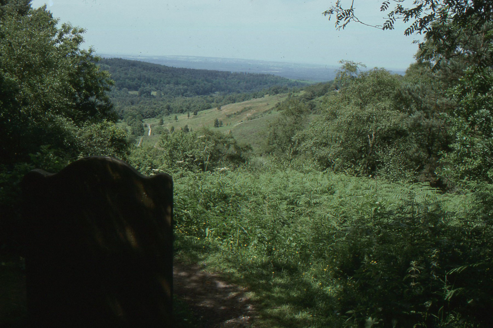
| Devil's Punch Bowl | 5 miles (8 km) | This circular walk in the Surrey Hills AONB takes you through Hindhead Common, up Gibbet Hill and to the Devil's Punch Bowl - a large natural amphitheatre and beauty spot. The area is National Trust owned so there is a car park, cafe, information boards and a series of well marked footpaths. You start at the car park and head through the Devil's Punch Bowl which has become a natural nature reserve, filled with heathland, streams and woodland. You then climb Gibbet Hill, the second highest hill in Surrey at 272 metres (892 ft). From here there are magnificent views over the punchbowl, Thursley, Hankley Common, Crooksbury Hill, the South Downs, Godalming and Guildford. The hills of Haslemere and Black Down can also be seen, while on a clear day the iconic buildings of London are also visible. View Full Details>> | |
| Downs Link | 36 miles (58 km) | This is a terrific walking or cycling path running from St Martha's Hill in Guildford to Shoreham by Sea. View Full Details>> | |
| Epsom Common | 2 miles (4 km) | Follow this cycle and walking track around this large open space in Surrey. There are peaceful woodland trails, several ponds, fields with grazing cows and a wide variety of wildlife (the site is also a local nature reserve). If you would like to continue your exercise why not visit the nearby Horton Country Park or follow the Thames Down Link which passes through the common. The adjacent Ashtead Common National Nature Reserve also has miles of cycling and walking paths to enjoy. Just to the south east you will find Epsom Downs. You can follow a footpath across the famous racecourse and enjoy attractive chalk downland, grassland and woodland. View Full Details>> | |
| Epsom Downs | 5 miles (8 km) | This circular walk takes you around Epsom Downs racecourse in Surrey. The downs consist of attractive chalk downland, grassland and woodland. You'll also enjoy wonderful views across the famous racecourse which hosts the Epsom Derby and the Oaks. You can start your walk from the Tattenham Corner car park at the northern end of the downs. Tattenham Corner train station is also very close to the start of the walk so you can easily visit by public transport. The footpath then passes through the course, heading across Walton Downs towards Walton on the Hill. The route then skirts the edge of Banstead Heath before returning to the car park via Tadworth Farm. The area is great for wildlife spotting. Look out for Skylarks and various butterflies including the rare Chalk Hill Blue. The walk can be extended by further exploring Banstead Heath which is criss crossed with miles of footpaths. There's lots of good options if you'd like to extend your walking in the area. A couple of miles to the north west you'll find Epsom Common and Ashtead Common National Nature Reserve. Both of these large open spaces have nice walking trails to follow. The Thames Down Link passes through Ashtead Park just to the west of the downs. National Cycle Network Route 22 crosses part of the downs so you can bring your bike too. View Full Details>> | |
| Esher Common | 4 miles (6 km) | Enjoy a cycle or walk around this large open space in Surrey. There are miles of peaceful woodland footpaths and a nice off road cycle track. The route will take you to two large ponds and the nearby Fairmile common. The common is a local nature reserve so look out for a variety of wildlife. View Full Details>> | |
| Farnham | 8 miles (13 km) | The Surrey town of Farnham has numerous choices for walkers. There's several woods, commons, hill climbs and waymarked trails to try. The town is also the starting point for the epic North Downs way which runs all the way to Canterbury. This walk makes use of the North Downs Way and the Greensand Way to visit one of the highlights of the area at Frensham Country Park. The National Trust owned site includes the popular Frensham Ponds and lots of nice walking trails. On the way you'll visit the River Wey, the Moor Park Nature Reserve, the attractive village of Tilford and Tilford Common. The route also passes close to the noteworthy Waverley Abbey. View Full Details>> | |
| Farnham Park | 2 miles (3.5 km) | Visit the ruins of the 12th century Farnham Castle and enjoy a stroll through the adjacent medieval deer park on this easy walk in Farnham, Surrey. View Full Details>> | |
| Fox Way | 39 miles (63 km) | This circular walk takes you on a tour of the countryside, woodland and canals surrounding Guildford in Surrey. You will pass through the stunning North Downs and Surrey Hills AONBs, visting a series of pretty villages, historical sites and sites of scientific interest. The walk starts and ends at the village of Ripley and first visits the Silent Pool. This interesting site is run by the Surrey Wildlife Trust as part of the Albury Estate. It's peaceful, eerie charm is popular with walkers and passers by as it's linked to a folklore tale that says King John abducted a woodcutter’s daughter who drowned in the pool. According to local legend, the maiden can be seen at midnight. The path then heads on through the attractive village of Shere. There's nice pubs for refreshments here, lots of pretty cottages, shops including a blacksmith and trekking shop, a tea house, art gallery, and a noteworthy Norman church. From here it is not far to another highlights on the walk at Blackheath Common. With 250 acres of attractive heathland it is popular with local cyclists and walkers. You'll also pass the delightful Albury Park with its peaceful woodland, pretty lakes and Saxon Church. View Full Details>> | |
| Frensham Ponds | 5 miles (8.5 km) | This park is run by the National Trust and contains the lovely Frensham Ponds which attract a variety of rare birds such as the reed bunting, sedge warbler, great crested grebe, nightjars and woodlarks. View Full Details>> | |
| Gold Valley Lakeside Nature Reserve | 1 miles (2 km) | A short walk around the peaceful Lakeside Nature Reserve in Aldershot. The reserve is a complex of wet habitats including river, ponds, lakes, reed beds, orchid meadow and wet woodland. The site includes the Basingstoke Canal Walk and Gold Valley Lakes. View Full Details>> | |
| Goldsworth Park Lake | 1 miles (1 km) | Enjoy a short stroll around the lake in this pretty park in Woking. The lake has a well surfaced walking path around its perimeter and attracts a variety of birdlife - look out for coot, geese, great crested grebe and mandarin duck. View Full Details>> | |
| Greensand Way | 107 miles (173 km) | The Greensand Way runs from Haslemere in Surrey to Hamstreet in Kent following the ridge of greensand rock that crosses the two counties. The route takes in two Areas of Outstanding Natural Beauty - the Surrey Hills and the Kent Downs - as well as numerous Sites of Special Scientific Interest. Highlights include
| |
| Guildford | 20 miles (32 km) | The town of Guildford has a huge selection of walks to choose from with several long distance trails, hill climbs, parks, rivers and canals to explore. This long circular walk makes use of some of the waymarked footpaths running through the area, showcasing the best of the surrounding North Downs countryside. You'll follow sections of the Fox Way, North Downs Way, Wey South Path and Downs Link long distance trails on this 20 mile tour of the area. The route starts in the town centre, near the castle. From here you can pick up the Wey South Path and follow the River Wey to Shalford Park. You then pick up the North Downs Way and head east towards St Martha's Hill, passing Pewley Down on the way. From the St Martha's Hill viewpoint there are tremendous views over Newlands Corner and the surrounding Surrey Hills. The walk then descends past the 17th century Chilworth Manor to Blackheath Common. The 250 acre common consists of lowland heathland, woodland and acid grassland. Look out for pretty heather in the autumn months. At the common the route turns west, following a section of the Downs Link to Chinthurst Hill and Bramley. Here you link up with the Fox Way which takes you to Farley Hill before coming to Godalming. There's a nice waterside section along the River Wey Navigation Canal to enjoy here. After leaving the canal the trail continues through Upper and Lower Eashing before passing through Shackleford Heath. You then skirt the edge of Puttenham Common where there's miles of good walking trails and two large ponds. The route then bends round to the east, passing Puttenham, Compton, Littleton and Loseley Park. The park has a series of splendid gardens and attractive grounds surrounding Loseley House. Shortly after Littleton you return to the River Wey for a final waterside section to take you back into Guildford. View Full Details>> | |
| Hankley Common | 3 miles (5.5 km) | Explore this large area of heathland and pine woodland on this walk near Elstead in Surrey. There's lots of paths to follow with some moderate climbs and great views over the surrounding countryside. The land is owned by the MOD so there may be training exercises at certain times but the area is also open to the public. The common is located very close to the excellent Frensham Country Park where you will find more trails taking you around the beautiful Frensham Ponds and the surrounding woodland and heathland. Just to the east is Thursley National Nature Reserve and Thursley Common. The Sculpture Park Churt and the Devil's Jumps. View Full Details>> | |
| Hatchlands Park | 3 miles (4.5 km) | Explore the 430 acres of parkland and gardens surrounding this red-brick country house in East Clandon. View Full Details>> | |
| Headley Heath | 3 miles (5 km) | Enjoy cycling and walking trails in this large area of open heathland, woodland and chalk downland in the Surrey Hills. View Full Details>> | |
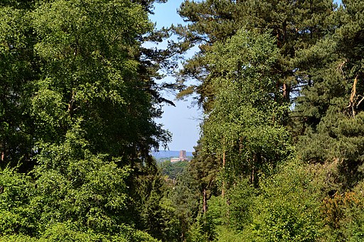
| Holmbury Hill | 3 miles (4.5 km) | Climb to the 856 feet (261 m) summit of Holmbury Hill on this circular walk in the Surrey Hills. The hill is the fourth highest point in the county and commands wonderful views over the surrounding area. The walk starts in the village of Holmbury St Mary, next to the church. You then pick up the Greensand Way and follow it through Hurt Wood to the hill summit where you will find an Iron Age hillfort and great views over the Weald of Sussex. You descend on more good woodland trails, returning you to the village. The area is also good for mountain bikers with a number of bridleways through Hurt Wood to try. If you'd like to continue your walking in the area then you could head east and climb the nearby Leith Hill, the highest point on the Greensand Ridge. Around here you'll also find the expansive Abinger Common and Holmwood Common with miles of good trails to try. If you head west you can climb Pitch Hill and explore the expansive Hurt Wood and Winterfold Forest. View Full Details>> | |
| Holmwood Common | 2 miles (3.5 km) | This National Trust managed common has miles of walking trails to try. The area covers 650 acres and consists of ancient woodland, grassland and several ponds. It's great for wildlife with butterflies, dragonflies, deer and a variety of birdlife including chiffchaffs, blackcaps and willow warblers. The common is also good for cycling with a number of flat trails to follow. If you would like to extend your walking in the area then you could climb the nearby Leith Hill. View Full Details>> | |
| Horsell Common | 2 miles (4 km) | This 880 acre common in Woking is a great place for a peaceful walk. There are miles of woodland walking paths, a number of Bronze Age barrows, wet areas, ponds and protected heathland. Look out for birdlife which includes nightjar, woodlark and Dartford warbler. The common is famous for its sand pits which were used by H.G. Wells as the site of the first Martian landing in his novel The War of the Worlds. View Full Details>> | |
| Horton Country Park | 3 miles (5.5 km) | This country park and nature reserve is located near Epsom in Surrey. Here you will find a rural landscape of fields, hedgerows, woods and ponds of great wildlife and historical value. There are 400 acres of attractive parkland to explore on a series of well laid out trails. The park is open to cycles with lovely flat paths like the one in the video below to enjoy. If you would like to continue your exercise you could head to the nearby Epsom Common or Ashtead Common National Nature Reserve which have more cycling and walking paths. The Three Downs Link and the London Loop trails also run past the park. View Full Details>> | |
| Hydon's Ball and Hydon Heath | 1 miles (2 km) | This National Trust owned hill is one of the high points of Surrey and a great place to stretch your legs. The area is covered with attractive heathland and woodland with fantastic views from the hill top. The woodland includes oak, rowan, birch and pine with birds such as Nightingales, siskin and brambling to look out for on the way. This walk starts at the National Trust car park and follows the Octavia Hill trail up to the 179 m (587 ft) summit. Here you will find a stone seat memorial to Octavia Hill, one of the founders of the National Trust. You can stop and enjoy the wonderful views towards the South Downs and the nearby Black Down. After taking in the views you descend on different paths to the car park. You can easily extend your walk by continuing south from Hydon's Ball to the Greensand Way which runs through nearby Hambledon. You could also visit the splendid Winkworth Arboretum from the same car park. View Full Details>> | |
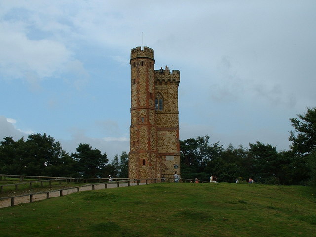
| Leith Hill | 4 miles (6 km) | Climb to the highest point in the South East on this challenging circular walk in the Surrey Hills AONB. View Full Details>> | |
| Lightwater Country Park | 3 miles (5.5 km) | This park is located in Camberley, Surrey, and comprises 145 acres of heathland habitat, woodland, shrubs and lowland bog. These habitats offer the opportunity to observe a wide variety of wildlife, birds, mammals, plants and insects. There are a number of fine walking trails in the park, an on site car park and an excellent visitor centre with a wealth of information. View Full Details>> | |
| London Loop | 149 miles (240 km) | Also known as the London Outer Orbital Path, this walk takes you on a tour of the parks, woods and fields around the edge of Outer London. You start at Erith, on the River Thames and pass through Crayford, Orpington, Petts Wood, Coulsdon, Kingston upon Thames, Uxbridge, Elstree, Cockfosters, Chingford, Epping Forest, Upminster and Rainham Marshes RSPB before finishing back on the River Thames at Purfleet, opposite Erith.
The walk has been divided into 24 manageable sections as follows: Erith Old Bexley Petts Wood West Wickham Common Hamsey Green Coulsdon South Banstead Downs Ewell Kingston Bridge Hatton Cross Hayes Uxbridge Harefield Moor Park Hatch End Elstree Cockfosters Enfield Lock Chingford Chigwell Havering-atte-Bower Harold Wood Upminster Bridge Rainham On the way you'll also pass numerous parks, common land and open spaces such as High Elms Country Park in Orpington, Hayes Common, Stanmore Common, Harrow Weald Common and Nonsuch Park. The walk is waymarked with a disc featuring a kestrel. View Full Details>> | |
| Mole Gap Trail | 6 miles (10 km) | Follow the Mole Gap Trail from Leatherhead to Dorking on this pleasant short walk through the Surrey countryside. It's a lovely area with great views of the Surrey Hills AONB, woodland sections, pretty weirs and lots of wildlife to look out for. Keep your eyes peeled for water loving wildlife such as swans, kingfishers, herons, various duck species, and little egrets. The trail runs for a distance of about 6.5 miles (10km) and includes some small climbs on the way. View Full Details>> | |
| Newlands Corner | 2 miles (3.5 km) | This lovely beauty spot on the North Downs is great for walking with a number of footpaths to try. There's several nice woodland trails and open chalk downland with wonderful views over the Surrey Hills. This circular walk starts from the excellent Newlands Corner Visitor centre where you will find information, a cafe, picnic tables and a car park. It's located just a few miles east of Guildford town centre so is easily accessible. The walk follows the North Downs Way and other footpaths around the visitor centre. You'll visit Albury Downs and Walnut Tree Bottom with lots of opportunities to sit on one of the many benches and soak in the splendid views. It's a great area for flora and fauna. In the summer the grassland is covered with a variety of wildflowers. In the woodland area you may see roe deer, green woodpeckers, nuthatches and tawny owls. View Full Details>> | |
| Nonsuch Park | 3 miles (5.5 km) | This large park between Cheam and Ewell Village is ideal for a peaceful afternoon stroll or safe family cycle. There are wide lawns, pretty gardens, woodland and Nonsuch Mansion where you can enjoy refreshments and learn about the history of the park and Palace. The park is the site of Nonsuch Palace, a Tudor royal palace, built by Henry VIII in the 16th century. It stood from 1538 to 1682–3 and was one of his grandest building projects. The London Loop runs through the park so you could pick up this trail if you wanted to continue your walk. If you follow it south for just over a mile, you will come to Banstead Downs. The downs are well worth a visit with open grass chalkland, wildflowers and nice views towards London from the high points. View Full Details>> | |
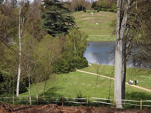
| Painshill Park | 2 miles (4 km) | Enjoy miles of splendid walking trails in this stunning 18th century landscaped park in Cobham, Surrey. There's 158 acres to explore with lovely waterside footpaths along the large Serpentine Lake and a number of peaceful woodland trails. The River Mole also runs through the southern side of the site. This circular walk takes you around the lake and the grounds with a small hill climb on the way. The park includes several interesting 18th century buildings including The Ruined Abbey, Turkish Tent, Gothic Temple and Gothic Tower. There is also a vineyard, a large working waterwheel and a fascinating crystal grotto with thousands of crystals including calcite, gypsum and quartz. The park is also great for flora and fauna. There are many fine specimen trees in distinct areas including the amphitheatre, water meadow and alpine valley. Look out for frogs, toads, various fish and birds around the lake. Most of the paths are fairly flat but you can enjoy a climb to Tower Hill on the western side of the park. Here you'll find a gothic tower with nice views across the surrounding woodland. If you'd like to extend your walk you could head to the nearby Wisley Gardens. It's a stunning garden and located only a couple of miles away, on the other side of Wisley and Ockham Common where there's also miles of nice footpaths to try. View Full Details>> | |
| Pewley Down | 6 miles (10 km) | This walk visits the Pewley Down viewpoint near Guildford. The route includes a canal-side stretch and a visit to Chantry Woods, before climbing the hill. The walk starts on the River Wey Navigation Canal near to the train station in Guildford. You follow the Wey South Path along the canal to Shalford Park where you pick up the North Downs Way. Follow it east and it will take you through Chantry Wood. The woods have some nice trails to try and pretty bluebells in the spring. Just before you reach Halfpenny Lane you turn north west and follow the Mile Path bridleway up to Pewley Down. From here there's nice views over the surround North Downs countryside and woodland. View Full Details>> | |
| Pilgrims Way | 133 miles (214 km) | Follow in the footsteps of the pilgrims who followed this ancient track from Winchester in Hampshire, to the shrine of Thomas Becket at Canterbury in Kent. View Full Details>> | |
| Priory Park Reigate | 2 miles (3 km) | This large park in Reigate is great for walking with miles of woodland trails, lakes and formal gardens. You can also climb the Priory Park Ridge for great views across the town and the North Downs. The park is good for flora and fauna with pretty bluebells in the spring, 207 plant species and champion trees which you can see on the tree trail. Look out for a variety of birdlife around the large lake. View Full Details>> | |
| Puttenham Common | 3 miles (5 km) | Enjoy a peaceful walk through the woodland and heathland of Puttenham Common in the North Downs, near Guildford. There are several large ponds and wetland areas that attract a wide variety of wildlife including great crested grebes and grey herons. Look out for roe deer and green woodpecker in the woodland areas. There are also some good bridleways which are suitable for cyclists with mountain bikes. This walk just takes you around Puttenham Common but you could easily extend your walk by heading west to the nearby Crooksbury Common where you can climb Crooksbury Hill for super views of the area. View Full Details>> | |
| Redhill and Earlswood Common | 3 miles (4.9 km) | This circular walk explores Redhill and Earlswood Commons in Surrey. The commons have miles of good footpaths taking you to ponds, lakes, woodland and grassland with lots of wildlife to look out for on the way. The walk starts at the car park at the southern end of Earlswood Common, off Woodhatch Road. You could also start from Earlswood train station which is very close to the commons. From the car park you head around Earlswood Lakes and north across the common to the little hamlet of St John's. It's a very pretty area with a Grade II listed church, a school and little cottages. After passing through St John's you come to Redhill Common where there's more footpaths to follow. The area is great for wildlife with various woodland birds, Roe deer, rabbits and foxes to see. View Full Details>> | |
| Reigate and Banstead Millennium Trail | 18 miles (29 km) | This splendid walk was devised by Reigate and Banstead Borough Council to celebrate the new millennium. It follows a series of footpaths, tracks and country lanes from Horley to Banstead via Reigate. You start in the delightful Riverside Gardens in Horley and heads north towards Redhill and Reigate where you will pass the Grade I listed Reigate Priory set in 65 acres of open parkland. The second section takes you through the beautiful North Downs from Reigate to Banstead, finishing on Banstead Common. View Full Details>> | |
| Reigate Heath | 2 miles (2.5 km) | This walk explores Reigate Heath on the western side of the town. The heath is criss crossed with a number of footpaths taking you across heather and acid grassland. There's also a number of Bronze Age burial mounds and the Reigate Heath Windmill. The building has been restored as a chapel and is thought to be the only windmill in the world which is also a consecrated church. Start the walk from the car park on Flanchford Road. From here you can pick up various footpaths taking you around the heath and the golf course. You'll pass an information board with a map and details of what you can expect to find on the heath. It's a really pretty area and ideal for an easy afternoon stroll. View Full Details>> | |
| Reigate Hill and Gatton Park | 6 miles (9.5 km) | This circular walk explores Reigate Hill and Gatton Park in the North Downs. It's a great area for walking with the North Downs Way and other good footpaths to follow. View Full Details>> | |
| River Wey Navigation | 20 miles (32 km) | Follow the River Wey Navigation towpath from Godalming to the River Thames at Weybridge on this super waterside walk. The whole of the route is suitable for walkers while cyclists can enjoy a nice waterside section in Guildford. You start off in Godalming and pass Guildford, Sutton Park, Pyrford and Byfleet before finishing in Weybridge where you can pick up the Thames Path. There's lots of scenic Surrey countryside to see and a series of pretty locks and bridges on the way. View Full Details>> | |
| Riverside Park Nature Reserve | 2 miles (3 km) | This lovely nature reserve in Guildford has nice boardwalks and footpaths to follow through the site. The reserve is located next to the River Wey and has a man made lake, a woodland area and lots of wildlife to look out for. There's lots of interesting flora with wildflowers including ox-eye daisies, bluebells and the white flowered meadow sweet, yellow flag iris and bright rose-pink flowers of the willow herb. Water loving birds such as Great crested grebe, water-rails, herons and reed buntings can also be seen in the wetlands area. Keep and eye out for roe deer and rabbits in the woods. National Cycle Network route 223 runs through the reserve so you can bring your bike too. The route runs from Guildford town centre right to the reserve so it's easy to visit by bike. View Full Details>> | |
| Runnymede | 2 miles (4 km) | Visit the birthplace of the Magna Carta on this riverside walk near Egham in Surrey. Runnymede Park includes nice footpaths running through woodland, wildflower meadows and along the River Thames. There's also the Langham Ponds wetland area where you can look out for interesting plants and insects. You may also see fallow or muntjac deer grazing in the meadows. You can start your walk from the large car park just off Windsor Road opposite Magna Carta Island. You then cross the road and pick up footpaths to the Magna Carta Monument. Here you can learn about the history of the charter which was agreed by King John at Runnymede on the 15th June 1215. It promised the protection of church rights, protection for the barons from illegal imprisonment, access to swift justice, and limitations on feudal payments to the Crown. Many consider it to be the the foundation of the free world and of individual freedom. Around here you can also find the John F. Kennedy Memorial Stone. The memorial consists of a block of Portland stone set in a symbolic acre of American soil. You reach it by climbing a steep path of granite steps, intended to symbolise a pilgrimage. From here there are great views back towards the River Thames. After leaving the monument you head to Cooper's Hill where there are some nice woodland trails. Look out for the ancient oak trees, wood anemones and carpets of pretty bluebells in the spring months. After leaving the woods you can follow other paths across the wide fields before returning to the car park. Before you finish your walk you could visit the Runnymede Pleasure Grounds where you can buy refreshments. The pretty gardens have nice wide lawns running down to the Thames and a good cafe with picnic tables. You can extend your walk by enjoying a stroll along the Thames Path. Heading north along the trail will take you towards Windsor where you can explore the expansive Windsor Great Park. Also nearby is the lovely Staines Moor Site of Special Scientific Interest. Here you can enjoy waterside paths around Wraysbury Reservoir with nice views of the River Colne. There's also a series of streams, rivers, ponds and lakes with lots of wildlife to look out for. The moor is located very close to Runnymede so well worth a visit if you have time. You can also pick up the Colne Valley Way long distance path from here. View Full Details>> | |
| Serpent Trail | 64 miles (103 km) | This walk runs from Haslemere to Petersfield through the beautiful Sussex greensand hills. The path takes its name both from its serpentine shape and from passing through the habitat of all three British species of snake. The route crosses many heathland areas and heads along the greensand ridges in the western Weald, visiting Liphook, Milland, Fernhurst, Petworth Park, Fittleworth, Duncton, Burton Mill Pond, Heyshott, Midhurst, Stedham and Nyewood before reaching the serpent's tail at Petersfield Lake and Heath in Hampshire. The trail is waymarked with white plastic discs showing a snake in the approximate shape of the route on a purple triangle. Route highlights include a climb to the highest point on the South Downs at Black Down in West Sussex. You'll also visit the pretty Iping and Stedham Commons near Midhurst. View Full Details>> | |
| Silent Pool | 1 miles (2 km) | This tranquil lake in the North Downs has a pleasant circular walkway and surrounding woodland trails. You can start your walk from the parking area just off the A25, a few miles east of Guildford. The pool is a popular destination with an eerie stillness and folklore tales. It is said King John on his horse abducted a woodcutter's daughter who was forced into the deep water and drowned. View Full Details>> | |
| St Martha's Hill | 2 miles (3 km) | This circular walk visits the lovely St Martha's Hill in the North Downs, near Guildford. From the high points there are tremendous views of the Surrey Hills and Newlands Corner. The walk starts from the St Martha's Hill, Guildford Lane Car Park, just east of the hill. You then follow the North Downs Way to the high point and the 19th century church of St Martha's. The hill summit stands at 574 feet (175 m) and commands wonderful views of the surrounding area. There are also a number of nice woodland trails, attractive grassland and a number of interesting plants. View Full Details>> | |
| St Swithun's Way | 34 miles (55 km) | Follow the St Swithun's Way from Winchester to Farnham on this historical walk through the Hampshire and Surrey countryside. The trail gives the walker the opportunity to visit numerous churches with pilgrimage connections. The walk begins at the splendid Winchester Cathedral and heads east, through the Itchen Valley towards Itchen Abbas. This opening section includes a long waterside stretch along the River Itchen, passing through the pretty village of Itchen Abbas as you go. The next section takes you from New Alresford to Alton along country lanes and through a couple of peaceful woodland stretches. You will also pass through the village of Chawton - home to Jane Austen. From Alton you head north-east, following the River Wey through Bentley, before finishing at Farnham in Surrey. Here you can enjoy a visit to Farnham Castle and Farnham Park where there's 320 acres (130 hectares) of hills, valleys, ponds and streams. View Full Details>> | |
| Staffhurst Wood | 1 miles (2 km) | This woodland area near Tandridge is popular with walkers in spring when there are carpets of pretty bluebells and a nice woodland pond to see. There are a number of trails to follow around the woods with the option of extending your walk into the adjacent Great Earls Wood and Merle Common. You can enjoy refreshment at the nearby Royal Oak Pub after your walk. There is a car park at the woods but if you wanted to visit the woods by train you could follow the Eden Valley Walk and the Vanguard Way from Edenbridge towards the woods. View Full Details>> | |
| Staines Moor | 4 miles (6 km) | This walk takes you across the Staines Moor Site of Special Scientific Interest in Surrey. The walk follows the Colne Valley Way from the River Thames in Staines to Wraysbury Reservoir, near Horton. You'll enjoy nice views of the River Colne and the King George VI Reservoir as you pass across the moor. You'll also pass through the village of Stanwell Moor before walking alongside Wraysbury Reservoir. You can return on the same path or there is a footpath along the Wraysbury River. This would take you back into Staines and turn it into a circular walk. The moor is a very pretty area with unimproved grassland which is covered in pretty wildflowers in the summer months. There's also a series of streams, rivers, ponds and lakes attracting birdlife such as tufted ducks, pochard, goosander and common goldeneye. On the rich pasture of the moor you can also see grazing horses and cattle. The start of the walk can be reached from car parks in the centre of Staines or from the nearby Staines train station. To extend your walk you could continue along the Colne Valley Way to Colnbrook. You can also pick up the Thames Path and enjoy a riverside stroll to Windsor. Just to the south west of the moor you can head to Runnymede Park and visit the birthplace of the Magna Carta. View Full Details>> | |
| Sussex Border Path | 137 miles (220 km) | A fabulous long distance walk following the Sussex county border from Thorney Island in West Sussex to Rye in East Sussex. You begin on Thorney Island with a lovely section along the coast from Emsworth. The route then heads through the South Downs to South Hartingand Liphook before continuing to Gospel Green, Rudgwick, Gatwick Airport, Horley and East Grinstead. You then head through the beautiful High Weald, passing Groombridge, Bewl Water and Northiam before finishing in Rye. The walk is well waymarked throughout. Route highlights include a climb to the highest point on the South Downs at Black Down in West Sussex. You'll also visit the lovely Weir Wood Reservoir and the interesting Bodiam Castle. View Full Details>> | |
| Thames Down Link | 15 miles (24 km) | This walk links the Thames Path and North Downs Way National Trails. It runs for about 15 miles through countryside, woodland and common land. The walk starts in Kingston upon Thames and heads south along the Hogsmill River to Epsom Common, Ashtead Common National Nature Reserve, Horton Country Park and Mickelham Downs. The route finishes at Westumble near the pretty Box Hill Country Park in Surrey. View Full Details>> | |
| The Sculpture Park Churt | 1 miles (2 km) | This wonderful arboretum in Surrey is filled with 600 amazing sculptures. There's 2 miles of good, woodland footpaths to follow through the 10 acre site. There's also a water garden with sculptures in the lakes and a pretty stream. The pieces are all for sale so the exhibition is always changing. You can easily spend a couple of hours strolling round the site. If you'd like to extend your walk then you could head north to the nearby Frensham Ponds Country Park where you will find woodland and waterside trails around the two large ponds. View Full Details>> | |
| Thursley National Nature Reserve | 5 miles (7.5 km) | This lovely nature reserve has miles of boardwalks and footpaths taking you to fine heathland, ponds, lakes and deciduous woodland. It's one of the finest areas in the country for wildlife with birds including woodlark, Dartford warbler, nightjar, stonechat, whinchat and curlew. Also look out for some very rare butterflies including silver-studded blue, white-letter hairstreak and purple emperor. In the heathland area you may see reptiles such as the rare sand lizard and smooth snake. Rare dragonfly and damselfly can be spotted around the pools and lakes. In the fen and open water area you can see various water loving birds such as great crested grebe, mute swan, coot, water rail and little grebe. Finally in the woodland area you can see woodpeckers, woodcock, redstart, tawny owl, nightingale and hawfinch. This circular walk starts at the Moat car park and takes you across Thursley Common to Silkmill Pond and Warren Mere. You then head across Ockley Common and pass Pudmore Pond before returning to the car park. If you would like to continue your walk you could head to the nearby Frensham Country Park where there are miles of cycling and walking trails. The Devil's Punch Bowl and Gibbet Hill is also a great option with more cycling and walking trails through a natural nature reserve, filled with heathland, streams and woodland. The Greensand Way long distance footpath also runs through the common so you could pick this up to continue your walk. View Full Details>> | |
| Valley Gardens | 3 miles (5.5 km) | Explore these stunning, colourful gardens located in Windsor Great Park. View Full Details>> | |
| Vanguard Way | 66 miles (106 km) | This 66 mile trail runs from the outskirts of London, through Ashdown Forest, Alfriston and Cuckmere Valley to the stunning East Sussex coast. Route highlights include the lovely Ashdown Forest, the White Horse near Alfriston and the wonderful final coastal stretch that gives views of the Seven Sisters Cliffs and Tidemills beach. The path also passes through the beautiful Cuckmere Valley with splendid views of Cuckmere River and Cuckmere Haven to enjoy. View Full Details>> | |
| Virginia Water Lake | 4 miles (7 km) | Enjoy a waterside walk around the beautiful Virginia Water in Windsor. The lake is located within the wonderful Windsor Great Park and is surrounded by woodland and gardens. A well defined walking path runs around the lake taking you to a number of interesting sites. You'll pass the 18th century ornamental cascade and the Leptis Magna Ruins - a Roman style temple built from columns and lintels brought from the ancient city of Leptis Magna in the early 19th Century. There is also a striking 100-foot high Totem Pole and the Virginia Water Pavilion built from wood from Windsor Great Forest. Right next to the lake are the stunning Valley Gardens. Here you'll find 250 acres of landscaped gardens and woodlands to explore using a series of well defined walking trails. You could also head further into Windsor Great Park to extend your walk. View Full Details>> | |
| Wey South Path | 36 miles (58 km) | Follow the Wey River and the Wey and Arun Canal on this wonderful waterside walk through Surrey and Sussex. The route starts off in Guildford and heads south to Rowly and then onto Billinghurst. This section passes through Sidney Wood and the delightful village of Loxwood. There's some pretty locks and the picturesque Drungewick Aqueduct to admire here. The walk continues towards Pulborough before passing through the delightful Amberley Wild Brooks wetland with its variety of interesting wildlife. The route then comes to an end near Amberley in Sussex. View Full Details>> | |
| Weybridge | 8 miles (13 km) | A circular riverside walk around the town of Weybridge, visiting Walton on Thames and Chertsey. Start the walk at the car park off Walton Lane and then join the riverside path, following it east past Desborough Island to Walton Bridge. Cross the river here and follow the trail through the Lower Halliford area of Shepperton. You continue west past Shepperton Lock and the Shepperton to Weybridge Ferry before coming to Lock Island. Here you will find a weir and a stretch of open ground where refreshments are served, making the island a popular place to visit or stop and rest. Continue on the trail past Dumsey Meadow to Chertsey Bridge where you cross the river. Follow public footpaths through Chertsey Meads and you can enjoy views of the River Bourne. The final section takes you along the Rivery Wey passing Hamhaugh Island before returning to the car park. This walk uses part of the Thames Path long distance trail. You could extend your walk by following the path north to Staines or east towards Sunbury. The River Wey Navigation trail also starts in Weybridge. You can follow the path south to New Haw and Guildford. View Full Details>> | |
| Whitmoor Common | 2 miles (3 km) | Explore the heathland, woodland, grassland and ponds on this large area of common land in Guildford. View Full Details>> | |
| Windsor Great Park | 8 miles (12.2 km) | A circular cycle or walk around the beautiful Windsor Great Park in Surrey. The park includes 5,000 acres of parkland, which includes a Deer Park, lakes, avenues, gardens, woodland and open grassland. National Cycle Network route 4 runs right through the park while the Three Castles Walk runs along the Long Walk Avenue where there are fabulous views of Windsor Castle. Cyclists please note that cycles are not permitted on the Long Walk. If you'd like to continue your exercise you could head to Virginia Water Lake. This large man made lake is located in the southern end of the park. It has a delightful walking trail running around its perimeter. Also of interest are the beautiful Valley Gardens. Located next to the lake they consist of 250 acres of landscaped gardens and woodlands and a series of well defined walking trails. You can also enjoy a walk along the Thames Path from Windsor to Dorney Lake. The lake has a nice surfaced cycling and walking trail to try. The Jubilee River also runs past Dorney. The river has a great waterside cycling and walking trail running from Maidenhead to Eton. Also of interest is our Windsor Circular Walk which will take you to Eton Wick and the famous Eton College. View Full Details>> | |
| Winkworth Arboretum | 2 miles (2.5 km) | Enjoy a series of woodland walking trails in this beautiful arboretum in Godalming. The area is run by the National Trust so there are very good facilities including a free car park and a tea room. In the woods you will find over 1,000 different shrubs and trees with many rare species. These include magnolias, bluebells, azaleas, rhododendron and holly. There are also large landscaped garden lakes, an attractive boathouse and lovely carved benches with animal figures. There are three colour coded, waymarked trails to try:- a blue 'Access for All' walk, a yellow 'Taste of Winkworth' walk and a red 'Challenging' walk. Look out for wildlife such as herons, green woodpecker and cormorants. It's a great place to spend a peaceful afternoon, particularly in autumn when the woods look spectacular. If you'd like to continue your walking in the area then you could head to the nearby River Wey Navigation and enjoy a waterside stroll along the towpath from Godalming. Just over a mile to the south west is another fine National Trust owned area. Hydon's Ball and Hydon Heath have a waymarked footoath taking you to the Octavia Hill memorial seat where there are splendid views over the Surrey Hills. You can follow footpaths from the arboretum through Busbridge Woods and the Juniper Valley to reach the site. View Full Details>> | |
| Winterfold Forest | 4 miles (6 km) | This lovely area of the Surrey Hills is a popular place for walkers and cyclists. Winterfold Wood and the adjacent Hurt Wood have many miles of footpaths and bridleways which are suitable for mountain bikers. View Full Details>> | |
| Wisley and Ockham Common | 2 miles (4 km) | Explore over 800 acres of heathland and woodland on this walk in Surrey. View Full Details>> | |
| Wisley Gardens | 1 miles (2 km) | These splendid RHS Gardens in Surrey have a number of lovely, well laid out footpaths to follow. View Full Details>> | |
| Witley Common | 2 miles (3 km) | This large area of common land in Surrey consists of heathland, ponds and birch, oak and pine woodland. It's run by the National Trust and is covered with lots of good footpaths to follow. The area is full of flora and fauna with purple heathers, interesting fungi and birds such as Tree pipits, Nightingales and Woodlarks. There's lots of good options to continue your walking in the area. If you head west you will soon come to Thursley National Nature Reserve and Frensham Ponds Country Park. View Full Details>> | |
| Woking to West Byfleet | 9 miles (14 km) | This easy cycle or walk follows the Basingstoke Canal Walk and National Cycle route 221 from Brookwood, near Woking, to West Byfleet. View Full Details>> |