Staffordshire Walks

Use the filter to show walks of a certain type such as woods, reservoirs, hills, long distance, country parks, canals and rivers.
In the spring walkers flock to the beautiful bluebell woods in the Staffordshire area. Click the 'Woodland' button below to see these.
Use the links to view full route information including elevation profiles, interactive maps and GPS downloads.
You can also view an overview map of all the routes in the using the Staffordshire Walk Map>>
| Filter: |
| Route Name | Photo | Distance | Description |
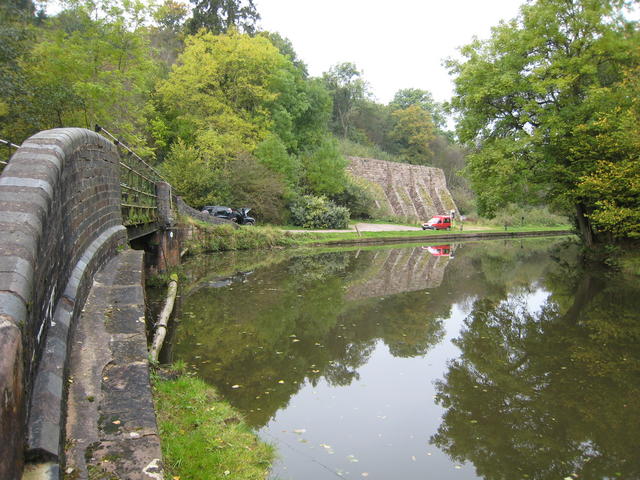
| Alrewas and Fradley Junction | 7 miles (11 km) | Enjoy a nice easy canal walk from Alrewas to Fradley Junction and then onto the village of Fradley. The route first follows the Trent and Mersey Canal to Fradley junction before turning south along the Coventry Canal to take you into Fradley. It's a very beautiful section of the canal, with lots of barges, old stone bridges and lovely tree lined towpaths. The walk starts in the little village of Alrewas, near Lichfield in Staffordshire. View Full Details>> | |
| Alstonefield | 6 miles (10 km) | This walk takes you from the Staffordshire village of Astonefield to Dovedale in the Peak District. View Full Details>> | |
| Apedale Country Park | 2 miles (4 km) | Explore 450 acres of community country park in Newcastle-under-Lyme, Staffordshire. There are a number of well maintained footpaths taking you to open meadows, secluded woodland glades and silent pools. Look out for Skylark, lapwing, grey partridge, water vole and Great Crested Newt in Apedale's wetland and ancient woodland. In the spring months the park is particularly lovely with carpets of bluebells in the woodland area. For cyclists there are also some good mountain bike trails to try. The park is located on a former mining area so there's a small museum with an interesting collection of mining related items. There's also a working narrow gauge railway to enjoy. The Newcastle Way walk also passes through the park so you could continue your walk. The adjacent Silverdale Country Park is also a good option if you would like to continue your outing. View Full Details>> | |
| Aqualate Mere | 2 miles (3.5 km) | Enjoy a peaceful walk through this lovely nature reserve near Newport on the Shropshire/Staffordshire border. In the reserve you'll find well surfaced footpaths taking you through pretty woodland and along the large mere which is the largest natural lake in the West Midlands. The area is great for birdwatching too. Look out for Eurasian curlew and common snipe from one of the bird hides. The reedbed habitat also supports reed warbler and sedge warbler while marsh harrier and osprey have also been seen in the area. View Full Details>> | |
| Baggeridge Country Park | 2 miles (3.5 km) | Enjoy 150 acres of woodland and countryside in this country park near Wolverhampton. The park has four walking trails of varying levels of distance and difficulty. You will visit a number of peaceful water pools and viewpoints with terrific views of the surrounding countryside. There is also a two-mile figure of 8 mountain bike trail suitable for families with older children and beginners. Other attractions include a sensory garden, miniature railway and tea room. The park is located in Sedgley, just a few miles south of Wolverhampton city centre. View Full Details>> | |
| Bathpool Park | 2 miles (3.4 km) | Enjoy a pleasant cycle or walk around Bathpool Park in Kidsgrove, Staffordshire. Follow the tracks/paths around the main lake, the peaceful woodland and several ponds. View Full Details>> | |
| Beacon Way | 16 miles (25 km) | This is the section of the Beacon Way from Sandwell to Chasewater, taking in the nature reserves, canals and woodland around Walsall. You start by the restored, Victorian Sandwell Park Farm in West Bromwich and head through the lovely Sandwell Valley Country Park. You continue past Rushall Junction and onto Barr Beacon where there are splendid views of the surrounding countryside. Pleasant waterside sections along the Rushall Canal and Wyrley and Essington Canal lead you to the finish point at Chasewater Country Park. View Full Details>> | |
| Belvide Reservoir | 4 miles (7 km) | Enjoy a circular walk around Belvide Reservoir in South Staffordshire on this easy route. The walk makes use of country lanes, public footpaths and a section of the Shropshire Union Canal to explore the countryside surrounding the reservoir. You can also apply for a permit to visit the area directly next to the reservoir. It's a great place for bird watching with bittern, goldeneye, pochard, shoveller and tufted duck to look out for on the water. Contact permits@westmidlandbirdclub.org.uk to apply for a permit which will also give access to the reserve car park and bird hides. The walk starts from the nearby village of Brewood, located just to the south of the site. From here you can pick up the Shropshire Union Canal and follow it north towards Shutt Green and the reservoir. Other public trails then take you through the countryside to the west of the lake before returning to the canal at Lapley Wood Farm. You can then follow the towpath back into Brewood. To extend your walk you could follow the canal south into Wolverhampton or north towards Gnossal Heath. The long distance Staffordshire Way also passes through the area so this is another good option. View Full Details>> | |
| Beresford Dale | 2 miles (4 km) | This walk takes you into the pretty Beresford Dale National Nature Reserve in the Derbyshire Peak District. It's a very peaceful and attractive area of the Dove Valley with riverside paths, weirs, woodland, wildflowers and birdlife to enjoy. This circular walk starts from the village of Hartington. From the western side of the village you can pick up a footpath heading south into Beresford Dale. You'll soon come to the reserve where you'll pass a series of weirs, wooden footbridges, limestone scenery and a Pike Pool. Just before Wolfscote Dale the route turns around, picking up other footpaths and country lanes to return you to the village. Back in the village you can enjoy refreshments at the Devonshire Arms pub. The quaint old 17th century pub has a lovely large beer garden to relax in during the warmer months. To extend your walk continue south to Wolfscote Dale, Milldale and the hugely popular Dovedale. View Full Details>> | |
| Biddulph Grange Country Park | 2 miles (3.5 km) | This circular walk runs for a distance of about 2 miles on a series of well laid out footpaths in this lovely country park in Biddulph. The 73 acre park includes woodland trails, open meadows and a lake. After your walk head to the visitor centre where you can enjoy refreshments in the cafe. There's also beautiful National Trust gardens which take you on a global journey from Italy to the pyramids of Egypt, a Victorian vision of China and a re-creation of a Himalayan glen. The Staffordshire Moorlands Walks long distance trail runs through the park so there is scope for extending your walk. You could follow the waymarked footpath south to Greenway Bank and Knypersley Reservoir. The park has some nice footpaths taking you to quiet woodland, a lovely waterfall and the Serpentine Pool. There's also the Biddulph Valley Way to try. View Full Details>> | |
| Birmingham and Fazeley Canal | 15 miles (24 km) | Enjoy a walk or cycle along the Birmingham and Fazeley Canal from the city centre of Birmingham to the town of Fazeley in Staffordshire. Along the way there's lots of pretty locks, old bridges, nature reserves and wildlife to look out for. You start off at Old Turn Junction near the National Indoor Arena in Birmingham and head through Aston and Tyburn where you pass close to Pype Hayes Park. The large park has 100 acres to explore with a lake, ornamental gardens and woodland. It's just north of the canal at Tyburn and worth a short detour. Just next to the park there is the pretty Plantsbrook Nature Reserve which consists of open water, wetland, woodland and meadow. You leave the city and head through Minworth and Cudworth before coming to the splendid Kingsbury Water Park. The 600 acre country park is a major highlight on the route. It consists of 15 lakes with miles of good cycling and walking trails to try. The final section takes you from Kingsbury Water Park to the town of Fazeley near Tamworth. On the way you'll pass Middleton Lakes RSPB reserve with 400 acres to explore. It's a great place for wildlife watching with common pochard, tufted duck and smew to look out for. View Full Details>> | |
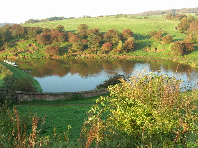
| Blithfield Reservoir | 1 miles (2 km) | This large reservoir in the Blithe Valley has three nice colour coded walking trails to try. The blue route shown below starts from the free car park towards the northern end of the lake. It's a short circular walk taking you through the broadleaf and coniferous woodland. The route is accessible and includes a bird hide where you can look out for a wide variety of birds. There are also two longer walks to try. The red route includes woodland trails, reservoir views and a boardwalk through wetland with various interesting plants and wildflowers to look out for. The yellow route is the longest and takes you through a wildflower meadow and Stansley Wood where there are bluebells in the spring. Another nice walk along the reservoir can be found at Watery Lane on the eastern side of the water just below the B5013. This takes you right along the water and is suitable for cyclists. You can see all the three routes marked out on the open street view map link below. The Staffordshire Way runs past the southern end of the reservoir so there is scope for continuing your walk along this long distance path. If you follow it west you can pick up the Trent and Mersey Canal and head to Shugborough Park near Great Haywood and Little Haywood. Here you will find the 900 acre Shugborough Estate with its mansion house and delightful gardens. View Full Details>> | |
| Branston Water Park | 2 miles (4 km) | Enjoy woodland, wetland and meadow in this lovely park in Burton Upon Trent. The park is located a couple of miles from Burton-Upon-Trent town centre. You can follow the Trent and Mersey Canal all the way to the park from the town. The park is a great place for wildlife with lots of birds to look out for on the lakes. To extend your walk follow the canal south to the village of Barton under Needwood where there's a pretty marina. View Full Details>> | |
| Brewood Canal Walk | 9 miles (14 km) | This circular walk from Brewood takes you along a section of the Shropshire Union Canal towards Wheaton Aston before heading through the countryside to visit the pretty Belvide Reservoir and the historic Chillington Hall. View Full Details>> | |
| Burton on Trent to Barton under Needwood Canal Walk | 4 miles (6.5 km) | This walk follows a lovely section of the Trent and Mersey Canal from Burton Upon Trent to Barton Marina in the the nearby village of Barton under Needwood. On the way you'll pass Branston Water Park where there's a series of lakes and lots of wildlife to look out for. View Full Details>> | |
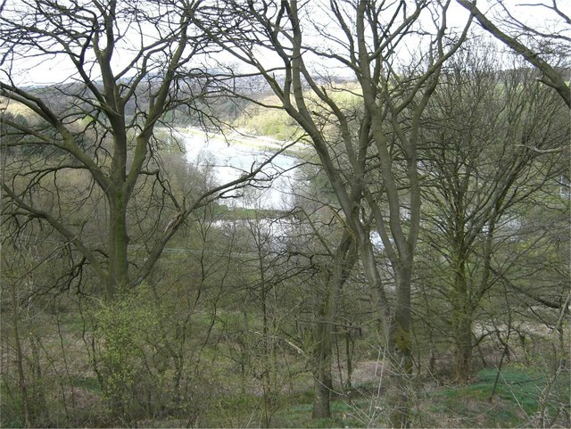
| Caldon Canal | 6 miles (10 km) | Follow the Caldon Canal through the beautiful River Churnet Valley on this easy walk in Staffordshire. The walk starts at the lovely Froghall Wharf where you will find a good sized car park. You then pick up the canal towpath and head to Cheddleton before finishing at Deep Hayes Country Park. Along the way you will pass some attractive woodland which is worth exploring with a small detour. For example the Consall Nature Park is located just to the west of the canal near Consall Forge. It has miles of nice walking trails and is easy to access from the route. Also of interest is the Churnet Valley Steam Railway which runs alongside the canal. One option would be to catch the train back from Cheddleton to Kingsley & Froghall Station. The canal runs along some of the prettiest countryside in Staffordshire with views of the River Churnet, pretty locks and arched stone bridges to enjoy. You'll also pass villages and hamlets such as the delightful Consall Forge where you can stop for refreshments at the canalside Black Lion Inn. There's great outdoor seating with views of the canal and the passing steam trains. View Full Details>> | |
| Cannock Chase Country Park | 6 miles (10 km) | This huge country park has 3000 acres of cycling and walking trails to explore. The route starts at the park cycle hire centre and takes you to Brindley Heath on woodland trails before returning to the start point. Cannock Chase is a designated Area of Outstanding Natural Beauty with a large variety of wildlife including 800 fallow deer. The park is located just a few miles from Stafford. Several long distance, waymarked trails run through the area including the Two Saints Way, Heart of England Way and the Sabrina Way. These trails are a great way to extend your walking in the area. If you head a short distance east from the park you can visit Milford Common where there's some nice trails through grassland and woodland to try. View Full Details>> | |
| Cheshire Ring Canal Walk | 98 miles (158 km) | This nice easy walk follows six historic canals through Cheshire, Greater Manchester and Staffordshire. The canal towpaths you will follow include:
The videos below show the sections along the Rochdale Canal in Manchester and along the Peak Forest Canal at Marple. View Full Details>> | |
| Churnet Valley | 7 miles (11 km) | This walk takes you through Staffordshire's beautiful Churnet Valley from Froghall to Cheddleton. The route follows the Caldon Canal and the River Churnet between the two towns with some stunning scenery to enjoy. The walk starts at Froghall Wharf on the Caldon Canal. You could also start from the Kingsley and Froghall Station on the Churnet Valley Railway. The station is located close to the canal and gives you the option of returning using the heritage railway. The route falls the towpath round to Consall where it takes a detour from the canal to visit Consall Nature Park. View Full Details>> | |
| Consall Hall Gardens | 1 miles (1.5 km) | Explore the beautiful landscaped gardens surrounding Consall Hall near Stoke-on-Trent. The public gardens are open from April until October on the 1st SUNDAY of the month. The gardens contain contain six lakes, follies, summer houses and packhorse bridges. It's a stunning area and perfect for a summer afternoon stroll but check with the website below for opening times and admission. Just to the south of the gardens you will find the delightful Consall Nature Park. There are four waymarked nature trails to try so you could easily extend your walk. The Caldon Canal also passes the gardens so you could pick up the towpath to Consall Forge. View Full Details>> | |
| Consall Nature Park | 2 miles (4 km) | This lovely nature park near Stoke-on-Trent has four waymarked walking trails to try. All the walks start from the visitor centre which has displays, exhibitions and a shop. In the park you will find two large ponds, streams, easy woodland trails and a more challenging climb to Kingsley Banks where there are wonderful views over the Churnet Valley. The area is also great for wildlife with birds including Redstart, Pied Flycatcher, Woodcock and Tree Pipit. Also look out for grass snakes, butterflies and dragonflies around the peaceful pools. There are also lots of pretty plants and flowers to enjoy such as marsh-marigold, Butterbur and bluebells in the woods. View Full Details>> | |
| Coventry Canal | 38 miles (61 km) | Enjoy waterside cycling and walking along the 38 mile long Coventry Canal towpath. Walkers can follow the whole of the route while cyclists can enjoy lovely sections through Coventry and from Marston Junction to Nuneaton. The canal runs from the centre of Coventry to Fradley Juction, passing through Bedworth, Nuneaton, Atherstone, Polesworth and Tamworth. Highlights along the canal include the vibrant Coventry Canal Basin with its shops, businesses and art gallery. You'll also pass the splendid Hartshill Country Park which has miles of footpaths and wonderful views over the Anker Valley. There's also some wonderful countryside to enjoy and a series of artworks by local artists on the Arts Trail from the Basin to Hawkesbury Junction. At the end of the route at Fradley Junction there is a nature reserve with excellent bird watching opportunities. View Full Details>> | |
| Dane Valley Way | 41 miles (66 km) | Follow the River Dane through Derbyshire and Cheshire on this fabulous walk from Buxton to Middlewich. Highlights on the route include the wonderful Three Shires Head where the counties of Cheshire, Derbyshire and Staffordshire meet. Here you will find pretty waterfalls, pools and an old packhorse bridge. Near here you will pass the fascinating deep mossy chasm of Lud's Church. The route also passes through the attractive town of Buxton and the delightful Buxton Country Park. View Full Details>> | |
| Deep Hayes Country Park | 2 miles (3 km) | Explore 143 acres of woods, meadows, canals and pools in this pretty country park in Cheddleton, Staffordshire. There are a number of waymarked walking trails and a visitor centre where you can find more details. View Full Details>> | |
| Dimmingsdale | 3 miles (5 km) | Explore the Dimmingsdale Valley and Furnace Forest on this lovely wooded walk. Waymarked footpaths will take you along a series of pools and streams with interesting sandstone outcrops and lots of wildlife to look out for on the way. Start the walk from the car park next to the Ramblers Retreat. The award winning country tearoom is a great place for refreshments before or after your walk. From the car park pick up the footpaths heading west through Threap Wood in the beautiful valley. You'll pass a number of photogenic pools where you can look out for birds such as black swan, heron, kingfisher, moorhen and Canada Goose. Buzzards and Muntjac deer have also been spotted in the area. Heather and wildflowers attract a number of different types of butterfly in the summer months too. After passing the pools there's some moderate climbing up to Oldfurnace and Stoney Dale where you can pick up the Staffordshire Way long distance trail. This will take you back to the car park. View Full Details>> | |
| Downs Banks | 2 miles (3.5 km) | Enjoy a circular walk around this pretty area of woodland and heathland near Stone, in Staffordshire. The area is also known as Barlaston Downs and is run by the National Trust so there is a car park and good walking trails to follow through the area. There is some climbing on the walk but you are rewarded with splendid views over the Staffordshire countryside from the Millennium Viewpoint. There is also a pretty stream with marshland and wildflowers next to it. The route below is designed for walkers but cyclists can follow a waymarked bridleway through the site. If you feel like continuing your walk then you could pick up the Trent and Mersey Canal which runs through Barlaston. View Full Details>> | |
| Greenway Bank Country Park | 2 miles (3.2 km) | Enjoy a short waterside walk around Knypersley Reservoir in this country park near Biddulph. View Full Details>> | |
| Gritstone Trail | 35 miles (56 km) | This beautiful, challenging walk runs through the Peak District from Disley to Kidsgrove. The walk begins at the train station at Disley and soon comes to the wonderful Lyme Park (video below) with its mansion house and Medieval deer park. You continue south passing the town of Bollington before climbing to the unusual structure of White Nancy and crossing the Saddle of Kerridge. From the elevated position above Bollington you can enjoy splendid views across the Cheshire Plain, the mountains of North Wales to the west, the hills of Shropshire to the south and the Pennines to the north and east. The route continues to the lovely Tegg's Nose Country Park via Tower Hill. The views are truly dramatic from this former quarry site, including Shutlingsloe, the second highest point in Cheshire. View Full Details>> | |
| Hanchurch Woods | 10 miles (16.5 km) | These woods near Trentham have three nice waymarked trails to try. The walks are colour coded and include the Green Walk, Red Walk and Blue Walk. The route below takes you around all three routes in a 10 mile, figure of eight walk. There's some moderate climbs and great views over the area from the high points. You can pick up all the trails from the car park off Drayton Road, about a mile west of the village of Hanchurch. The woods are also great for mountain biking with some decent off road trails. The red section of the route climbs through Harley Thorns woods with fantastic views over Cannock Chase AONB to The Wrekin hill in Shropshire. The green section heads towards the village of Hanchurch, passing the pretty Hanchurch Pools on the way. The series of ponds lead to the village where you will find a Model Farm, Hanchurch Manor and a 17th century farmhouse and medieval schoolhouse. You'll also pass through the edge of Swynnerton Old Park and Hanchurch Heath. The long Blue Walk takes you south towards the village of Swynnerton, passing local caves and climbing to a high point of over 700ft. From here there are splendid views all the way to the Welsh Hills. Swynnerton is a very pretty village and nice place to stop for refreshments before continuing your walk. From the village you head north through farmland towards Beech, before returning to the car park. To extend your walking in the area then look no further than the lovely Trentham Gardens. Here you will find 300 acres of landscaped parkland, gardens and woodland with a fabulous lake. The long distance Two Saints Way also passes the woods. You could pick up the trail and follow it to the Trent and Mersey Canal. This route is designed for walkers but the woods are also popular with mountain bikers. There's 6 miles of mountain bike singletrack and other shorter tracks to try. View Full Details>> | |
| Hanley Forest Park | 1 miles (2 km) | This large park in Stoke-on-Trent has some nice walking and cycling paths to try. In the park you'll find woodland trails and a large lake. There's also a small hill with nice views over the city and surrounding countryside. View Full Details>> | |
| Heart of England Way | 101 miles (163 km) | Follow the Heart of England Way through the Midlands of England. The walk starts from Milford Common on Cannock Chase and heads through Staffordshire, Warwickshire and Gloucestershire before finisihing at Bourton on the Water in the Cotswolds. Major towns and cities on the route include:
| |
| Hen Cloud | 1 miles (2 km) | Enjoy a short climb to Hen Cloud on this circular walk in the Staffordshire Peak District. The hill is on the southern end of a gritstone escarpment which includes The Roaches and Ramshaw Rocks. You can start your walk from the roadside parking area on the Roach Road, just to the west of Hen Cloud. On the eastern side of the road you can pick up a footpath climbing to the summit. There's footpaths you can follow around the hill top with wonderful rock formations and fabulous views to enjoy as you go. View Full Details>> | |
| Highgate Common | 3 miles (4.5 km) | This walk follows the numerous trails on Highate Common - a designated country park and local nature reserve near Wolverhampton. Here you will find 320 acres of lowland heath covered with heather, broom and gorse. There are also areas of woodland, with silver birch, pendunculate oak and coniferous plantation. Also look out for a variety of wildlife including lizards, Slow Worms, Grass Snakes, Rabbits, Bush-crickets, moths, beetles, flies, and Dragonflies. If you would like to continue your walk then the Staffordshire Way is a good option as it runs right through the park. The park is located a few miles south west of the city of Wolverhampton. View Full Details>> | |
| Hopwas Woods | 2 miles (3 km) | Enjoy walking and cycling trails in these woods near Tamworth. There's 385 acres of ancient woodland to explore with the Coventry Canal running through the eastern edge of the forest. For mountain bikers there are opportunites for some fun off road cycling with natural single track, dirt tracks and some short steep descents. You can gain access to the woods from the village of Hopwas by following the canal into the woods and then picking up the bridleways. View Full Details>> | |
| Ilam Circular Walk | 8 miles (13.5 km) | Explore Ilam Park before heading into the beautiful Manifold Valley on this circular walk in the Staffordshire Peak District. The route runs for just over 8 miles and includes some moderately challenging hill climbs, so a reasonable level of fitness is required. The walk starts in the parking area of the National Trust owned Ilam Park. The park is a great base for exploring the White Peak area of the national park and includes lovely gardens and the Grade II* listed Ilam Hall. You can follow footpaths west across the park before crossing the River Manifold and climbing past Musden Low hill where there are great views over the area. The route continues west past the village of Calton before coming to the River Hamps where you pick up the Manifold Way long distance trail. At Beeston Tor you have the option of continuing north along the River Manifold but this route turns south east past Old Park Hill. You'll pass the ruins of Throwley Old Hall before following country lanes to Rushley and then back to Ilam Park. If you enjoy this walk then you could head east from the park and try our Dovedale Circular Walk. The route visits the beautiful valley of the River Dove with its fascinating limestone rock formations, interesting plant life and cave system. You can also pick up the long distance Limestone Way and explore the Peak District's finest limestone scenery. View Full Details>> | |
| Ilam Park | 1 miles (2 km) | Ilam Country Park is a delightful open space owned by the National Trust. It is situated on the River Manifold about five miles north west of Ashbourne in the Staffordshire and Derbyshire Peak District. Highlights in the park include Ilam Hall and gardens, Bunster Hill, Hinkley Wood, a Visitor Centre, tea-room and shop. The park is perfect for a short riverside stroll in one of the prettiest areas in England. It's easy to extend your walk in this beautiful area by heading to the nearby Dovedale. You can follow a footpath east for about 1 mile to reach the River Dove and the famous Dovedale Stepping Stones. You could also try our Ilam Circular Walk which starts from the park. It explores the valleys of the River Manifold and the River Hamps to the west of Ilam Park. View Full Details>> | |
| Kingsford Country Park | 4 miles (7 km) | Explore 200 acres of woodland and heathland in this Worcestershire based forest park. Terrain in the park consists of hills and cliffs, with sandy paths crossing the area. The park has 4 waymarked trails of varying lenghts to explore. The route below also visits the National Trust owned Kinver Edge. This woodland sandstone ridge offers dramatic views across surrounding counties and miles of heathland walking. Kingsford park is located about four miles west of Stourbridge, and four miles north of Kidderminster. There are three great options for continuing your walk through this lovely part of England. The Staffordshire Way, the North Worcestershire Path, and the Worcestershire Way all run past the park. View Full Details>> | |
| Kinver Edge | 2 miles (4 km) | This National Trust owned woodland escarpment has miles of good walking trails to try. It's excellent walking country with lovely heathland, woodland trails and magnificent views over the surrounding Staffordshire and Worcestershire countryside. The sandstone ridge also includes an Iron Age Hill Fort and fascinating red sandstone formations. You can stop and admire the views from a number of seats dotted along the ridge top path. This circular walk around the site starts from the parking area off Compton Road next to the Holy Austin Rock. You then follow a nice way marked trail along Kinver Edge to Nanny's Rock. You can actually explore this fascinating sandstone rock house with its five empty rooms and the 'devil's' chimney. Just after Nanny's Rock the path heads north east through some pretty bluebell woods before returning to Holy Austin Rock House. This rock house has been restored by the National Trust so you can see how it would have looked when people lived in them. The houses are carved right into the rock and were inhabited right up until the 1960s. The area is great for wildlife watching with highlights including green hairstreak butterflies, willow warbler and cuckoo. It's also great for flora with yellow gorse and lovely purple heather in the late summer months. The long distance Staffordshire Way, Worcestershire Way and North Worcestershire Path all pass the site. You can easily pick up any of these trails to extend your walking in the area. Heading south will take you through Kingsford Country Park to Drakelow where there is a small multivallate Iron Age hillfort. Continuing along the Worcestershire Way will take you to Shatterford Lakes Wildlife Sanctuary, Eymore Wood and Trimpley Reservoir. Heading north from the edge along the Staffordshire Way will take you to Enville. Cookley village on the River Stour can be also be easily reached by descending along the North Worcestershire Path. These are all nice places to visit if you feel like stretching your legs further. For cyclists National Cycle Network Route 54 passes through Cookley just to the east of the site. If you are coming from Kidderminster you could follow the route north to Cookley and then follow country lanes east to each Kinver Edge. View Full Details>> | |
| Ladderedge Country Park | 1 miles (1 km) | Explore 70 acres of wetland, meadows and woodlands on this short circular walk in Leek. The park has good footpaths with views of the River Churnet Valley and the Peak District. View Full Details>> | |
| Lichfield Canal | 1 miles (1.5 km) | Enjoy an easy walk along a section of the Lichfield Canal Heritage Trail. It runs along a recently restored section of the Lichfield Canal in Lichfield, Staffordshire. The walk starts from just south of Darnford Park. You then follow the canal west past the Borrowcop Locks Canal Park. Just to the east the canal links with the Coventry Canal where there are nice cycling and walking trails along the towpath. The Heart of England Way also crosses this section of the canal. View Full Details>> | |
| Lichfield City Walk | 2 miles (3 km) | This fascinating city walk explores the area around the magnificent cathedral in the Staffordshire city of Lichfield. There's much to enjoy with interesting architecture, historic sites, pretty parks and lakeside trails. The walk starts from the tourist information centre on Market Street and heads north west to the lovely Minster Pool. The pool lies directly south of Lichfield Cathedral with views over the water to the wonderful building. It's a beautiful spot with an ancient avenue of lime trees that are lit up at night. The trails pass along the pool before entering Beacon Park. There's 69 acres to explore here with the pretty Museum Gardens, Beacon Pool Lake and interesting sculptures including Captain Smith of the RMS Titanic and King Edward VII. After exploring the park the walk turns to the north east passing Erasmus Darwin House and the cathedral. The building dates from the 12th century and is the only medieval English cathedral with three spires. Highlights include a medieval wall painting, the famous Herkenrode stained glass and the Lichfield Angel. There's also a nice cafe which is a good place to stop for refreshments. Entry to the cathedral is free but you are encouraged to make a donation. You can also visit Erasmus Darwin House the home of Charles Darwin's Grandfather. Erasmus led a scientific revolution, founding the Lunar Society in the 18th century. There's a museum where you can explore Darwin's work through interactive exhibits, replica costumes and historical objects. There's also a restored Georgian herb garden that has been faithfully recreated with plantings of the period and features a relief sculpture of Erasmus Darwin. After exploring the cathedral area the walk heads to the delightful Stowe Pool reservoir. Nice footpaths take you around the water before returning to the tourist information centre. Just to the south of the tourist information centre you will find the Garrick Theatre, which is also well worth a visit. Also near here is the Samuel Johnson Birthplace Museum which is dedicated to the life and works of the author and lexicographer Samuel Johnson who wrote the first authoritative Dictionary of the English Language. Two long distance trails pass through the city so you can easily extend your walk. Heading north west along the Heart of England Way or the Two Saints Way will take you to the splendid Cannock Chase Country Park. Here you will find miles of great walking and cycling trails in an Area of Outstanding Natural Beauty. Heading south east takes you through the countryside to Kingsbury. View Full Details>> | |
| Limestone Way | 46 miles (74 km) | Travel through the beautiful Peak District National Park on this walk through Derbyshire and into Staffordshire.
The walk starts at Castleton, passing through the scenic Cave Dale and past the remains of Peverill Castle. You continue south through the stunning Monk's Dale and Miller's Dale, where you cross the River Wye. The next stage takes you through Flagg and Monyash where you will pass close to the beautiful Lathkill Dale. It's pretty river, limestone cliffs and waterfalls mean it's worth a small detour to the route. You continue to Youlgreave, where you enter Bradford Dale for a pleasant waterside stretch before heading on to Brassington, Parwich and Tissington. View Full Details>> | |
| Longnor | 5 miles (8.4 km) | The village of Longnor is based in a lovely part of the Staffordshire Peak District. This circular walk visits some of the highlights of the area including the River Manifold, the River Dove and the prominent hill of High Wheeldon. There's some gorgeous rolling countryside and fine, far reaching views from the high points to enjoy. The walk starts in the village centre and follows Green Lane north east towards High Wheeldon, crossing the River Dove on the way. The distinctive dome-shaped hill sits close to the Staffordshire border in Derbyshire, in the valley of Upper Dovedale, overlooking the villages of Earl Sterndale, Longnor and Crowdecote. From the 422 metre (1387 ft) summit there are wonderful views of the Dove and Manifold valleys. The route then descends south to the village of Crowdecote. Here you cross a pretty section of the River Dove before continuing south toward Under Whitle. The route then turns west towards Over Boothlow before picking up a footpath along the River Manifold to take you back to Longnor. View Full Details>> | |
| Lud's Church | 3 miles (5 km) | This walk visits the fascinating deep chasm of Lud's Church on the edge of the Staffordshire Peak District. It's a lovely place for a walk with nice views of the Dane Valley and woodland trails through Forest Wood and Gradbach Wood near the chasm. You can start the walk from the car park off Gradbach Mill Lane, about a mile to the east of the cave. From here you can pick up the Dane Valley Way and follow the River Dane to the chasm. The Millstone Grit geological formation is covered in moss and has an unusual atmospheric feel to it. It's 100 metres (328ft) long and 18 metres (59 ft) deep so you can walk along for quite a way between the tall mossy rocks. After exploring Lud's church you can explore the surrounding woodland before crossing Black Brook and returning to the car park along the riverside path. This area of the White Peak is great for walkers so there's lots of options for extending your walk. You could continue west along the Dane Valley Way and visit nearby Danebridge. From the same car park you can visit Three Shires Head. The beautiful area is where the counties of Cheshire, Derbyshire and Staffordshire meet. There's lots of pretty waterfalls and a wonderful grade II listed packhorse bridge over the River Dane. Just to the south of Lud's Church you will find The Roaches. The elevated rocky ridge, includes fascinating rock formations and wonderful views of the surrounding countrsyide. View Full Details>> | |
| Manifold Way | 8 miles (13 km) | Follow the River Manifold and the River Hamps through the Manifold Valley on this splendid shared walking and cycling path through the Peak District. The path runs from Waterhouses to Hulme End along a former railway line with beauitful Peak District Scenery to enjoy. The route passes Beeston Tor, Wetton Mill and the wonderful Thor's Cave which is well worth exploring. View Full Details>> | |
| Milford Common | 4 miles (6 km) | This walk takes you around Milford Common near Stafford. The common has a series of nice trails with woodland, grassland and ponds to see. The walk starts from the car park located at the northern end of the common. It's located just a few miles south east of Stafford, near to the canal. From the car park you can pick up the trails heading south along the Heart of England Way which runs through the common. You'll pass through the Mere Valley toward Brocton before following peaceful woodland trails through the Brocton Coppice. View Full Details>> | |
| Millennium Way | 41 miles (66 km) | Travel across the width of Staffordshire and visit Stafford, Colwich, Rugeley, Yoxall and Barton Under Needwood on this splendid walk. View Full Details>> | |
| Monarch's Way | 615 miles (990 km) | This incredible 615-mile walk approximates the escape route taken by King Charles II in 1651 after being defeated in the Battle of Worcester. The Monarch's Way starts at Worcester then travels north to Boscobel and then south to Stratford upon Avon. It then continues south through the Cotswolds to Stow on the Wold before turning south west towards Bristol via Cirencester. The route then heads south through the Mendip Hills to Wells and then on through Somerset towards Yeovil and then south west to Charmouth. You then follow the Dorset coast before turning north again to Yeovil, before heading east across the Downs to Brighton and then onto the finish point at Shoreham-by-Sea. The walk also takes you through two World Heritage Sites, one National Park and six Areas of Outstanding Natural Beauty. For those interested in the history of the walk there is ample opportunity to learn and discover more with a series of museums and historical sites dotted throughout the route. The walk is waymarked with a picture of the ship The Surprise, the Prince of Wales crown and the Royal Oak tree at Boscobel House. The route has been split into two separate gpx files. The first includes the section from Worcester to Bridport via the Midlands and Somerset. View Full Details>> | |
| Mow Cop | 1 miles (1.5 km) | Visit Mow Cop Castle and the Old Man of Mow on this short circular walk on the Cheshire–Staffordshire border. The castle sits in an elevated position above the village with wonderful views over the surrounding Staffordshire countryside and the Cheshire Plain. The 18th century folly is a well know landmark positioned 355m above sea level and visible for miles around. The walk also visits the Old Man of Mow - an interesting 65ft rock formation just to the north of the castle. Near here is a triangulation pillar and more great views to enjoy. Mow Cop is on the Gritstone Trail so you can extend your walk by continuing along this long distance trail. View Full Details>> | |
| National Memorial Arboretum | 5 miles (8 km) | This peaceful circular walk takes you through the National Memorial Arboretum and its surrounding countryside in Alrewas, near Lichfield in Staffordshire. There are 30,000 trees in the 150 acre Arboretum, forming a unique living tribute to those who have served and continue to serve our country. There are also over 300 thought-provoking memorials, each with a story to tell. This walk starts in the Arboretum car park and takes you through the grounds to Wychnor Viaduct on the River Trent. You will pass the pretty Croxall Lakes Nature Reserve. The reserve consists of two large lakes which attract various wildfowl and waders during the autumn months. It's a pretty area with reedbeds and the River flowing through it. Look out for otters and short-eared owls during winter. From the nature reserve you continue to Catholme and Wynchnor Bridges where you pick up the Trent and Mersey Canal. View Full Details>> | |
| Newcastle Under Lyme | 5 miles (8.8 km) | The Staffordshire based town of Newcastle Under Lyme is well known for a number of attractive parks and gardens. It has done consistently well in the Royal Horticultural Society Britain in Bloom competition. There's lovely walks to be found in the Queen's Gardens at the eastern end of Ironmarket and also along the Lyme Brook in Lyme Valley Parkway to the south of the town centre. It's also well known for its market which takes place six days a week on the High Street. This walk from the town takes you along the Lyme Brook to the nearby Apedale Country Park. It's a pretty area with nice waterside paths and easy woodland trails in the park. View Full Details>> | |
| Newcastle Way | 25 miles (40 km) | Starting at Mow Cop, follow the Newcastle Way through Staffordshire to Market Drayton. You will pass through rough Moorland scenery around Mow Cop, rich farming country near Madeley before heading along the sandstone ridges of Maer and Ashley and then across the wide open spaces of Blore Heath to Almington. View Full Details>> | |
| Oakamoor | 5 miles (8.2 km) | The pretty Staffordshire village of Oakamoor makes a great base for exploring the beautiful Churnet Valley. This circular walk makes use of the Staffordshire Moorlands Way and the Staffordshire Way to explore the wooded valleys surrounding the village. You'll first visit the lovely Dimmingsdale where there's a waymarked trail to follow along a series of streams and pools. The route then heads to the National Trust's Hawksmoor Wood Nature Reserve. The ancient woodland is located just to the west of the village and is a great place for wild flowers and wildlife spotting. On the walk you'll enjoy nice views of the River Churnet and miles of peaceful woodland trails. The area looks particularly stunning in the autumn months. View Full Details>> | |
| Park Hall Country Park | 2 miles (4 km) | Enjoy a cycle or walk in this large country park in Stoke-on-Trent. The park is popular with dog walkers with its nice woodland areas and two ponds. From the high points in the park there are good views over the city. You can extend your exercise by visiting the nearby Hanley Forest Park where there are more cycling and walking paths to try. View Full Details>> | |
| Royal Shrovetide Football Challenge | 19 miles (31 km) | This walk celebrates the Royal Shrovetide Football Match which occurs annually on Shrove Tuesday in the town of Ashbourne. View Full Details>> | |
| Rudyard Lake | 4 miles (7 km) | Enjoy a cycle or walk around this large lake in the Staffordshire Moorlands near Leek. Cyclists can cycle the whole of the route apart from a section around the north western area where you need to dismount while crossing private property. The route starts and ends at the visitor centre at the southern end of the lake. It follows good paths along the shoreline and through several long woodland sections, making use of the Staffordshire Way along the western side of the water. The lake is a great area for wildlife spotting. Look out for Snipe, Redwind and Goldeneye Drake on the water. View Full Details>> | |
| Sabrina Way | 203 miles (327 km) | This route is part of the National Bridleroute Network and primarily designed for horse riders but can be used by walkers and cyclists also. The trail starts at the deer park at Great Barrington and heads north to Hartington. The route passes through the Cotswolds, the Malvern Hills, the Wyre Forest and Cannock Chase Forest, before finishing in the Derbyshire Peak District. View Full Details>> | |
| Sandon Hall | 6 miles (9.4 km) | This walk takes you around the historic Sandon Hall estate in the Staffordshire village of Sandon. View Full Details>> | |
| Shenstone | 3 miles (5 km) | This Staffordshire based village is located just south of the city of Lichfield. View Full Details>> | |
| Shropshire Union Canal | 66 miles (106 km) | Travel from the ourskirts of Wolverhampton to Ellesmere Port on this long distance waterside walk along the Shropshire Union Canal. The route starts at Autherley Junction in the Oxley area of Wolverhampton. You follow the canal north into the countryside, passing Pendeford Mill Nature Reserve where there are good bird watching opportunities. You continue north to Brewood and Wheaton Aston before passing Belvide Reservoir. The canal enters Shropshire, passing Market Drayton before entering Cheshire where you pass Audlem with views of the River Weaver. The route then passes through Nantwich and Chester before finishing at Ellesmere Port where you join with the Manchester Ship Canal and the River Mersey. The canal also links with the Llangollen Canal and the Montgomery Canal which run into Wales. View Full Details>> | |
| Shugborough Park | 4 miles (6.5 km) | This circular walk uses public footpaths and the Staffordshire Way to take you around Shugborough Park in Great Haywood. You also have the option of exploring the 900 acre Shugborough Estate with its mansion house and delightful gardens. This does require and entry fee though. The walk starts from the car park at Milford, passing Milford Common and heading to Shugborough Hall. You return with a lovely waterside section along the River Sow. The Trent and Mersey Canal passes along the northern edge of the park so there is scope for continuing your walk through the beautiful Trent Valley along this waterway. You are also right on the edge of the Cannock Chase AONB so you could extend your outing by exploring miles of woodland trails. The Two Saints Way runs right through the area to Lichfield so this is a good way of extending your walk. View Full Details>> | |
| Silverdale Country Park | 2 miles (3 km) | This pretty country park is located in Newcastle-under-Lyme, Staffordshire. It has safe, family cycle paths and well maintained walking trails taking you around the open grassland landscape. There is a large pond which attracts great crested newts, a plateau with lovely views of the surrounding countryside, farm meadows, wilidlife conservation areas and woodland areas. The Newcastle Way walk runs past the park so you could continue your walk along this long distance path. The adjacent Apedale Country Park is also a good option if you would like to continue your outing. View Full Details>> | |
| South Staffordshire Railway Walk | 11 miles (17.7 km) | This easy route follows a dismantled railway line from Wolverhampton to Pensett. View Full Details>> | |
| Stafford | 2 miles (4 km) | Stafford is the county town of Staffordshire and has some nice waterside walking trail along the canal, river and nature reserve in the town centre. There's also some fine historic buildings including the 12th century St Chad's Church and the Elizabethan Ancient High House which is notable as the largest timber-framed town house in England. View Full Details>> | |
| Staffordshire and Worcestershire Canal | 46 miles (74 km) | Follow the Staffordshire and Worcestershire Canal from Stourport-on-Severn to Great Haywood on this easy waterside walking and cycling route. The walk starts at Stourport-on-Severn by the Staffordshire and Worcestershire Canal Basin near to the River Severn. You then head north to Kidderminster with views of the River Stour as you go. You continue to Kinver where you could deviate from the path to visit the splendid Kingsford Country Park and Kinver Edge. The large area of woodland and heathland has miles of walking trails with wonderful views across the region. The next section takes you through Wolverhampton, passing the National Trust owned Wightwick Manor Gardens and the wildlife rich Smestow Valley Nature Reserve. You continue to Stafford before the final stretch to Great Haywood Junction, passing the beautiful Shugborough Park on the way. The 900 acre estate is well worth visiting with its expansive parkland and stunning gardens. At Great Haywood the canal links with the Trent and Mersey Canal. View Full Details>> | |
| Staffordshire Way | 95 miles (153 km) | Travel through Staffordshire, Cheshire, Derbyshire, Worcestershire and enjoy canals, lakes, country parks and a series of pretty towns and villages. Highlights on the walk include lovely views of the popular Blithfield Reservoir and the Caldon Canal. View Full Details>> | |
| Stoke on Trent Canal Walk | 2 miles (4 km) | This waterside walk takes you along the Trent and Mersey Canal and the Caldon Canal to Hanley Park in Stoke on Trent. View Full Details>> | |
| Stourbridge Canal | 3 miles (5.5 km) | Enjoy an easy waterside walk along this pretty canal in the West Midlands. The walk starts in the town of Stourbridge in the West Midlands and heads to Stourton Bridge in Staffordshire. Here the canal links with the Staffordshire and Worcestershire Canal. There's lots of pretty locks and some lovely countryside as you make your way into Staffordshire. View Full Details>> | |
| Tamworth Canal Walk | 4 miles (6.5 km) | This walk follows the towpath of the Coventry Canal through Tamworth, from Fazeley Junction to Pooley Country Park. It's a very pleasant section of the canal, running for just over 4 miles with pretty locks, barges, old bridges and tree lined sections. The walk starts at Fazeley Junction where the Birmingham and Fazeley Canal terminates and meets the Coventry Canal. Follow the towpath north east, passing the aqueduct over the River Tame before you make your way through Tamworth. You'll pass Bolehall and the impressive Glascote lock flight before coming to Amington. Here you can visit the Grade II listed St Editha's Church which is noted for its stained glass windows. The route continues through the Alvecote Marina to the fascinating ruins of Alvecote Priory. The Benedictine Priory was founded in 1159 with the main entrance arch still standing at around 20 feet high. The walk finishes shortly after in Pooley Country Park where there are a number of pretty lakes with lots of wildlife to see on the water. View Full Details>> | |
| The Roaches | 3 miles (5.5 km) | This circular walk is one of the most popular in the Peak District and a favourite for many. It runs along an elevated rocky ridge, with fascinating rock formations and wonderful views of the surrounding countrsyide and the nearby Tittesworth Reservoir. Ridge walking is always a joy but this one is something special. Highlights include a series of weathered gritstone boulders and the mystical Doxy Pool. The pool is said to be inhabited by a malicious water spirit which drags victims into the depths. The area is also great for unusual wildlife. In the 1930s five Australian Bennett's wallabies were released into the wild from a private collection. A small colony is believed to continue to live around the area with occasional sightings. The circular walk starts from the roadside parking area on Roach Road (ST13 8UA). You will see a gate and information board on the eastern side of the road where you can pick up the nice path up to the ridge. The path runs north past the Doxy Pool to the high point on the ridge at 505 m (1,657 ft). You descend to Bearstone Rock where you turn south and follow the Roach Road back to the car park. View Full Details>> | |
| Thor's Cave | 2 miles (2.5 km) | This walk takes you to the stunning natural cavern
of Thor's Cave in the Manifold Valley area of the Peak District. There is a good footpath through the countryside from the nearby village of Wetton which takes you to the cave. Once there you can enter the cave and enjoy the fascinating rock formations and mineral colours. It's a magical place with interesting nooks and crannies to explore. There are also great views of the Manifold Valley through the cave entrance. You can return to Wetton along the same path and then enjoy refreshments at the 18th century Royal Oak Inn. It's also nice to have a stroll around Wetton Village with its little cottages, village green and church which has a 14th century tower. The River Manifold and the Manifold Way run right past the caves so an alternative route would be to start from Waterhouses and follow the lovely riverside path to the cave. If you'd like to cycle to the cave you can hire bikes from the Manifold Valley Cycle Centre and follow the Manifold Way to the cave. If you'd like to extend your walking in the area then you could visit the nearby Dovedale where you will find a lovely walking path along the River Dove to the famous stepping stones. View Full Details>> | |
| Three Shires Head | 4 miles (6 km) | Explore this beautiful section of the Dane Valley and enjoy rivers, old stone bridges and waterfalls on this lovely walk in the Peak District. Three Shires Head is a point on Axe Edge Moor where the counties of Cheshire, Derbyshire and Staffordshire meet. Here you will find a Grade II-listed packhorse bridge over the River Dane. The bridge is thought to have been constructed in the 18th century. It's a delightful area with a number of small waterfalls and the surrounding Peak District scenery to enjoy. The walk begins from a parking area in Gradbach a couple of miles south of Three Shires Head. You then follow the Dane Valley Way and other footpaths to the bridge and the river. Here you will also find Panniers Pool, a popular place for a paddle or swim in the summer months. An alternative route would be to come from Buxton and follow the Dane Valley Way across Axe Edge Moor to the bridge. This is a much longer walk but does pass through the pretty Buxton Country Park on the way. To extend your walking in the area you could visit the fascinating Lud's Church. The deep chasm is located just to the west of the start point of this walk. Just to the south you can climb to The Roaches. View Full Details>> | |
| Tittesworth Reservoir | 4 miles (7 km) | Enjoy a circular walk around this lovely reservoir on the edge of the Peak District. There are waterside sections along the shoreline, woodland trails and fantastic views of the nearby Hen Cloud and The Roaches. The walk starts and ends at the visitor centre at the northern end of Tittesworth Water. Here you will find a cafe, an interactive exhibition, and picnic areas overlooking the River Churnet Valley. View Full Details>> | |
| Trent and Mersey Canal | 95 miles (153 km) | Follow the Trent and Mersey Canal through Derbyshire, Staffordshire and Cheshire on this long distance waterside walk. The route starts at Shardlow near Long Eaton in Derbyshire and heads through Weston-on-Trent and Willington to Burton Upon Trent where you will pass Mercia Marina and the lovely Branston Water Park with its woodland, wetland and meadow. You continue to Alrewas where you will pass the National Memorial Arboretum. The Arboretum contains over 50,000 trees with nearly 300 memorials for the armed forces, civilian organisations and voluntary bodies who have played a part in serving the country. The next stage takes you through Handsacre to Rugeley where you will pass the wonderful Cannock Chase Country Park. It's worth taking a short detour to explore the Cannock Chase AONB with miles of woodland walking and cycling trails, lakes, ponds and wildlife including deer and various birds to look out for. You continue through the beautiful Trent Valley passing the National Trust Owned Shugborough Park at Great Haywood. It is worth a visit with a grand hall, museum, kitchen garden, model farm and extensive parkland with follies, woodland and a Chinese House with two Chinese-style bridges. The route continues through Weston to Stone before coming to the outskirts of Stoke-on-Trent where you will pass the splendid Trentham Gardens. Also in Stoke you will pass Westport Lake which is worth a small detour. You continue north to Kidsgrove where you will find the Grade II* listed Rode Hall, surrounded by parkland and formal gardens. The hall and gardens are open to the public from April to September and are well worth a small detour from the canal. The canal continues through Cheshire to Sandbach where you will pass close to the Watch Lane Flash Nature Reserve. Onward to Middlewhich and Northwhich where you will pass Marbury Country Park. View Full Details>> | |
| Trentham Gardens | 2 miles (4 km) | This circular walk in Staffordshire takes you around the beautiful Trentham Gardens and Trentham Lake. There's 300 acres of landscaped parkland, gardens and woodland to explore on a series of good footpaths. Features in the park include a Floral Labyrinth, Secret Garden, Japanese Garden and Italian Gardens. It's great for wildlife with a deer park, monkey forest and heronry by the large lake. There's also a lakeside boardwalk, a maze and a miniature railway to try. The estate is located just outside Stoke-on-Trent. You can use the google street view link below to virtually explore the estate! If you would like to continue your walking in the area then you could pick up the Trent and Mersey Canal just to the east of the estate. Just to the west you will find Swynnerton Old Park and Hanchurch Woods with miles of woodland walking trails and the pretty Hanchurch Pools. There's also some nice climbs to try on Hanchurch Hills with fantastic views over Cranborne Chase to the hills of Wales. The long distance Two Saints Way also passes the park. You could pick up the trail and follow it to the Trent and Mersey Canal. View Full Details>> | |
| Trimpley Reservoir | 2 miles (3.5 km) | This circular walk on the edge of the Wyre Forest visits Eymore Wood and Trimpley Reservoir. There's nice woodland trails and a path along the reservoir to enjoy. You can park at the Eymore Wood car park to start your walk. Then follow footpaths south to the two reservoirs. Here you cross the Severn Valley Railway before picking up the Severn Way which runs between the reservoir and the river. The path heads along the river towards Upper Arley before cutting back across the woods to the car park. The river and reservoir are great for wildlife watching with kingfishers, grey herons and goosanders to look out for on the water. Pheasants, cuckoos and woodpeckers can be seen in Eymore Wood. View Full Details>> | |
| Two Saints Way | 92 miles (148 km) | Travel through Cheshire and Staffordshire on this wonderful long distance walking trail. The 92 mile pilgrimage route runs from Chester to Lichfield, passing through Nantwich, Stoke-on-Trent and Stafford. It is named after the saints St Werburgh and St Chad, Saxon saints who brought Christianity from Northumbria to the ancient kingdom of Mercia in the seventh century. It runs between St Werburgh's shrine at Chester to St Chad's shrine at Lichfield. The route is typically completed in the following four sections: Chester to Nantwich The route starts at Chester Cathedral and heads through the town, passing the Roman amphitheatre and the pilgrim church of St John's. You then pick up the Shropshire Union Canal passing along the towpath on the Baker Way. You'll pass Waverton, Beeston Castle, Bunbury, the River Gowy, Barbridge and Hurleston Reservoir before arriving at St Mary's Church in the market town of Nantwich. Nantwich to Stoke-on-Trent You leave Nantwich, heading south along the River Weaver, before turning east towards the village of Wynbunbury and the Wynbunbury Moss Nature Reserve. You continue through Weston, Barthomley and Newcastle-under-Lyme where you skirt the edge of the pretty Apedale Country Park. The last section takes you through Stoke-on-Trent, passing Westport Lake before coming to the halfway point of the trail at Stoke Minster, with its Saxon preaching cross. Stoke-on-Trent to Stafford You leave Stoke, heading south towards the beautiful Trentham Gardens with a section along the Trent and Mersey Canal. You continue through the lovely Trent Valley passing Tittensor Chase, Stone and Hopton before coming into Stafford. There's some nice sections along the River Trent on this leg of the journey. You finish at St Chad's, the oldest church in the county town of Stafford. Stafford to Lichfield The route then follows the River Sow out of Stafford, joining the Heart of England Way at Milford where you pass Shugborough Park and cross the Cannock Chase AONB. It's a lovely section, passing through Cannock Chase Country Park where you will visit the Katyn Memorial and Castle Ring hill fort. View Full Details>> | |
| Walk Around Alton | 6 miles (9 km) | This Staffordshire village is most well known for the Alton Towers Theme Park but it also has some lovely walks to try. This circular walk uses Staffordshire Way to take you to one of the highlights of the area at Dimmingsdale. These lovely woods include waymarked footpaths taking you along a series of pools and streams with interesting sandstone outcrops and lots of wildlife to look out for on the way. The walk runs for just under 6 miles, rising to a height of over 700ft from the high points. Starting from the village you can pick up the waymarked trail and follow it north west to the woods. At Hawksmoor you turn around and pass through Sutton's Wood before picking up the Ousal Dale Track and returning to the village. Here you can see the noteworthy Alton Castle. The gothic-rivival castle was constructed in the mid-19th century by John Talbot, 16th Earl of Shrewsbury. The original castle dates from the 12th century, built on a rocky precipice overlooking the River Churnet. View Full Details>> | |
| Weaver Hills | 6 miles (9 km) | This circular walk explores the Weaver Hills area of the White Peak. View Full Details>> | |
| Westport Lake | 1 miles (2 km) | Enjoy an easy circular walk around this pretty lake in Stoke-on-Trent. View Full Details>> | |
| Wolfscote Dale | 7 miles (12 km) | This walk visits Wolfscote Dale in the Dove Dale area of the Peak District. You can start the walk from the village of Hartington just north of the dale. There's a car park and cafe in the village so it makes a good start and end point for the walk. The footpaths then head south to Beresford Dale Nature Reserve where there's riverside paths, weirs, woodland, wildflowers and birdlife to enjoy. The route then crosses a wooden footbridge and leads you into the Wolfscote Dale Nature Reserve. The footpath winds its way along the River Dove with woodland sections and a number of weirs to enjoy. It's a beautiful area with the option of continuing south along the river to Milldale and then on to Dovedale. You could also visit the nearby Ilam Park where there are beautiful gardens and views of the River Manifold. Just to the east of Wolfscote Dale is the Biggin Dale Nature Reserve. You could return to Hartington on the footpath through the reserve. It's a lovely area with lots of interesting plants and flowers to look out for. The dale is located near to the pretty village of Alstonefield which makes a worthy alternative start point for the walk. View Full Details>> | |
| Wombourne Railway Walk | 5 miles (8.5 km) | A circular walk from Wombourne taking you along a dismantled railway line before returning along the Staffordshire and Worcestershire Canal. The route follows a section of the old Wolverhampton to Dudley railway line which now forms part of the South Staffordshire Railway Walk. View Full Details>> |